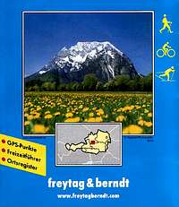
freytag & berndt hiking maps
Product Description
Freytag & berndt is Vienna/Austria based map publisher.Their WK(wanderkarte - hiking maps)series is major source
of hiking maps for the Eastern Alps, next to those published by Kompass.
Features
1:50000 (1 inches to the mile)scale topographic maps.Size: 12 1/2 to 12 1/2 cm size folded, 97 1/2 to 81 1/2 cm unfolded
-colour print
-contour interval set at 100m
-lattitude/longitude grid, 5 degrees interval
-Map legend in German/French/English
-weight: 280g (map only, without supplement).
All maps are sold with PVC jacket and 70 pages or so supllement booklet, which has some additional info like routes detail and list of huts/bivouacs.
Compared to maps of similar type, freytag & berndt are slightly larger then Kompass maps and smaller then Italian Tabacco maps. Paper quality in terms of durability is better compared to Kompass, and at about same level with Tabacco.
Publisher website
When purchased in bookshops Freytag&Berndt maps are usually priced around 7 Euros.
Images
 |  |  |
Reviews
Viewing: 1-2 of 2 |

DoJo - Oct 28, 2011 9:46 am - Voted 3/5
F+B
I prefer the Alpenverein maps - or the ÖK maps 1:50000 (if there are no Alpenverein maps of the area)
Viewing: 1-2 of 2 |
rufus - Apr 28, 2007 5:55 pm - Voted 4/5
F&BIt's negative is the contour interval 100m, although this can be linked with the scale 1:50000 that has some other disadvantages too, but for a return the map illustrates a larger area.
They could have chosen a better combination of color tones for a hiking map (too dark for me).
The positive thing is the detailed, very useful information (in German language) on routes, huts etc. at the map's backside.
I'm also having F&B maps WK 225 and WK 191 I purchased earlier. These are classical F&B hiking-biking-freetime maps, with supplemental booklet added and for that reason the weight of a set is higher. The colors they have used for these maps are fine, much brighter.
Their other parameters are the same as previously described.