
Comments
No comments posted yet.
|
|
Trip Report |
|---|---|
|
|
46.55330°N / 86.4623°W |
|
|
Sep 5, 2020 |
|
|
Hiking |
|
|
Summer |
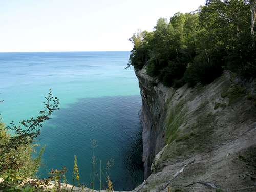
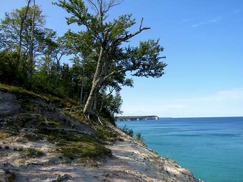
Pictured Rocks National Lake Shore preserves a portion of Lake Superior’s southern shoreline in the Upper Peninsula of Michigan. The park is so called because of cliffs that rise as much as 200 feet above the lake. “Pictured” refers to mineral stains on the surface of the rocks. A trail goes through the forest close to the edge of the cliffs providing you, at views points, with great views of Lake Superior and the cliffs. By looking at Google Earth, I had decided that the most scenic part of the clifftops hike was the 11 mile section between Miners Castle and Spray Falls. I had further broken that section into two day hikes. Reaching the edge of the cliffs from trailheads itself required a 2-3 mile hike in the forest.
This is the description of a 14 mile loop hike from Chapel Trailhead to Mosquito Beach then Spray Falls and return to trailhead via Chapel Beach Trail (The shorefront distance between Mosquito Beach and Spray Falls is 6.0 miles one way).
Hike Length: 14.0 miles
Total Ascent: 1200 ft
Maximum Elevation: 790 ft (near Grand Portal Point)
Minimum Elevation: 600 ft (Lake Superior)
Chapel Trailhead Elevation: 750 ft
Left the vacation rental house in Munising, Michigan at 6:40 a.m. (sunrise around 7:15 a.m.). Drove on Route H-58 and then got on the five mile long dirt road to Chapel Trailhead. I had been on that dirt road the day before at around noon when there had been a traffic jam with a line of parked cars 1.2 miles long before the trailhead. At the early hours of today, however, there were few other vehicles on the road and I was able to drive all the way to the trailhead where I parked. I was worried about traffic jam at the end of the day when I would have to drive back home.
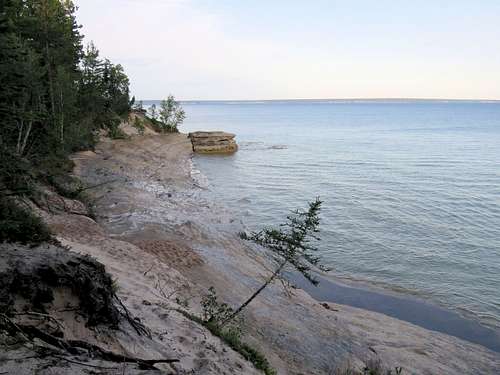
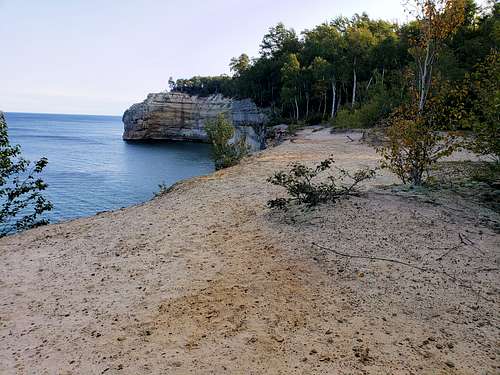
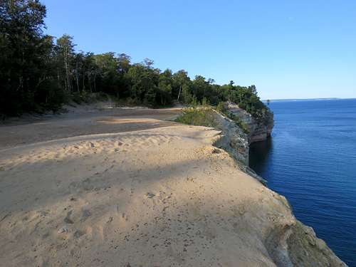
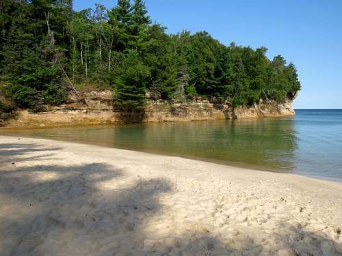
Started my hike at 7:20 a.m. a few people were at the trailhead but then I did not see any other people until two hours later. Got on the two mile long Mosquito River Trail which went in the forest toward Lake Superior. By just before 8 a.m., I reached Mosquito Beach Campground near the shores of the lake. I turned right and followed the shoreline trail northeast.
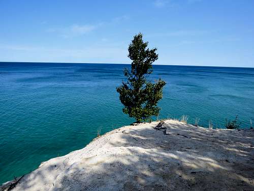
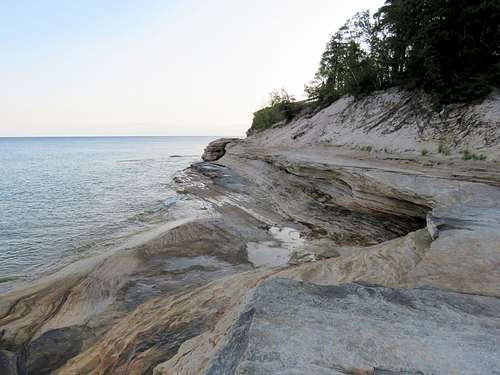
Went down a short spur trail to reach a slickrock beach. The shoreline of Grand Island was visible in the horizon across the lake.
|
|
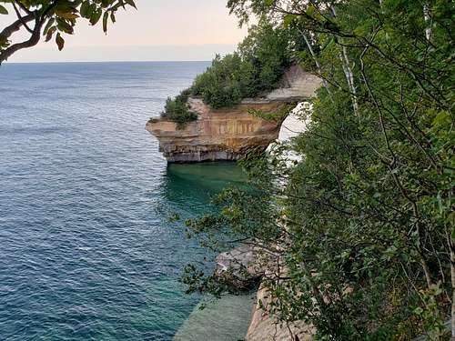
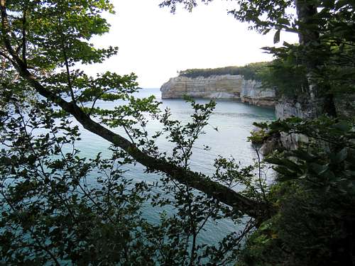
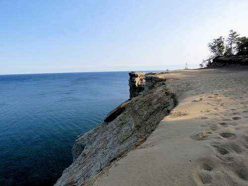
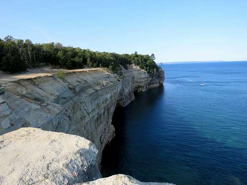
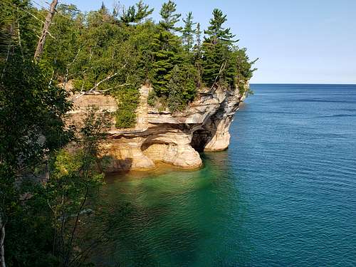
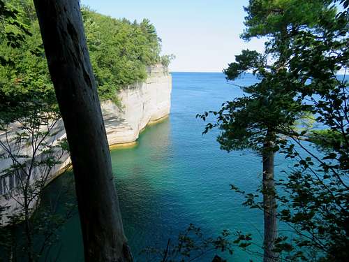
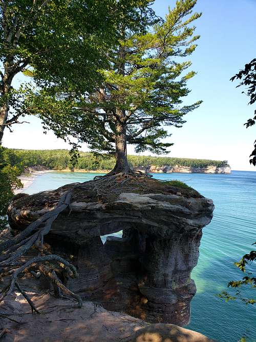
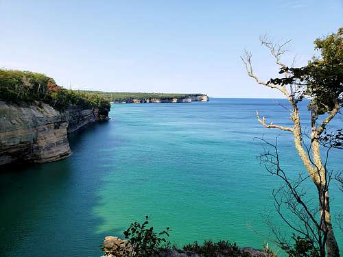
Got back on the trail which as I suspected went in the forest giving me little to no views of the lake. I knew I was approaching the natural bridge known as Lover’s Leap so I went off trail in a couple of spots to the edge of the cliffs until I could take this shot.
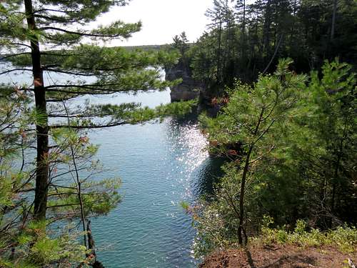
Went on a spur trail to the top of Lover’s Leap and then back to the main trail again until I could look back (southwest) to see Lover’s Leap from a different angle.
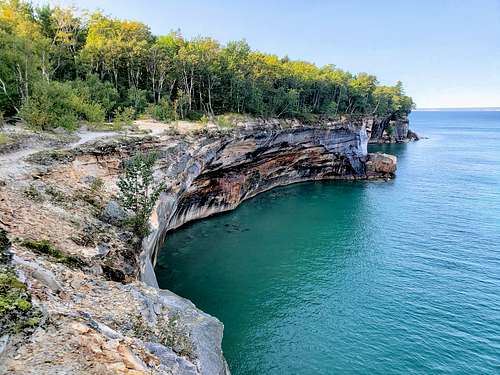
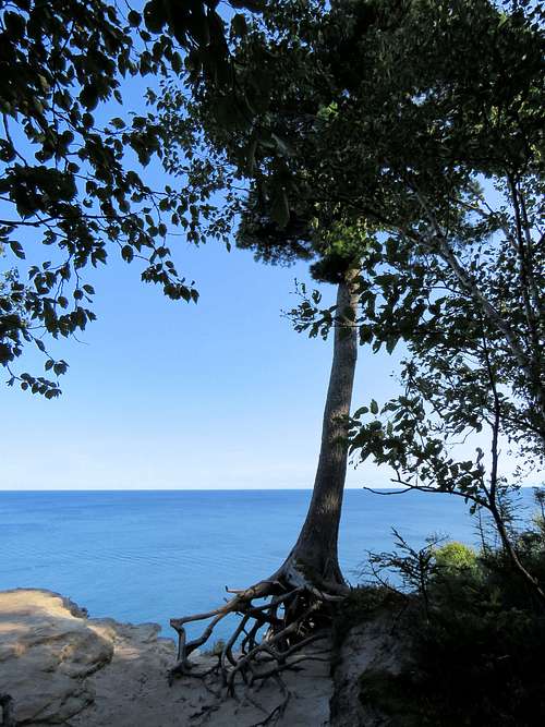
The trail went higher in elevation taking me toward Grand Portal Point.
|
|
|
|
|
|
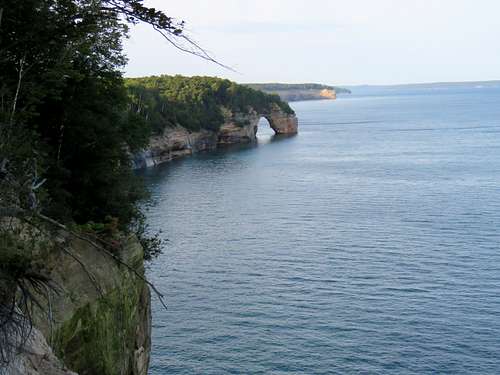
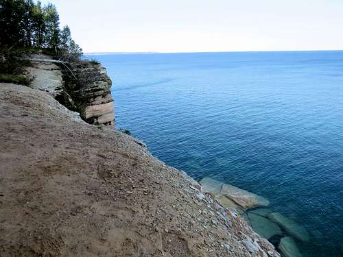
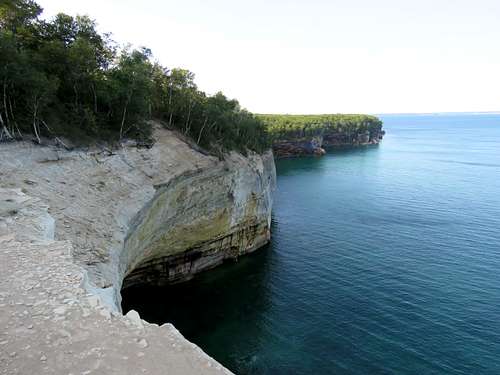
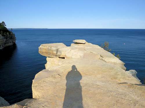
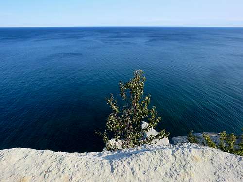
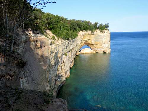
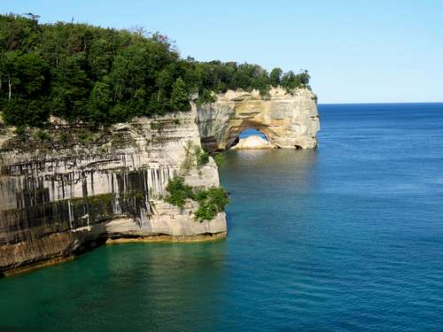
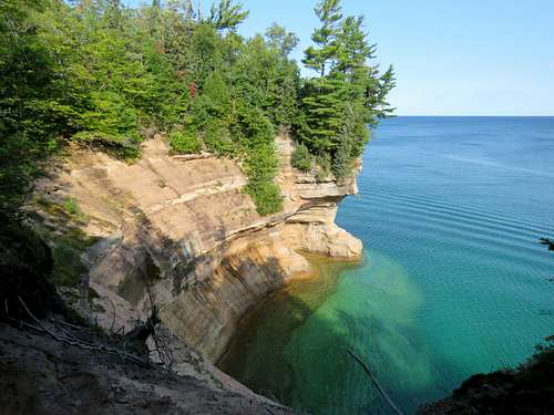
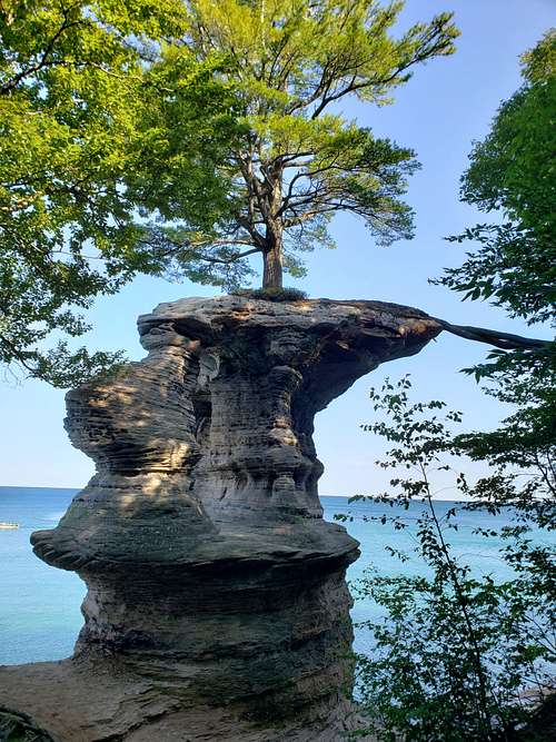
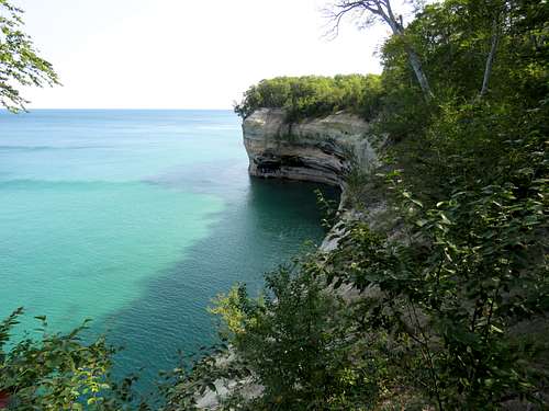
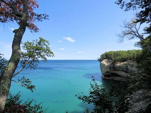
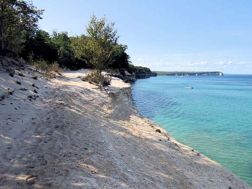
At around 9:45 a.m., I reached Grand Portal Point where there was a very nice large opening on top of the cliffs which rose almost 200 feet above the lake. It was still early and I was lucky to have the whole area to myself. Sat there for 20 minutes to eat and enjoy the views. I did not know it at that time but I was sitting on top of another natural bridge. Boats and Kayaks came there frequently.
|
|
|
|
|
|
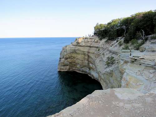
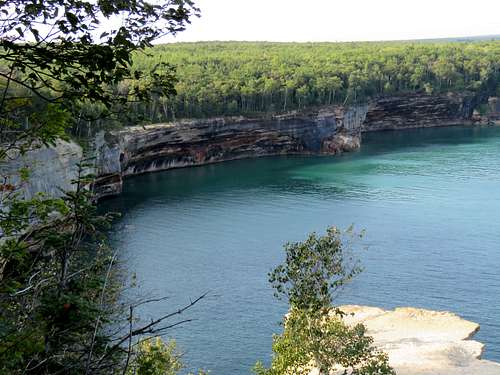
As I began to hike again, I started to run into other people frequently. Looking back west, I saw a big impressive natural bridge under where I had earlier sat at Grand Portal Point.
|
|
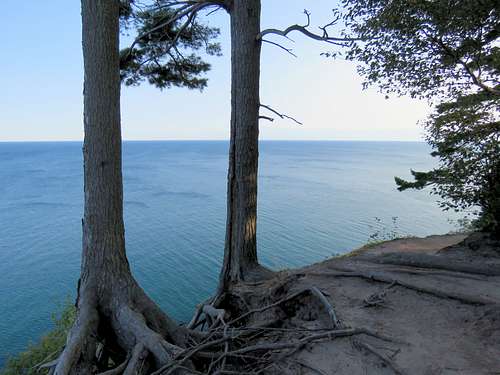
Continuing east, the trail slowly came down in elevation.
|
|
|
|
|
|
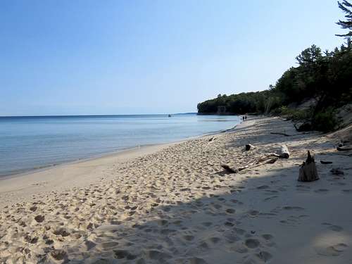
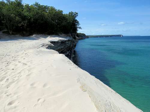
At 10:40 a.m., I reached Chapel Beach which was a beautiful sandy beach. A lot of people were there.
|
|
At the east end of the beach, there was a small waterfall called Chapel Beach Falls.
|
|
Got back on the trail to reach the crowded Chapel Rock. Had to wait my turn to take a picture without other people obstructing the view.
|
|
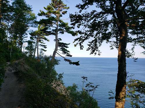
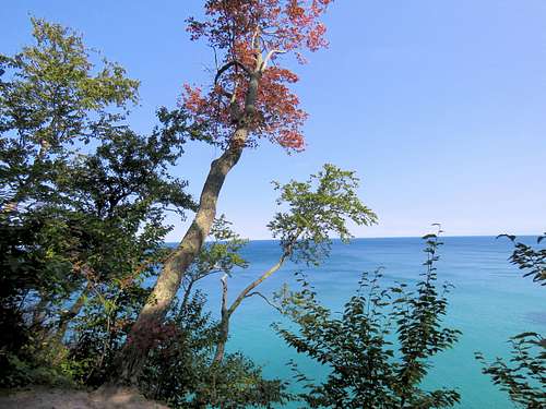
As I continued east beyond Chapel Rock, crowds disappeared. The trail slowly went up again going along the edge of the cliffs.
|
|
|
|
|
|
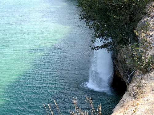
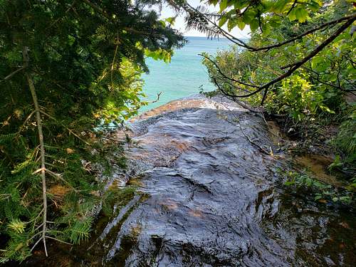
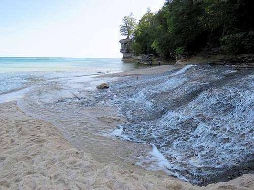
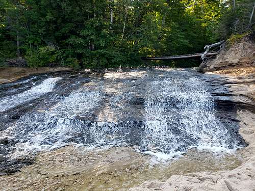
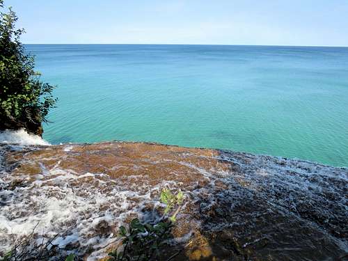
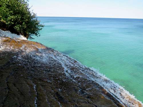
I then reached a creek which I knew was the one giving rise to Spray Falls. Followed a beaten path along the west banks of the creek to reach a nice open sandy area that provided me a view of Spray Falls. A bush obstructed the view of the upper parts of the falls but the lower parts of the 70 foot tall falls could be seen.
Went back to the west bank of the creek hoping to reach where the water poured down. This was as far as I could go.
Went back to the trail, crossed to the east side of the creek and followed it toward Spray Falls. I was able to go until 2 feet before the pour off. Stepping on the wet slickrock to go further would have been stupid.
|
|
Went back to the open sandy area where I sat at 12:00 noon to eat and enjoy the views. Had the whole place to myself except for a number of boats that came to view Spray Falls.
|
|
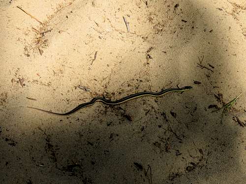
Left at 12:20 and walked back to Chapel Beach and then got on the Chapel Beach Trail to take a different route back to the trailhead. It became partly to mostly cloudy. A pleasant wind was blowing in the trees making me feel so good. Small snake on the trail.
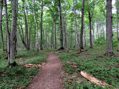
The forest itself was beautiful.
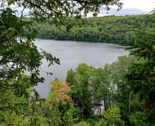
In one spot I got a good view of Chapel Lake.
Reached the trailhead at 2:15 p.m. I was glad to see a few open spots in the parking lot and falsely assumed that there would be no traffic jam on the road. When I finally began to drive back, I noted that cars were parked on one or both side of the narrow dirt road making the road wide enough for only one car. As I Frequently reached cars that came in the opposite direction, one of us had to backup into a tight squeeze, to let the other one go. That situation continued for more than a mile.