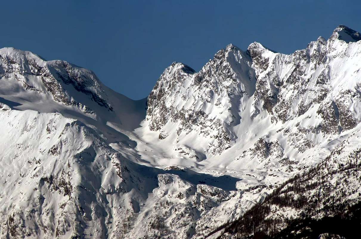
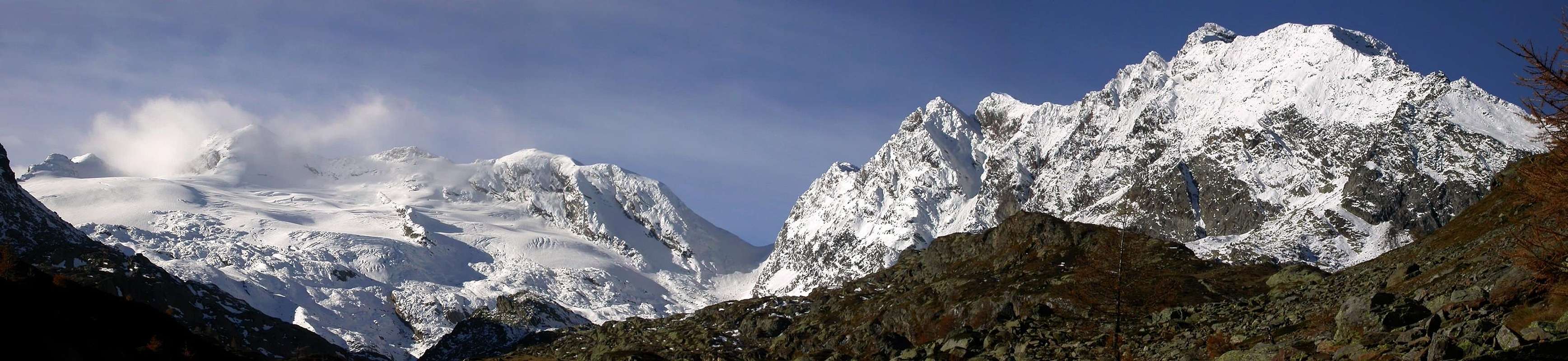
Good trip, in enough solitary environment it asks for a good training because of the length of the itinerary. Excellent panorama along the whole run.
Ottima gita, in ambiente abbastanza solitario richiede un buon allenamento per via della lunghezza dell'itinerario. Eccellente panorama lungo tutto il percorso.
Getting There
BY CAR:
From Torino, Milano, etc: Motorway A5. Exit at Aosta Ovest.
From Switzerland: through the Grand Saint Bernard Tunnel or the namesake Pass.
From France: through the Mont Blanc Tunnel or Petit Saint Bernard Pass: It is not necessary to take Motorway A5: you can drive on SS.26, in the direction of Leverogne.
BY PLANE:
Aeroporto "Corrado Gex" Saint Christophe (Aosta).
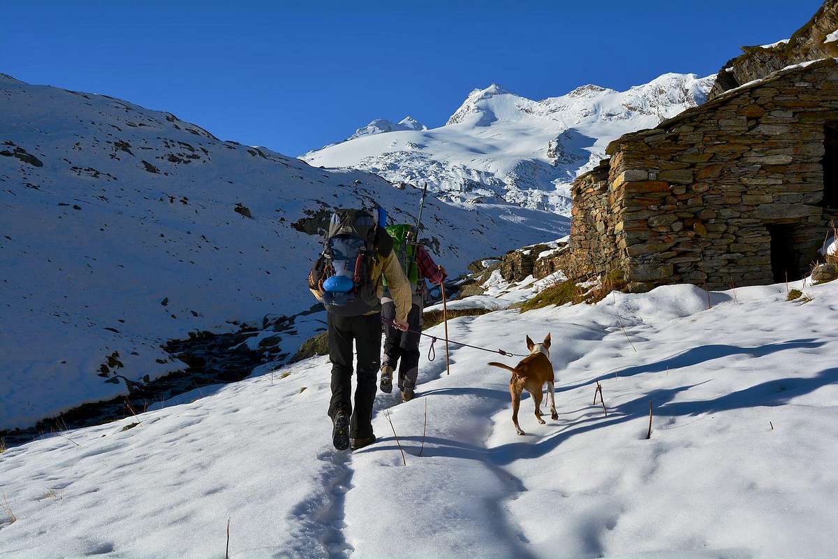
From the City of Aosta (583m) follow the SS.26 in the direction of Mont Blanc. Near the Village of Leverogne (780m) turn left on the Regional Road for Valgrisenche. Go past the Villages of Rochefort, La Ravoire, and Chamencon; then turn right for the Village of Planaval (1.557m), about 10 km from Leverogne. You can park here and continue on foot along the paved road in the direction of the Village of La Clusaz (1.631m): once out of the village, turn left after two switchbacks. But, if you are lucky, you can also park your car just in front of the start of the trail, that is clearly visible and well-marked.
Dalla città di Aosta (583 m) si percorre la SS.26 per il Monte Bianco e giunti nei pressi dell'abitato di Leverogne (780 m) si imbocca sulla sinistra strada regionale per la Valgrisenche, dopo aver superato le frazioni di: Rochefort, La Ravoire e Chamencon girare sulla destra per la frazione di Planaval (1.557 m) situata a circa 10 km. da Leverogne. Qui lasciare l'auto e proseguire a piedi lungo la strada asfaltata verso il villaggio di La Clusaz (1.631 m) dopo aver superato i due tornanti dopo l'abitato svoltare sulla sinistra (sentiero evidente e ben segnalato da cartelli).
Route Description
Gain the initial, steep 500m of elevation and go past a water outlet at 2.060m to reach the first plateau. Continue along the bank of the stream that flows from the Château Blanc Glacier. Past a small wooden bridge, the trail climbs steeply for another 100 meters before reaching the second plateau, where another small bridge is located. Cross the bridge and aim straight for the Baracche (Huts) of Fond (2.340m, 2h'00). Good trip, in enough solitary environment it asks for a good training because of the length of the itinerary. Excellent panorama along the whole run. From the Alpeggio to continue along the valley decidedly aiming I pour the well visible Pass to West, after having coasted along to the left the glacier of "Château Blanc" to go up again the final ramp (ice axe and crampons) that it brings to the Pass of Planaval (3.016m). From La Clusaz 5h'00/6h'00.
Superati i primi ripidi 500 metri di dislivello e dopo aver superato una presa d'acqua (2.060 m) si raggiunge il primo pianoro, continuare sul lato del torrente che scende dal ghiacciaio dello Château Blanc, dopo aver oltrepassato un piccolo ponticello in legno il sentiero risale ripido per un altro centinaio di metri dopodiché si raggiunge un secondo pianoro dove anche qui è posto un piccolo ponte, attraversalo e dirigersi verso le baracche di Fond (2.340 m)2h'00. Dall'Alpeggio continuare lungo il vallone puntando decisamente verso il Colle ben visibile ad Ovest, dopo aver costeggiato a sinistra il ghiacciaio di Château Blanc risalire la rampa finale (picozza e ramponi) che porta al Colle di Planaval (3.016 m). Da la Clusaz 5h'00/6h'00.
Essential Gear
High mountain equipment: including Rope, ice axe, and crampons.
Parents refers to a larger category under which an object falls. For example, theAconcagua mountain page has the 'Aconcagua Group' and the 'Seven Summits' asparents and is a parent itself to many routes, photos, and Trip Reports.

 5137 Hits
 77.48% Score
 8 Votes