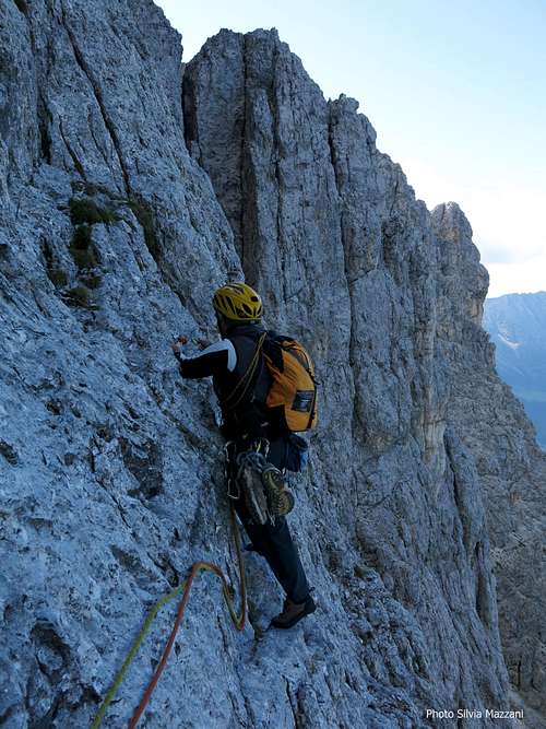
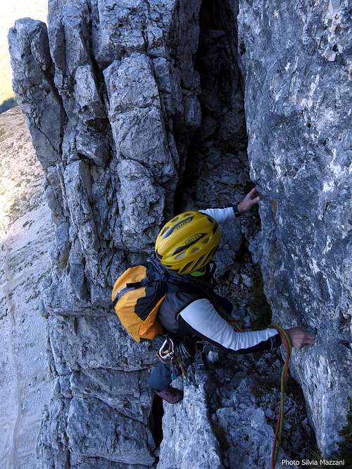
-
 4525 Hits
-
 85.36% Score
-
 20 Votes
|
|
Mountain/Rock |
|---|---|
|
|
46.44720°N / 11.61910°E |
|
|
Trentino Alto-Adige |
|
|
Trad Climbing |
|
|
Summer |
|
|
8976 ft / 2736 m |
|
|
Overview
Geographical classification: Eastern Alps > Dolomites > Catinaccio Group > Cresta di Davoi > Punta Kafmann
Punta Kafmann m. 2736
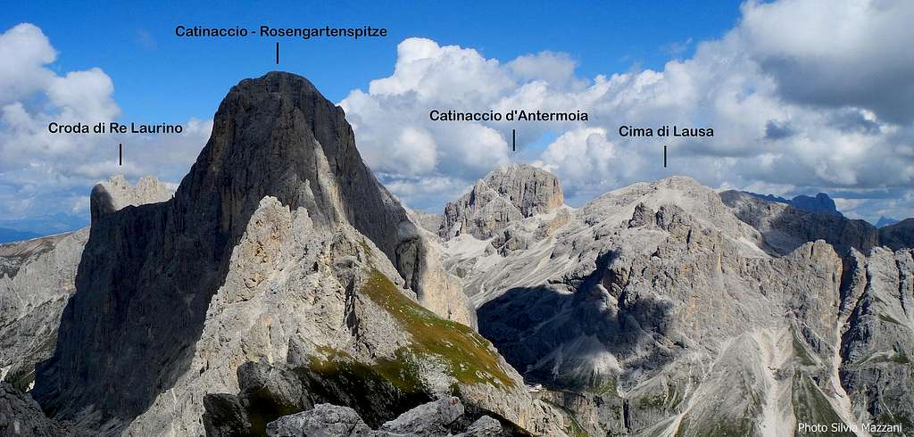
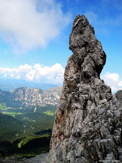
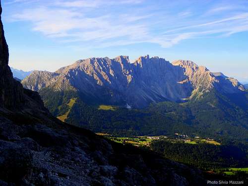
Catinaccio Group – Ciadenac in Ladin dialect, Rosengarten in German - is a superb group belonging to the Western Dolomites, located between the valleys of Tires, Ega and Fassa; its central sector, including the main summit of Catinaccio, is the finest and best known, so that the name Catinaccio has been applied to the whole massif. An extended crest about 1300 meters long runs from Forcella Sud del Catinaccio as far as Passo delle Coronelle: it’s Cresta di Davoi or Baumann und Tschager-Kamm, showing some rocky towers lined up from North to South.
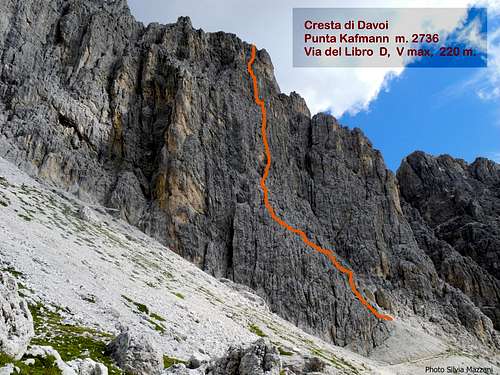
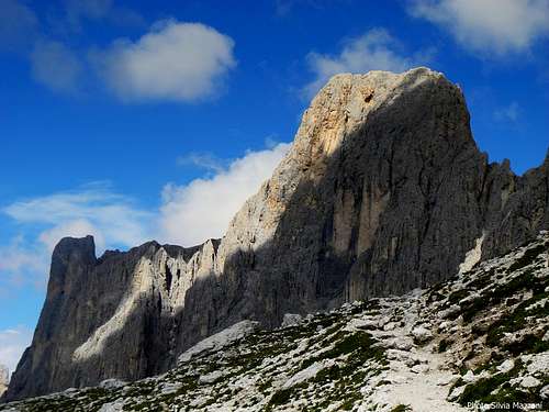
The mountain stretches towards the West with a beautiful wall 200 meters high built of good quality "dolomia", articulated in a succession of corners and chimneys, overlooking the Refuge Fronza alle Coronelle To the East it appears as a shorter side facing to the Gardeccia basin.
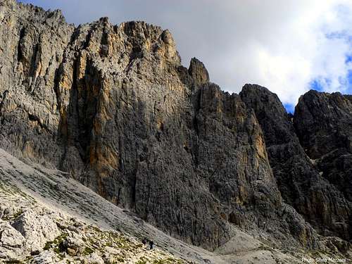
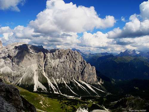
The third tower along Cresta di Davoi - starting from North - is Punta Kafmann, which takes its name from its first climber, Hansi Kafmman from Nova Levante.
Getting There
The starting point is Rifugio Fronza alle Coronelle, quickly accessible from the road between Passo Nigra and Passo di Costalunga Road access
- From Trento and Bolzano: Take the Brennero motorway, exit Bolzano Nord, then follow the Val d’Ega road to Nova Ponente, carry on until the junction located between Passo di Costalunga and Passo Nigra. At the junction follow to the left the signposts to Passo Nigra – without reaching the pass - as far as the chairlift "Re Laurino" on the right side of the road near the Malga Frommel. Wide parking on the left side.
- From Val di Fassa: From the main Fassa Valley road follow the signposts to Vigo di Fassa and Passo di Costalunga (Karerpass), getting to the pass. From here continue towards Passo Nigra and park the car as described at the previous point.
Access to Rifugio Fronza alle Coronelle
The shelter can be reached by walking on a path starting nearby the chairlift station in about 1 hour and 15 min., otherwise by the chairlift Re Laurino.
Punta Kafmann Via del Libro report
Punta Kafmann - Via del Libro report UIAA scale
- Summit altitude: m. 2736
- Difficulty: Alpine D, max V UIAA
- Climbing length: 250 m.
- Pitches: 8
- Exposure: W
- Equipment: some pegs
- First ascent: H. Kafmann, F. Kafmann and M. Bittner summer 1978
- Starting point: Rif. A. Fronza alle Coronelle m. 2201
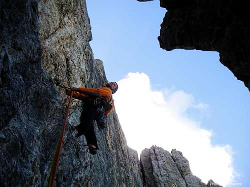
A classic route on good rock. The climb is amusing and some pitch are truly fantastic; the pleasant atmosphere, the proximity to the refuge and the quick access make it quite advisable. The wall remains in the shadows until the middle of the morning. The pegs on the route are enough, however to be integrated with some rare hourglass, nuts or friends (if you want to protect yourself better). Nuts and friends are useful to reinforce the belays.
Route report
L1/ L2 - Under the vertical of the characteristic black spot on the first third of the wall, follow slanting left a chimney ramp located behind a little spur for about 100 meters, reaching a small pulpit. II with a step of III. The pitch can be divided in two ones, with a possible intermediate stop on spikes or hourglasses.L3 – Directly reach a corridor between the main wall and a detached pillar, climb to the right the 5 meters high little chimney and reach a stance above the chimney and below the crux pitch. 40m
L4 - To the right of the stance climb the large flake that above widens to form a magnificent hidden dihedral V, IV +, 25 m.
L5 - Follow for a few meters the small ramp on the right, then continue on the flake and to the left on a slab (III and II, an hourglass) until you reach a ledge. III, 45 m. Belay below a yellow hole.
L6 - Follow the black wall above the belay slant to left, then go a few meters to the right. Near a dihedral move to left again to reach a belay on a hourglass under a yellow overhang. Route-book IV+, 35 m.
L7 - Traverse definitely to right for a few meters then follow the ramp ascending to the right that leads to the top of a foresummit where to stop IV, 30 m.
L8- Overcome the foresummit and cross the next fork to the left, until reaching the bottom of a white corner. Climb it directly up to the crest IV, then II, 40 m.
Descent: the descent is not difficult but the ground is rather unstable and delicate. From the belay on the crest descend 10 meters towards the East (the opposite side of the face climbed), then definitely slanting right, doing a descending traverse on easy rocks, steep scree and meadows (follow the cairns) as far as the well marked path that rises to the Coronelle Pass. From here follow the trail 550, reaching comfortably the Ref. Fronza (from the top 1 to 1.5 h).
Red Tape
There are no special restrictions or prohibitions in hiking and climbing. Punta Kafmann and Catinaccio Group are situated inside the Natural Park Catinaccio - Sciliar.


Moreover this area is one of the nine mountain systems of the Dolomites acknowledged as UNESCO World Heritage Site and deserve the best care and respect. More info about Dolomiti Unesco World Heritage here:
Dolomites living mountains
Dolomiti Unesco
Hut
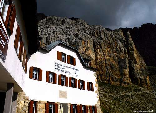
Rifugio Fronza alle Coronelle 2337 m., Provincia Autonoma di Bolzano
Situation: Foot of Catinaccio and Cresta di Davoi
Open: 15 of June - 15 of October
Size: 64 persons
Getting There: by walking from Malga Frommel in 1,15 hour - by the chair-lift "Re Laurino"
When to climb
Best season goes from the middle of June to the end of September
Meteo
METEO BOLZANO
METEO TRENTINO
DOLOMITI METEO - TRENTINO
Guidebooks and maps
Guidebooks


- "Arrampicare nel Catinaccio e dintorni" by Mauro Bernardi, Ed. Athesia 2014
- “La nuova guida del Catinaccio” by Antonio Bernard, Ed. Mediterranee, 2008 – A wide selection of the Catinaccio group climbing routes
- "Dolomiti e dintorni" by Roberto Iacopelli - Cierre Edizioni 2000
- “Catinaccio” by Dante Colli and Gino Battisti, Tamari Editori in Bologna, 1984
Maps

Val di Fassa e Dolomiti Fassane - 1:25.000 - foglio 06 - Tabacco


