
Comments
No comments posted yet.
|
|
Trip Report |
|---|---|
|
|
43.83480°N / 102.2015°W |
|
|
Download GPX » View Route on Map |
|
|
Oct 1, 2020 |
|
|
Hiking |
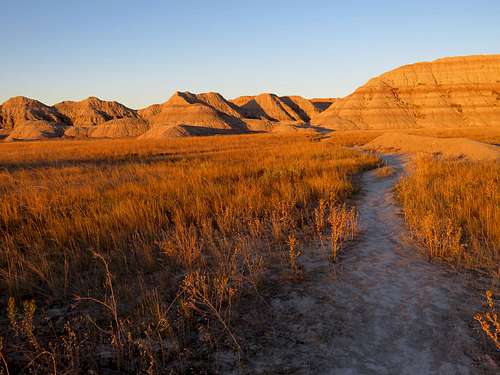
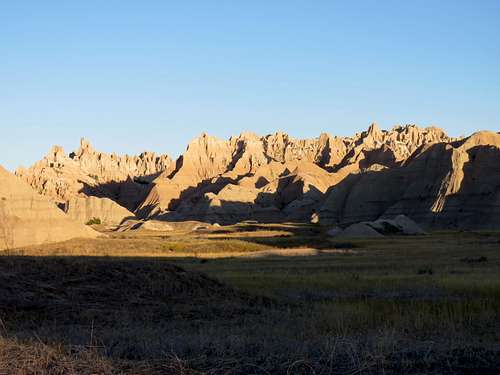
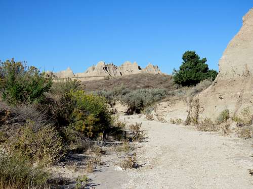
Sage Creek is a 23 mile long hiking path in South Dakota’s Badlands National Park. The trail does not appear on the park’s official map but I had found the GPS track for it on the internet. This came in very handy in places where the trail was not well established. My plan was to do a day hike, not the entire 23 mile loop.
From the trailhead on Conata Road, I followed the trail to Deer Haven, went up a forested slope to a saddle and then descended into the canyon of Sage Creek. After following the dry creek bed downstream for some time, I turned back and went upstream going off trail beyond where I had entered the canyon to reach the upper end of the canyon in an enchanted land of strange formations.
Hike Length: 12.2 miles
Total Ascent: 830 ft
Minimum Elevation: 2610 ft
Maximum Elevation: 3010 ft
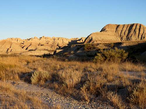
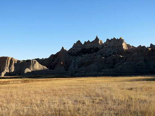
Left the cabin at Cedar Pass Lodge in Badlands National Park around 6:30 a.m. and drove around 20 miles on park’s main road to the trailhead on Conata Basin Road. At viewpoints along the road, I saw people who were presumably waiting to take pictures at sunrise (around 6:50 a.m.).
There were a few vehicles at the trailhead but I did not see any people. It was 32 degrees F with a little wind and elevation was 2625 ft. Started my hike at 7:00 a.m. as the sun was rising over the badlands.
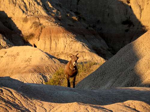
Saw a wild goat in the distance and took a zoomed photo of it. As I went on the trail toward the goat, the goat seemed to come toward me rather fast making me wonder if it was going to attack me. Had my hiking poles ready to defend myself but it went right by me without paying any attention to me. It seemed to have a tracking device around its neck.
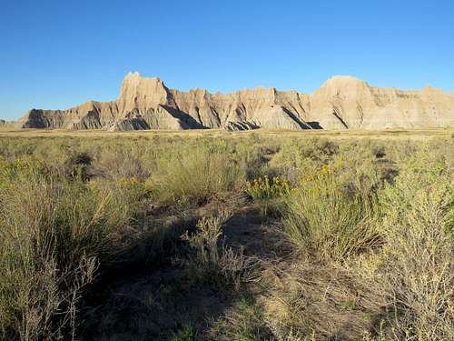
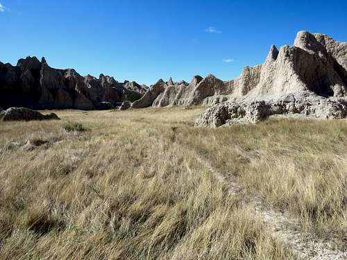
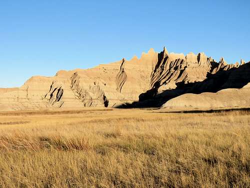
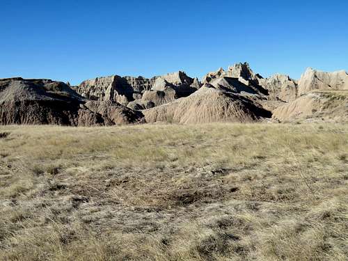
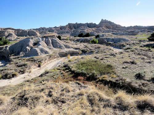
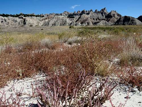
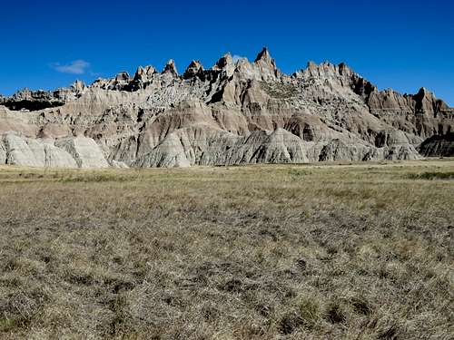
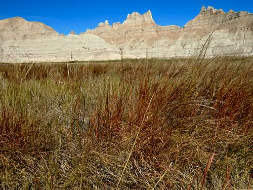
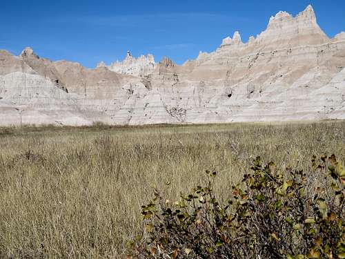
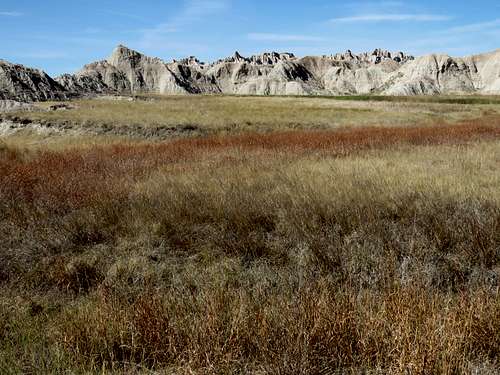
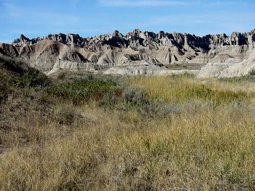
I could not see a trail and noted that I was way off the path shown on my GPS. Walked on the grassy plain until I reached a well established trail where my GPS showed. I then followed the trail west at the base of the badland mountains that rose very steeply to the north. To the south, a grassy plain stretched into the horizon.
|
|
|
|
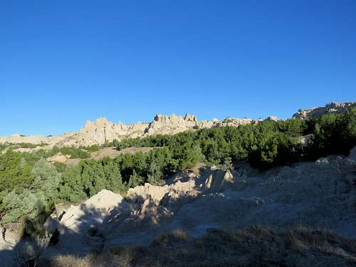
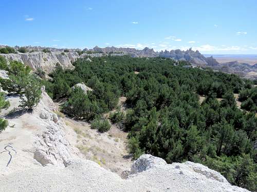
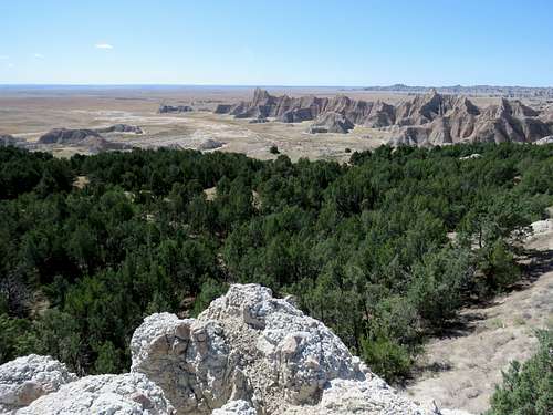
After around 1.6 miles, the trail turned northwest and entered a small plain that was surrounded by badland mountains except to the south. The slopes to the north were forested. I knew that I would eventually be going up the forested slope, which is named Deer Haven.
|
|
As I traveled north toward the forested slope, the trail faded away. Did not want to go up the slopes at the wrong place and find myself at the base of a wall. Fortunately, my GPS took me on the correct path.
Went up a gentle slope that I can only describe as baked mud with a lot of bumps similar to moguls on a ski slope.
As I entered the forest, a well established trail appeared again but it seemed to take a totally different path than what my GPS showed. I decided to follow the obvious trail .
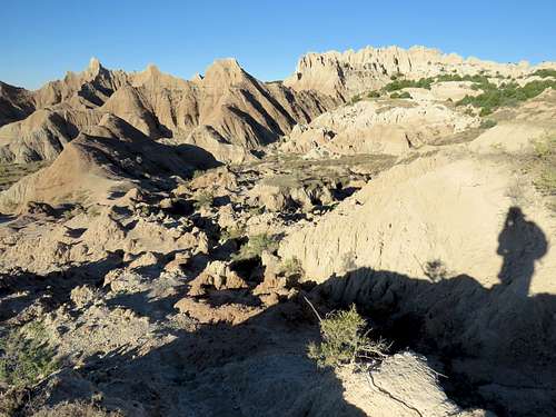
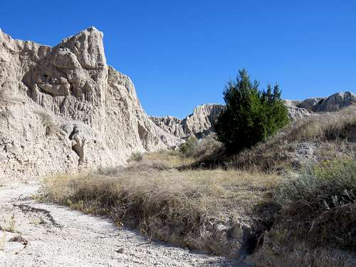
Looking down at the small plain where I had been.
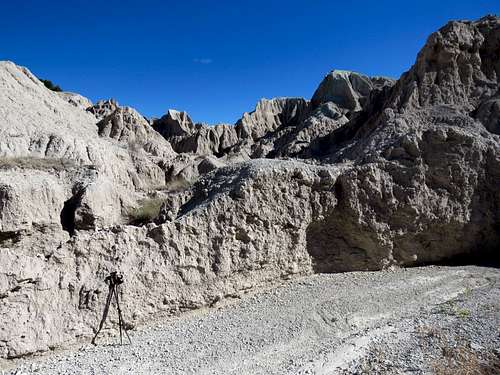
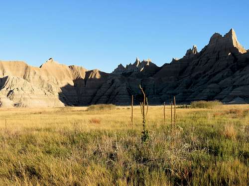
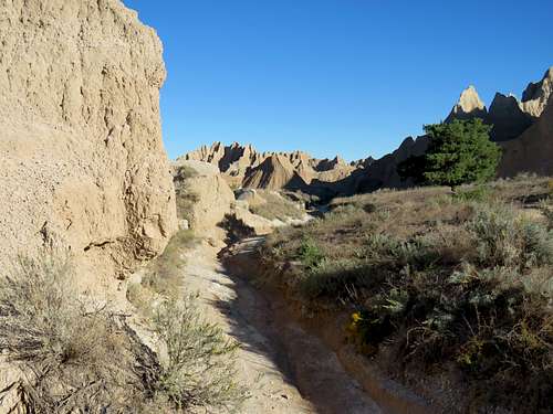
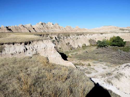
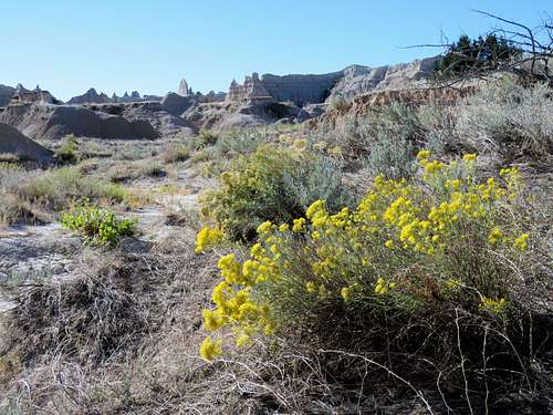
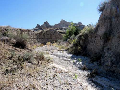
I then reached a 2915 ft saddle where I ran into two hikers. They were the only people that I saw all day while hiking. They asked if I knew the correct path. I told them that we were off of the path that I had entered into my GPS but could see that Sage Creek Canyon was a short distance down the slopes to the north. There was no trail but we went down easy slopes to reach Sage Creek Canyon where my GPS said the path was. Once in the canyon, I stopped to let those hikers get way ahead of me. Did not see anyone else all day. Got in the canyon which was basically a dry wash and began to follow it downhill. Sometimes walls rose on the sides of the wash blocking my view but at other times there were no walls. The path was very tortuous.
|
|
|
|
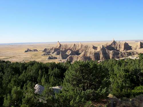
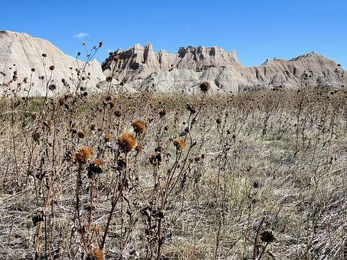
After a while, I wondered how much more I should go. I did not want to be crazy enough to attempt to go the entire 23 miles. The day was probably not long enough (although it later turned out that despite all my stops and picture takings, the day was just long enough). At a spot, I went up a hill to a flat area where I had good views. It was 9:05 a.m. and I had gone 4.55 miles. Took the backpack off and sat there to eat. It felt pretty cold so I had to put on my jacket. Views from the hill top.
|
|
|
|
Decided to go back up Sage Creek to explore the upper end of it, which is not part of the usual 23 mile Sage Creek Hiking Path. Left at 9:30 a.m. and began to walk back up the canyon.
|
|
Soon went past where I had entered the canyon and 0.6 miles later reached where my GPS said I should have entered the canyon. I usually leave a map for my wife showing where I plan to go. From there on, I knew that I would be beyond where rescue people might be looking for me. That was not a good thing to do but the area was too enticing.
|
|
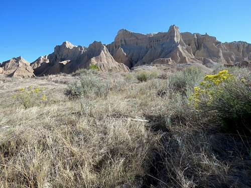
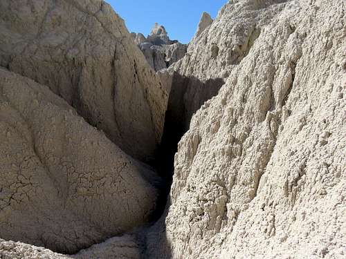
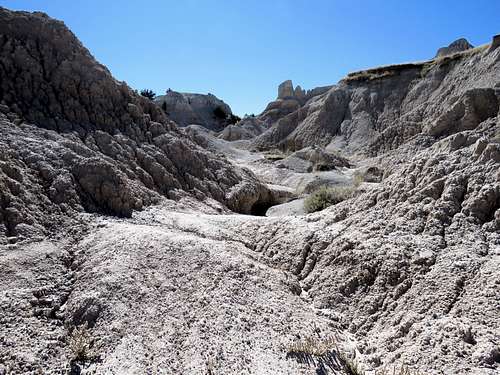
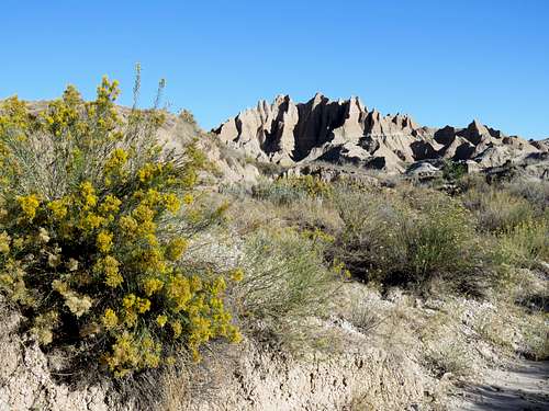
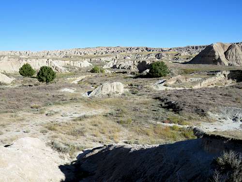
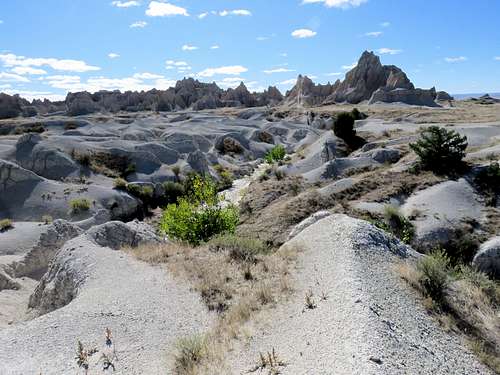
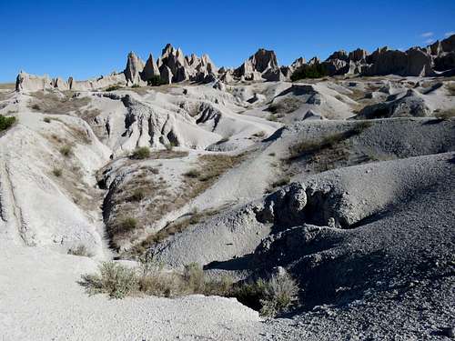
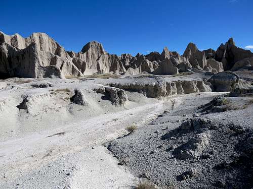
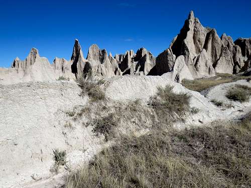
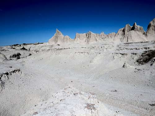
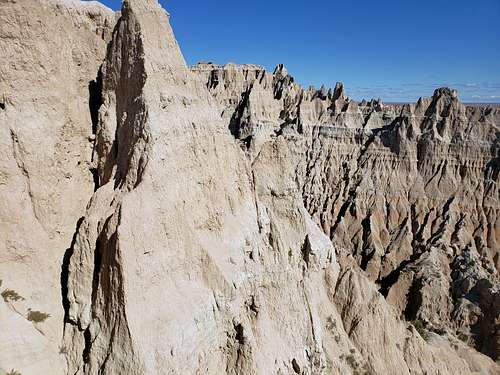
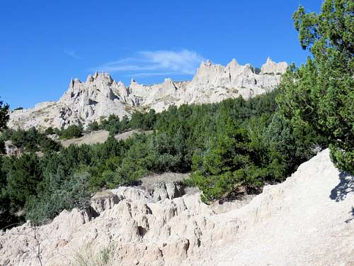
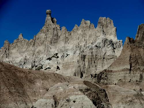
As I went higher, the walls of the canyon became shorter. In a spot, I went up a slope to find myself in a spectacular white colored fairyland of strange formations.
|
|
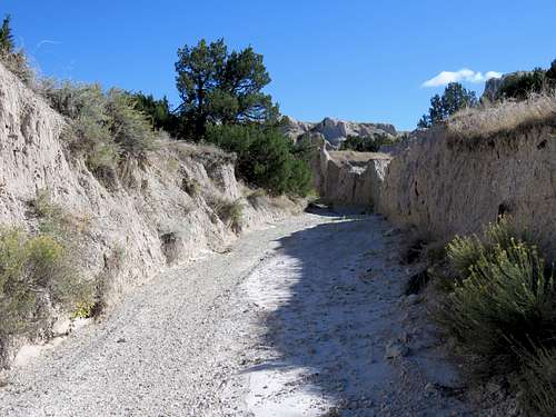
The terrain outside the canyon (which was turning into just a dry wash) was too rough to hike on so I returned to the bottom of the dry wash. The wash kept branching and at each split I followed a random branch. It really felt as if my spacecraft had crash landed on an unknown planet where I was the only human.
|
|
|
|
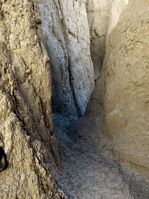
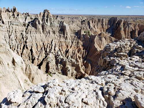
Going further up a branch, I reached a wall which I though would be the end of my path. To my surprise, I found a slot canyon behind the wall and went into it. In places the canyon was barely wide enough for me and my backpack to pass through.
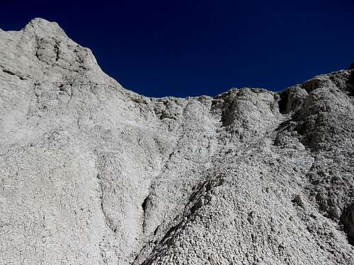
I was finally at the very end of the path surrounded by walls and very steep slopes. It looked as if I could crawl up a steep slope say two stories tall to reach a ridgetop. Left my hiking poles, backpack and camera there and went up the steep “baked mud” slope.
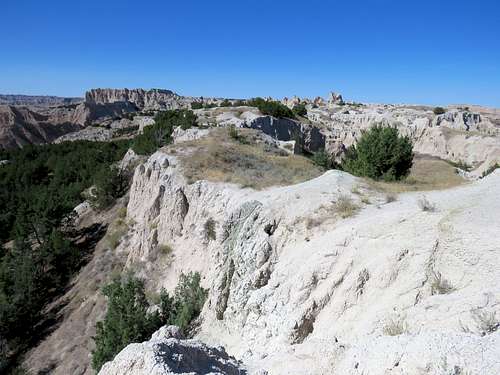
The ridgetop turned out to be only 12 inches wide. I did not want to stand on top of it fearing that it might collapse causing me to tumble into a deep canyon on the other side. I stopped where my head went above the ridgeline and took these pictures with my call phone. It was 10:55 a.m., 3010 ft elevation and I had hiked 7.4 miles.
|
|
Went down to my backpack and retraced my way out of the slot canyon.
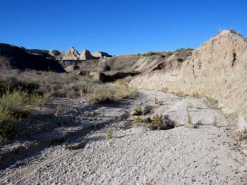
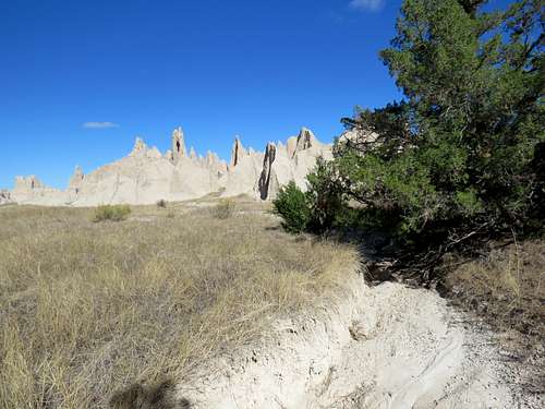
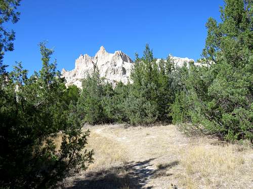
Further down, I sat in an area among the white colored formations to eat and absorb the strange scenery. Could not get enough of that spot but left at 11:25 a.m. and went further down the canyon to the spot where my GPS said I should have entered the canyon. I suppose that was the old trail that was no longer in use. Decided to try to return via the path that my GPS said. Exited the canyon by going up a slope and reaching a forested area with no trail. A little bushwhacking brought me to an edge with great views.
|
|
To continue via the path that I had entered into my GPS, it appeared that I had to go down a nasty slope and then bushwhack through the forest. That just seemed like too much trouble so I went back into Sage Creek Canyon and followed it downhill until I reached where I had entered the canyon.
Went up the slope to the 2915 ft saddle where I had been in the morning and got on the trail that took me down into the forest.
|
|
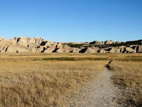
Out of the forest and down the mogul slope, I reached the grassy plain at the base of the mountains and retraced my way back to trailhead where I arrived at 1:30 p.m.
|
|
|
|
|
|
|
|