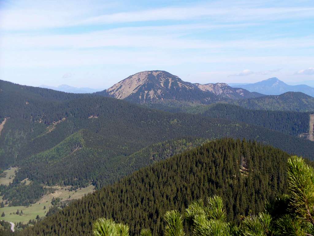
Salatín at 1630m, with an imposing prominence of 530m, is located in the northwest corner of the Low Tatras, away from the main ridge. It is one of the grandest limestone and dolomite mountains in this mountain range. And it is a classic of its kind: wild, bear-friendly, covered by forest and bushes of the dwarf mountain pine higher up, its slopes and surroundings rich in karst landforms, such as the canyon of Mraznica brook named Hučiaky through which one of the waymarked trails to the summit runs. No wonder I just had to climb it.
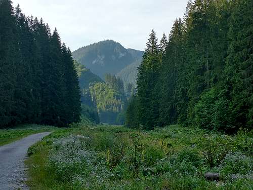
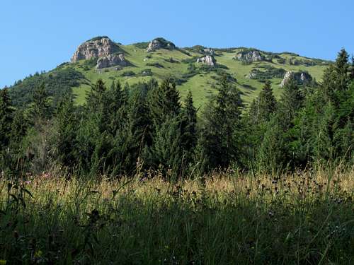
The most interesting route to Salatín leads through Hučiaky. The trailhead is in the village of Ludrová, just 6km south of the town of Ružomberok. For the first five kilometres you walk, along what used to be a tarmac road and now often looks like a dirt track, up the Ludrovská dolina (dolina = valley). One kilometre before the end of this stretch you get the first sight of the limestone crags that make up the massif of Salatín.
Crags of Salatín massif from Ludrovská valley
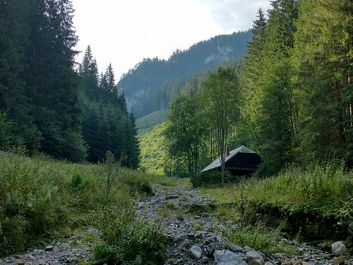
You will pass a lone cottage and turn left leaving Ludrovská dolina at the sign that reads 'Hučiaky, ústie (735 m).' The signpost stands at the mouth (ústie) of the valley of Mraznica brook. The valley here is wide enough for a lodge named Skalnô, which was locked when I was passing by and seems to be a property of the national park.
Skalnô
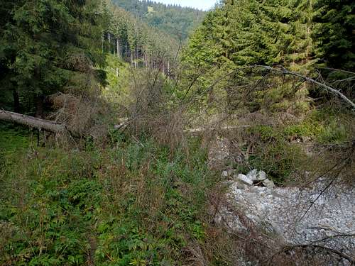
After walking along the streambed (usually dry in summer) for several hundred metres, you may run into fallen trees barring your passage. This means you have missed the point where the path left the gully so as to save you some tough bushwhacking. Marking along this trail is not excellent, partly for natural reasons: the action of running water, plenty of fallen trees.
Just past Skalnô cabin
On the other hand, there is no doubt that the trail is maintained. But if you do not have much time, you had better be careful. Throughout the valley, until it turns into the gorge of Hučiaky proper with its vertical walls, the trail leaves the streambed twice to run up its southern (left as you face downstream) bank. The more trodden path is not always the answer. For example, just before the actual entrance to the canyon, the most trodden path leads you up the other side of the valley, away from the waymarked trail.
Disappearing trail
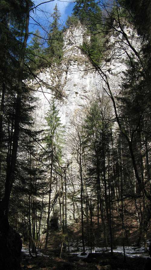
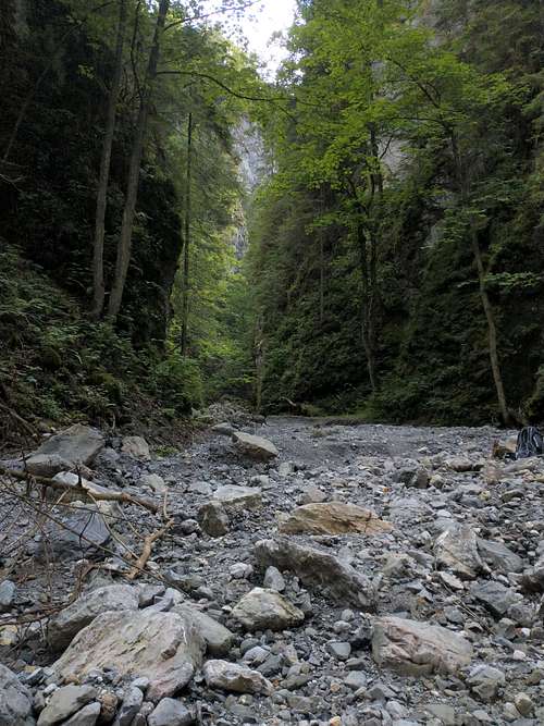
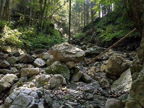
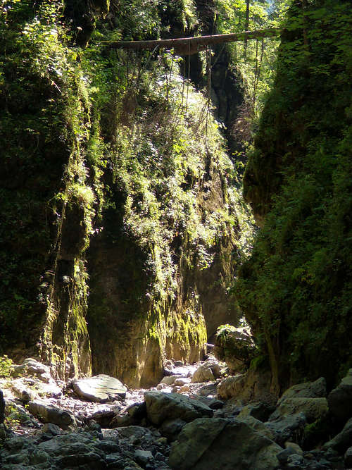
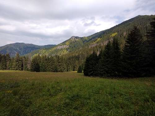
Although the sign at the mouth of Mraznica brook reads Hučiaky, ústie, meaning the mouth of Hučiaky, the lower Mraznica (as well as its valley) is actually called Skalnô, and despite its steep sides, is not a canyon yet. The actual canyon has been cut by the stream in its middle course, one kilometre away from the mouth of its valley. After you have entered the canyon, you don't need to look for the marks any longer, you just hike along the streambed. The hike is pure fun and the scenery magical.
Actual entrance to HučiakyWalking up HučiakyIn the upper part of Hučiaky
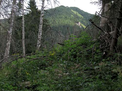
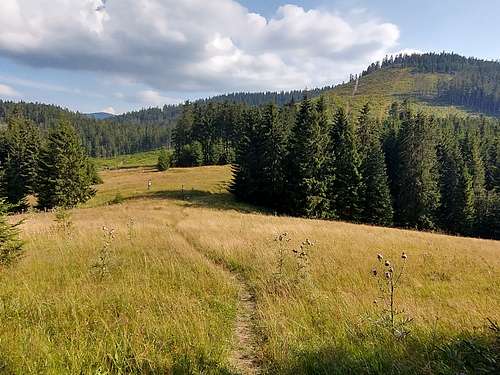
Past the upper end of the canyon is a sizable clearing, where the path (and the valley) forks. The left-hand branch is unmarked and runs somewhere towards Uplazy and Malý Salatín, whereas the marks turn right. Now you will be walking up the uppermost section of Mraznica valley, through fairly dense vegetation, and you will need to watch the marks closely again.
Above Hučiaky
In 2021, when I was there, the marks (not frequent and sometimes hard to spot) kept to the left (as you face downstream) bank of the shallow gully in which the stream flows (if there has been enough rain) for over half a kilometre. Having crossed the gully, they stuck to its right bank and the trail soon became obvious.
In uppermost Mraznica valley
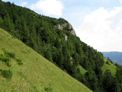
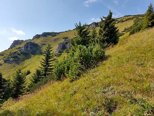
Before the trail climbs onto the ridge of Magura, which extends from the summit of Salatín to the west, you will get the first view of the mountain from a vast clearing at about 1230m.
NW slope of Salatín
Just after this clearing is another meadow, whose upper end sits on the west ridge of Salatín between Magura and Magurka. Here, at 1280m, the most demanding part of the ascent begins, steep and making you feel that it may have no end.
Salatín from Magurka
There will be some interesting views of the village of Liptovská Lúžna down in the valley and the range of Veľká Fatra beyond it.
BánSkalaLooking SW, towards Veľká Fatra
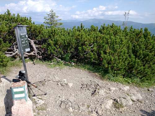
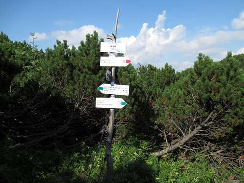
When it seems you are almost at the summit, the trail starts to slowly descend and you may think you have somehow missed the target. This does not last long though and soon you get to a T-junction with a sign that reads 'Salatín 1630 m'. This is a bit confusing again as it is not the summit yet.
Trail junction near the summit
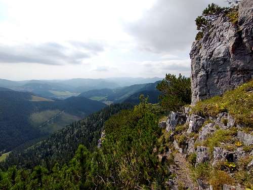
To finally set foot on the summit you take the left turning and walk another hundred metres following green marks. (The green trail carries on north along the main ridge towards Malý Salatín, before which it turns left to head for Ludrová via a side ridge whose uppermost part is known as Uplazy.)
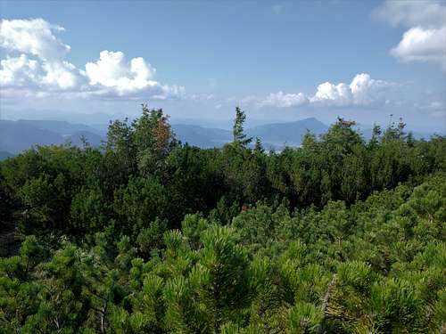
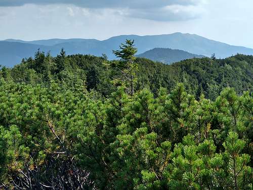
Summit view NorthSummit view South
Start point
Via
Approx. total elevation gain (m)
Approx. distance (km)
Approx. time of hike up (hr)
Ludrová
Hučiaky
1100
10
4.5
Ludrová
Úplazy
1200
9
4.5
Liptovská Lúžna*
Ráztocké sedlo
950
7
2.5
Železné
Ráztocké sedlo
700
5
2
Partizánska Ľupča
Malý Salatín
1250
15
6
*Please see the text below the next photo
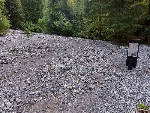
The shortest route
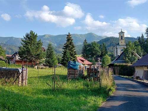
Liptovská Lúžna
The 'normal route' has its trailhead in the village of Liptovská Lúžna. It heads in a northerly direction, following a dirt road and then a forest track up Ráztočná brook. If you drive up the dirt road until it turns into a cart track, you can shorten this route to less than 4km and just 1.5hrs walk up.
SW slopes of SalatínRáztocké sedlo
At Ráztocké sedlo (saddle) at 1233m an extremely steep ascent begins.
S side of SalatínBetween Ráztocké sedlo and summit
It will not get any easier until you reach the T-junction with the confusing sign that reads ‘Salatín, 1630 m’. To the left runs the trail to Hučiaky while you continue straight to the summit.
In the past two years there have been several bear attacks on people in the vicinity of Salatín. In June 2021 a local man was killed by a bear outside the village of Liptovská Lúžna: Bears
The Lower Tatra Mountains are protected as a national park.
Camping within the area in question is not permitted. You are supposed to stick to the waymarked trails.
During/After heavy rain the trail through Hučiaky can be impassable/dangerous.
In Slovakia those who do not carry commercial insurance have to pay for any rescue services rendered by Mountain Rescue Service (HZS).
Getting There & Accommodation
Ružomberok, the second largest town in the region of Liptov, is easily accessible by both road (D1 motorway) and rail (one of the oldest railway lines in Europe; several Intercity and fast trains a day). The distance between Ružomberok and the nearest trailhead (Ludrová) is just about seven kilometres.
Parents refers to a larger category under which an object falls. For example, theAconcagua mountain page has the 'Aconcagua Group' and the 'Seven Summits' asparents and is a parent itself to many routes, photos, and Trip Reports.