
-
 3226 Hits
-
 84.27% Score
-
 18 Votes
|
|
Route |
|---|---|
|
|
Mountaineering, Sport Climbing |
|
|
Summer, Fall |
|
|
Half a day |
|
|
5.10c (YDS) |
|
|
4 |
|
|
Overview
Eureka, Colorado
The rock is granite. Most routes are bolted, and 2-4 pitches in length. The approach is very short - about 10 min, and parking is available right below the cliff. Keep in mind that you are climbing at high altitude - Eureka is 9,862 feet high (3,006 meters), so even if bolted, think about this adventure as an alpine climb. Thunderstorms are frequent here in the afternoons - consider rain gear. Plan to start early. The whole climb including the approach and the descent can be done in 2-3 hours. There is no cell service available in case of emergency.
The road right below the climbs leads from Silverton towards a popular ghost town of Animas Forks, and further up over Cinnamon and Engineer Pass where you go either into Lake City or Ouray. Expect people stopping by and taking pictures of you while climbing.
Mountain project gives some description - click here.
Rock climbing book Ouray, Silverton & Ridgway (new edition) by Jason Nelson describes this climb as well (the book is available at Ouray Mountain Sports).
![Sunnyside Mill remains]()
Sunnyside Mill remains![Animas River]()
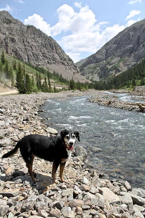
Animas River, Eureka
The fastest way to access the climbs is to exit Highway 550 = Million Dollar Highway into the historic town of Silverton.
Getting There
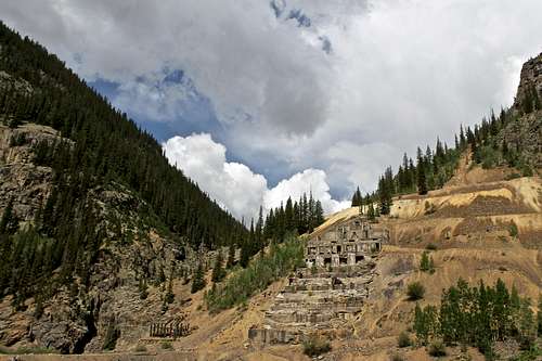
Sunnyside Mill remains
Animas River, Eureka
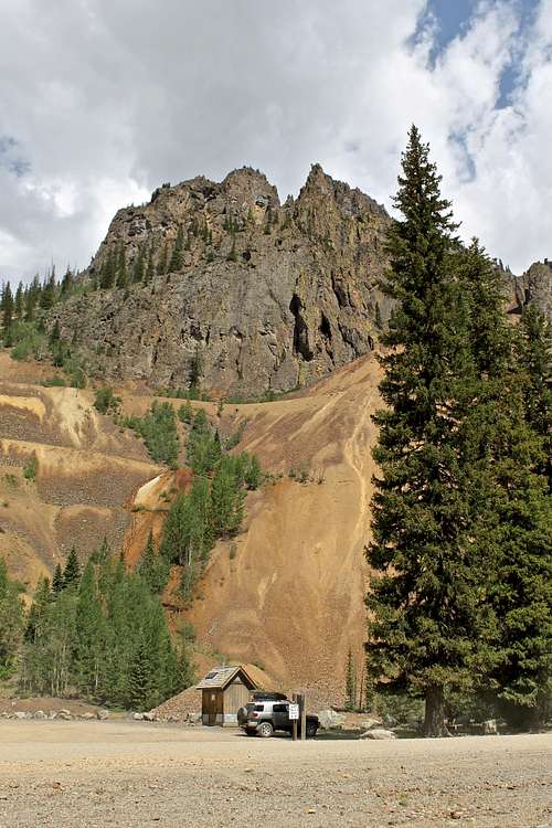
Drive through the town. At the end of the town turn right onto County Road 2 towards Howardsville/Eureka/Animas Forks. Drive about 10 miles until you reach Eureka, which is noted by it's old concrete stepped mill site on the northern site of the road (photo on the right). There is a big parking lot (free) right after you cross Animas River, toilet and an informative sign about the scenic alpine loop.
You can either park here and hike about about 1 mile up the road, or drive one more mile on the road past Eureka towards Animas Forks/Engineer Pass, and park on a small pull out right below the Goldrush Rock climbing area. There is a limitd parking area - one pull out right below for one to two cars, and second pull out slightly higher up, again only for one or two cars.
The jeep traffic can be heavy in this area since it provides access to one of the most popular jeeping and ATV destinations in Colorado.
You can also access this route via scenic alpine loop from Lake City or Ouray (it is much longer to drive from Ouray over Engineer Pass towards Silverton, and the road is very rough, passable only for high clearance 4WD vehicles), the road from Lake City also requires high clearance 4WD vehicle, but is not as rough.
Location and Identification of the route
We came in unprepared, I had no beta on the route, only brought my iPhone with a mobile application for mountain project - I could not pull any photos and we thought we were on 5.9 route "Five Card Draw". The description of this route on Mountain project was not great, and since there is no internet, I had no photos, only a written brief description. In some ways I am happy we did this route by mistake. I am not sure if I would want to climb 5.10c, but it felt much easier - I like slabs. Later a party came and climbed a route to the left of us (towards the Goldrush ice climb site) and they told us they are on the 5.9 route, and we are on the 5.10c route.
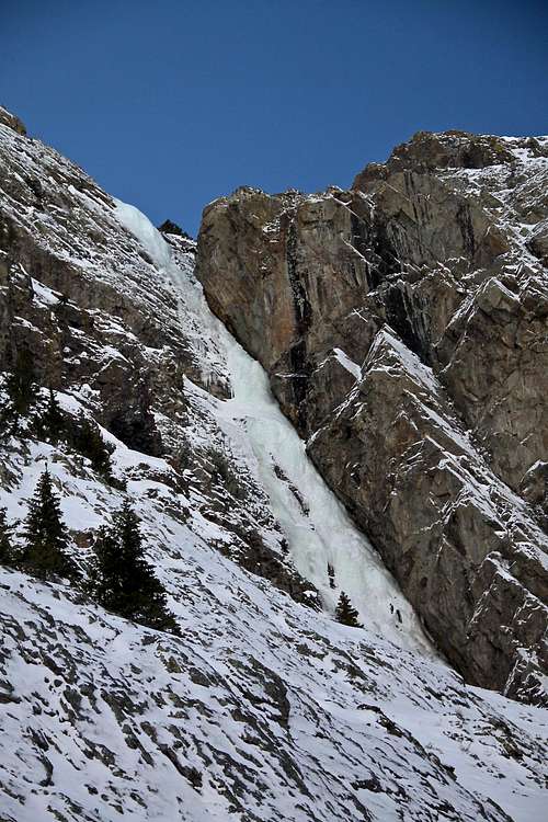 Goldrush WI4/5 | 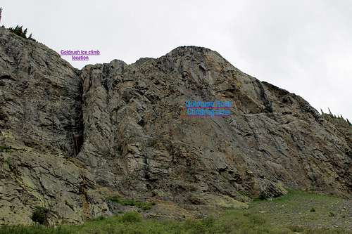 Goldrush Area - purple ice climb, blue rock slabs | 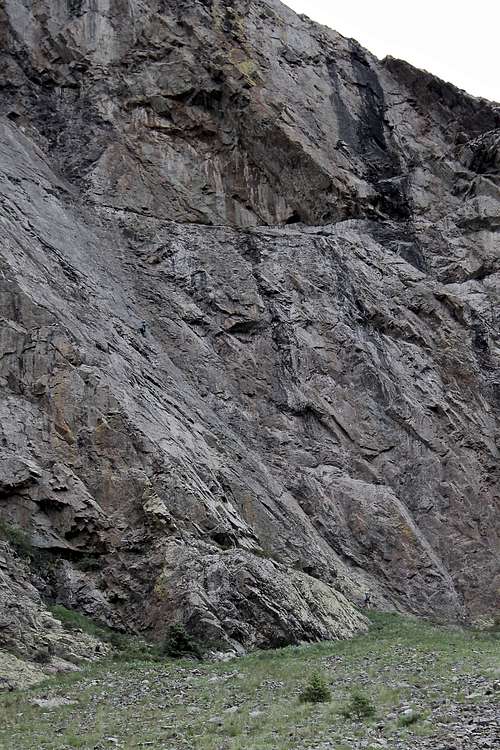 Goldrush Rock |
It is easy to identify the slabs - visible from the road, just past the winter ice climb Goldrush, streaked with water in the summer. Slabs are located just to the right (north) of this climb. There is not really an approach trail and the slope is a little loose and steep, but not difficult. The approach time is less than 10 min and the whole time you see the climb, road, and your car.
Silver Stage is located right in the middle of the slabs, first bolt is seen above the lichen, greenish colored rock, about 10 meters up. (Five Card Draw is more difficult to spot, you have to access a little ledge and hike past Silver stage to get onto it).
Route Description
Length: 200 metersProtection: fully bolted, no gear needed
Rock: granite
Quality: nice climbing especially first two pitches, some loose rock on pitch 3,4
Rating: 5.10c
By: Rex Wolters
Pitch 1: rated as 5.10c, a long run out to the first bolt ~ 10 meters up - this is the easier section, the crux was just below the anchor and pretty short, felt much easier than 5.10c. Total length ~ 45-50 meters, ~ 10 draws, mostly slaby climbing except the start.
Pitch 2: rated as 5.8/5.9, again nice slab climbing, protected with bolts, anchors at the top of the slab (just before entering into the loose terrain). This pitch was again ~ 45-50 meters long. Nice views down on the road.
Pitch 3: this pitch starts up on class 3-4 terrain, and there is a short climbing section of steeper rock rated as 5.8/5.9. It is protected with bolts, about 25 meters long. There are anchors there and some loose rock (we pulled some of that rock down when pulling on our rope on the descent).
Pitch 4: rated as 5.9, we missed this one! we did not like pitch 3 (boring and loose), had no beta and per oral report the best climbing was supposed to be on the first two pitches, but Ouray, Silverton Rock climbing guidebook describes it as a good pitch. You supposed to traverse 20 feet right from the anchor at the top of 3rd pitch and climb up a dihedral for 30 meters.
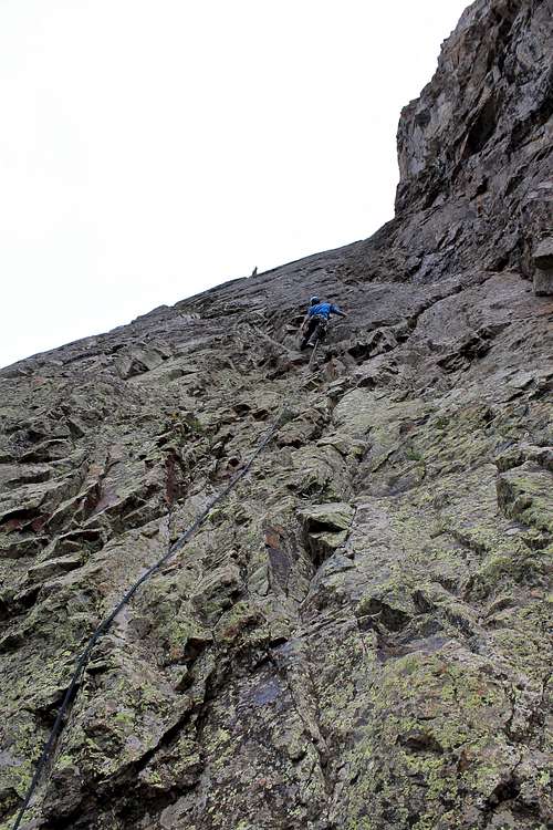 Silver Stage 5.10c | 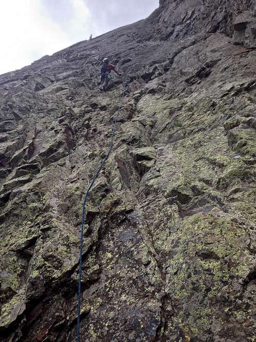 Silver Stage, 1st pitch | 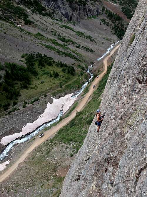 Climber on Five Card Draw | 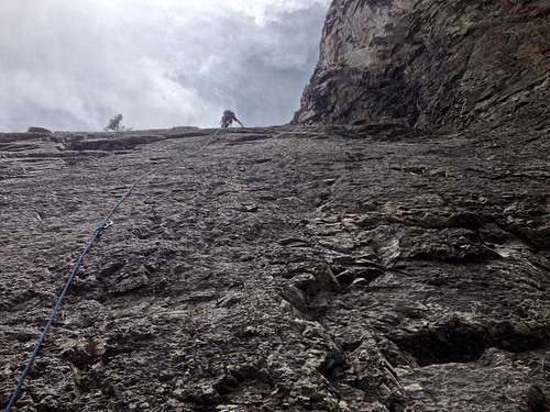 Silver Stage, 2nd pitch |
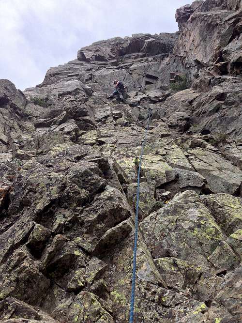 Silver Stage, 3rd pitch | 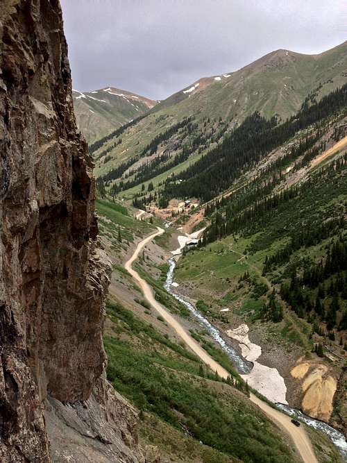 View from Silver Stage | 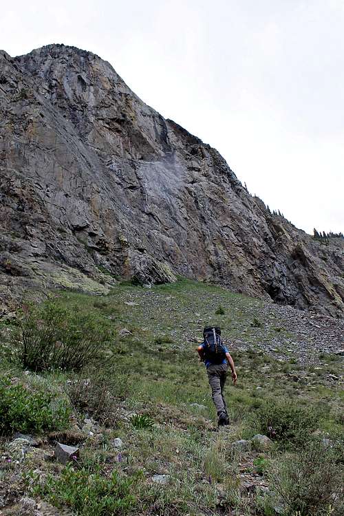 Approach to Goldrush slabs | 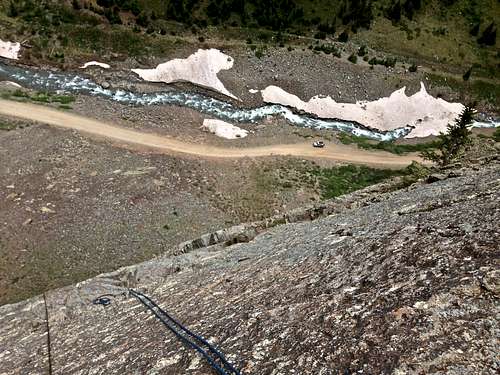 View from the top of 2nd pitch |
- Quickdraws ~ 10
- Personal gear: harness, belay device, rock shoes, helmet
- 60 meter is sufficient, but for rappel you need two 60 meter ropes to descent
- Prusik for descent is always a good idea
- Camera
External Links
- Silver Stage on Mountain Project
- Ouray Mountain Sports - there is no climbing store in Silverton, so this is the closest and well supplied store in the area).
- Eureka, Colorado
- Colorado Scenic Alpine Loop
- The Alpine Loop
- Eureka Lodge - nice accommodation right below the climbs.
- Eureka Campground - open only during the summer and absolutely crazy over 4th of July weekend.