
Comments
No comments posted yet.
|
|
Trip Report |
|---|---|
|
|
46.76340°N / 10.88050°E |
|
|
Sep 14, 2023 |
|
|
Hiking, Scrambling |
|
|
Fall |
Though the route is well known and even has a page on Summitpost, the conditions might change a lot since the page was last updated. So I decided to describe my trip in some detail. The trip took place early in the fall, so the described conditions can be irrelevant for other seasons.
September, 2023 I walked a variation of the E5 route and had a spare day for my travel. So I decided that if I will still have this day upon the arrival to Vent, I will try to climb Similaun, which looks reachable for a solo hiker. Such an approach means, however, that you will be unable to choose the weather; rather, the weather will choose you. In fact, the weather had not interfered significantly into my plans, though the visibility was limited. As a result, only the nearby summits, and only in certain moments, came into view.
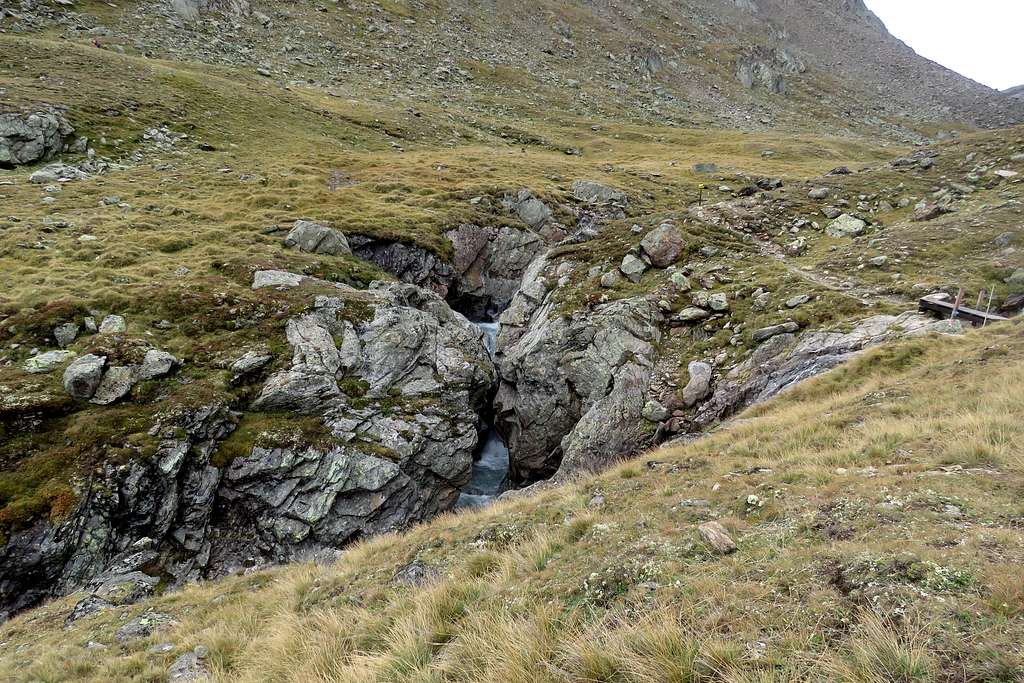
I started at 8:10 at the elevation of 1900; it was wet but not raining. By 10:00, I reached the Martin-Busch-Hütte (2500) by a narrow gravel road, which runs up the valley 50-100 meters above Niederbach. The hut overlooks the join of several creeks originating in different glaciers. In the present time the farthest one, Schalfbach, is the biggest. All others, including the one retaining the name Niederbach, are way smaller.
At 10:20 I stopped trying to take a decent picture in the present weather conditions and stepped on the trail to Marzellkamm ridge. This ridge continues the NW edge of Similaun. As the folks ascending from Vent to Martin-Busch-Hütte typically proceed up the valley to Rifugio Similaun (Similaunhütte) and further to the Italian side of the main ridge of the Alps, I expected to be alone for the rest of the day. However, one man took the same trail as I did. He hiked without poles, so his goal was apparently somewhere on the Marzellkamm.
The trail crossed Niederbach and its small tributary:
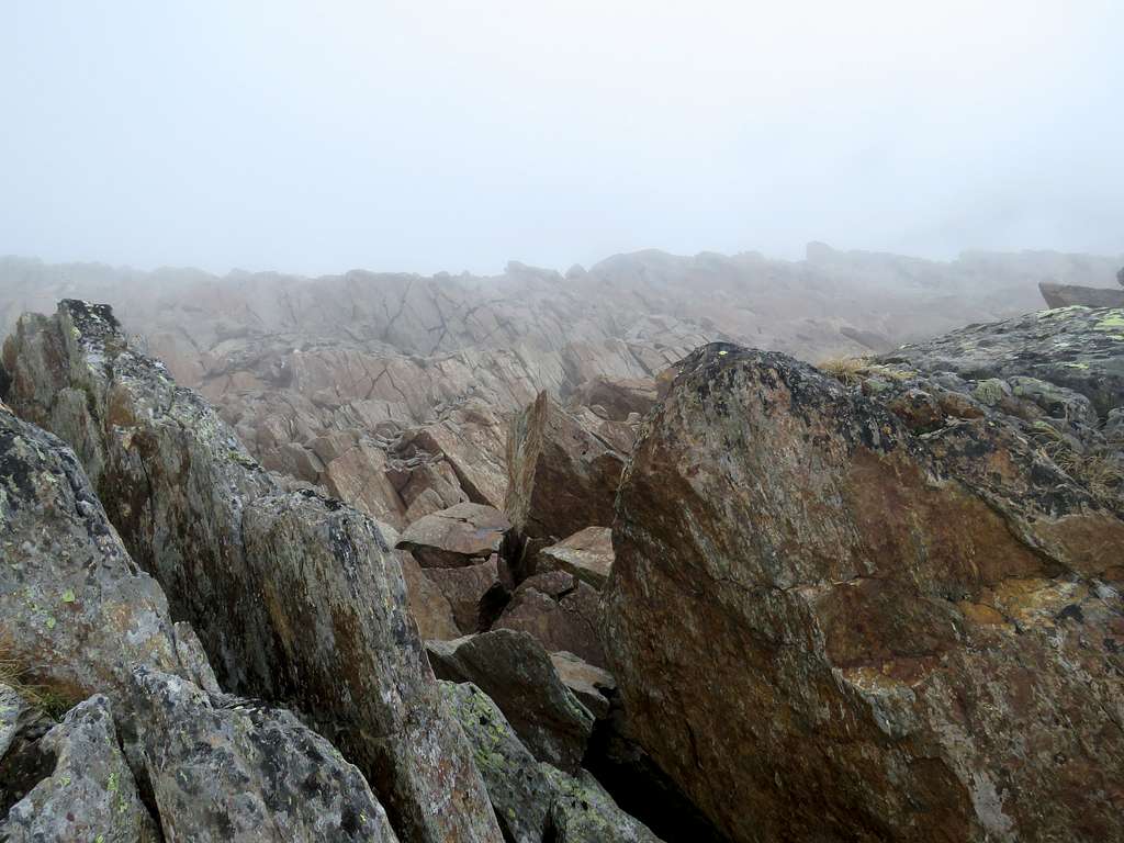
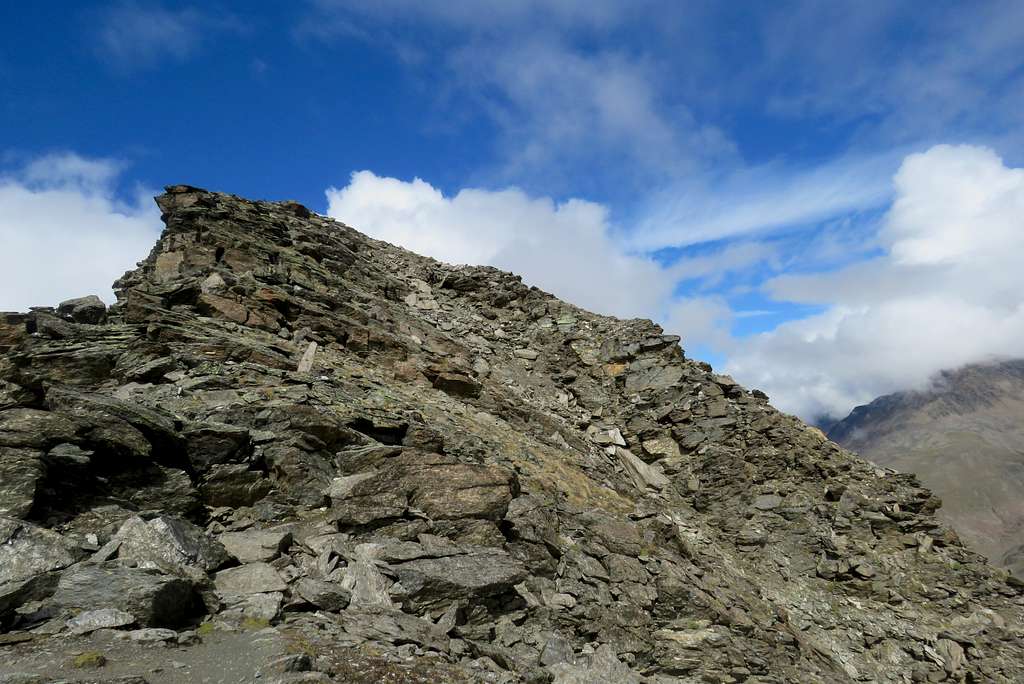
and climbs the North end of Marzellkamm. At 11:15, I reached the first small "top" on the ridge (2820). Soon, a signpost to Hintere Schwärze pointed to a trail descending to the left. The visibility did not improve, so I had to enjoy the landscape of Marzellkamm itself. In places, it seems to crumble inside rather than outside:
At 12:10, I reached a narrow place on the ridge (3020):
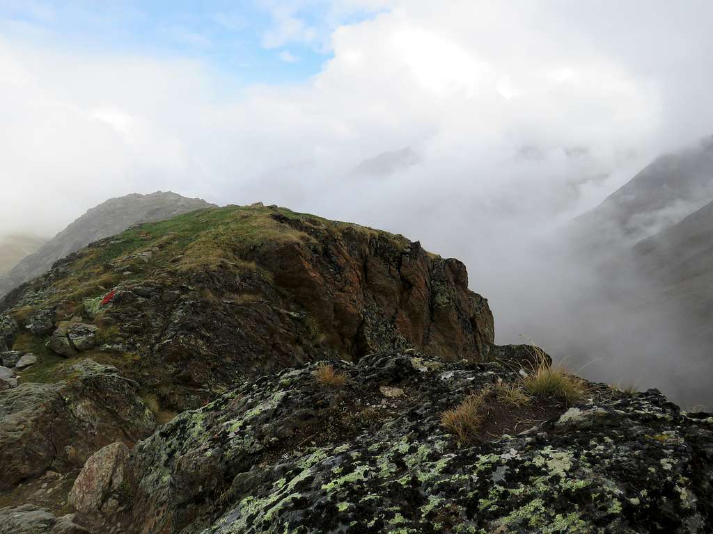
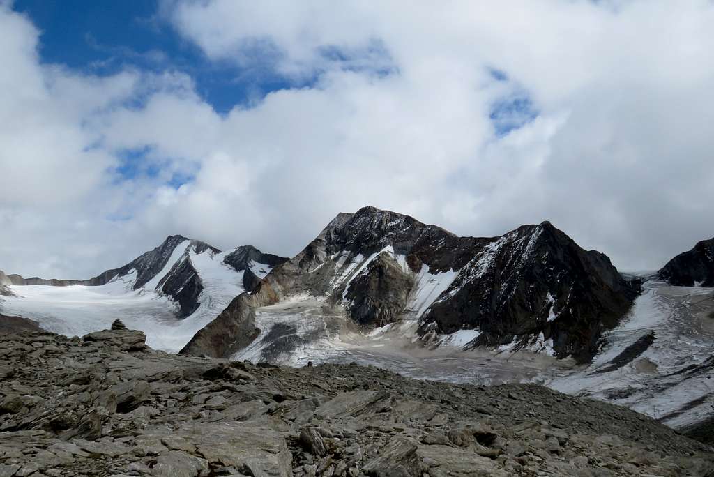
Soon, the trail turned left and left the ridge to avoid sharp teeth on its top. At that time, heavens finally granted me with a cold shower, and I waited under a small cornice until it stopped. Following the trail, I climbed back to the ridge, arriving at its only named top, Marzellkammspitze (3149, 13:05). After the shower, the clouds lifted a bit, so I was able to see my main goal:
After a short lunch break, I resumed the traversal at 13:25. First, the trail dropped fifty meters. While I descended, the skies cleared for a moment, and I shot the top of Marzellkammspitze
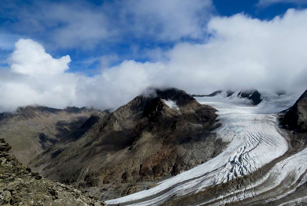
... and the main part of Marzellferner (Marzell glacier):
At the lowest point of the drop I spent some time figuring out where the trail (well-marked till this point) continues. I didn't want to miss the trail especially if it somehow goes down a steep side of the ridge towards the glacier. Soon I realized that no painted marks can be seen anywhere. Then I tried to spot cairns, with a better result: occasional cairns do mark the way along the ridge:
The way gained the altitude to about 3180 and descended just a few meters to the edge of the Niederferner (Nieder glacier). Once again, the nature allowed me to take a couple of pictures.
A closer look to Similaun and the east part of Niederferner:
Hintere Schwärze, finally seen (left):
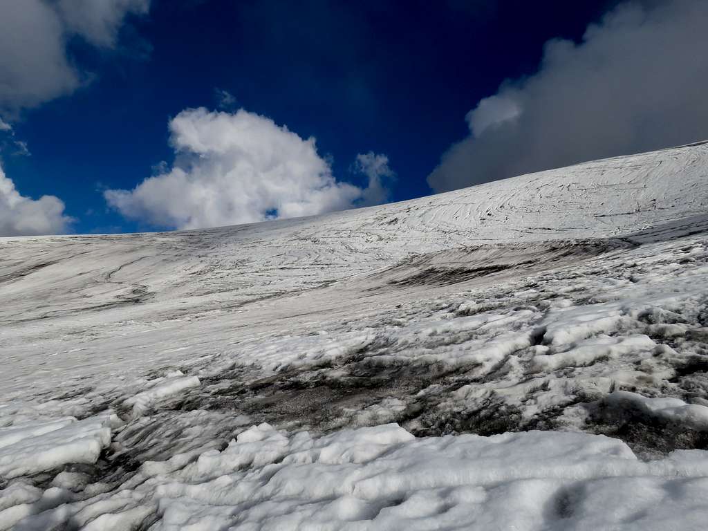
I reached the glacier at 14:20, put my crampons on, checked the map and began the walk by ice. The ice on the inclined part of the glacier was bare, the upper layer melting, so some care was needed to keep the boots dry. I almost succeeded. Otherwise, the glacier is quite safe. I met just a few small crevasses, all of them easy to pass or avoid.
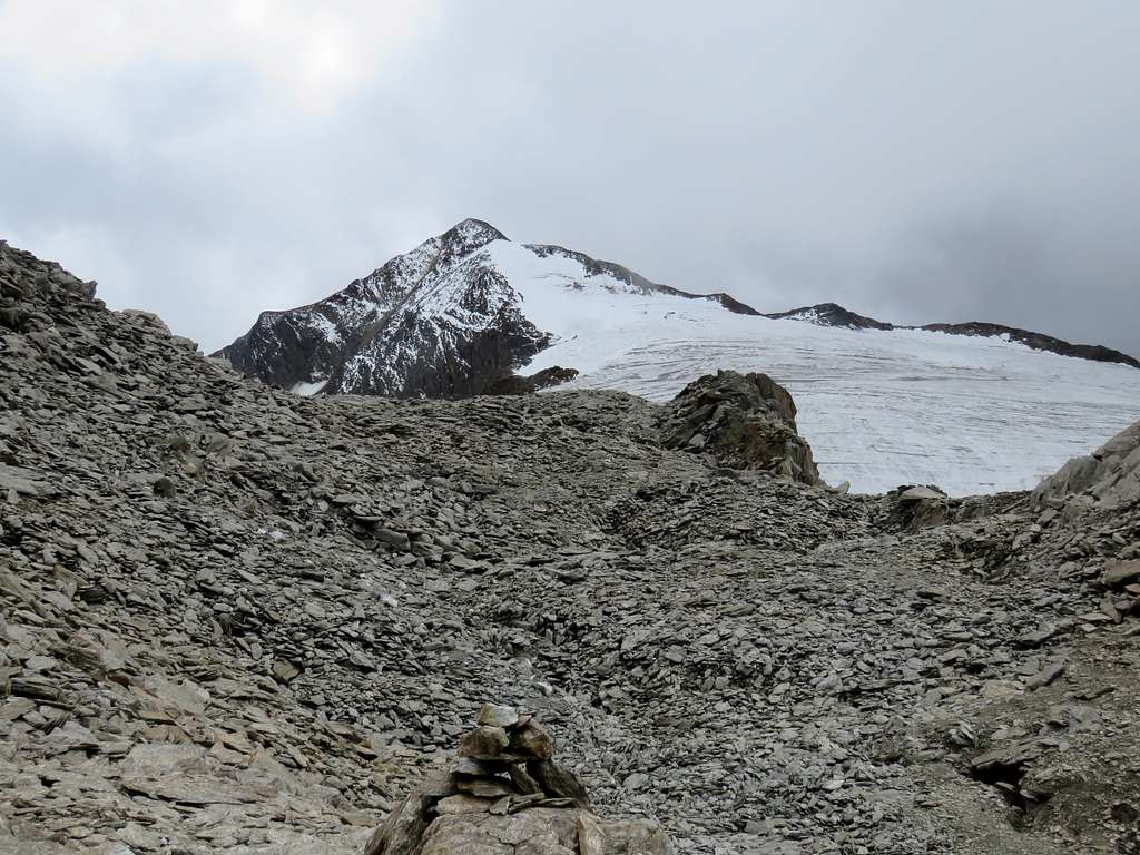
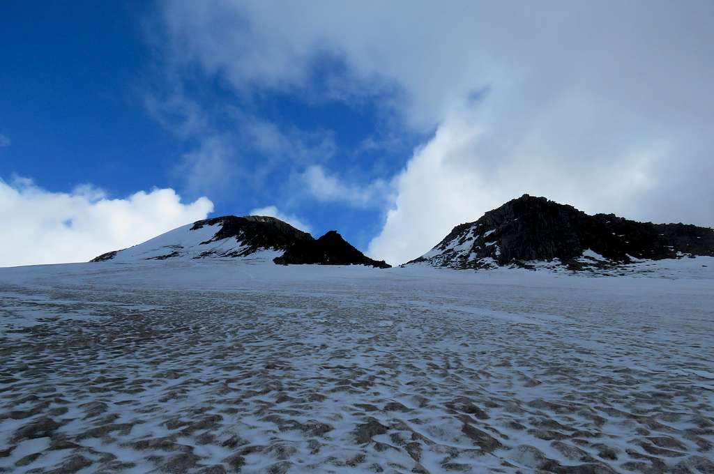
In forty minutes, I reached a more flat upper part of the glacier, with a clear view of the west ridge and the summit:
Note the homeopathic dose of snow covering the glacier...
In several minutes I caught the traces from the right, left by people ascending from Rifugio Similaun, and soon (15:35) approached the ridge (left of the small hill in the middle of the above picture, about 3440). There I spotted three pairs of crampons and then their owners, descending the ridge. Seeing those guys with tons of mountaineering equipment made me a bit concerned. But they told me that they hadn't use it at all and described what to expect on the way to the summit.
I started the walk by the ridge at 15:50, leaving the backpack together with the crampons at the glacier edge. The start of the way is marked by a cairn. Later, the ridge is quite narrow (though at least 1.5-2 meters wide in all places), making the navigation obvious. In fifteen minutes I reached a patch of snow, extending from the top end of the Niederferner:
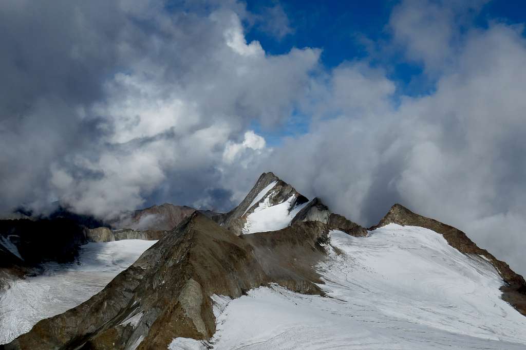
This last patch of snow is followed by the crux: a steep step, about 8-10 meters high. The scrambling is very easy but exposed, so it is better to make this step slow and carefully. Soon after this step, I was awarded another view of Hintere Schwärze and its neighbors:
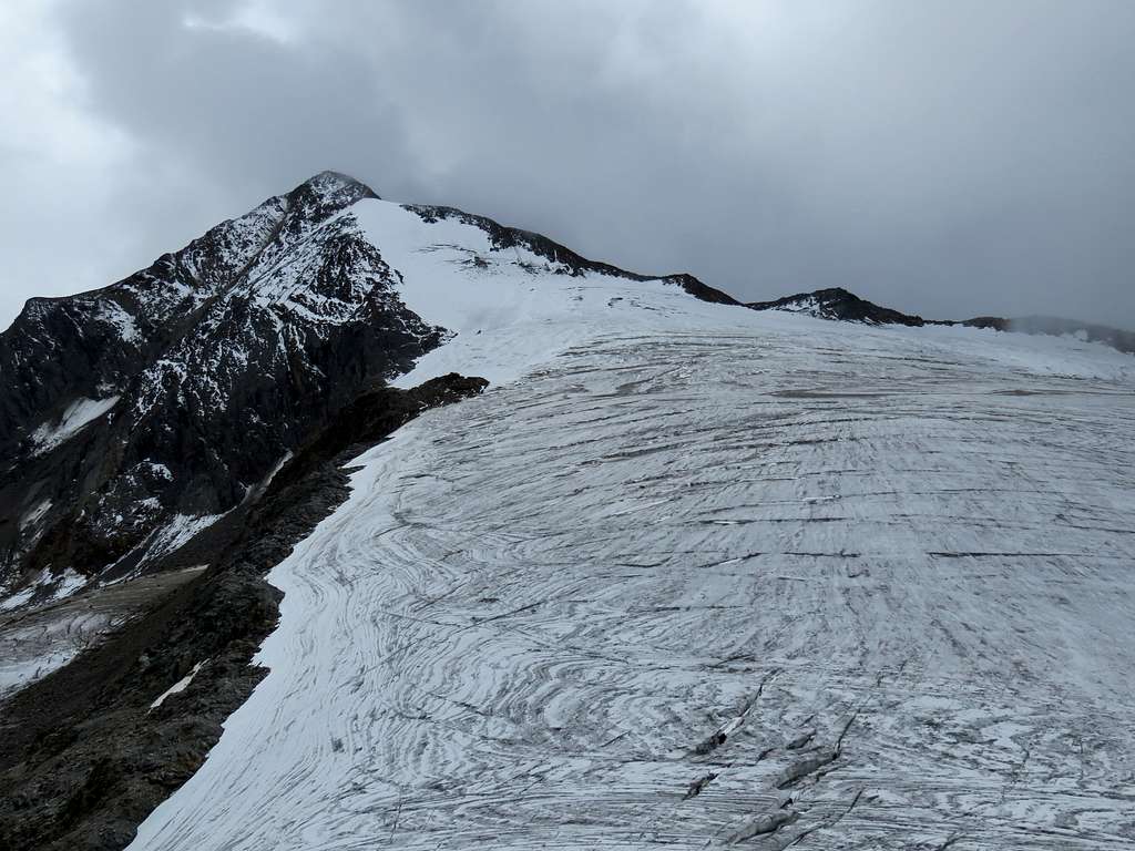
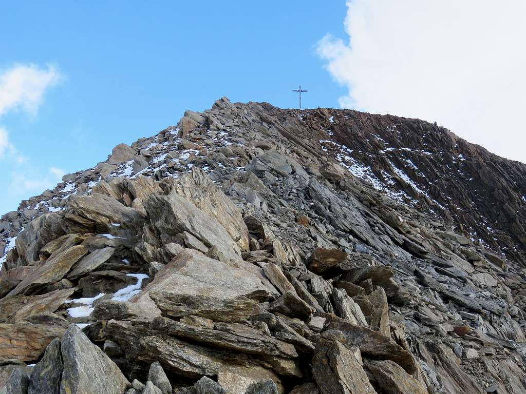
... and also of the final straightforward part of the ascent:
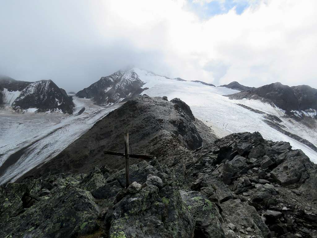
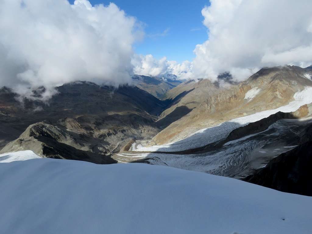
However, when I arrived to the summit (16:25, 3606), the cloud from the last picture met me there:
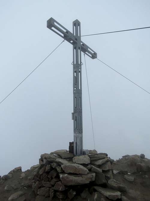
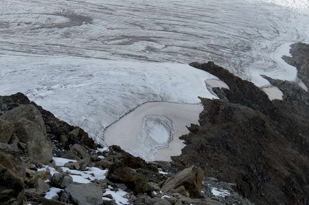
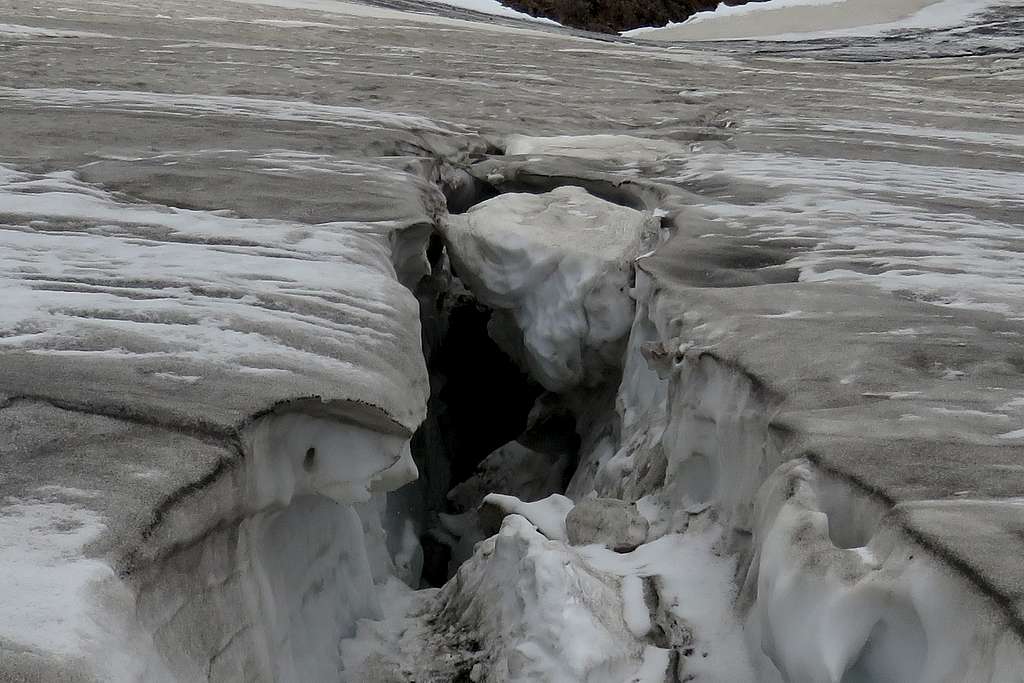
Guessing why I didn't deserve a panoramic view from the top, I added my name to the summit book (in the box begind the cross) and started the way back. The only thing I spotted from the top was this strange feature (maybe an eye of the glacier, maybe a portal to another world):
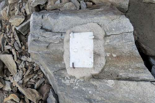
Going down the ridge, which is the Austrian-Italian border, I ran into a very concise border sign:
(Showing this picture to friends, providing no context, proved to be fun. People started to guess how this strange switch operates.)
I returned to my backpack at 17:15, put the crampons on and started the descent by the glacier towards Rifugio Similaun. I felt somewhat tired, so preferred to move slowly an carefully, especially on the steep section of the glacier. The walk by the glacier brought another couple of pictures (note the sculpture of a human face deep in the crevasse):
It took an hour from me to reach the glacier's westmost point; this point was located 20-30 meters east of a narrow gap between two rocky slopes, coming from S and NE. Taking crampons off, cleaning them a bit (lots of dirt at this end of the glacier), searching the trail (you need to go a bit farther, past the gap)... Finally, at 18:45 my trip ended at the door of Rifugio Similaun. The dinner was damn good.