
-
 3804 Hits
-
 77.73% Score
-
 9 Votes
|
|
Mountain/Rock |
|---|---|
|
|
Spring, Summer, Fall |
|
|
5407 ft / 1648 m |
|
|
Overview
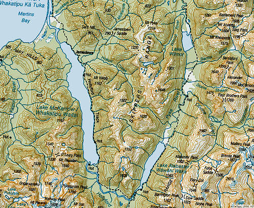
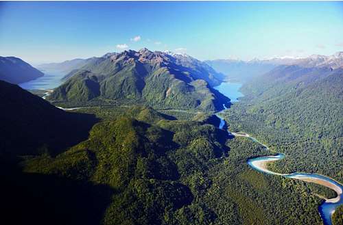
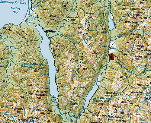
Skippers Range Highpoint is an unnamed ultra prominent peak in the rugged backcountry of New Zealand's south island, located in Fiordland National Park. The range is bordered by Lake Alabaster on the east side and Lake Mckerrow on the west side. Skippers Range HP is 1 of 10 New Zealand Ultras, and likely one of the most remote Ultras of the country.
Getting There
Access to Fiordland is simple. The famous Milford road allows for easy access to the trails, Access to the peak, however, is not simple by any means. There are two options of approach by foot, either via Hollyford track on the east side of the range or the infamous 'Demon Trail'. Access has also been achieved by float planed to Martins Bay or via helicopter of the West Ridge. There is no trail beyond the track and involves some of the most challenging bushwhacking NZ has to offer.
Route
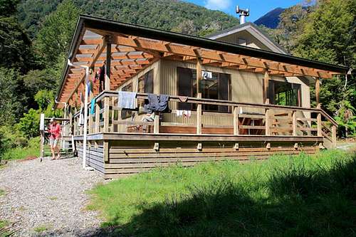
The route I will describe is of the Eastern Approach via the Hollyford track. It look me approximately two days to reach the Olivine Hut via Pyke/Big Bay route. The trail is simple to the Alabaster hut, once you reach this beautiful hut, things get crazy.
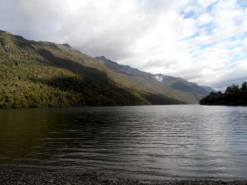
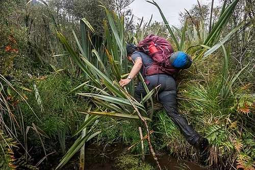
To start, traverse around the eastern shore of Lake Alabaster... You will encounter chest deep water and extremely slow travel through rocks and bush.
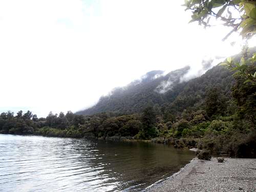
Lake Alabaster from the Alabaster hut. The only reasonable option is a raft or a traverse around lookers right side of the lake from the hut.
Past the lake, this is an extremely challenging 'trail' filled with mud, hateful vegetation and lots of water. The route is 'marked' but also a very loose term. There are orange triangles to mark the way, which are usually destroyed, covered in dense vegetation or sometimes surprisingly visible!
Once at the Olivine hut, there is a cable car which crosses an arm of the Olivine River. Across the cable car, it was a 2KM hike upstream the Pyke River, in which I found a relatively tame spot to cross, although the river was still powerful! Across the Pyke river, it is a free for all bushwhack until the alpine zone is achieved. Cliffs must be climbed and navigated until the alpine zone is reached with very tricky routefinding. Above the alpine zone, the terrain becomes much more open, albeit scrambly. The east ridge goes at an easy YDS class 3 until just below the summit, where a steep col travels to the summit ridge. From the top, enjoy the views of Fiordland national park and delay your misery back down as long as possible! Once back to the Olivine hut, it took me a day to hike back out.
Red Tape
Hut permits are needed if staying at any of the huts along the way.
When to Climb
Austral spring/summer/fall. Fiordland is very wet and Skippers Range sits at an elevation of around 1600m, it retains snow into late November and possibly December in a very snowy year.
Camping
Lots of options for camping. For a more comfortable/less wet experience, the wonderful NZ huts can also be utilized.
External Links
Approach via Helicopter of East Ridge:
https://www.peakbagger.com/climber/ascent.aspx?aid=493429
Approach via Float Plane of Martins Bay/West Side:
https://www.peakbagger.com/climber/ascent.aspx?aid=508382
Approach via foot of Pyke/Big Bay Route:
https://www.peakbagger.com/climber/ascent.aspx?aid=1075351