-
 12860 Hits
-
 0% Score
-
 0 Votes
|
|
Route |
|---|---|
|
|
21.83518°S / 15.17588°E |
|
|
Trad Climbing |
|
|
Winter |
|
|
Most of a day |
|
|
5.8 (YDS) |
|
|
Complex and fun approach .Solid and sunny granite climbing after that |
|
|
5 |
|
|
V |
|
|
Overview
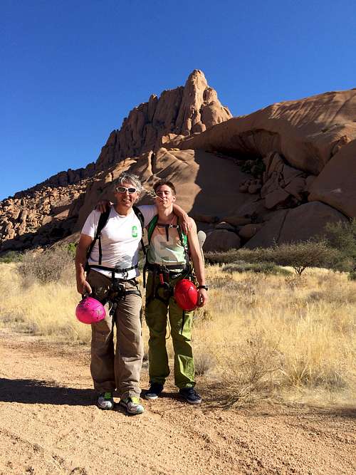
Route description from the climb realized in August 2014 by Paul Rechatin and Pascal Rechatin
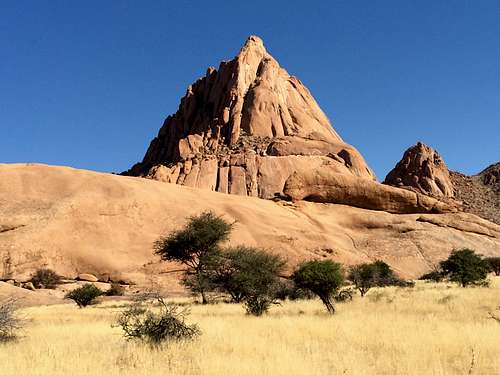
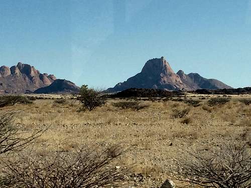
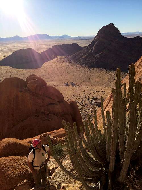
Spitzkoppe has been called for good reasons the Matterhorn of Namibia as it truly stands out from the desert floor ( 700 m above) , the whole natural reserve area is well worth a visit .Fortunately or unfortunately depending on your point of view, as the area has not reached the national park status, it is far less visited than other touristic places in Namibia such as Etosha or Sossusvlei, this is a shame , even if you are not a technical climber the place is really magic, the boulder valley camp site is one of the 2-3 most beautiful Namibia campsites and there are several interesting things to do. Sunsets and sunrises are unforgettable .
There are relatively few routes going to the top of Spitzkoppe and the one described here is the normal route also called standard route . We recommend to buy the book from Eckhardt Haber : Spitzkoppe and Pontoks Namibia a Climber’s Paradise .it was published in 2010 and to our knowledge is the only climbing guide available for the area. This route description is making references to this guide and provides additional pictures and information based on our recent climb of the Standard route. Ordering info about this guide book can be found here http://www.spitzkoppe.eu/ncg.shtml . We found it for sales at ‘Le vieux campeur’ in Paris but took the last copy! We deeply regretted we could not stay longer as the rock quality is really fabulous and there are beautiful routes across a wide range of levels .
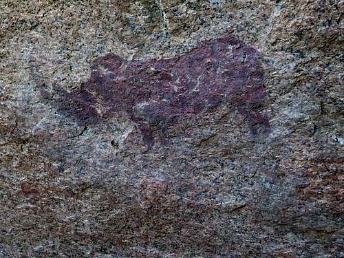
There are several rock paintings ,many of them in the area of Sugar Loaf which is the large and beautiful rock mound located directly south of the Spitzkoppe , this is within walking distance from the 'Boulder valley’ campsite. Local guides are available to take you to different locations where similar paintings can be found.While the painting are not as spectacular than the ones that can be found in the Brandberg area they are well worth a visit and can be combined with climbing routes on Sugar loaf.
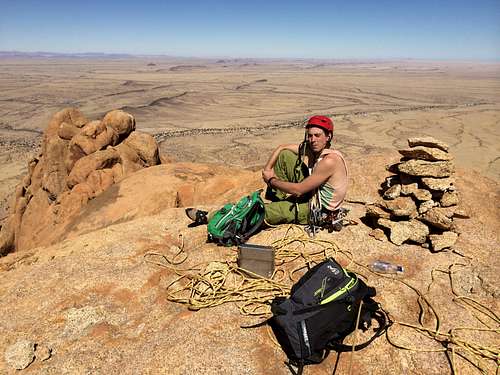
The Boulder Valley Campsite is a camper’s paradise and there are multiple all levels bouldering opportunities, you can easily spend a whole day just going through the challenges around the campsite. At Sunset or sunrise ( you can also do both for different points of view) it is a must to take a walk directly above the boulder valley campsite to the SouthWest ridge of Spitzkoppe where the picture below was taken at sunrise with Klein Spitzkoppe in the background. It will take about one hour to get to the ridge top from the campsite so you need to calculate your timing for optimum sighting. You will need to take a lamp either on the way up or on the way dawn depending on wether you go at sunset or sunrise.
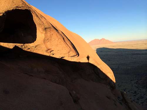
Sun rise from the South West ridge of Spitzkoppe
Getting There

Map of Erongo province Namibia
Spitzkoppe seen from the North arriving from the city of Uis

Location of pictures of this article on a satellite image of Spitzkoppe region (click to enlarge)
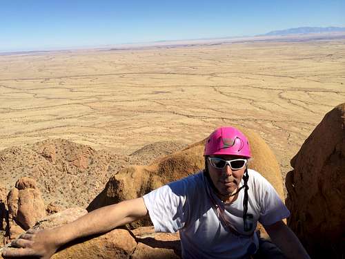
Route Description
Observations and notes based on route realized by Paul Rechatin and Pascal Rechatin on August 9 2014.
Rough description of the route:
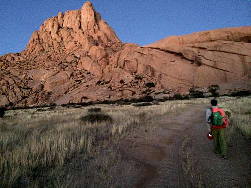
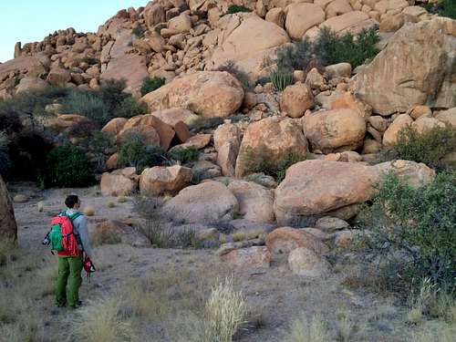
The route can be divided roughly into 5 sections, below is indicated the approximative time for each section ( in line with how much time we spent during our climb). One of the fun and difficulties of this route is actually to find the way to the beginning of the ‘real' climb. Hopefully some of the pictures and descriptions below will help you in addition to the Spitzkoppe climbing guide.
1- From the first Cairn to the first climbing section. 45 mn - 1 hour (without getting lost!)
Mostly rambling/walking .Follow the cairns!
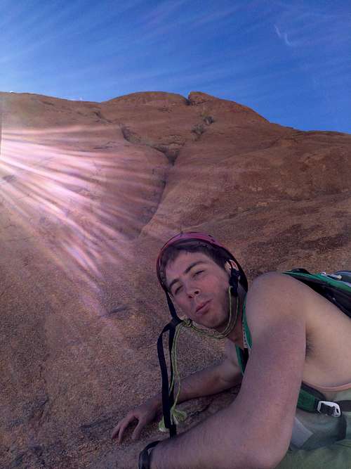
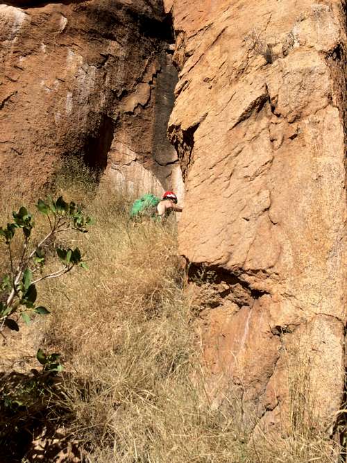
2- First climbing section (most of it is abseiled down during the descent). This includes the so called ‘dark narrow cave like chimney’ 45 mnThis includes some more rambling but also real climbing where roping up may be necessary depending on your level . (grade 12-14 Namibia scale, III to IV UIAA and 4-4+ french) including some more walking/rambling to the third section below
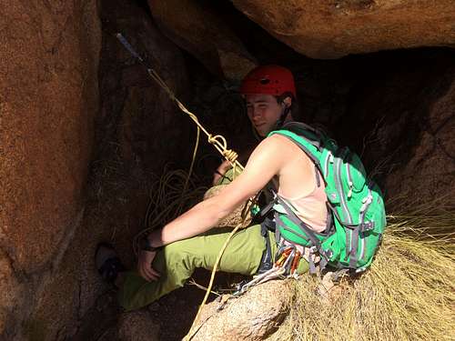
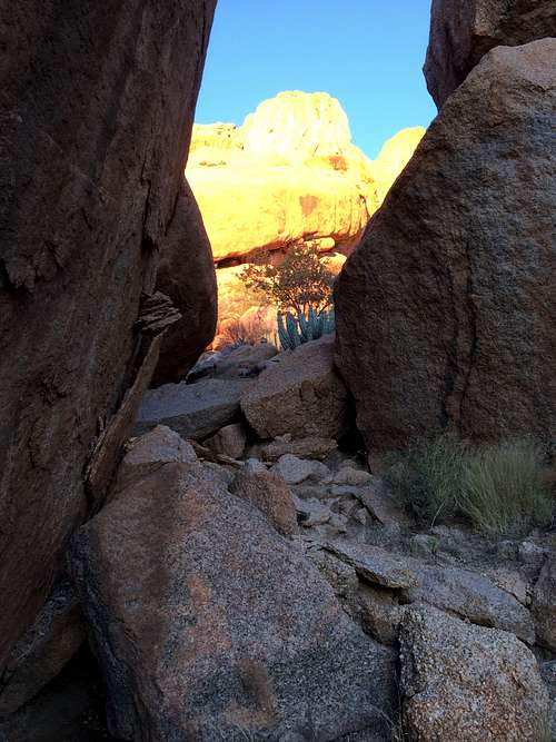
3- 'Three step chimney' and 'squeeze chimney' 30 mn
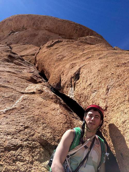
4- From the exit of the 'squeeze chimney' to the start of the ‘real’ climb 20 mn-30 mnThere are fixed ropes left in place to climb up the three steps of the 3 step chimney , the squeeze chimney is a pretty unique passage!
This includes one abseil down of about 15 m
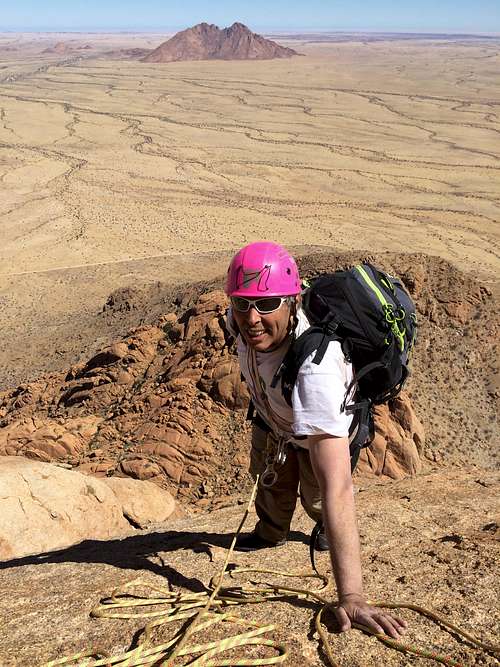
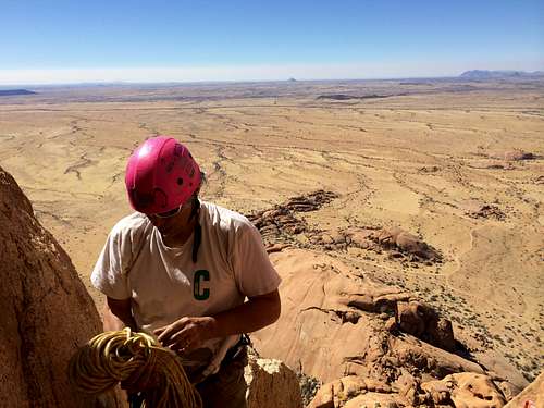
5- The Final climb to the summit. 2 h
Descent: Following the abseils along the route and all the way back to the first cairn . 2h 30 mn5 beautiful pitches !
We followed the abseils that are coming down along the standard route. There are two long abseils to come back down to the ‘squeeze chimney’ and then two or three abseils below the squeeze chimneyTotal: from the first cairn to the top and back in 6h50 to 7h15 mn say 6h30 mn to 8 h to round things up. Chances are you will get lost more likely on the way down than on the way up.If so retreat back to the last cairn.
The fastest combination to the top is probably to take the ‘Prima Variante’ on the way up ( which saves the section 4 above as the climb starts almost directly after the ’squeeze chimney') and to abseil down from the new line of abseil situated to your left (90degree to your left) when you reach the top with the standard route in your back. This new line of abseil saves you from the need to go through the squeeze chimney again on the way down. This combination probably saves about 1 hour versus the route described here. We did not follow it as we were totally alone and for the first time on this mountain so did not want to go outside of our selected route and also unsure of the protection on the prima variante.

Arriving from the North at dawn after going through the north fence
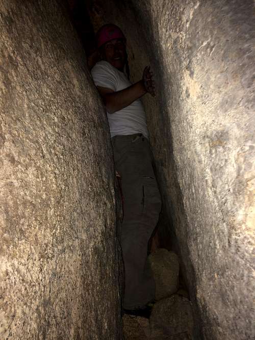
Going (painfully!) through the squeeze chimney