Rationale
The parent article https://www.summitpost.org/thabana-ntlenyana/637672, written by WouterB = Wouter Bertels, https://www.summitpost.org/users/wouterb/41123, http://wouterbertels.be, on July 13, 2010, says it all: „... with a good map (note: only height lines will be available on these maps as there is nothing else!) you can easily do it yourself.“
So why bother writing a child trip report on such an easy mountain?
Here are a few reasons to the contrary, as follows:
1) Thabana Ntlenyana is the highest mountain in the Kingdom of Lesotho and in all Africa south of Mount Meru in Tanzania (often people say: south of Kilimanjaro, but this is wrong: Mt Meru is 10 minutes of arc south of Kilimanjaro!). This means there is no higher peak within a distance of 3,143 km. Associated with that, Thabana Ntlenyana is a peak with a high prominence: 2,390 m.
2) The first records of climbing Thabana Ntlenyana are from 60 years ago by the British mountaineers Anderson, Goodwin and Watkins. However, these gentlemen have certainly not been the first ones on top, as shepherds in the area frequently visit the summit and may have done so many times in the past 3,000 years or more. Thabana Ntlenyana is therefore a classical mountain, a peak that deserves attention.
3) Not enough: Through grand tectonical movements Thabana Ntlenyana will rise into the sky, higher than any other mountain on Earth, as far as the US disaster movie „2012“ of Roland Emmerich goes. I wanted to be on its top before that was going to happen. I couldn't care less about Mount Everest! It just doesn't count any longer.
4) Thabana Ntlenyana offers a long-distance hike in an absolutely heavenly surrounding, too beautiful to dismiss. The mountain reminds me I climb not to conquer, I climb not to stand on top, but I climb to charge my batteries, I climb to fly.
Route
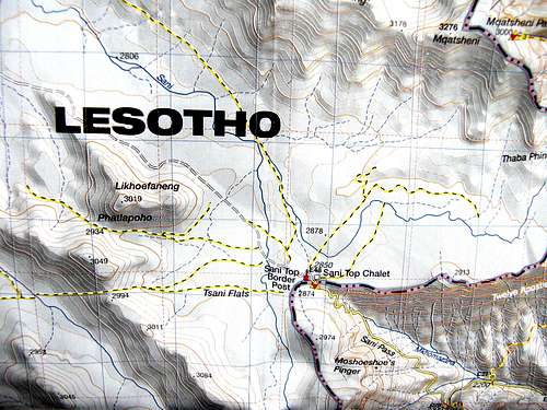
I choose to take the Sani Top Chalet as my „base camp“. I use the 1 : 50,000 map no. 5 „Cobham“ from the Ukhahlamba Drakensberg Park series, edited by the KwaZulu Natal Nature Conservation Service at www.kznwildlife.com; the map is available in Gemany from Namibiana Buchdepot, Bismarckplatz 2, 27749 Delmenhorst, http://www.namibiana.de, as well as locally from the shop at the KwaZulu-Natal Wildlife Office of Giant's Castle Game Reserve. There is a trail – as far as the map goes – leading from Sani Top Chalet (2,883 m) to the summit (3,482 m). I study the isohypses on the map and they tell me that I will have to walk pretty level in NW direction for the first 5 km, then turn northwards around the nose of Tsatsa-La-Mangaung, then walk slightly downhill to cross the Mangaung river at point 2,835, then uphill through the left – easterly – bank of the opposite side valley, bear right NNE bravely uphill, cross a pass at around 3,220 m, then downhill again into the valley of the Sehonghong river and uphill beyond, all in more or less northerly direction, to another pass at about 3,350 m, from which I will reach the summit in an elegant curve. Not to miss.
![Around Sani Pass]()
Around Sani Pass
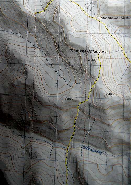
Around Thabana Ntlenyana
(Taken from 1 : 50,000 map no. 5 „Cobham“ from the Ukhahlamba Drakensberg Park series, edited by the KwaZulu Natal Nature Conservation Service)
Coordinates to start with
The Internet tells me the coordinates of Sani Top Chalet as S 29° 35.081' E 29° 17.284' (waypoint 1) and of the summit of Thabana Ntlenyana as S 29° 28.083' E 29° 16.150' (waypoint 15). I feed my GPS accordingly.
Timing
Experience tells me that the trail on the map will be „as good as no trail“ in reality. With http://www.geody.com/geocoordist.php I calculate the straight line distance as 13.11 km. In reality I estimate the distance as 15 – 16 km. Walking level constantly above 2,800 m in such a terrain means at least 5 hours.
Overall, the trip involves a vertical altitude difference of + 600 m. In reality there are ups and downs, which I estimate to add up to a total vertical altitude difference of around 850 m. Experience tells me I need one hour for 300 m vertical altitude, so I have to add another 3 hours. In total I will need 8 hours. Both ways: 16 hours. One hour rest on the summit: 17 hours.
To be on the safe side I will carry my sleeping bag and water-proof bivouac sack with me. I will try to do the entire trip in one day, but I am not sure whether I will succeed. I will walk in February; this is high summer time, involving daily thunderstorms in the afternoons – maybe I will have to hide somewhere under a rock and wait, until the lightning, rain, hail, snow or whatever is over, and return to Sani Top Chalet only the day after. Who knows?
All this together means I have to leave Sani Top Chalet before daybreak, to be back before the night falls in. Here it helps that I do this trip in summertime.
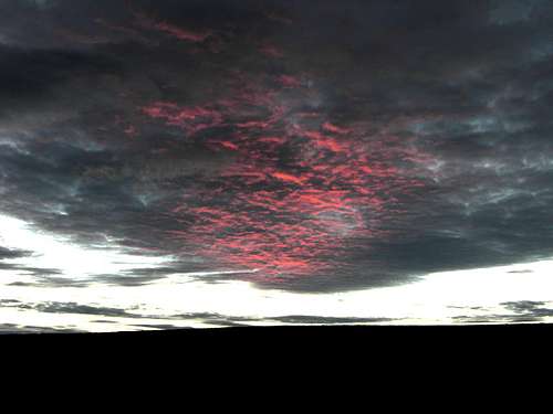
![Daybreak at Sani Pass]()
Daybreak at Sani Pass. Half past five: a new day over Africa
Snakes
There are frequent warnings of snakes in the Drakensberge. These apply for lower altitudes. As high as 2,800 m and above there are no snakes anymore – it's just too cold for them; so don't worry.
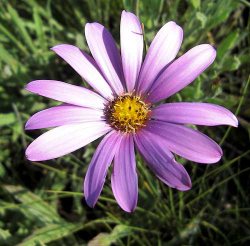
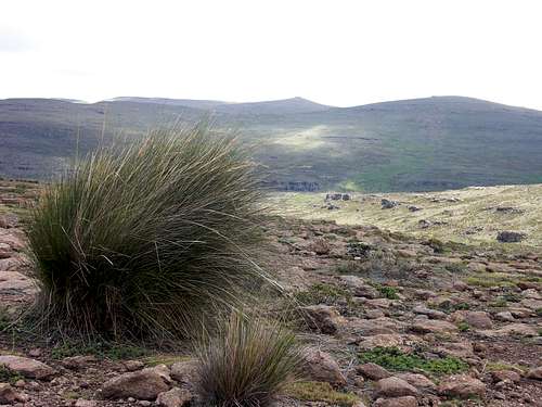
Nameless companion. Just to enchant. You will find me at the banks of Mangaung River
Action
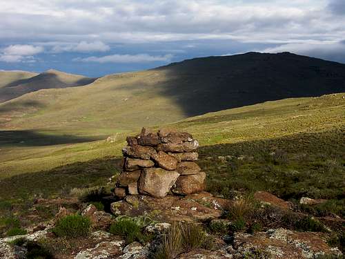
I begin walking at 5:20h on 7 February, just enough to see where I am stepping on. The first kilometer slightly downhill to a point where I cross the Sani River on stepping stones (waypoint 2). Then I follow the contours 5 km in more or less NW direction, leaving the Sani River more and more to my left hand side and the Tsatsa-La-Mangaung ridge to the right (waypoints 3 and 4), until I reach a cairn piled up on a minor nose of the ridge: point 2905 on the map (6:30h).
Into a glorious morning. Along the contours towards NW
At point 2905. The lonely cairn signals the turn towards straight north
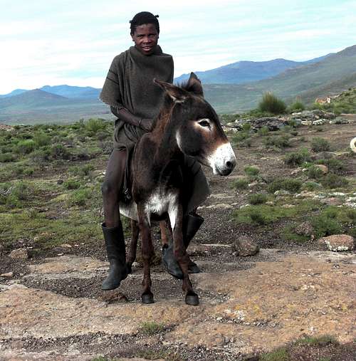
Here the faint trail turns N and begins to softly descend, two rondavel shepherd huts to the left. A shepherd closes up to me: „I'm hungry“, he asks for my bread and receives what is required to permit me taking a picture of him. Further to the NE I walk down into a side valley coming from S (waypoint 5). This will lead me N to where I can ford the Mangaung River, blocking my way E to W (waypoint 6). It appears all the way only grassy slopes with scree make my way, nothing of any difficulty, occasionally very wet and swampy.
"I'm hungry!" Lesotho is a poor country. Herdsmen know what they are working for. Are they happier than we?
![Transporting wool]()
Transporting wool. The shepherd has a long way to go across the mountains of Lesotho, before he reaches the place where wool can be woven to blankets.
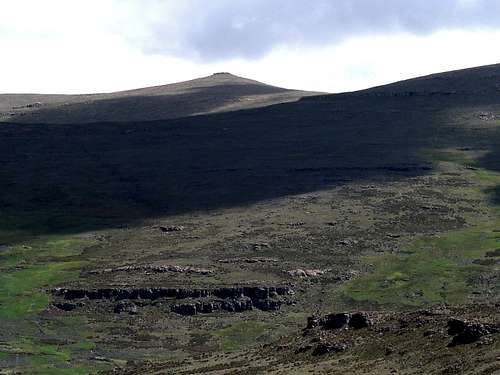
Having barely managed the Mangaung without having to put off my shoes I continue up into the side valley coming from the opposite side (N). Right from the beginning I stay on its left – east – bank (waypoint 7) and soon leave the valley floor to ascend on its eastern slope in NNE direction. Here I have to cross another sharp side valley, contributory to the former from NE, always gaining height (waypoint 8). Further up towards the horizon, where I assume reaching a pass over into the next main valley (waypoint 9). A shepherd shows me the right spot on the flat ridge where I have to pass over, left of a rocky castle fortifying the ridge (waypoint 10, 11; 10:10h). From here I see my destination for the first time, a broad, quite insignificant peak far in the north, some 4.5 km still to walk.
![Thabana Ntlenyana in the distance]()
Thabana Ntlenyana in the distance. This is the first view on the mountain from the pass dividing the Mangaung and Sehonghong valleys
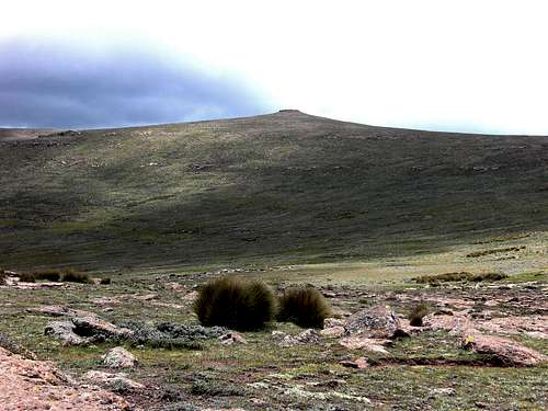
Down into the next transversal valley, straight N. This time it is the Sehonghong River, flowing E – W. Before I reach the river, hidden in its bed, I cross the stream running down S – N in the side valley over to its right bank. This makes me arrive at the main river just between the mouths of the two side valleys, the one I just came from and the one I am heading for. Again I can cross the river with my boots on (waypoint 12). The opposite side valley runs N – S; I stay on its left – western – bank (waypoint 13). At 12:20h I reach the final pass that had blocked my view on Thabana Ntlenyana while I was crossing the Sehonghong valley (waypoint 14). Now my target stands directly in front of me. More or less I have to maintain a northerly direction, circling around the slope of point 3465 to my right hand side and ascending at the same time, eventually over a flat stony ridge and through the rocks forming the crown on Thabana Ntlenyana's head. It is 13:00h, when I reach the summit.
![Thabana Ntlenyana gets closer]()
Thabana Ntlenyana gets closer ...
... From the final pass in front of Thabana Ntlenyana, 3360 m high
The "Little beautiful mountain" is also called Thadentsonyane or Thabantshonyana, "Black little mountain". In the Sotho language "Thaba" means "mountain", "na" is the diminuitive = "little", and "Ntlenyana", pronounced with a click sound from the cheek, stands for "beautiful".
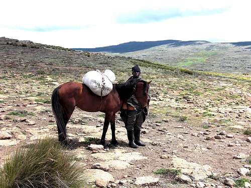
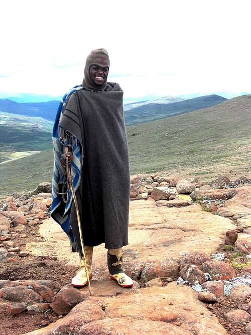
Still the visibility is good, down into broad valleys towards all sides. But I have little time to rest. A shepherd joins me; he is driving his donkey across the summit, laden with a sack of wool, which is to be used to manufacture a blanket, somewhere at an unknown location far in the distance. But in my back clouds are amassing, calling for a quick return. Only 15 minutes are given to me on the summit.
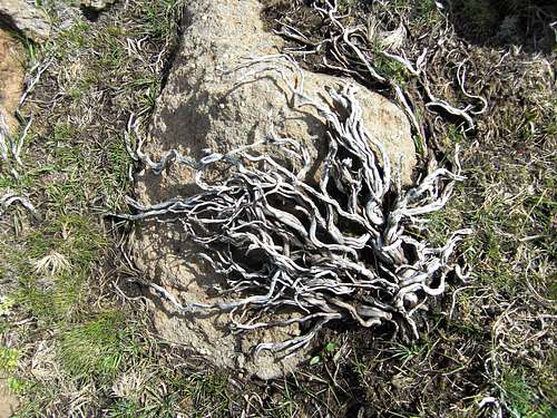
Roots. There is beauty even in death
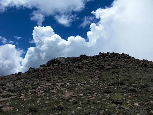
The summit in reach. An easy walk-up to Southern Africa's highest
Unexpected encounter on the summit: A proud Sotho shepherd
Return
All in reverse would have been easy if there had not been this thunderstorm. The first drops are falling on my way down to the Sehonghong River. Still I can traverse it balancing and hopping from stone to stone. Up on its southern side the storm then hits with all its force. Within 10 minutes I am fully soaked. Fortunately there is no major drop in temperature, so I decide no longer to care about where I step – finally I cross the dangerously swollen Mangaung River even with my boots on, the waves wobbling over knee-high. I cannot be wetter than wet, I say to myself, all the more since my boots render the necessary stability to my feet.
Night falls in when I negotiate the last ascent from the Sani River crossing – again with water running into my boots – towards the village and the huts on Sani Pass. Fog covers me, too – nothing to be seen anymore, except the black statures of shepherds counting their sheep as they return to their stables. On the last 100 meters I desperately need my GPS, otherwise I possibly would not find the friendly people at Sani Pass and my bed for the night anymore. 5 minutes past 19h I open the door to the pub at Sani Top, highest in Africa, me, the most drenched individual in Africa.
Only a few people sit inside. „Where do you come from?“ they exclaim in horror. They hear my story. Sheer astonishment. „Have you already been on Everest?“ O dear, is that all what innocent tourists can ask!?
![Morning after at Sani Top Chalet]()
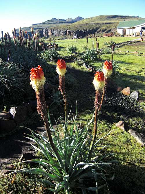
Morning after at Sani Top Chalet: After the thinderstorm the air is clean and fresh, and the sun is out. What else can one desire after a long day's walk?
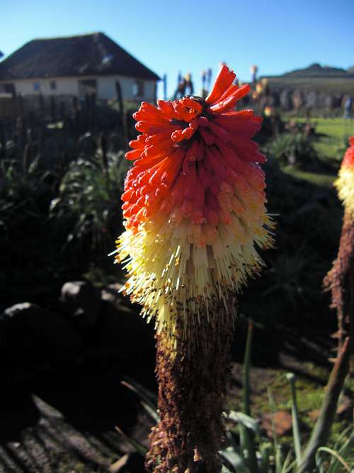
Kniphofias in full bloom. Can this be real after that horrendous torrent yesterday?
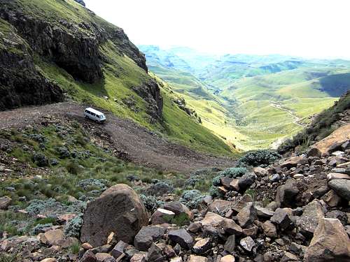
Down Sani Pass. The bumpy road winds down through many hairpin curves. Only 4x4 vehicles in first gear can negotiate this
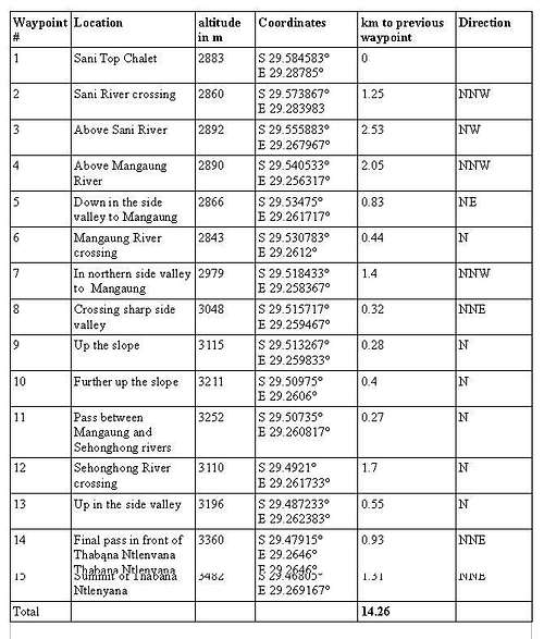
The waypoint coordinates in full
www.gipfel-und-grenzen.eu


Comments
Post a Comment