The Winds at Our Backs - A ski crossing of the Wind River Range
In late April of 2015 a friend and I skied across the Wind River Range from the Torrey Lake entrance, up over Burro Pass, down into Dinwoody Creek, took in the summit of Gannett, then exited over Bonney Pass and out to Elkhart Park. It was true wilderness experience; we did not see another human for the entire trip.
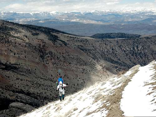
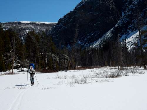
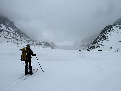
![First snow climbing up from Torrey Lakes area]() Just starting to hit snow after long hike up from Torrey lakes area
Just starting to hit snow after long hike up from Torrey lakes area
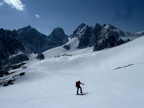
![Burro Pass]() Starting the ski down into Dinwoody from Burro Pass
Starting the ski down into Dinwoody from Burro Pass
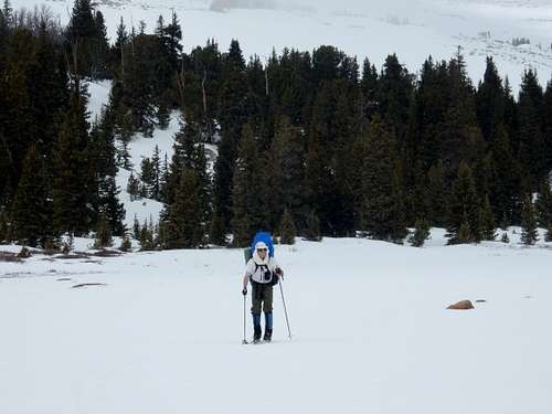
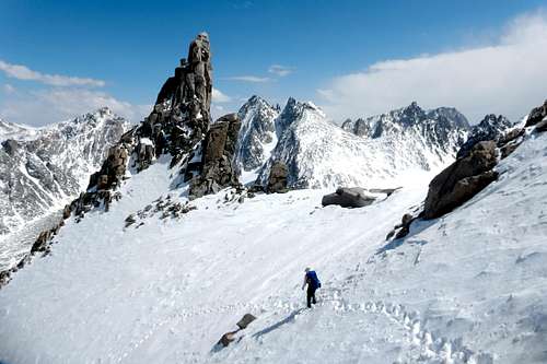
![Back in trees below Burro Pass]() This is partway down from Burro Pass dropping into the Dinwoody valley. This descent proved tricky, as there were quite a few skis-off spots, with bare rocky stretches or trees down.
This is partway down from Burro Pass dropping into the Dinwoody valley. This descent proved tricky, as there were quite a few skis-off spots, with bare rocky stretches or trees down.![Entering the Dinwoody]() Almost at the bottom, snow was mostly good. We now turned our attention to the many miles of skiing to Gannett.
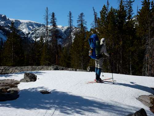
Almost at the bottom, snow was mostly good. We now turned our attention to the many miles of skiing to Gannett.![Skiing up the Dinwoody]() Most of the way we had acceptable snow cover, making for very pleasant travel.
Most of the way we had acceptable snow cover, making for very pleasant travel.![Relic in his element]() Skiing in the Dinwoody valley. Really, does wilderness travel get any better than this?
Skiing in the Dinwoody valley. Really, does wilderness travel get any better than this?
The snow drought of 2015 was very evident, the lack of snow in spots on the east side required us to carry the skis almost to Burro Pass,then in quite a few intermittent spots as we worked our way up the Dinwoody. It took 4 days to hike or ski in, with Gannett Peak finally coming into view at the end of day 3; we intentionally set a camp that evening with a great view of the mountain. Day 4 we moved up into the basin directly below the Gooseneck Glacier, finding a perfect rocky alcove in which to set a partly protected camp.
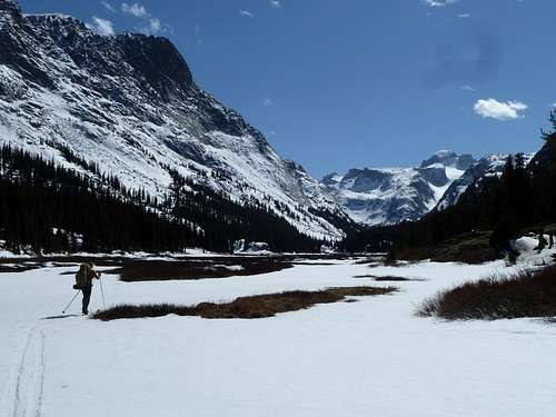
![Gannett finally in view]() After 3 days, we finally rounded a corner on the Dinwoody to see Gannett
After 3 days, we finally rounded a corner on the Dinwoody to see Gannett
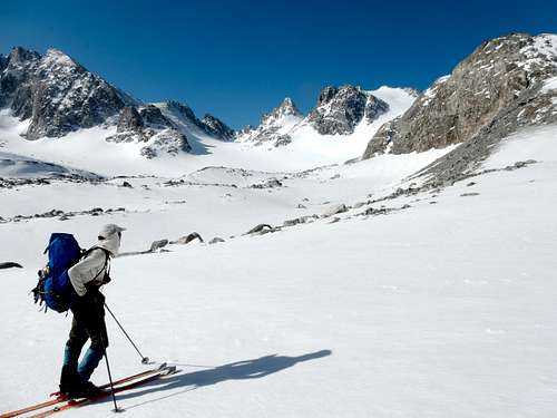
![Summit day, skiing up toward Gannett.]() Summit day, weather could not have been better.
Summit day, weather could not have been better.We had experienced very changeable weather during the approach, but summit day the weather gods gave us a gift with blue skies and sun. We skied up the Gooseneck Glacier to the start of the steep spot by the Gooseneck tower. I switched to crampons at one steep part on the glacier but regretted that as my friend stayed on skis and buzzed right on up and had to wait for me at the tower. We both got onto crampons at that point. Interestingly, the bergschrund that is so often discussed and photographed on this route was not even visible; the slope up was an easy crampon. Being a bit tired this day, I was very grateful for my energetic friend who kicked solid steps all the way up.
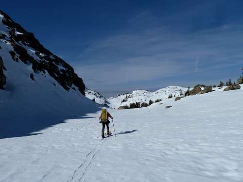
![Approaching Gannett on skis]() Summit day - Approaching Gannett on skis
Summit day - Approaching Gannett on skis
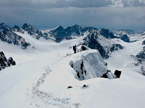
![Gannett Gooseneck]() The Gooseneck On Gannett.
The Gooseneck On Gannett.
We sat on the summit in warm sun. The peaks glowed with that ethereal inner light that happens when sun shines on snow-covered mountains. Surrounding us in the far distance were clouds and snowfall, but we had this hole of open blue sky just over our part of the range. Perfect.
![Gannett summit ridge]() Gannett summit ridge
Gannett summit ridge
The ski back to camp was, of course, a celebratory blast;near perfect snow and gravity doing all the work.
The next day the weather closed in; we skied up to Bonney Pass then cramponed over the top in low visibility. As we started down, we could not see the bottom of the slope through the blowing snow, this is always a tad intimidating to me. But last year we had skied into Titcomb Basin and looked up at the pass, so we had that memory to go on. Soon we were back on skis and flying downhill, making long looping back and forth swings across the canyon down toward the lakes.
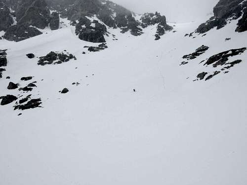
![Bonney Pass in bad weather]() Skiing down from Bonney Pass in low visibility. There is a skier in this shot!
Skiing down from Bonney Pass in low visibility. There is a skier in this shot!
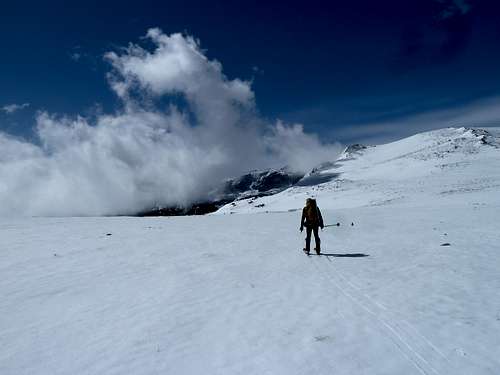
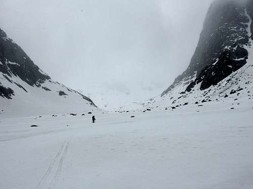
![Stormy day in Titcomb Basin]() Heading out to Titcomb Lakes in less than ideal weather
Heading out to Titcomb Lakes in less than ideal weather
Oddly, once the valley bottomed out, we hit some of the worst rotten snow either of us had ever experienced. Skis kept breaking through and dropping us a couple feet, stopping any forward glide. Nasty and exhausting.
![Upper Titcomb basin in storm.]() Upper Titcomb basin. Somewhere behind my friend up in the clouds and snow is Bonney Pass, which we had just crossed.
Upper Titcomb basin. Somewhere behind my friend up in the clouds and snow is Bonney Pass, which we had just crossed.
The rotten snow made setting a camp that night difficult; anytime we stepped off our skis we sank to our hips or farther. We finally located a relatively flat rock large enough to set tents on. Luckily the night was quite cold so the snow froze for better skiing. Down at Island Lake we encountered our first signs of recent human visitation, ski tracks. Never saw the track makers though.
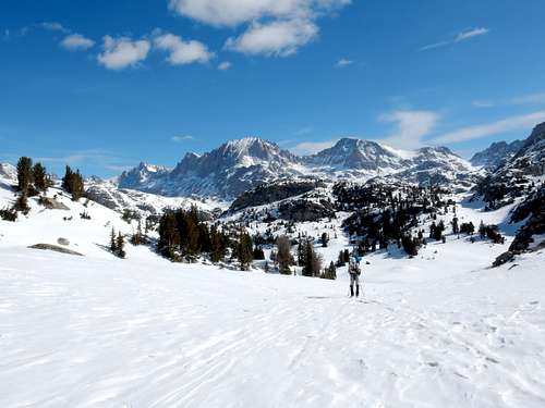
![Skiing through Indian Pass area]() Skiing the low passes between Island and Seneca Lakes. The crest of the Winds is behind us now. The big one on the distant skyline is Fremont Peak, and Titcomb Basin is alongside it to the left. Of course the weather is great now!
Skiing the low passes between Island and Seneca Lakes. The crest of the Winds is behind us now. The big one on the distant skyline is Fremont Peak, and Titcomb Basin is alongside it to the left. Of course the weather is great now!
![Approaching Seneca Lakes]() About to turn the corner toward the drop to Seneca Lakes
About to turn the corner toward the drop to Seneca LakesWe made good time on the frozen snow out through Seneca Lakes and camped once more at a pleasant clearing in Miller Park. We were euphoric on the knowledge that we had done it, completed an epic crossing of a major North American mountain range and summitted the highest peak in the Northern Rockies to boot. We had the Winds at our backs. This is one of those once-in-a-lifetime trips where everything comes together perfectly. Deep immersion in an indescribably beautiful and wild mountain range, a successful summit, the joy of skiing great distances over mostly ideal terrain, and a best mountain friend to share it with.
Adding to our incredible luck, the last day provided more good snow to allow effortless and fast gliding through the forest to Elkhart Park. We made it out in time for lunch at the Rock Rabbit in Pinedale. How great is that?
My co-conspirator on this trip put together a great slideshow with some of these images plus many more on vimeo. To view, click:
https://vimeo.com/189659326


Comments
Post a Comment