
-
 15393 Hits
-
 76.66% Score
-
 7 Votes
|
|
Route |
|---|---|
|
|
46.52600°N / 12.03070°E |
|
|
Mountaineering, Scrambling |
|
|
Summer, Fall |
|
|
Most of a day |
|
|
high altitude hike, F+ |
|
|
Approach
You start the tour at Rif. A. Dibona (2037 m) which can be reached by a narrow road from the main road Cortina - Falzarego Pass, on which you deter just west of Pocol meadow.
If the road to the hut is closed, we have an alternative option. From above Cortina d'Ampezzo you can take a chairlift to Rif. Pomedes, 2303 m. From there you can go westwards by a ferrata, which detours the southern rocks of Punta Anna ridge (Sentiero Astaldi).
Character and Rating of Route
Tofana di Rozes normal route leads us on top quite around the mountain. That has some advantage too: the route is not excessively steep and we get acquainted by three sides of the mountain - the southern, eastern and northern. The route itself is not very attractive, but great is the surrounding and of course the goal. From the saddle the route mainly goes over steep screes, rock slabs and over not difficult rock stepc. The difficulty of the route is rated by Swiss Scale as T4. For the ascent we need normally 3 h 30 min to 4 h.
Route Description
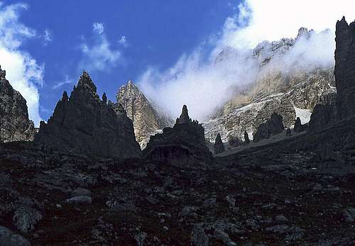
From Rif. Dibona we first go by a broad path towards the NW, but soon the path No, 403 deters to the right. It leads us northwards into a broad basin, filled with gravel. Soon from the right the path coming from Rif. Pomedes joins. We continue in wide and quite comfortable switchbacks up the valley. Even if the path is not very attractive itself, the scenery around is very impressive. All artound we can see picturesque, wild rock towers. Near decayed Rif. Cantore we can see also many remains from the World War I. We reached Forcella (notch) Fontanegra, beyond which in the middle of a rocky plane Rif. Giussani stands. The elevation is 2580 m.
 Towards Forcella Fontananegra |
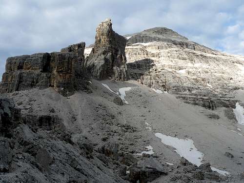
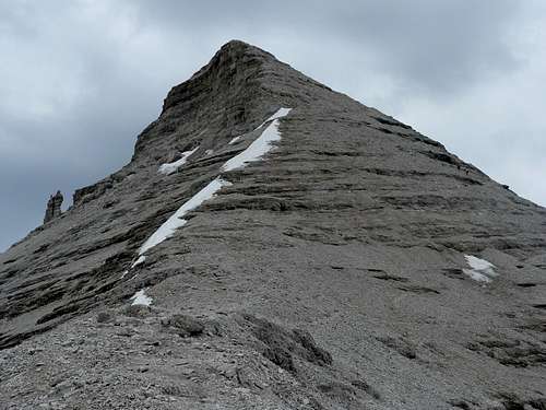
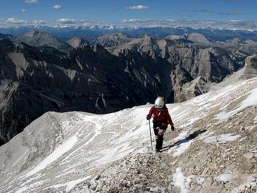
On the notch we turn sharp left (following inscriptions). From now on we shall be guided by blue marks. The route onwards is actually not the best marked. Several variants are beaten, in gravel slopes shortcuts exist so when ascending (and on a descent as well, especially if you did not also climb up there) you should carefully choose where to go. In addition to marks also cairns help us. The route first goes towards the west and only later (after branching, the continuation goes in the same direction to Tre Dita) turns up more decisively, aiming the north ridge of Tofana di Rozes. The path reaches it on some 3000 m of altitude, close to the point where also Ferrata Lipella exits the west face. The north ridge is not too steep, but also not completely easy, because normally it is covered with snow also in summer. So, before the tour check carefully if a danger of ice is on the summit ridge and take appropriate equipment.
By the normal rout also a hard and steep ski tour goes. In winter conditions Ice pick and crampons are mandatory, even if conditions for skiing are good.
Essential Gear
Good shoes and poles. In early summer there can be many rests of snow on north slopes and on the north-northwest ridge, so consider taking with you also a snow pick and crampons. The route over the north slope can be tricky in bad weather conditions, especially if fog disables orientation (compass, GPS).
In times of tour skiing, take full tour skiing equipment and additionally also ice pick and crampons.