-
 86609 Hits
-
 99.04% Score
-
 96 Votes
|
|
Area/Range |
|---|---|
|
|
46.94000°N / 10.78000°E |
|
|
12375 ft / 3772 m |
|
|
Overview
The Ötztal Alps are one of the largest and most important groups of the Eastern Alps. Though certainly not the highest alpine mountain range it nevertheless is one of the most glaciated ones. More than 300 mountains surmount the 3000m mark with impressive drops to the valleys below. The Ötztal Alps derive their name from the village of Ötz, which is located at the mouth of the Ötztal Valley, where it opens into the broad Inn Valley. The whole group of the Ötztal Alps is wedged between the two most important east-west traffic routes in the eastern Alps, the Inn Valley to the north and the Vinschgau Valley / Val Venosta to the south. The eastern boundary is the Ötztal Valley (N) itself together with the Passeier Valley (S) while the western boundary is composed by the upper Inn Valley (N) and the upper Vinschgau / Val Venosta (S). These eastern and western boundaries again are important traffic ways (N-S) with Reschen Pass in the west and the Timmelsjoch Pass in the East.
While the Valleys to the North and South are rather deeply set into the mountains (averaging about 750m) the Ötztal Alps themselves reach Altitudes of more than 3000m. Actually more than 300 mountains can be counted which reach and surmount this altitude so that from the sheer bulk the Ötztal Alps are one of the most massive mountain ranges in the whole Alps. The main ridge, which runs in an east - westerly direction forms the border between Austria and Italy in this region and both parts of the border couldn't be more different (having nothing to do with politics). The Austrian part of the range is heavily glaciated and together with its easy accessibility by motorway through the Inntal Valley this resulted in very far developed tourism. Especially in Winter the northern valleys are packed with downhill skiers who remain there until well after Easter each year to ski on the glaciers. In consequence a lot of ski-lifts and cable cars have been built which mar big parts of the landscapes. The deeper you get into the valleys however, the more remote and lonesome they get. The drainage in the northern (Austrian) part runs from South to north through three deeply set valleys: Ötztal, Pitztal and Kauner Tal. The mountains in between form very distinctive ridges which are generally each considered subgroups of the Ötztal Alps.
In the southern (Italian) part of the Ötztal Alps things are very different. Glaciers are rather small, only near the main ridge several of the northern glaciers reach further down to the south. Since Vinschgau / Val Venosta is a far less travelled route than the Inntal Valley in the north, the southern ranges of the Ötztal Alps are remote and lonely (with one exception: Kurzras in Schnalstal Valley, where there is a cablecar to Grawand on the main ridge). The drainage runs all ways so that valleys run sharp angles. Many of the valleys are closed to cars so that in order to reach the trailheads you need to hike long access routes. Still the mountains are beautiful and often you can take advantage of the small cablecars that alp farmers built to reach their farms. A call from the "bottom station", a shaky ride across infinity, a heavy bump at the top, 1 or 2 Euros fee and off you go. Quite an experience - draw your breath and close your eyes!
Ötzi
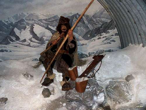
I was amazed by the feedback I got on all my Ötztal Alps pages from people all over the world. Many of you wanted to know if it was here that the Stone Age cave dwelling human, who has been named Ötzi, was found. And the answer is yes! For those interested I added a section in the lower reaches of this page where you can find some links and further information.
Languages
I feel I have to say something about the names of these mountains. Before the First World War the whole region belonged to Austria and German was spoken everywhere. The part south of the main ridge went to Italy after the War but still German is the principal language spoken there. Of course, over the years many (if not all) of the mountains in the south acquired Italian names, mostly literal translations of the German ones. Therefore - wherever I could find them - I include both names into the listings below with the original German name up front. Especially for the main ridge I was having trouble finding the Italian names - I have the suspicion that for these mountains the German names are in use even in Italy.
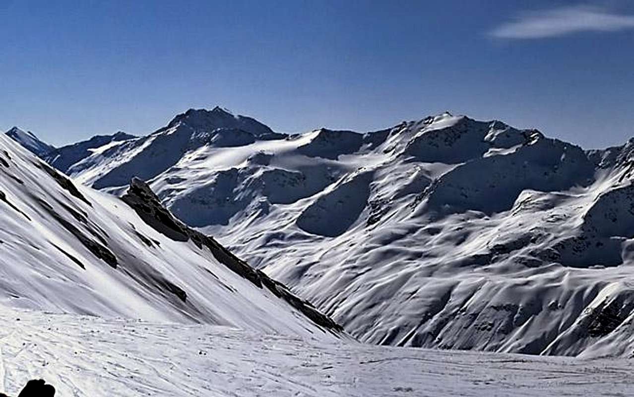
Panoramic View
 |
 |
 |
The Subgroups / The Ötztal Alps on SP
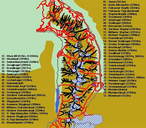
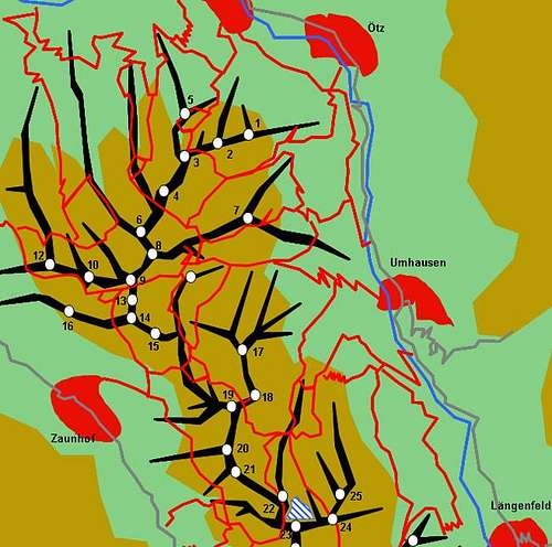
With its deep set valleys the Ötztal Alps can be divided quite neatly into several subgroups, the most of which are composed of single ridges. The subdivision on this page follows the suggestions by the German Alpine Club, as put down in the Alpenvereinsführer (see Maps & Books Section). Mountains, which already have been submitted to SP are listed within their corresponding subgroup.

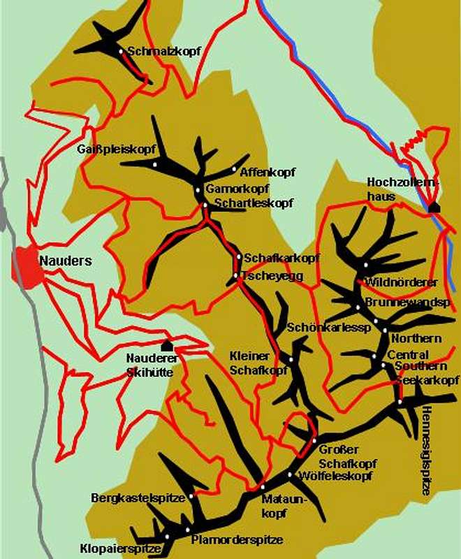
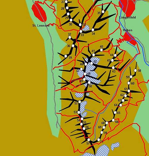
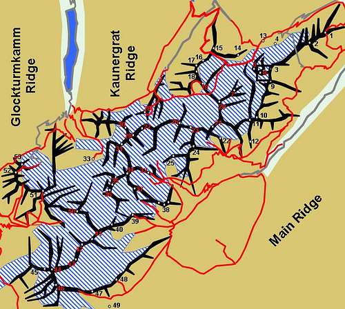
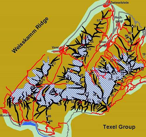
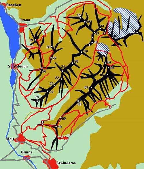
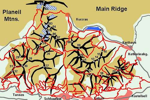
Interactive Map of the Ötztal Alps. Click the numbers to be directed to the respective sections.
- Nauderer Berge (this page)
Nauderer Berge (separate page) - Glockturmkamm (this page)
Glockturmkamm (separate page) - Kaunergrat
Kaunergrat (separate page) - Geigenkamm
Geigenkamm (separate page) - Weisskamm (This Page)
Weisskamm (separate page) - The Main Ridge (this page
The Main Ridge (separate page) - Planeiler Berge (this page)
Planeiler Berge (separate page) - The Saldurkamm Ridge (this page)
The Saldurkamm Ridge (separate page) - The Texel Group (this page
The Texel Group (separate page)
1 - Nauderer Berge (Nauders Mountains)
This is the north-westernmost subgroup of the Ötztal Alps. Located in Austria, on the northern side of the main ridge the mountain carry only German names (exceptions are the ones on the ridge itself. The subgroup is small; its boundaries are
- the Radurschlbach Creek to the north-east
- the upper Inn Valley to the north-west
- the main ridge to the south.
The area between Tscheyegg and Bergkastelspitze is covered by the cablecars, lifts and ski runs of Nauders. Most interesting for climbers are the vie ferrate that have been built (to increase the traffic on the cablecar in summer!) at Bergkastelspitze ("Goldweg") and Plamorderspitze ("Tiroler Weg"). For a hiker the eastern part with basis at Hohenzollernhaus is a nice option.
For more information see the Nauderer Berge Page.
2 - The Glockturmkamm Ridge
The Glockturmkamm Ridge is the first of the S-N ridges on the northern side of the border. The subgroup is bounded by
- the Inntal Valley to the north and west
- the Radurschlbach Creek to the south-west
- the main ridge to the south
- the Kaunertal Valley to the east
For more information see the Glockturmkamm Page.
3 - The Kaunergrat Ridge
Wedged between the Kaunertal and Pitztal Valleys the Kaunergrat Ridge is bounded by the Inntal Valley to the North and the Weisskamm Ridge to the south. All mountains are on Austrian ground and carry only German names.
For more information see the Kaunergrat Page.
4 - The Geigenkamm Ridge
The Geigenkamm Ridge - the easternmost of the northern ridges is located between the Pitztal (W) and Ötztal (E) Valleys. Further boundaries are the Inntal Valley to the north and the Weisskamm Ridge to the south.
For more information see the Geigenkamm Page.
5 - The Weisskamm Ridge
The Weisskamm Ridge contains the highest and most glaciated (therefore the name) summits of the Ötztal Alps. It runs WSW-ENE between Weissseespitze on the main ridge and Gaislacher Kogel above the Ötztal Valley. It builds the southern boundary for both the Kaunergrat and the Geigenkamm Ridges as well as for the Kaunertal and Pitztal Valleys. Its southern boundary is the Valley of Vent. For more information see the Weisskamm Page
6 - The Main Ridge
As said above the main ridge constitutes the border between Austria and Italy in this part of the Alps. It runs along the whole width of the range and makes a long southern bend between Weissseespitze (where the Weisskamm Ridge starts) and the Timmelsjoch Pass in the east. In its eastern part it splits in two the Ramolkamm Ridge (which turns off northward at Karlesspitze) and the eastern main ridge. For more information see the Ötztaler Hauptkamm Page
7 - Planeiler Berge (Planeil Mountains)
Located to the west of the Ötztal Alps this subgroup is the loneliest of them all. Several valleys turn off from the main Vinschgau Valley, which can be used for access. Aside from cattle and sheep you rarely see a "soul" here. Nevertheless the subgroup certainly has its charme. Summits reach way more than 3000m and views into the heart of the Ötztal Alps are breathtaking. The summits are listed east to west.
For more information see the Planeiler Berge Page.
8 - The Saldurkamm Ridge
The Saldurkamm Ridge is located east of the Planeil Mountains and is cut off from the main ridge by the deep cut of the Schnalstal Valley / Val di Senales. The ridge runs from north to south but bends to the east. It is in this southern part, the Vinschgau Sonnenberg, where you will find the best views. Across the deep cut valley you'll be able to see the mountains of the Ortler / Cevedale Group and to the east the western Dolomites can be seen.
For more information see the Saldurkamm Page
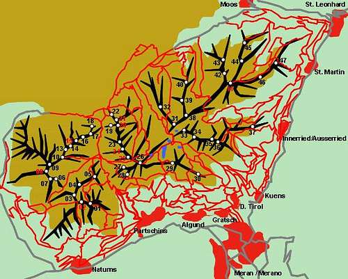
9 - The Texel Group / Gruppo di Tessa
The Texel Group / Gruppo di Tessa is set apart from the rest of the Ötztal Alps. Located in the mountain range's south-west it is separated by the Pfossental and Pfelderer Tal Valleys (Val di Fosse, Val di Plan). The subgroup is a rather complicated mountain range in itself as there are no distinctive ridgelines to be found. The outer reaches of the group is very popular among hikers because the Meraner Höhenweg hiking trail runs around the group. In its inner parts the group - like all the southern subgroups of the Ötztal Alps - is very remote and lonely.
For more information see the Texel Group / Gruppo di Tessa Page
Ötzi, the Iceman from Hauslabjoch
As stated in the overview section, Ötzi the 5300 year old ice age man has been found between Grawand and Similaun at Hauslabjoch. For those of you interested in archaeology here are a couple of useful links:
- Iceman Museum
- Archeopark Schnals
- List of publications
Getting There
- Austrian part (N)
- From the north
From Germany the easiest way to reach the Austrian valleys of the Ötztal Alps is to take the Inntal Autobahn, a motorway, which connects Kufstein in the north-east with Bregenz in the west. In its western part the motorway gives way to a regular road which only near Bregenz turns again into a motorway, now called A14. In any way the motorway runs through the Inn valley. Between the towns of Imst and Landeck the Ötztal, Pitztal, Kaunertal and upper Inntal Valleys turn of south and reach into the Ötztal Alps Mountain Range. - From the south
Here the easiest access is the Brenner Motorway, A22. Take it from Verona through Trento and Bolzano, cross the Brenner Pass and head down into the Inn Valley until you reach Innsbruck. Here turn westward on A12 and chose your valley of destination (see above).
- From the north
- Italian part (s)
- From the north
From Innsbruck take the Brenner Motorway to Sterzing / Vipiteno. Here take SS44 the road across Jaufenpass / Passo di Giove to Meran / Merano. There take SS38 into the Vinschgau Valley / Val Venosta.
Alternatively you can take the road through Ötztal across Timmelsjoch / Passo del Rombo, which also will take you to Meran / Merano. - From the south
Take the Brenner Motorway A22 to Bozen / Bolzano where you need to turn onto SS38, direction Meran / Merano.The road turns west into Vinschgau Valley.
- From the north
Mountain Huts And Refuges
While there are many mountain huts there doesn't seem to be a need for bivouacs. I'm only aware of one of these "mailboxes" but I'm not sure if I missed any. The mountain huts are listed according to the subgroup they are located in.
Refuge / Hut Height Summer Winter Tel. Thumbnails Nauders Mountains /Glockturmkamm Ridge Anton-Renk-Hütte 2261m reservations needed reservations needed +43/5472/6278 Nauderer-Ski-Hütte 1913m reservations needed reservations needed +49/421/72484 Hohenzollernhaus 2123m mid June - end Sept self service for 12 +49/421/72484 ![Ötztal Alps photo_id=65659]()
Kaunergrat Ridge Verpeilhütte 2025m mid June - end Sept. closed +43/664/4319634 Kaunergrathütte 2817m end June - mid Sept. closed +43/5413/86242 ![Ötztal Alps photo_id=62356]()
Rifflseehütte 2293m mid June - end Sept. mid Dec - mid April +43/5413/86235 Taschachhaus 2434m mid June - beg. Oct. self service for 16 +43/5413/86239 ![Ötztal Alps photo_id=7013]()
Gepatschhaus 1928m mid June - end Sept. two weeks around Easter +43-664/5349044 Geigenkamm Ridge Armelenhütte 1750m n.a. n.a. +43/ 5236/502 ErlangerHütte 2550m end July - mid Sept. serf service for 4 +43/664/3043335 ![Ötztal Alps photo_id=150487]()
Hochzeigerhaus 1876m mid June - end_Sept. end Dec - end April +43/5414/87335 Frischmannhütte 2192m end June - end Sept two weeks around Easter +43/676/3355436 ![Ötztal Alps photo_id=150488]()
Innerbergalm 1990m n.a. n.a. +43/5253/5631 Stabele Alm 1908m n.a. n.a. +43/5253/5825 Hauerseehütte 2383m end June - end Sept. closed +49/7141/927893 Rüsselsheimer(Chemnitzer) Hütte 2323m mid June - end Sept. self service for 12 +43/664/2808107 Hahlkogelhaus 2042m n.a. n.a. +43/5253/5897 Weisskamm Ridge BraunschweigerHütte 2759m mid June - end Sept. self service for 11 +43/5413/86236 BreslauerHütte 2844m end June - end Sept. self service +43/5254/8156 ![Ötztal Alps photo_id=116389]()
Vernagthütte 2766m end June - mid Sept. beg. March - mid May +43/664/1412119 Hochjochhospiz 2413m end June - end Sept. mid March - mid May +43/664/540 25 74 BrandenburgerHaus 3272, beg July - mid Sept. n.a. +39/0340/4154306 ![Ötztal Alps photo_id=6194]()
Rauhekopfhütte 2731m beg. July - mid Sept. self service for 12 +43/664/5349044 Weisskugelhütte 2542 end June - mid Oct. beg April - end May on weekends +39/0473/633191 ![Ötztal Alps photo_id=201159]()
Main Ridge ZwickauerHütte 2989m beg July - end Sept. self service +39/0473/646002 Schönwieshütte 2262m n.a. n.a. +43/5256/6524 Hochwilde Haus 2883m beg July - mid Sept. beg March - mid May +43/5256/6233 Martin Busch Hutte 2501m end June - end Sept. mid March - mid May +43/5254/8130 ![Ötztal Alps photo_id=143932]()
Ramolhaus 3006m beg July - end Sept. self service for 10 +43/5256/6223 ![Ötztal Alps photo_id=7030]()
Langtaleregg Hütte 2883m mid July - end Sept. beg March - beg May +43/5253/5396 ![Ötztal Alps photo_id=130481]()
Similaunhütte 3019m beg June - mid Oct. end Feb - end May +39/0473/669711 ![Ötztal Alps photo_id=100830]()
SchöneAussichtHütte 2842m end June - beg. Oct. beg Nov - ??? +39/0473/662140 Texel Group / Saldurkamm Ridge Hochganghaus 1839m n.a. n.a. +39/0473/443310 Lodnerhütte 2259m n.a. n.a. +39/0473/967367 ![Ötztal Alps photo_id=149388]()
StettinerHütte(Eisjöchlhütte) 2875m beg. July - mid Sept. n.a. +39/0473/646789 Oberetteshütte 2677m end June - beg. Oct. self service for 20 +39/3351/050424
Bivouac Height Thumbnails Forchheimer Biwakschachtel 2443m Guido Lammer Biwak 2707m ![Ötztal Alps photo_id=149829]()
Rheinland Pfalz Biwak 3247m ![Ötztal Alps photo_id=7994]()
Accommodation
On both sides of the border you have the choice among a lot of hotel rooms and apartments. Here is a selection of links:- Ötztal accommodation
- Pitztal accommodation
- Kaunertal accommodation
- Vinschgau / Val Venosta accommodation
- More Vinschgau / Val Venosta accommodation
- Schnalstal / Val Senales accommodation
Red Tape
In the south only the whole Texel Group / Gruppo di Tessa has been declared Natural Park. Here the usual regulations for natural Parks apply. In the north the areas around the summits have been declared "Ruhezone" (=calm zone). This means they are off limits for downhill skiing at all times of the year while hiking and climbing (again with the obvious restrictions) is allowed.
Weather Conditions
Look for the actual weather conditions, using one of the links below:
Maps & Books
- Austrian part (N)
- Maps
Kompass has some very good overview maps, scaled 1:50000 which show all the neccessary trails but don't go into too much detail:- Ötztaler Alpen
Kompass Map WK43
1:50000
ISBN: 3-85491-049-5 - Meran / Merano
Kompass Map WK53
1:50000
ISBN: 3-85491-059-2 - Vinschgau / Val Venosta
Kompass Map WK52
1:50000
ISBN: 3-85491-058-4
Better are the maps by the German Alpine Club, available for the nothern (Austrian) part of the range. They are scaled 1:25000 and can be obtained by The DAV-Shop (look under "Zentralalpen"). Both hiking and ski-touring trails are marked on these maps. However, the outlying regions of the Ötztal Alps are not shown. Thanks to Mathias Zehring for the Info. There are six maps:- 30/1 Ötztaler Alpen, Gurgl
- 30/2 Ötztaler Alpen, Weißkugel
- 30/3 Ötztaler Alpen, Kaunergrat
- 30/4 Ötztaler Alpen, Nauderer Berge
- 30/5 Ötztaler Alpen, Geigenkamm
- 30/6 Ötztaler Alpen, Wildspitze
The southern part of the Ötztal Alps is covered by the following Tabacco Maps, all also scaled 1:25000:- 39: Val Passiria / Passeier Tal
- 43: Alta Val Venosta / Vinschgauer Oberland
- 44: Val Venosta / Vinschgau Sesvenna
- 45: Latsch, Martell, Schlanders
- Ötztaler Alpen
- Maps Online
- Books
- Ötztaler Alpen
W. Klier
Alpenvereinsführer
Rother Verlag
ISBN: 3-7633-1123-8 - Ötztal
H. & W. Klier
Rother Verlag
ISBN: 3-7633-4094-7 - Pitztal
H. & W. Klier
Rother Verlag
ISBN: 3-7633-4058-0 - Vinschgau / Ortlergruppe
Kompass Wanderbuch 950
Kompass Verlag
ISBN: 3-87051-404-3 - Meran / Burggrafenamt
Kompass Wanderbuch 951
Kompass Verlag
ISBN: 3-87051-386-1
Overview books (both out of print) with 20+ routes in the Ötztal Alps- Ötztaler Alpen, Silvretta, Ferwall (Bergwandern und Bergsteigen zwischen Timmelsjoch, Reschen und Arlberg)
S. Schnürer
BLV München 1990
ISBN: 3-405-13171-5 - Bergsteigen in Südtirol Band 2 (zwischen Bozen und Reschen)
S. Schnürer
BLV München 1982
ISBN: 3-405-12212-0
- Ötztaler Alpen





Sebastian Hamm - Nov 14, 2006 8:23 pm - Voted 10/10
PanoramaHabe ein Panorama vom Wildspitz-Gipfel eingefügt. Eventuell ist es nützlich. http://www.summitpost.org/view_object.php?object_id=244011 Salü Sebastian
Gangolf Haub - Dec 8, 2010 7:16 am - Hasn't voted
Re: ÖtziYou're right of course - at the time I wrote I meant it figuratively speaking - someone very old. I'll change it. As for the dead links. There are probably more dead links - I have been willing to work on the page for ages but get deflected again and again ...