|
|
Area/Range |
|---|---|
|
|
45.97406°S / 72.91077°W |
|
|
Hiking, Mountaineering, Trad Climbing |
|
|
Spring, Summer, Fall |
|
|
8776 ft / 2675 m |
|
|
Overview
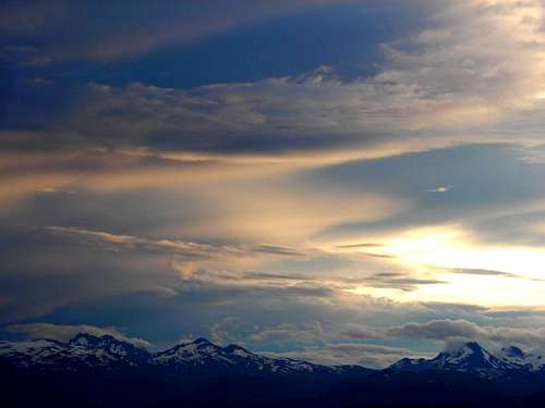
The Cordillera Castillo gets its name from the main summit: Cerro Castillo. Which means the Castle Mountain. Having a look at it, you figure out easily why. It is in the Aisen Region in Chile, which part of Patagonia.
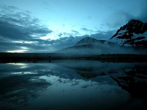
The Cordillera Castillo is located within the protected area of Reserva Nacional Cerro Castillo. Less know than its neighbors from down South (Fitz Roy and Torres del Paine), it does however provide great hiking and climbing.
This site is populated with glaciers, sharp and massive mountains and colorful lakes. It starts being popular among people traveling on the Carretera Austral (THE road going through Southern Chile),
but it is still quiet and preserved from mass visitors.
If you go to Patagonia, try to go through this Park, for sure!
Getting There & Logistics


From Santiago, fly to Coyhaique with LAN (regular company) or Sky Airline (low cost company).
From Coyhaique catch going south bound to Cochrane. They will all stop in Villa Cerro Castillo, the village by the Park.
Coyhaique is the biggest town (40,000 people) in the area. It is therefore recommended to withdraw cash and buy food there, before heading to Cordillera Castillo.
For accommodation in Villa Cerro Castillo check their home page. This place is very small, you can easily find your way around without a map.
If you need transportation around, check out with locals owning a 4x4. They will be happy to help you... if you pay around CHP 7,000 for the ride! (equivalent to $14)
There is a small grocery store in town, but again it is better to buy everything Coyhaique.
Red Tape

No red tape for this Reserva Nacional.
Just bring your trash back with you and only lit fires in the places meant for it.
Hiking & Climbing

HIKING
There are two itineraries that people usually take :
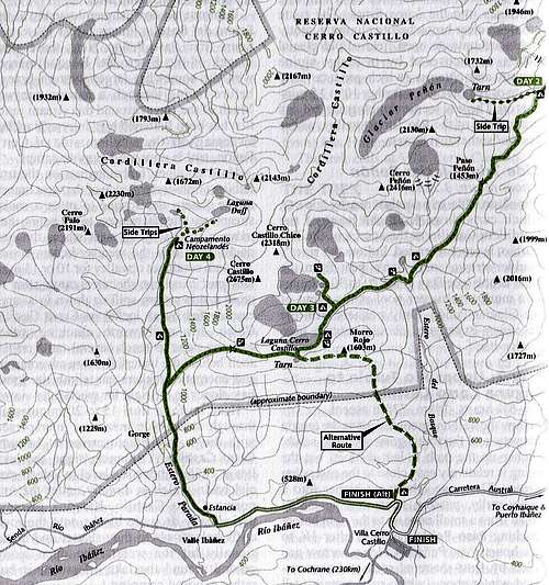
1. 3-day Hike (Western part)
Day 1 : from Villa Cerro Castillo to the Estancia (possible with a 4x4 for this part) then up to Campamento Neozelandes (5 hrs)
Day 2 : from Campamento Neozelandes along the western slope that is under Cerro Castillo to reach a pass (11 kms - 5 hrs)
Then down to Laguna Cerro Castillo or Laguna Tarn to camp there.
Day 3 : back to Villa Cerro Castillo. Always take the track going on the left ! (3 hrs)
2. 4-day Hike (Eastern & Western parts)
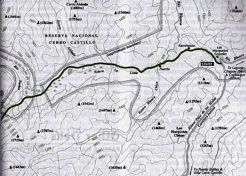
Day 1 : From VCC north bound, hitch-hike or take a bus and ask to be dropped off at Las Horquetas Grandes.
Then a very long day walking to the campsite before the Paso Peñon (6 hrs - 18 kms).
Day 2 : Walk to Laguna Cerro Castillo to camp there (14 kms - 5 hrs)
Day 3 : Laguna Cerro Castillo to Campamento Neozelandes.
Going around Cerro Castillo, first heading West then North (11 kms - 5 hrs)
Day 4 : Campamento Neozelandes back to VCC throught the Estancia by Rio Ibañez.
Two good guidebooks for hiking would be :
Trekking in the Patagonian Andes(Lonely Planet)
Chile and Argentina Trekking Guide(Bradt)
CLIMBING
The mountains are barely climbed even though they provide a good variety of accessible routes.
The main peaks to climb are :
Cerro Castillo (2675m)
Cerro Palo (2320m)
Cerro Castillo Chico (2318m)
Cerro Puntudo (2061m)
For details on climbing in the area, check out the excellent guide written by John Biggar :
Andes - A guide for climbers
Maps of the Area
Weather
For forecast in the Aisen region, check Meteo Chile.