
|
|
Route |
|---|---|
|
|
36.05850°N / 112.08306°W |
|
|
Hiking |
|
|
Most of a day |
|
|
Strenuous |
|
|
Approach
 South Kaibab Trail | The South Kaibab Trail Head is located at Yaki Point, inside the Grand Canyon National Park. Yaki Point is the only viewpoint on Desert View Drive that is not accessible with a private vehicle. It can be reached using the free Shuttle Bus (Orange) departing from the Grand Canyon Visitor Center across the street from Mather Point on South Rim. Busses run from just before sunrise to just after sunset. The schedule changes slightly according to season, so check departing times on the Grand Canyon Visitor Center website (see below.) There is no private parking at this trailhead. Parking is permitted along the Desert View Drive, near the gate at Yaki point. However, there is a 1/2 mile (one way) walk to the trail head. |
Route Description
General info
Elevation at trailhead is 7,262 feet (2213 meters). The Colorado River is at elevation 2,400 feet. The trail descends 4,862 in total. The trail runs 6.3 miles from rim to river. Trail is in ok condition, but difficult going either up or down due to the nature of the earth. Steep trail, no water, little shade. Watch out for mule trains and their droppings. This is the fastest way from the South Rim to the river. This is also the most strenuous way from the river to the South Rim. There is neither camping at the trail head nor anywhere else on this trail.
Upper part of the Trail
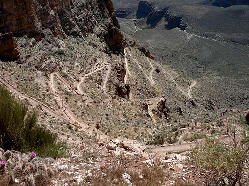
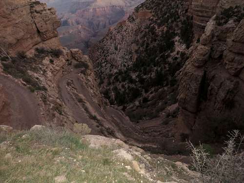
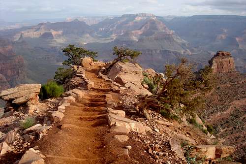
The path begins by descending into a side ravine (Pipe Creek, generally referred by the hikers as the chimney) but soon the walls open out allowing for magnificent views both west and especially east along the canyon. The first popular stop for picture comes .9 mile from the top at Ooh Aah Point. After another .9 mile (1.5 miles from trail head) and a descent of 940 feet the NPS have installed restrooms along Cedar Ridge, which is a sensible target for a half day hike; certainly far fewer people progress beyond. The trail continues fairly straight, going down steadily but not too steeply, curves around O'Neill Butte (after 2.5 miles from TH). 1.5 miles from Cedar Ridge comes Skeleton Point and then the trail descends very sharply with a long series of switchbacks towards the Tonto Plateau, arriving at Tipoff after 1.4 miles (4 miles from trail head.)
Inner Canyon
An easier, flatter section passes a place known as The Tipoff (1.4 miles from Skeleton Point) which is just above the rim of the Inner Canyon Gorge - here are located more restrooms and an emergency phone. From Tipoff to the river are 1.1 miles. The rocks in the canyon walls opposite are composed of ancient metamorphosed granite, mineralized and particularly colorful, exhibiting many shades of red and purple. The last section is steep again, especially the part just above the river, which is clearly visible for the last mile or so of the descent. At the end of the trail there is a short tunnel which leads directly onto a suspension bridge, one of two which cross the Colorado River (the other is for the Bright Angel Trail, half a mile downstream.)
At the Colorado River
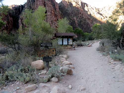
After a short distance walking along the north side of the Colorado (1/2 mile) one arrives at the Phantom Ranch buildings (a "advance place your order for a meal" restaurant, a guest house, cabins, ranger station, mule stables, flushing restroom, potable water) and Bright Angel Campground. Once getting to the river one also can continue on the mile long trail on the South bank Of Colorado River to traverse to the Bright Angel Trail.
 The chimney | 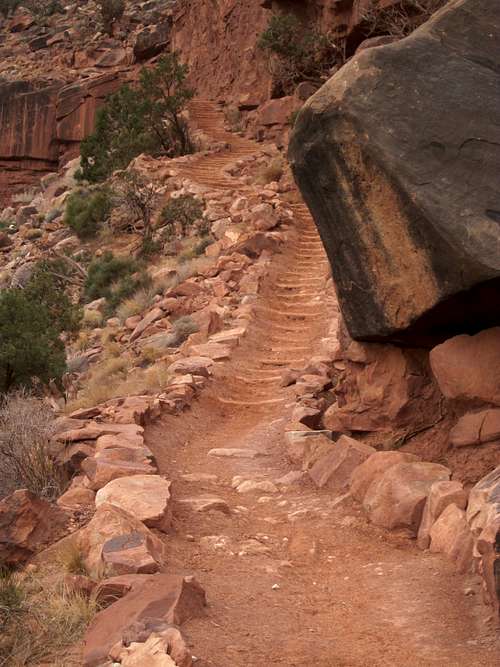 S Kaibab S Kaibab |  Cedar Ridge | 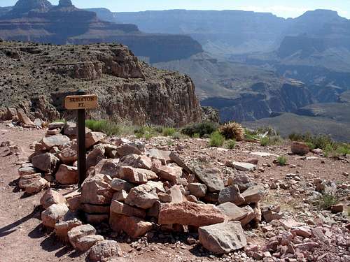 Skeleton Point | 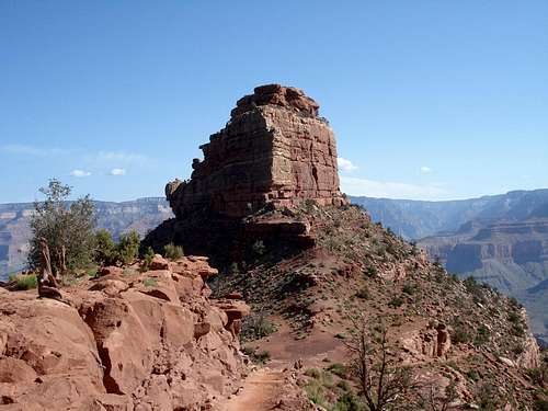 O'Neill Butte | 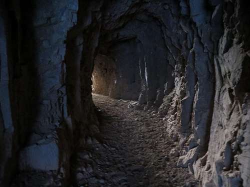 Tunnel before Bridge | 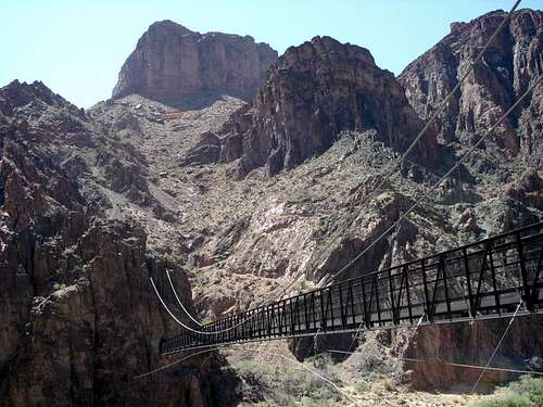 Black Bridge |
South Kaibab distances breakdown
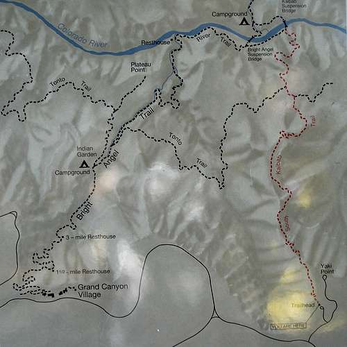 South Kaibab Map at the trail head | South Kaibab TH to Bright Angel Campground/Phantom Ranch -7 miles South Kaibab TH to Ooh Aah Point - .9 mile |
Water on Trail
There are no water stations or creeks along the way: the only available water (year-round) is at the South Kaibab Trail Head and Phantom Ranch/ Bright Anger Campground. However note that due to occasional, sudden and unpredictable pipeline breaks water at Bright Angel Campground is not guaranteed: bringing an alternative form of water treatment, such as iodine tablets or a water filter, is essential.
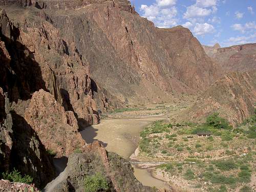 Colorado River From S Kaibab | 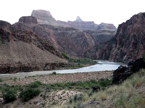 Colorado River from River Trail | 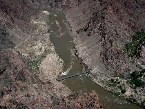 Panorama View from South Kaibab | 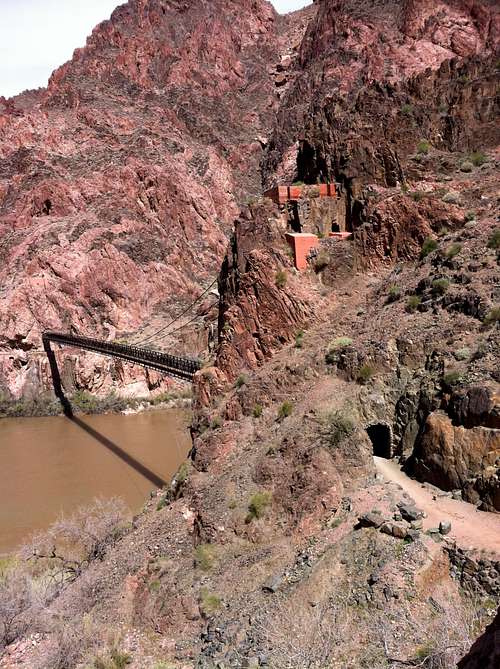 The Black Bridge |
Essential Gear
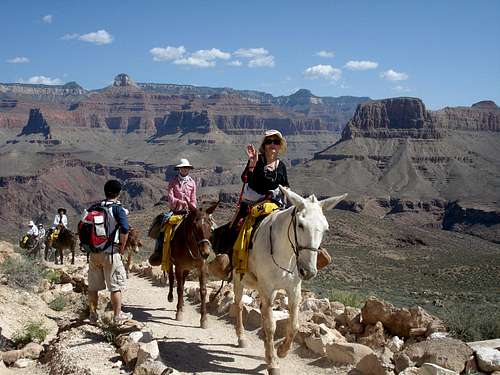
Mules going up the trail
History
 South Kaibab Trail, Grand Canyon | In 1925, the National Park Service wanted a quick route into the canyon since Ralph Cameron refused to give up control of the Bright Angel Trail. (Cameron asked $150,000 for the right of using the trail. The South Kaibab trail, initially estimated at $40,000, was eventually built for $73,000.) They decided to build their own trail at Yaki Point, since it was near the village and allowed a fairly direct route into the Canyon. Today known as the South Kaibab Trail, it was originally referred to as the Yaki Trail because it began near Yaki Point. The word "Kaibab" in the Paiute language means "Mountain Lying Down," their term for the Grand Canyon. The South Kaibab Trail was built from December 1924 to June 1925 under park engineer Miner Tillotson’s supervision. Tillotson later went on to serve as Grand Canyon National Park Superintendent in the 1930s. The trail cuts across the canyon in a northerly direction, dropping through 8 major geologic formations, almost 5,000 vertical feet in about 6.5 miles. The route was chosen because all but a quarter mile of its surface gets year-round sun, minimizing snow accumulation and making it virtually a year-round trail. At the same time, the sun and absence of water along the route makes it a hot and dangerous trail in the summer. Because it was meant to be a fast route, it did not follow natural features, but instead was designed to follow the most feasible direct route. Below Tipoff, the South Kaibab Trail loosely follows the course of an earlier trail called the Cable Trail (built in 1907 to accommodate access to the old cable car system across the river that existed before construction of the present suspension bridge). Vestiges of this earlier trail can be seen as the South Kaibab Trail descends toward the Colorado River. |
Red Tape
There is $30 a car to enter the park as of January 2018 (when I was last there.)
For 2018 there are only four free fee entrance days (compared to 10 in 2017.) These four days are January 15, April 21, September 22 and November 11. There is talk to increase the entrance fee to $70 per car during peak season.
There are also permits required when it comes to camping. (See link below.)
External Links
South Kaibab Trail Map: http://www.nps.gov/grca/planyourvisit/upload/corridor_map.pdf
Intersection in the canyon
Trails Distances and facilities associated with each trail: http://www.nps.gov/grca/planyourvisit/trail-distances.htm
Shuttle Buss Schedule: http://www.nps.gov/grca/planyourvisit/shuttle-buses.htm
NPS South Kaibab Trail page: http://www.nps.gov/grca/planyourvisit/upload/South_Kaibab_Trail.pdf
Critical Backcountry Updates: http://www.nps.gov/grca/planyourvisit/trail-closures.htm#CP_JUMP_140503
Backcountry Permits: http://www.nps.gov/grca/planyourvisit/backcountry-permit.htm
ASU South Kaibab Trail: http://grandcanyonhistory.clas.asu.edu/sites_rimtoriverandinnercanyon_southkaibabtrail.html
|
|