

-
 5332 Hits
-
 75.81% Score
-
 6 Votes
|
|
Route |
|---|---|
|
|
64.06109°N / 16.98512°W |
|
|
Hiking, Mountaineering |
|
|
Summer |
|
|
Most of a day |
|
|
Class 2 in good conditions |
|
|
I |
|
|
Overview
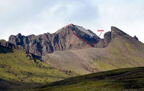
Kristinartindar from the SE with the approximate line of the route shown.
In good conditions the route to the summit of this marvelous viewpoint is not difficult. It is a mostly Class 2 climber’s trail above the saddle which is reached by a good hiking trail. With new unconsolidated snow, we found two places to be more comfortably done using our hands, but we are sure that without the snow there would be no need for most people. According to the Park’s conditions page, the route can be difficult with “special equipment needed”. We assume that this would be with consolidated snow and ice when crampons and an ice axe would be needed. The summit itself is very exposed and affords amazing views of the peaks, glaciers and icecap of the Skaftafell area.
Even if the upper part of the mountain is out of condition for a summit climb with whatever gear you have, it is worth hiking to the saddle between the main peak and the subsidiary peak to its west for the view (assuming good weather).
Distance: about 16 Km (about 10 miles) roundtrip
Vertical: about 1,020 m (about 3,350 feet)
Approach
The possible trails leading to the saddle where the route begins start on the south side of the camping area to the west of the visitors center. The trail heads and trails are well marked with stakes driven into the ground at frequent intervals.This Site has a description of the approach with a shortest way indicated. The map in the upper right can be enlarged to better see the trails mentioned (It is the same map that appears here).
Though it is slightly longer, it is worthwhile to go by way of Svartifoss (Black Waterfall) and to make a loop of the approach and descent. Going this way affords some very nice views.
Both main trails leading to the mountain go through several very boggy muddy areas. If you wear low cut shoes, you will almost certainly end up with wet feet.
Check ahead as the trails are occasionally closed due to poor conditions.
 Detailed map Detailed map |  Schematic Map Schematic Map |  Svartifoss Svartifoss |  Rocky trail below saddle Rocky trail below saddle |
Route Description
The route from the saddle is not difficult to find. Follow the well worn climber’s trail up.In one place fairly low down, the trail leaves the talus and crosses a solid rock rib. The best crossing was marked with a wooden stake in August, 2013. The trail resumes on the other side.
The last bit to the gentle ridge top crosses a steep step of broken rock that in dry conditions should not cause anyone concern. With snow extra caution is warranted. Above this, it is an easy walk to the exposed summit.
There is a register attached to the communications equipment on the ridge below the summit.
 The start of the climber's trail above saddle The start of the climber's trail above saddle |  Rock Rib Rock Rib |  Steep step below ridge crest Steep step below ridge crest |  Last bit with snow Last bit with snow |  Last bit no snow Last bit no snow |
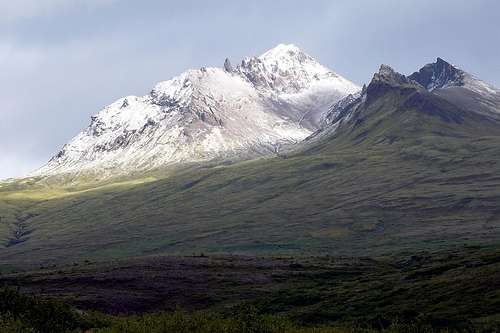
From the S. The trail to the saddle from this side is clearly visible - more so if you enlarge the image.