
-
 42315 Hits
-
 98.52% Score
-
 84 Votes
|
|
Area/Range |
|---|---|
|
|
42.26958°N / 112.09785°W |
|
|
Hiking, Mountaineering, Trad Climbing, Scrambling, Skiing |
|
|
Spring, Summer, Fall, Winter |
|
|
9282 ft / 2829 m |
|
|
Overview

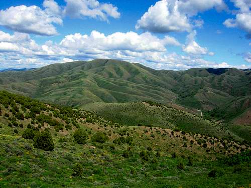
Oxford Peak
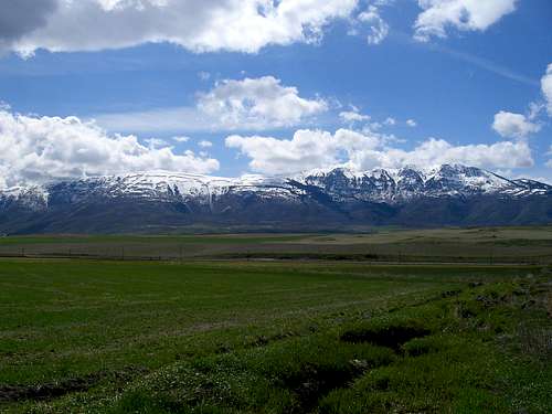
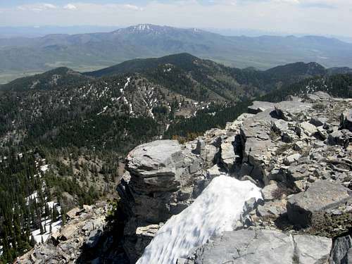
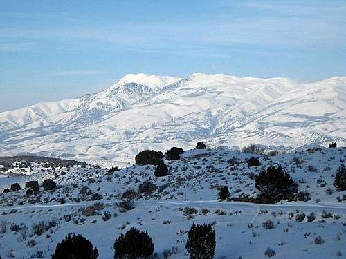
The Bannock Range is located in Southeast Idaho with the southern end of the range extending into Northern Utah. The main crest of the range runs for about 65 miles traveling in a north to south direction. It is an interesting mountain range that few climbers seem to know about. The majority of people who hike in these mountains are locals who live nearby. Summit routes generally require off-trail hiking and minor scrambling. The mountains are covered in green vegetation and forests with several streams and no alpine lakes. You won't find any jagged peaks in this range, but you will have great views and solitude.
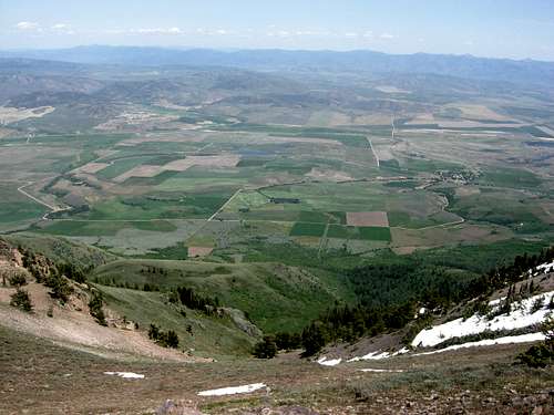
The view from any of these peaks is outstanding due to their location above the surrounding valley. Although, they are not high in elevation, the range contains several prominence peaks. You should be able to see the Portneuf Range to the east across the valley, Deep Creek Mountains to the west, Marsh Valley, Malad Valley, or Cache Valley, the Northern Wasatch Mountains to the south, and I-15 which travels along the entire range. The mountains above Pocatello are climbed often and so is Oxford Peak, by Idaho standards, which is still a small number of people. The mountains are made mostly of limestone. Other rock layers include dolomite, quartzite, and shale. At lower elevations near Pocatello are volcanic and basalt cliffs.
Geographically, the range has large rounded summits and foothills. The Bannock Range is broken into three distinct areas. These areas are divided by low mountainous passes. The northern section is southwest of Pocatello and Inkom and goes south toward Garden Creek Gap. The central section is just west of Malad Summit on I-15. The southern section then crosses over to the east side of I-15. The highest peak in the range, Oxford Peak, is located here. This section is located east of the city of Malad and west of the city of Preston. There are several smaller sub-ranges that branch off to the west of the southern end of the Bannock Range. They all are located on the Idaho-Utah border.
The range was first climbed by Native Americans who lived below the mountains. The first white explorers to Idaho were Lewis and Clark in the early 1800s. Mountain surveyors came to the range in the 1870s. Henry Gannett climbed numerous peaks in Southeast Idaho, including Oxford Peak and Elkhorn Peak in the Bannock Range. He is most famous for climbing Gannett Peak in the Wind River Range, which now bears his name. Henry’s climbing partner was Allen D. Wilson who was a member of the Hayden Survey. Wilson Peak and Mount Wilson in Colorado were named after him. Thomas M. Bannon was a surveyor who climbed and identified hundreds of peaks throughout Idaho and Wyoming. Mount Bannon in the Tetons would later be named after him.
The range was named after the Bannock Indians. Much of the area was inhabited by Native Americans. They speak the Northern Paiute Language and are closely related to the Northern Paiute people. The ancestral lands of the Shoshone and Bannock Indians included parts of Montana, Idaho, Yellowstone National Park, Northern Utah, Nevada, and California. The Bannock are well known in American history due to the Bannock War of 1878 where they bravely fought a final battle for traditional existence. After the war, the Bannock moved onto the Fort Hall Indian Reservation, where they live with the Shoshone and Lemhi Indian tribes. The reservation is located near Pocatello and Blackfoot.
 Southern Bannock Range seen from the east - by mtybumpo
Getting There
Access to the Bannock Range is very good due to Interstate 15. Dirt roads branch off toward all of the mountains. Most of the roads are in good shape and a car should be able to make it to the base of most mountains. A high clearance vehicle may be needed to get to some trailheads.
From the North: If coming from Idaho Falls, Blackfoot, or other cities. Take 1-15 or Highway 91 south toward Pocatello and Chubbuck. This is at the northern end of the range. Pocatello is the largest city near the Bannock Range and has all amenities.
From the South: If coming from Utah. Take 1-15 north over the border toward the city of Malad. The east side of the range can be reached by driving north of Logan, Utah on Highway 91 toward Preston, Idaho. This gives access to the main southern peaks of the range. I-15 meets up with Highway 91 near the small town of Virginia.
From the East: If coming from Montpelier, Soda Springs, or Logan Canyon. Highway 89 meets up with Highway 30 at Montpelier. Take Highway 30 northwest toward Soda Springs and Lava Hot Springs. Continue on Highway 30 toward I-15 south of the town of McCammon. To get to the southern peaks take the exit a few miles west of Soda Springs and go south on Highway 34 toward the cities of Grace and Niter. Continue south toward Preston.
From the West: If coming from Boise, Mountain Home, Twin Falls, or other cities. Drive east until you get to the junction with Highway 84 south and Highway 30 north. Take Highway 86 and drive northeast through American Falls and continue toward Pocatello.
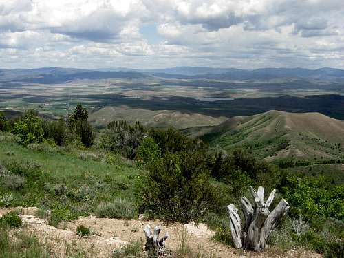
 Scout Mountain seen from Slate Mountain
Northern Peaks
This area is southwest of Pocatello. It is one of the largest cities in Idaho. There are many dirt roads and trails that give access to these mountains. Expect to see a few people during summer weekends. Many trails are open to motorcycles. There are also several low elevation mountains that can be climbed year round. They include Kinport Peak, Slate Mountain, and Gibson Mountain.
Kinport Peak
Kinport Peak - (7,222 feet)

Kinport Peak
This is the northernmost major mountain in the Bannock Range. It is located 4 miles southwest of Pocatello. A couple of hiking trails lead to the top of the mountain. The best route up the mountain is from City Creek Canyon. Another route goes up Cusick Creek which is the next canyon south of City Creek. There is a dirt road that goes all the way to the top from the southwest but it is a long drive. The peak has a radio transmission on its summit.
To get there, drive to Fifth Avenue north, which is a one way road. Turn left on Benton Street and go west until reaching South Grant Street. Turn south on South Grant until you come to a Mormon Church. Just to the east of the church is a small park. The City Creek trailhead is just beyond the chain link fence. Some sections of the trail are rocky. At times, it meets the gravel road, so just look for places to get back on the main trail. About a mile and a half up the trail is an intersection. Turn south to go up Kinport via Cusick Creek, or keep heading west to climb Kinport via City Creek.
Kinport Peak is thought to be named after Colonel Harry D. Kinport, who lived in Pocatello since 1885 and was an important military recruiter. He worked for the Oregon Short Line Railroad which was a key to the founding of the city. He was said to be the first white man to climb the peak. He was also noted for accompanying President Teddy Roosevelt on hunting trips. Other reports say that the mountain was named after Gideon R. Kinport. He and two companions carried a six-by-four foot American flag and a 28-foot pine pole they cut two miles below the summit. This event may also be responsible for the name. He and two others put the flag on the summit on Sunday, June 20, 1889.

Gibson Mountain
Gibson Mountain - (6,775 feet)
Gibson Mountain is located northwest of Slate Mountain. The Gibson Jack trail was named after the creek of the same name that flows beneath is slopes. To get there, drive southwest of Pocatello onto the Bannock Highway. The signed Gibson Jack road is directly opposite Juniper Hills Country Club. Follow the Gibson Jack road 3.2 miles to the trailhead.
The Gibson Jack trail is open to hikers, mountain bikers, horseback riders, and dogs. So be prepared to share the trail. From the parking area, take the trail that leads west directly up the main canyon and creek. You will parallel Gibson Jack Creek. The area is popular due to it's proximity to Pocatello and the nearby suburban subdivisions. You'll see few people farther up the trail. The trail trends southwest and then climbs to the north of Gibson Peak. You can hike to the summit from here.
At the top of the drainage, you can hike back the way you came, or go down the south fork of Gibson Jack canyon. The trail in the canyon is worth the effort because of the good views of Pocatello, the blackrock gap to Inkom, and north to Fort Hall. Once you are down from the mountain it is a level or downhill hike the rest of the way to the trailhead. The full loop will take most of a day to hike but many people only do part of the loop and return the way they came. The loop is about 8.5 miles round trip.

Slate Mountain
Slate Mountain - (6,980 feet)
Slate Mountain
This is a good mountain to climb in winter and early spring. Snow melts off early in the year due to its sunny location. It is located about 4.5 miles south of Kinport Peak near the west fork of Mink Creek. The trailhead is located right off of the Bannock Highway Road which is southwest of Pocatello. There is a sign saying Slate Mountain Trailhead near the parking area which is below. It can only be seen by those driving south so it is easy to miss.
A maintained trail goes across a bridge at the beginning and then enters into a canyon. There several are switchbacks that go across the mountainside and the elevation gain is gradual. It enters into another canyon where you get your first view of the mountain which is still far away. The trail heads in the direction of the mountain as it goes through several meadows which are covered in wildflowers during spring and early summer. Once you are at the base of Slate Mountain the trail splits at a junction.
The trail on the right goes down the Gibson Jack trail in the canyon below. The trail on the left goes uphill and is the one that you want to take for a short distance. Now you will see the west face of Slate Mountain above you. Climb up the face through the trees and brush and follow the ridge to the summit. The top of the mountain is large and had a cairn when I was there. An alternative route starts from the West Mink Creek Trailhead. This route goes beneath the west side of the mountain where you can leave the trail and hike to the top.

Scout Mountain
Scout Mountain - (8,710 feet)

Scout Mountain
This is the most climbed mountain in the Bannock Range due to its proximity to Pocatello. The mountain got its name from the boy scout camp which is located below the mountain. Many of them climb the mountain each year. Scout Mountain has a long ridgeline with broken cliffs on its west face.
Access is from Bannock Highway. Turn at the junction for Mink Creek Road #281. After 6.5 miles turn left on Road #001. Continue on the East Fork of Mink Creek on this paved road until you get to Scout Mountain Campground. To get to the trailhead go right on Road #002 to the end of the road instead of driving into the campground.
A hiking route starts from Scout Mountain Campground. It is called the East Mink Trail and starts on the west side of the mountain. Along the way is a nice scenic pond. The trail climbs for 3 miles to the ridge on Scout Mountaintop Road. It is another 2.5 miles to the north along the road to the summit. This is a washboarded dirt road and in good condition. There is 2,400 feet of elevation gain. The dirt road to the summit is usually only open during the summer months.

Old Tom Mountain
Old Tom Mountain - (8,733 feet)

Old Tom Mountain
Old Tom Mountain is the highest mountain in the northern end of the range. It was named after a well known mountain lion that lived in the area. Old Tom Mountain is the third most prominent peak in the range after Oxford and Elkhorn. The mountain was first climbed in the 1870's by the Hayden Survey.
To access the mountain, drive on I-15 north of the town of Arimo. Take exit 40 west toward the mountains. This is a dirt road that goes through Garden Creek Gap. The main road can be driven by cars but most side roads will need high clearance. There are parking spots on the side of the road that are used by rock climbers.
Several years ago, I climbed up the south ridge of Old Tom Mountain from Garden Creek Gap. I liked this route because it was straight forward and had good views of the Portneuf Range across the valley. As of 2009, I noticed that a fence and no trespassing signs had been posted near the road that blocked off direct access to this route. I found a better way up the mountain from the north ridge. You can drive up to the saddle and start hiking from here all the way to the summit.
 Indian Mountain in the Bannock Range
Central Peaks
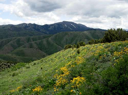
The Central Peaks are located west of Malad Summit on Interstate 15. It is part of the long ridgeline that connects Wakley Peak, Elkhorn Peak, and Kents Peak. They are part of a small sub-range called the Elkhorn Mountains which is 16 miles long and 6 miles wide. The range appears as an island that stands above the surrounding valley. The area has dry sagebrush and grasslands with aspen and firs in the upper elevations.

Wakley Peak
Wakley Peak - (8,801 feet)

Wakley Peak
Wakley Peak is 4.5 miles north of Elkhorn Mountain. They are connected by the same ridgeline. The first ascent was made by the Wheeler Survey who named the mountain Fontaine Peak. Mountain surveyer Thomas M. Bannon originally identified it as Elkhorn Peak but later changed it to Wakley Peak.
To get there, drive on Interstate 15 north of Malad City. Take Devil Creek Reservoir (exit 22). Drive north past the reservoir which will be to the right. Continue down this paved road for 3.2 miles until you get to the overpass above I-15. Turn left at the sign for Summit Campground. This turns into forest dirt road #041. Drive for 2 miles down the road. You will come to a side road that leads to the Wright Creek National Recreation Trail on the right.
The standard route up the mountain goes up the Wright Creek National Recreation Trail which is southeast of the peak. It climbs for 5 miles to a saddle below the peak. You can climb up the southwest ridge from here. The mountain can also be climbed from the west by Forest Roads #043 and #044 northeast of Daniels Reservoir. The route up the north ridge is a good winter climb.
Elkhorn Peak
Elkhorn Peak - (9,095 feet)

Elkhorn Peak
Elkhorn Peak is the second most prominent mountain in the range. It stands high above Malad Summit on I-15 and is a great mountain to climb. It is located on a long ridgeline that is called Elkhorn Mountain with the highpoint known as Elkhorn Peak. It was one of the mountains in Southeast Idaho used as a triangulation station in the 1870’s.
The mountain is usually approached from the east. Access is from forest road #041. Drive down this road for about 3 miles. You will pass a side road that leads to the Wright Creek National Recreation Trail on the right. Keep driving and stay on the main road which becomes narrow. You will pass the entrance of Summit Campground on the left. Stay on the main road and keep driving until you get to the end of the road. There will be a small turnaround point at the end of the road where the trailhead is located.
The main routes up Elkhorn Peak include the southeast ridge and north ridge. The north ridge from Indian Mill Canyon is the easiest route up the mountain. The southeast ridge from Kents Canyon is shorter and provides more challenge. The long summit ridge has huge cairn on its highpoint that can be seen from far away. This is one of my favorite mountains in the range.

Kents Peak
Kents Peak - (8,451 feet)
Kents Peak is a forested cone located south of Elkhorn Peak. It was named after the canyon that is north of the summit. The mountain is not climbed much because Elkhorn Peak is higher and looks more interesting. The hike from Kents Canyon to the summit is about 7.5 miles round trip with 2,600 feet elevation gain.
The mountain is usually approached from the east. Access is from forest road #041. Drive down this road for about 3 miles. You will pass a side road that leads to the Wright Creek National Recreation Trail on the right. Keep driving and stay on the main road which becomes narrow. You will pass the entrance of Summit Campground on the left. Stay on the main road and keep driving until you get to the end of the road. There will be a small turnaround point where the trailhead is located.
From the trailhead, follow the old jeep road to a junction. The left fork goes to Kents Canyon and is the trail you want to take. At the start, the hillsides are fairly open with pockets of Juniper and maple, with cottonwoods and chokecherry in the bottom of the canyon. As you go deeper into the canyon the junipers and maples give way to pines and aspens. It is a pleasant hike that goes into the forests and up a canyon that curves around Kents Peak. At the saddle you will get an excellent view of the Bannock Range. This route can also be used to climb the south ridge of Elkhorn Peak. You can follow the gentle north slope to the summit of Kents Peak.
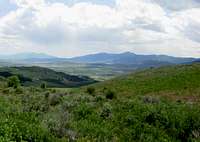
 Oxford Peak south ridge view - by mtybumpo
Southern Peaks
This part of the range is located east of Interstate 15 and west of Highway 91. Anyone driving along these roads will notice the mountains that rise abruptly from the valley. The area is about 20 mile long and 6 miles wide running in a north to south direction. The two largest cities are Malad which is on the west and Preston which is on the east. Other towns include Downey, Oxford, Clifton, Dayton, and Weston. To the south of Old Baldy Peak, the range separates into several different sub-ranges heading west.

Oxford Peak
Oxford Peak - (9,282 feet)

Oxford Peak
Oxford Peak is the highest mountain in the Bannock Range. It is also the highpoint of Oneida County. This makes the peak a fine objective to many climbers. It is the only mountain in the range with a hiking trail all the way to its summit. The summit is located on a long ridgeline of several points. It was first climbed by Henry Gannett and Allen D. Wilson in 1878.
The most popular route up the mountain is the south ridge from Davis Basin. A dirt road climbs up to 7,000 feet from the town of Clifton. This is where the trailhead is located. The distance is 12.5 miles round trip with a lot of up and down hiking on the ridge. There are great views in all directions of Malad Valley and Cache Valley.
There are several other routes up Oxford Peak from every direction. Rockslide Canyon trailhead is located on Oxford Creek Road to the east. This route is 11 miles round trip with 3,440 feet elevation gain. The trail is steep and you must scramble up the final part of the route. Another route starts from Cherry Creek Campground on the northwest side of the mountain. This route is 10 miles round trip with 3,480 feet elevation gain. There are two other trailheads that are lightly used. They are from Aspen Hollow, forest road #050, from the town of Downey and Third Creek Campground, forest road #038, from Malad.

Weston Peak
Weston Peak - (8,165 feet)

Weston Peak
Weston Peak is located above the towns of Dayton and Clifton. It is the cone shaped mountain that is north of Old Baldy Peak. The mountain was named after the town of Weston. Weston was originally named West Town because it is west of the city of Franklin. The city is ten miles south of Dayton.
The mountain can be accessed from the north or south. The northern route is accessed from Clifton Creek Road. Park your vehicle beneath Buck Peak which is near Davis Basin. A 4-wheel drive road continues west around Peak 7,870. It then heads south when it goes into Ruben Hollow. It passes right beneath the west face of Weston Peak where you can hike up to the summit.
The southern route is accessed from Dayton. Turn west on Five Mile Road which is not signed. It is located south of 1200 North Street. This is a two wheel drive high clearance road when dry. There are deep ruts in the road and it is impassible when wet. It goes west and then north toward the area east of Weston Peak and Old Baldy Peak. A 4-wheel drive road continues to the saddle between the two peaks. It is better to hike there because the road is quite rough and rocky. From the saddle, you can climb up the south ridge of Weston Peak.

Old Baldy Peak
Old Baldy Peak - (8,356 feet)
This is the last major peak on the main crest of the Bannock Range. It is the large mountain directly south of Weston Peak. It stands to the northeast of Weston Creek Reservoir. All mountain ranges usually have at least one "bald" mountain and this is the one in the Bannock Range. You can access the mountain from the south or east by dirt roads.
The most direct route up Old Baldy begins from a jeep trail south of Weston Creek Resevoir. There is a jeep road that is located east of the reservoir. It is a 4-wheel drive road that goes north toward Old Baldy Peak. It ends at a spring at approximately 6,600 foot elevation. The south peak, which is 8,298 feet, will be directly east. You can climbed up its west face and follow the ridge north to the highpoint.
The eastern route is accessed from Dayton. Turn west on Five Mile Road which is not signed. It is located south of 1200 North Street. This is a two wheel drive high clearance road when dry. There are deep ruts in the road and it is impassible when wet. It goes west and then north toward the area east of Old Baldy Peak and Weston Peak. A 4-wheel drive road continues to the saddle between the two peaks. It is better to hike there because the road is quite rough and rocky. From the saddle, climb up the forested north ridge of Old Baldy Peak.
 Scout Mountain seen from the Portneuf Range - by pioneerclimber
Sub-Ranges
The Bannock Range consists of several sub-ranges on the border of Idaho and Utah. They are located west of the southern end of the range. Most of the sub-ranges are called by different names in books and on maps but I will refer to them by their most common name.

Gunsight Peak
Malad Range
The Malad Range
Gunsight Peak - (8,244 feet)
The Malad Range is located to the west of the southern Bannock Range and east of I-15. The mountains were named for their location near the city of Malad. The whole range was once referred to as the Clarkston Mountains. This ridge is at the southern end of the range and contains Gunsight Peak. It is the highest in the Malad Range at 8,244 feet in elevation. Other mountains include Sheep Dip Mountain, 7,057 feet, and Red Knoll, 6,813 feet. The highest point in the Idaho portion of the range is Peak 7,005.

Wood BM

Wood BM
The Samaria Mountains
Samaria Mountains Highpoint - (7,780 feet)
The Samaria Mountains are west of I-15 on the Idaho-Utah border. The town of Samaria is to the north, Ridgeline to the west, and Woodruff to the east. The origin of the range’s name comes from Mormon apostle Lorenzo Snow. He was impressed by the hospitality and kindness of the people. He named the mountains and nearby town of Samaria after them. The highest point in the range is Samaria Mountain aka Wood BM in Idaho, which is 7,780 feet in elevation. The highest point in Utah is Peak 7,196.

Hansel Mountains
The North Hansel Mountains - (6,986 feet)
This range is also known as the North Promontory Mountains. They are located northwest of the Promontory Range and are a continuation of the Hansel Mountains in Utah. They are the westernmost sub-range of the Bannock Range. Pocatello Valley separates them from the Samaria Mountains and the Blue Spring Hills. The highest point in Idaho is unnamed Peak 6,986. There are a number of dirt roads in the area that provide access to the base of these mountains. The highest point in Utah is Peak 6,303. The Hansel Mountains were named after Samuel J. Hensley but his named was spelled incorrectly on maps.
Pleasantview Hills Highpoint - (7,420 feet)
The Pleasantview Hills are named for their proximity to the small town of Pleasantview which is located on the southeast side of the range just west of the city of Malad. The Idaho portion of the range runs for 30 miles in a north to south direction. It is a long ridgeline that connects the main Bannock Range with the Samaria Mountains. South of the Samaria Mountains are the West Hills. Peak 7,420 is the highest point in the Idaho portion of the Pleasantview Hills.
 Old Tom Mountain
Rock Climbing
There are several climbing areas in and around the Bannock Range. The type of rock varies from dark basalt to limestone with mixed granite intrusions. Developed areas offer solid rock and are climbed often. The undeveloped areas tend to have some loose rock so wear a helmet.
Massacre Rocks

Garden Creek Gap
Massacre Rocks has over 300 routes on black basalt rock. It is mostly a sport climbing area with a few trad routes thrown in. Some of routes are long and require over a dozen quickdraws. The area is accessed from the backside of Massacre Rocks State Park. It was named for an ambush between emigrants and Native Americans near Devils Gate. The climbing area is located southwest of American Falls. Drive on State Highway 39 across the American Falls Reservoir dam. Take the first left, Lamb-Weston Road. Access is from two-wheel dirt roads. The climbing season is during fall, winter, and spring. It is too hot to climb here in summer.
Ross Park
While driving down I-15 you will notice the short cliffs and walls on both sides of the road. Ross Park is located south of Pocatello on the right side of Fourth Street or the left side of Second Street. The climbs vary in length from 25 feet to 50 feet. It is a nice place to climb if you are in the area. The Shady Side (Fourth Street) provides climbing for the 5.5 - 5.11 climbers on friction faces and cracks and is good for toproping. The Sunny Side (Second Street) has higher walls and excellent routes rated around 5.9 and some aid routes. The Pocatello Pump is a climbing contest held every fall on the basalt crags of Ross Park's Sunny Side and Shady Side.
Garden Creek Gap
Garden Creek Gap is located on the south side of Old Tom Mountain. It is located north of Malad and about 45 minutes south of Pocatello. Access is from I-15 to exit 40 near Arimo. Follow the road to the obvious notch in the mountainside. This area consists of multi-pitch trad routes. They are 2 to 6 pitches in length on both the north and south faces. Standard routes are rated 5.3 to 5.10. There are several cracks systems as well as ramps, faces, and chimney problems. Most of the frequently climbed routes are clean while others are quite unstable.
 Cache Valley seen from Weston Peak
Area History
Northern Cache Valley

Oxford Peak
The Bannock Range was named after the Bannock Indians. Most of the area was inhabited by Native Americans. They speak the Northern Paiute Language and are closely related to the Northern Paiute people. The Bannock are well known in American history due to the Bannock War of 1878 where they bravely fought a final battle for traditional existence. After the war, the Bannock moved onto the Fort Hall Indian Reservation, where they live with the Shoshone and Lemhi Indian tribes. The reservation is located near the cities of Pocatello and Blackfoot. Pocatello is the largest city in the area. The name Pocatello comes from an Indian chief of the Shoshone tribe who granted the railroad a right-of-way through the Fort Hall Indian Reservation.
The ancestral lands of the Shoshone and Bannock Indians included parts of Montana, Idaho, Yellowstone National Park, Northern Utah, Nevada, and California. The Shoshone and Bannock tribes were granted 1.8 million acres of land in southeastern Idaho under the Fort Bridger Treaty of 1868. There were survey errors, treaties, and promises that were kept and broken over time. The boundaries of the tribal lands were reduced to as little as 418 thousand acres. The area now occupies about 544 thousand acres. These Indian tribes inhabited southeastern Idaho for hundreds of years before Lewis and Clark came across Idaho in 1805. When settlers arrived, they recieved help from a Lemhi Shoshone woman named Sacagawea. Their reports of this beautiful region attracted fur trappers and traders to southeastern Idaho.
Hudson's Bay Company established one of the first permanent settlements at Fort Hall in 1834, which is only a few miles northeast of Pocatello. When over-trapping and a change in fashion to silk put an end to the fur trade, Fort Hall became a supply point for immigrants traveling the Oregon trail. The discovery of gold in Idaho in 1860 brought the first group of settlers to the region. The area became an important meeting place for transportation of goods and freight. In 1877, Jay Gould of the Union Pacific Railroad acquired and extended the Utah and Northern Railway, which had previously stopped at the Utah border, into Idaho through Portneuf Canyon. Pocatello Junction was founded as a stopping place along this route during the gold rush.
Much of southeastern Idaho was settled by the Mormons. The city of Franklin was settled in 1860 and was the first and oldest settlement of Idaho. Twelve years went by before the Mormons found out they were actually in Idaho and not Utah. They named the city in honor of Franklin Richards. It is located in the southeast corner of the state just across the Utah-Idaho border. Malad Valley was first visited between 1818 and 1821 by Donald McKenzie, a French-Canadian trapper. He named it Malade, meaning sick in French, because many of his trappers became ill. The city of Malad was settled in 1864 and two years later it became the fastest growing place in southeast Idaho. The city of Preston was settled in 1888 and named after William B. Preston. Several other cities would be settled over the next dozen years.
After the gold rush was over, the settlers who remained turned to agriculture. By 1882, the first residences and commercial development appeared in Pocatello. With the help of irrigation from the nearby Snake River, the region became a large supplier of potatoes, grain and other crops. Residential and commercial development gradually appeared. On July 3, 1890, Idaho became the 43rd state in the United States. Idaho State University is located in Pocatello. It was established in 1901 as the Academy of Idaho. Through the years it has been renamed several times. In 1963, it received its current name of Idaho State University. There are over 12,000 students that attend the university. It is among the fastest growing of the four higher education institutions in state of Idaho.
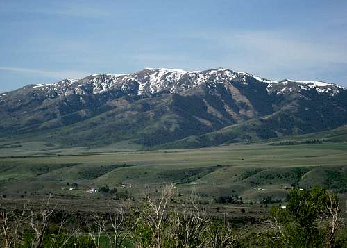
 Oxford Peak seen from the summit ridge of Elkhorn Peak
When to Climb

Oxford Peak

Marsh Valley
The Bannock Range can be climbed all year. Most people hike and climb in these mountains from May through October. The mountains are dry during summer and all snow will be melted. During spring, snow patches will last into late May. Hunting season takes place in fall and people will be in most areas of the range so use caution during this time. Autumn colors can be seen from mid-September to mid-October.
Winter is also a nice time to visit the range. The lower elevation peaks around Pocatello are climbed often in winter. Snow melts early from Kinport Peak, Slate Mountain, and Gibson Mountain. Scout Mountain is a nice peak to climb. The south ridge of Old Tom Mountain from Garden Creek Gap is the best of the northern peaks. Elkhorn Mountain and Oxford Peak would require longer approaches to reach in winter.
The city of Pocatello is located at 4,448 feet. It has a four-season climate with clear, sunny and dry days and an occasional thundershower. The city receives less than 15 inches of precipitation annually. Summers are dry and warm with a July average temperature at 72.4 degrees. The average daily temperature during the winter months is 35.4 degrees.
Weather Forecast for the cities of Pocatello and Malad and Preston
 Northern Cache Valley and the Bear River Range
Red Tape

Bannock Range Storm
The Bannock Range and Malad Range are administered by Caribou-Targhee National Forest.
The Samaria Mountains, Blue Spring Hills, and North Hansel Mountains are located on BLM land.
There are no fees for hiking and climbing in the Bannock Range.
Contact Information:

Cache Valley
Caribou-Targhee National Forest
Headquarters Office
1405 Hollipark Drive
Idaho Falls, Idaho 83401
(208) 524-7500
Pocatello Office
4350 Cliffs Drive
Pocatello, Idaho 83204
(208) 236-7500
Malad Office
195 South 300 East
Malad, Idaho 83252
(208) 766-5900
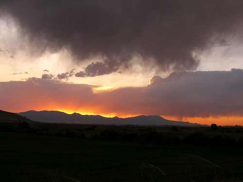 Bannock Range Sunset - by mtybumpo
Camping
Northern Peaks Area:

Davis Basin
Mink Creek Road can be accessed directly from Pocatello. Besides campgrounds, there are many hotels in the city. Because of the large amount of dirt roads in the area, there are numerous primitive places to camp too.
Scout Mountain Campground
This campground is located on the west side of Scout Mountain. Take exit 63 off I-15, south of Pocatello. Follow the white on brown "Mink Creek Recreation Area" signs to Bannock Highway (two miles), Turn south (left) up the canyon. Go 4.5 miles to the East Fork of Mink Creek road and turn left. Go 5.3 miles up East Fork of Mink Creek road to Scout Mountain Campground. The road is paved all the way, but there are switchbacks on the road.
Mink Creek Campground Group Site
Mink Creek is located 12 miles south of Pocatello. Take exit 63 off I-15, south of Pocatello. Follow the white on brown "Mink Creek Recreation Area" signs to Bannock Highway (Two miles), turn south (left) up Mink Creek Canyon. Go 7 miles south on Bannock highway (past Bannock Guard Station) to Mink Creek Group Site Campground. The road is paved all the way and easy access for motor homes.

Oxford Peak Homestead
Central Peaks Area:
There are two places to stay here. They are both located in close proximity to Malad Summit and have similar names. There are also primitive places to camp throughout the area. The camping areas are only full during holiday weekends during the summer. Finding a spot shouldn’t be difficult if you get there early.
Malad Summit Guard Station Campground
This lodging has a family cabin that cost $40 a night. This includes showers, kitchen, and bedroom. Malad Summit Guard Station is located about 14 miles north of Malad, Idaho on Malad Pass just off I-15. Take Devil Creek Reservoir (exit 22). Go north on Highway 191 for 3.2 miles, turn left and cross over the interstate on Forest Service Road #041 and go about two miles on a good graveled road, then turn left and go a few hundred feet to the guard station. It is located near Mill Creek in a narrow canyon drainage.
Malad Summit Campground
This campground is located by Forest Service Road #041 about a mile before the trailhead to Elkhorn Peak. Single family sites are $10.00 and two family sites are $20.00 per night. There are tent pads, picnic tables, and vault toilets. There are 12 campsites and 1 group site, which can hold up to 125 people. It is open from May 15 to September 30. Keep in mind that this campground may be full on weekends.

Clifton Creek Road
Southern Peaks Area:
There are several dirt roads in this area. Cherry Creek Campground is the best developed place to camp. There are also plenty of primitive site available. The two largest cities are Malad on the west and Preston on the east which have all amenities.
Cherry Creek Campground
Cherry Creek Campground is located northwest of Oxford Peak. It sits at 5,900 feet elevation. There are five campsites available on a first come, first serve basis. A hiking trail up Oxford Peak also starts from this campground. To get there, drive to the town of Downey and go about 10 miles south on Cherry Creek Road which is Forest Road 047.
Twin Lakes Reservoir Campground
Twin Lakes Reservoir is a popular place to go fishing. They have largemouth bass, perch, rainbow trout and bluegills. There is also water skiing and camping available. Camping at this reservoir cost about $12 to stay overnight. Access is from Twin Lakes Road off Highway 91 north of Preston. Phone: 208-852-3731
Third Creek Campground Group Site
Third Creek Group Site Campground is located 12 miles north and east of Malad. Go 3.5 miles north of Malad, Idaho. Take exit 17 (Weston Highway) off I-15, and go east on Weston highway. Stay on Weston highway for seven miles to Upper Deep Creek Reservoir. Turn left on Forest road #231. Go one mile to Third Creek Group Site Campground. Weston highway is paved and the road to the campground is a good gravel road and easy access for motor homes.
Backcountry Camping Regulations
Backcountry camping is allowed in undeveloped sites. Camping is free in these areas as long as you select a site outside a developed campground. This must be 200 feet away from any road, trail, or water source. The dispersed camping limit in one spot is 16 days. Some of these spots may have fire rings.
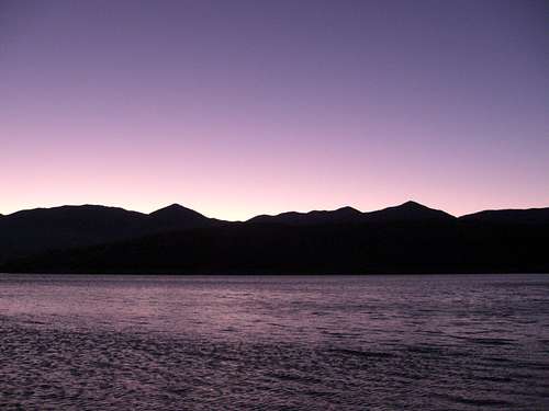 Twilight on the Southern Bannock Range - by mtybumpo
Peak Lists
Idaho County Highpoints List
This is a great list of Idaho County Highpoints made by SP member SawtoothSean. Oxford Peak is the highpoint of Oneida County.
Idaho Prominence Peaks List
This website has information on the Idaho Prominence Peaks. There are five of these mountains in the Bannock Range.
Utah's 100 Most Prominent Peaks List
The 100 most prominent peaks in Utah by SP member redsplashman23. Some are located on private land so this is difficult to complete.
The Bannock Range has mountains over 9,000 feet. There are many summits worth hiking here. All of them are class 1-2 hiking.
| BANNOCK RANGE | ||
| Mountain | Elevation (Feet) | Summitpost Page |
|---|---|---|
| 9,000 foot Peaks | ||
| Oxford Peak | 9,282 | Page |
| Elkhorn Peak | 9,095 | Page |
| 8,000 foot Peaks | ||
| Wakley Peak | 8,801 | |
| Old Tom Mountain | 8,733 | Page |
| Scout Mountain | 8,710 | |
| Kents Peak | 8,451 | |
| Old Baldy Peak | 8,356 | |
| Gunsight Peak | 8,244 | Page |
| Weston Peak | 8,165 | |
| 7,000 foot Peaks | ||
| Samaria Mountains HP | 7,780 | Page |
| Buck Peak | 7,579 | |
| Pleasantview Hills HP | 7,420 | |
| Indian Mountain | 7,298 | |
| Bradley Mountain | 7,258 | |
| Rock Knoll | 7,268 | |
| Kinport Peak | 7,222 | |
| Wild Mountain | 7,220 | |
| West Benchmark | 7,196 | |
| Sheep Dip Mountain | 7,057 | |
| "Dry Canyon Peak" | 7,047 | |
| Peaks below 7,000 feet | ||
| North Hansel Mountains HP | 6,986 | |
| Slate Mountain | 6,980 | |
| Cal Mtn Benchmark | 6,880 | |
| Swan Benchmark | 6,854 | |
| Walker Benchmark | 6,852 | |
| Gibson Mountain | 6,775 | |
| "Marlow Peak" | 6,718 | |
| Limekiln Knoll | 6,660 | |
| "Standing Rock Peak" | 6,625 | |
| Cedar Mountain | 6,380 | |
| Sam Benchmark | 6,266 | |
| Lemon Peak | 6,041 | |
| Rattlesnake Peak | 5,915 | |
| Howard Mountain | 5,860 | |
 Oxford Peak seen from the west - by Russ Durrant
The Bannock Range is not very high in elevation but there are several prominent peaks in the range. They are listed below.
| BANNOCK RANGE MOST PROMINENT PEAKS | ||||
| Mountain | Location (State) | Elevation (Feet) | State Ranking | Prominence (Feet) |
|---|---|---|---|---|
| Oxford Peak | Idaho | 9,282 | 10th | 4,002 |
| Elkhorn Peak | Idaho | 9,095 | 14th | 3,495 |
| Old Tom Mountain | Idaho | 8,733 | 31st | 2,893 |
| Samaria Mountains HP | Idaho | 7,780 | 54th | 2,360 |
| Gunsight Peak | Utah | 8,244 | 59th | 2,364 |
| BANNOCK RANGE COUNTY HIGHPOINTS | ||
| Mountain | County | Easiest Route |
|---|---|---|
| Oxford Peak | Oneida | From Davis Basin (South Ridge) : Class 1-2 |
Books
Idaho: A Climbers Guide: Climbs, Scrambles, and Hikes
By Tom Lopez. The book has four pages on the Bannock Range. It describes the mountains and access roads in each area.
External Links
Pocatello Rock Climbing
This is an online guide to rock climbing in and around Pocatello including the areas of Ross Park and Massacre Rocks.
Pocatello Skiing and Snowshoeing Trails
This is an online guide to cross-country skiing in the Pocatello area. Nearby Portneuf Range offers resort skiing at Pebble Creek.
Bannock County Historical Museum
This museum is located on 3000 Alvord Loop in Pocatello. It focuses on the history of Bannock County with exhibits of items relating to Pocatello's early railroad history and Native American items that tell about the Shoshone-Bannock tribes from the area.