Mt. Villard (12,337'), West Granite Peak, and Granite Peak (12,799') - August 2-4, 2013
The Absaroka-Beartooth Wilderness is located northeast of Yellowstone National Park, yet it remains infrequently visited and for the most part unheard of by your average hiker, backpacker, or peak-bagger. I first became familiar with the Beartooth Mountains last month during a random hiking trip with coworkers over the 4th of July. Prior to that, I was completely unaware of its existence. I had heard rumors of how Granite Peak, Montana's state highpoint, is a pretty amazing climb, yet for some reason I didn't realize it was located in this remote and beautiful wilderness area, in the heart of a mountain range that I only envisioned in my dreams. Many of the peaks, routes, and approaches in this range are infrequently visited or climbed, which was quite refreshing coming from Colorado, where a simple internet search will give you unlimited information about almost any peak in the state.
My friend Matt had just recently moved to Red Lodge, Montana, and had been climbing in the Beartooths on a regular basis, gathering information for a guidebook he is writing. I happened to be working near Cody, Wyoming the previous week, and we agreed to meet up for a climb that weekend. While at first I tried to convince Matt to head down to the Tetons and climb the Grand with me, he instead brought up the Beartooths, and how we could climb Granite Peak via the obscure traverse from West Granite, possibly including some other 12ers in the trip as well. Even though I knew little about the area and Granite Peak itself, I had heard great things, and decided it would be awesome to explore the Beartooths some more. Matt had already climbed Granite via the standard route, but he wanted to try it via the traverse from West Granite, which would give him a new route to add to the guidebook. So it was a win-win situation for both of us, and we were in for an awesome adventure.
On Friday, Matt and I met up in Red Lodge and we managed to squeeze in a short sport climb on some limestone just outside of town...unfortunately for us, Granite Peak has no limestone (hence the name "Granite" Peak), but it was still good to get some rope work in.
August 2nd, 2013
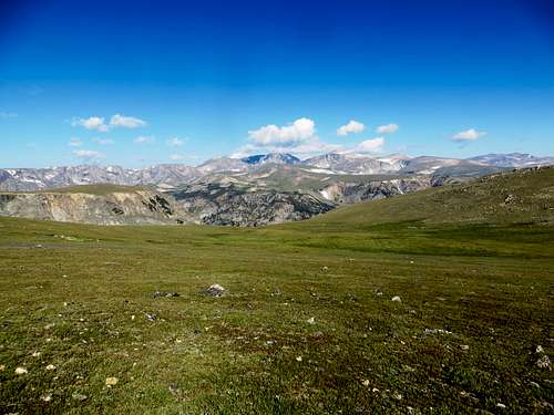
![View from Beartooth Pass]()
Views from Beartooth Pass
We took our time getting ready on Saturday morning, then headed out of town. The drive from Red Lodge to Cooke City over Beartooth Pass is quite possibly the most scenic drive over any pass in the lower 48. It ascends up a forested valley, switchbacks to treeline, then you drive for miles and miles over an alpine plateau with endless views of jagged peaks, steep valleys, and lots of gorgeous lakes in all directions. Unfortunately we had a 30-minute construction delay near the top of the pass, but weren't too concerned as we only had an 8-mile approach that day.
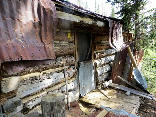
Our goal was to camp above Upper Aero Lake, which is a seldom used approach for Granite Peak. However, it made sense for our itinerary, and it was actually an easier approach than some of the others due to the fact that the "trailhead" is higher. We turned off Highway 212 about 1.5 miles before Cooke City and made our way up to the "trailhead", which consisted of a small parking area surrounded by old mining ruins. We shared this area with some jeepers, one of which had a 10-year old kid driving the rig. I definitely felt like I was in Montana! After crossing the creek by the old mining shack, we started up the trail towards Lady of the Lake at 11:15am.
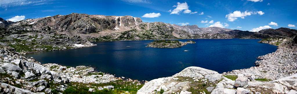
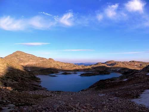
The weather so far was perfect, and we made good time past Lady of the Lake and up Zimmer Creek. The approach was gorgeous as we passed through large meadows with lots of wildflowers, lodgepole/spruce/fir forests, and enormous whitepark pine trees near treeline. We passed a couple of unmarked trail junctions, but luckily Matt, being the Beartooth expert he is, led us up the right drainage to Lower Aero Lake, where we were greeted with one of the best alpine lake views I have ever seen. When we had looked at the map prior to the trip, I noticed how big Lower and Upper Aero Lakes appeared, however, seeing them in person was another story. They are HUGE lakes! We took a long break to soak in the views and do some fishing.
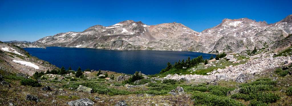
As I would come to learn during this trip, looks are very deceiving in the Beartooths. Everything appears closer than it actually is, and the rock always appears more stable than it actually is. Due to the first point, it took us a long time to hike around Lower Aero Lake, and possibly even longer to hike around Upper Aero Lake (although that could've been due to the strange swarms of gnats that populated the lake shore and liked to fly into our noses and mouths). Fortunately the views were out of this world, most of our elevation gain was done for the day, the weather was still perfect, and we were both in high spirits. A jagged set of spires (known as "The Spires") soared above Upper Aero Lake, and we were also greeted with views of Glacier Peak, Mt. Villard, Cairn Mountain, and Pilot Peak in the distance.
![Old mining shack at TH]() Mining shed by the trailhead
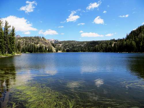
Mining shed by the trailhead | ![Lady of the Lake]() Lady of the Lake
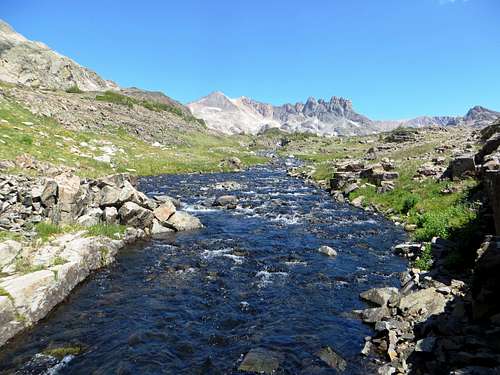
Lady of the Lake | ![Approaching Upper Aero Lake]() Lower Aero Lake inlet stream
Lower Aero Lake inlet stream |
![Lower Aero Lake panorama]() Lower Aero Lake Panorama
Lower Aero Lake Panorama
![Upper Aero Lake Panorama]() Upper Aero Lake Panorama
Upper Aero Lake Panorama
We set up camp on a grassy bench just above Upper Aero Lake near 10,300', below the saddle separating it and Rough Lake. By this point it was dinnertime, and we quickly set up camp so that we could feast. Unfortunately, the first night's dinner wouldn't work out so well for either of us. I realized that my freeze-dried dinner had expired in January of 2011 (lesson learned - don't buy packaged food from the Sierra Trading Post Outlet in Cody, WY. There is a reason it is on sale!), and since we had a big day ahead of us the following day, I didn't want to risk any food-related problems. Matt had brought some packaged cous-cous, though he soon realized he had bought the parmesan-flavored kind by accident, which apparently he finds disgusting. Luckily we both had some back-up food to eat instead.
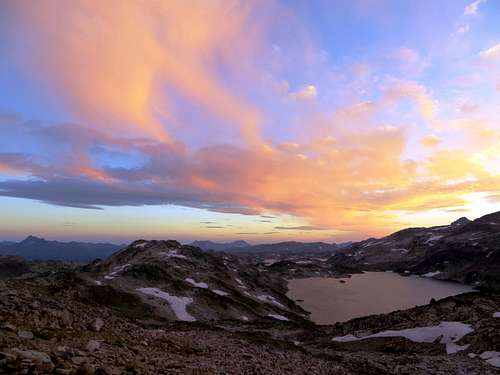
After dinner I took a stroll around our camp to get some sunset pictures, and ended up checking out the saddle above Sky Top Lakes that we would hike up and over the following morning in the dark. Here I had my first view of Granite Peak and the traverse...needless to say it was a somewhat daunting perspective. The sunset that night was pretty amazing, and soon after it got dark we hit the hay, awaiting a 3:45am wake-up call the following morning that, as always, would come too soon.
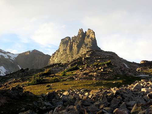
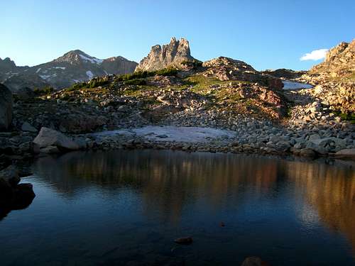
![Sunset on The Spires]() The Spires
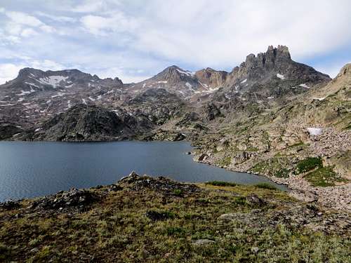
The Spires | ![Upper Aero Lake and The Spires]() Upper Aero Lake
Upper Aero Lake |
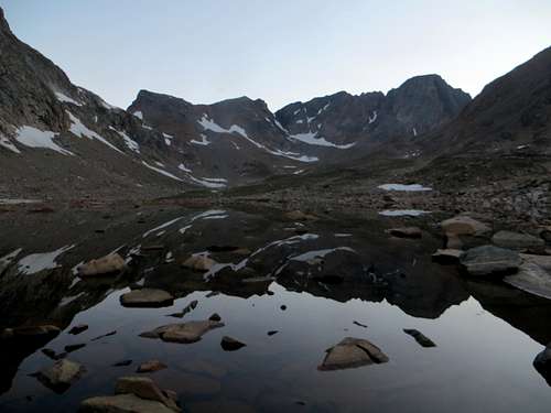
![Rough Lake at Sunset]() Rough Lake at Sunset
Rough Lake at Sunset | ![Upper Aero Lake at Sunset]() Upper Aero Lake at Sunset
Upper Aero Lake at Sunset |
August 3rd, 2013
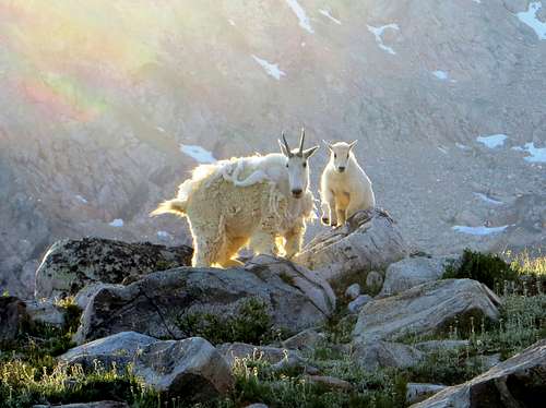
After we got ready in the morning and lazily exited the tent, a loud scuffle startled Matt and I. We soon realized that a herd of mountain goats had made our campsite their home for the night, and were just as startled as we were to hear movement in the dark. At this point Matt expressed his immense hatred for mountain goats, claiming they were his least favorite animal (side note: It is a miracle that Matt and I were able to make this trip work, since mountain goats happen to be my FAVORITE animal). We made sure to "goat-proof" our campsite before leaving, and headed up to the saddle south of The Spires.
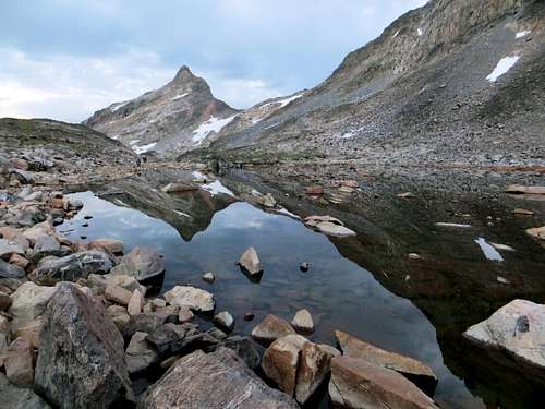
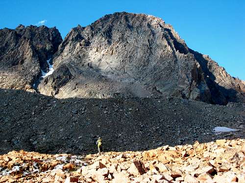
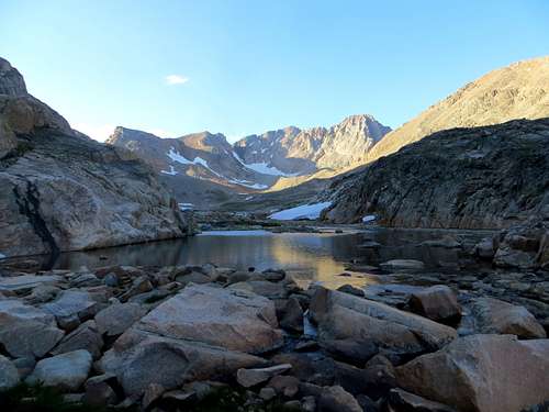
The talus hopping began right away; an early sign of things to come. We made it to the top of the saddle just as light began to appear to the East, and headed down towards Sky Top Lakes. There was a decent amount of snow on this side of the saddle, however, we were able to stay on rocks to the right all the way down. Just above the lake, we headed north and continued up the drainage towards Granite Peak. The sky got lighter, and we had endless photo opportunities as we passed the upper Sky Top Lakes higher in the drainage. There were a few other parties hiking up near us that were also attempting Granite, however, they were all doing the "standard" SW couloir route and we wouldn't see them the rest of the day.
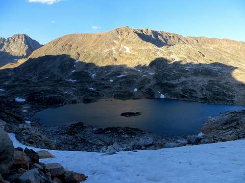
![Early morning light on Sky Top Lake]() Early morning light over Sky Top Lake
Early morning light over Sky Top Lake | ![The saddle back to Upper Aero Lake]() Sky Top Lake reflection
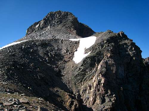
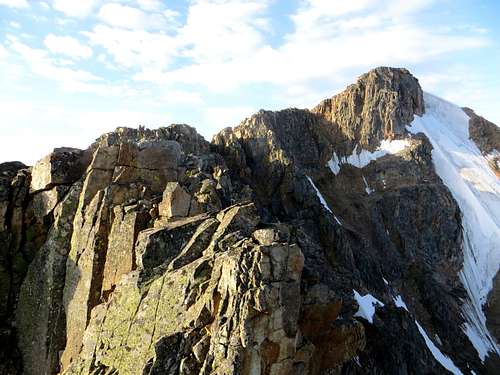
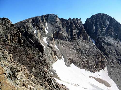
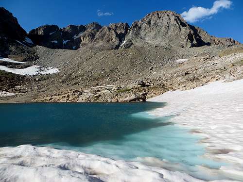
Sky Top Lake reflection | ![West Granite and Granite Peak]() Granite Peak from the south
Granite Peak from the south |
The official "standard" route on Granite Peak goes up the East Ridge from the West Rosebud Drainage. However, in recent years, more and more people have been using the SW couloir, which some would say is easier because it is mostly class 3, while the east ridge has 4th and possibly 5th class terrain (some people use ropes, some don't, depending on comfort levels). This being said, the SW couloir has much looser rock than the east ridge, and also a longer approach. So pick your poison.
Our itinerary for the day consisted of climbing Mt. Villard first (a 12er that Matt still needed to climb for his guidebook) via the north ridge, hiking over to West Granite Peak, traversing to Granite Peak, and descending the SW couloir route. Despite our relatively early start, we would still be relying on good weather the entire day, as this whole plan took us much longer than anticipated. I suppose luck was on our side though, because we had mostly bluebird skies the entire day with only minimal winds.
![Mount Villard north ridge]() NE Ridge of Villard from the saddle
NE Ridge of Villard from the saddle
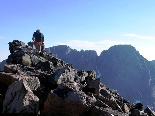
The views from the summit made the long traverse worthwhile, and at this point I concluded that the Beartooths are more amazing than all the places I have climbed in Colorado. As one person stated in the tiny summit register, "This place inspires silence and solitude." While I could've stayed on the summit all day admiring the views, we had to get on our way. The West Granite to Granite traverse was eerily whispering our names, and as Matt stated, "we have bigger fish to fry."
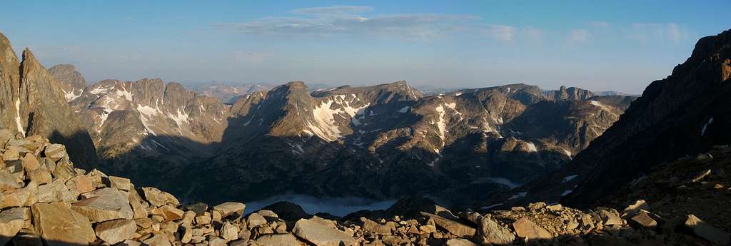
![Western Beartooth sunrise panorama]() Sunrise from the Villard/W. Granite saddle
Sunrise from the Villard/W. Granite saddle![Upper West Rosebud Drainage]() West Rosebud from the Villard/W. Granite saddle
West Rosebud from the Villard/W. Granite saddle
![On top of the crux section, Mt. Villard's north ridge]() One of the NE ridge cruxes
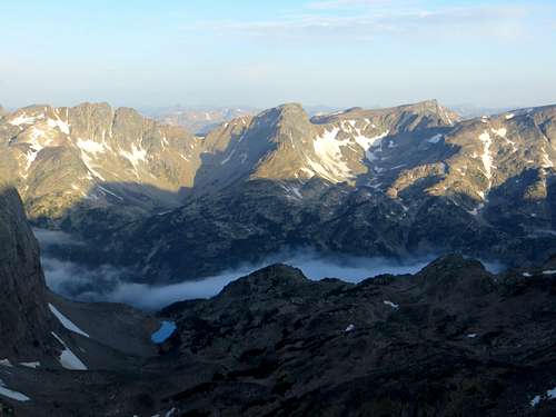
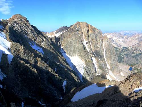
One of the NE ridge cruxes | ![Glacier Peak]() North face of Glacier Peak
North face of Glacier Peak
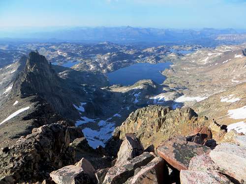
![Aero Lakes from Mt. Villard's summit]() Aero Lakes from the summit of Villard
Aero Lakes from the summit of Villard | ![Our route up Mt. Villard]() NE Ridge of Mount Villard
NE Ridge of Mount Villard
![Matt on the summit of Villard with the Granite Traverse behind]() The Granite Traverse from Villard
The Granite Traverse from Villard |
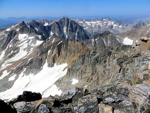
The ridge run and talus hop from Villard's summit back down to the saddle took much less time than on the way up, and we were soon on our way up towards West Granite. From the saddle, we traversed around to another saddle directly south of Storm Lakes, and then traversed through more loose and annoying talus to the summit of West Granite (a couple of class 3 moves were required on the ridge, but it was mostly class 2). We reached the summit at 11:30 am, and by this point we both knew we were way behind schedule. The traverse to Granite would take at least a few hours, and based on the highly daunting and intimidating view we received on West's summit, we knew it was not a good place to get caught in a thunderstorm. However, the weather was holding up perfectly, and we decided to go for it.
![West Granite to Granite Traverse]() Granite Peaks traverse
Granite Peaks traverse | ![View back to Villard and Glacier from West Granite's summit]() Villard and Glacier from West Granite's summit
Villard and Glacier from West Granite's summit | ![Mount Villard north face]() North face of Villard
North face of Villard |
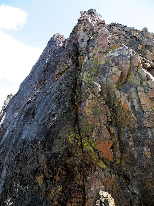
As far as route beta goes, there exists maybe a one sentence description of this traverse, and it had maybe been completed by only a handful of people according to the Beartooth experts that Matt knew from Red Lodge. We knew that there would likely be a rappel or two into a large, obvious notch, and that the climb up from the notch to Granite's summit was rated 5.7 by someone somewhere. All in all, we were mostly on our own for route-finding, which greatly added to the adventure, intimidation, and enjoyment factors.
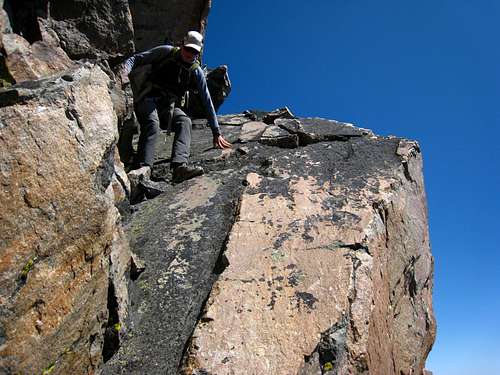
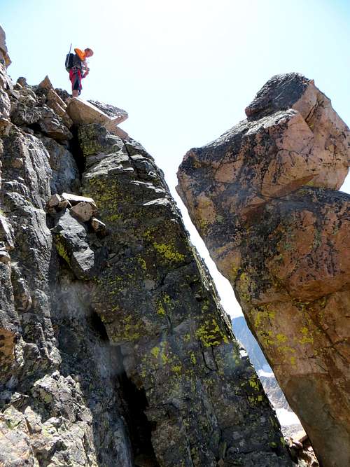
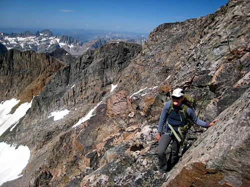
The committing terrain began directly off the summit of West Granite. We descended down the ridge and were quickly forced to traverse right around a series of towers as we headed towards the notch. The terrain here was loose and somewhat exposed class 3 and 4, however, nothing too challenging that we hadn't experienced before. Eventually we were forced to regain the ridge crest, and soon after found ourselves perched 150 feet directly above the notch. The terrain dropped vertically below us, and directly opposite of us was the near-vertical wall that we had to ascend to reach Granite's summit. Needless to say, this spot was one of the most precarious and intimidating places I have ever been!
It would require two rappels to reach the notch below, and Matt did an awesome job of setting up an anchor off of a large boulder and rappelling first into the abyss below. Rappelling is probably one of my all-time favorite activities, and in the past I've highly enjoyed each one I've done. However, this one got my heart pumping more than usual. Maybe it was the loose rock, the overhanging lip, the exposure, how exhausted I already was at that point in the day, or all four of those combined, but I was very relieved when I finally got down to the notch. We had a 70-meter rope with us, which unfortunately was not long enough to reach the notch in one rappel. So we anchored off of another boulder after the first rappel and had one more short one to go before we reached the notch.
![Descending the slab from Granite West]() Descending the slab off West Granite
Descending the slab off West Granite
![West Granite to Granite Traverse]() Granite Peaks traverse
Granite Peaks traverse | ![Descending Granite West on the traverse]() Descending off Granite West
Descending off Granite West
![Two rappels to reach the notch]() Two rappels down to the notch
Two rappels down to the notch | ![Crossing the ledges on the granite Traverse]() Traversing ledges
Traversing ledges
![Rappelling into the notch]() Rappelling to the notch
Rappelling to the notch |
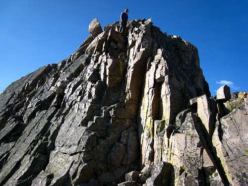
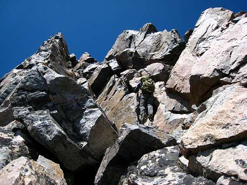
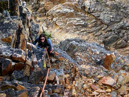
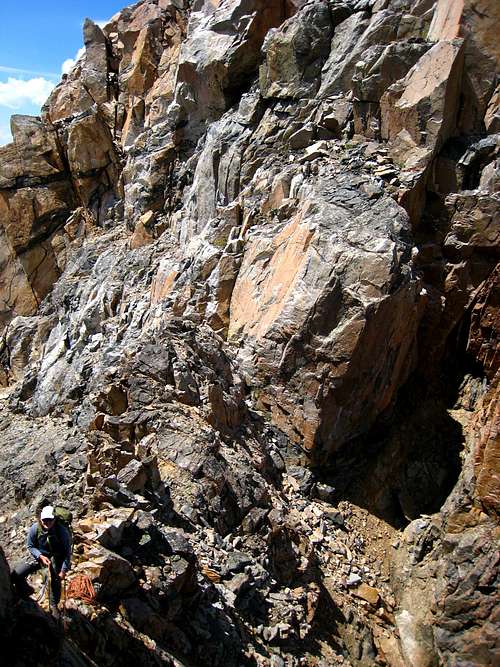
From this vantage point, we were very pleased to see that the climb up out of the notch appeared nowhere as difficult as it did above the rappels. We had scouted a chimney/gully system that went directly up from the notch to what appeared to be easier class 3/4 terrain above, and to our surprise the initial section didn't even look harder than 4th class! We found an old piton in the wall next to the chimney, which was the first sign of any previous climber on this route. Matt mentioned that he was surprised we didn't find any evidence of rappel anchors higher up, since we had determined that rappelling into the notch was necessary for this traverse. We guessed the climbers who had put in the piton had climbed up to the notch from the loose, steep gully below, and not actually traversed from West Granite.
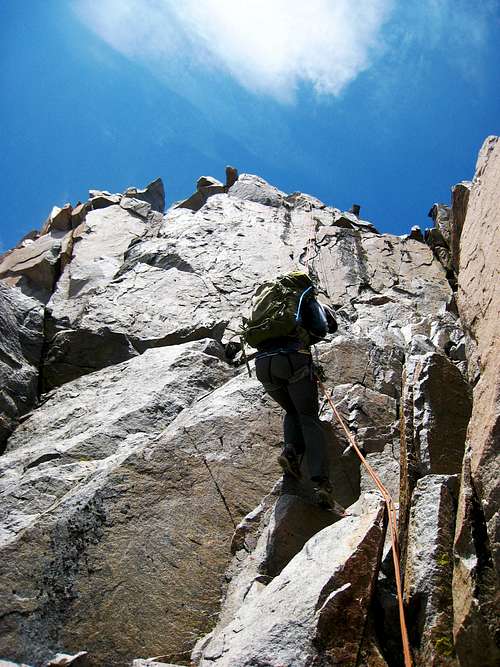
I anchored myself to the piton and belayed Matt as he led up the chimney. The piton was strategically placed so that it was off to the side and out of rockfall danger from the gully...a crucial aspect of the route, since lots of loose rock came down right next to me as Matt climbed up the chimney. We were able to stay within verbal (not visual) communication, and Matt reached the top of the chimney just as the end of the rope was reached. It turned out to be the perfect length (70 meters), since everything above him was class 3/4 terrain and we wouldn't need a rope. Matt yelled down that it wasn't necessary to put my rock shoes on. I was happy to hear this, and easily made my way up the route.
Since the rock in the chimney was very loose, Matt and I both found it easier to climb up on more stable terrain to the left for most of the time. Matt only had to place four pieces of gear, which was very easy for me to clean. At the top of the pitch, we concluded that the route was not in fact 5.7, but maybe 5.4 at the most. We put the technical gear away and made our way up the short scramble to Granite's summit, which we reached at 3:20pm. This was one of the most rewarding summits for me in my climbing career, and I was very proud of our efforts to complete the traverse. We found a very large summit register that had been signed by a whopping 15 people before us that very day, but at the time, we had the summit to ourselves and were likely the last ones to summit that day.
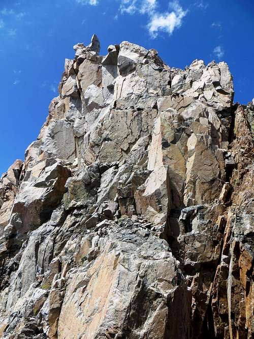
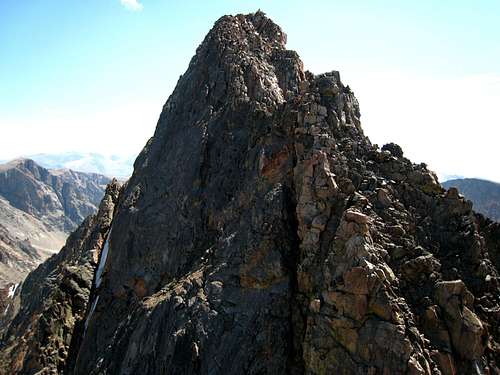
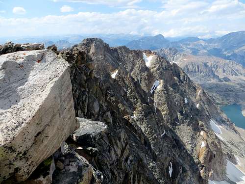
![Granite Peak and the ascent chimney]() Granite Peak from the top of the rappels
Granite Peak from the top of the rappels
![climbing up the chimney]() Sarah climbing the chimney
Sarah climbing the chimney | ![The ascent chimney up to Granite's summit]() The chimney from the notch
The chimney from the notch | ![Belaying Matt as he climbs up the chimney]() Looking down at Sarah
Looking down at Sarah |
We hung out on the summit for a good 30 minutes. The weather was still ideal, and I almost fell asleep while basking in the sun on a large boulder. We both knew we had a long decent ahead of us though...lots more loose talus/boulder/scree terrain to deal with, as if we hadn't gotten enough of that already. Unfortunately I decided to eat the rest of my food on Granite's summit, despite the fact that we wouldn't get back to camp for another 4.5 hours.
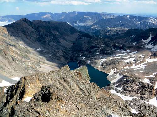
![Granite Peak summit views]() Granite Peak summit views
Granite Peak summit views | ![Granite Peak summit views]() Granite Peak summit views
Granite Peak summit views | ![Granite Peak summit views]() Granite Peak summit views
Granite Peak summit views |
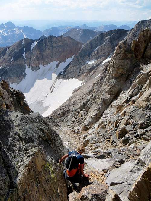
We saw a cairn that marked the entrance to what we thought was the SW couloir, however, as we descended we found ourselves having to traverse left into an easier gully. While the exposure was very minimal on the way down the couloir, the rock was much more loose and annoying, and the decent seemed to go on forever. Eventually the couloir ended, and we traversed around some large slabs that were actually quite impressive. Then we got off-route for a little bit and had to traverse across some wet grassy/slabby ledges, but eventually we got down into the boulderfield below. After that it was easier going down the drainage, past some gorgeous tarns and Sky Top Lakes to the saddle we had to re-ascend. Matt and I had debated climbing Cairn Mountain after Granite, a walk-up 12er that Matt still hadn't done. It would be feasible to traverse over and up to its summit from where we descended off of Granite, and that way Matt wouldn't have to make the trip back to this drainage. However, by that point in the day we were both pretty sick of dealing with talus, boulders, and skree, and Cairn Mountain was covered in all of that. So we passed.
Luckily we found some snow to walk across as we headed down the drainage, which gave us some much needed relief from the rocks. Most of the snow we encountered was "watermelon snow" (a red tint given to it by the algae Chlamydomonas nivalis), which actually dyed the sides of my shoes red...a welcome addition to the boring grey color that they were. The sun began to set as we ascended back up to the saddle, and we were treated with stunning views of Granite and the traverse we had just completed.
It took us approximately 1847283 years to ascend back to the saddle, and after that another 382812 years to hike back down to camp. Luckily the views were amazing, and I distracted myself by envisioning the food that I would soon consume in record time when we got back to the tent.
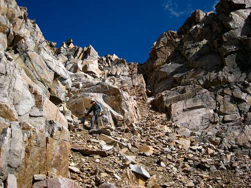
![Descending the SW couloir]() Descending the SW couloir
Descending the SW couloir | ![Descending the SW couloir]() Descending the SW Couloir
Descending the SW Couloir
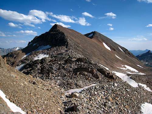
![Cairn Mountain]() Cairn Mountain
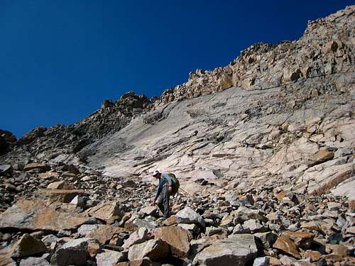
Cairn Mountain | ![Looking up at the slab below the SW couloir]() The slab at the base of the SW Couloir
The slab at the base of the SW Couloir
![We are so small]() We are so small!
We are so small! |
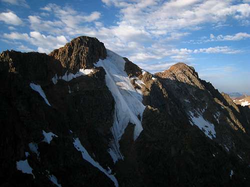
![Granite Peak]() Granite Peak and the traverse
Granite Peak and the traverse | ![Cairn Mountain and Sky Top Lake]() Cairn Mountain at Sunset
Cairn Mountain at Sunset | ![Granite Peak]() Granite Peak at Sunset
Granite Peak at Sunset |
I was pleased to find that the herd of mountain goats from the night before was still hanging out around our camp. Matt, on the other hand, was not so pleased, but luckily they had left our tent alone throughout the day. We quickly unpacked and started making dinner, and I entertained myself by watching the goats play "king of the hill" near our camp (two of the adorable baby goats in particular were very good at it). Matt had brought along a Mountain House raspberry crumble for dessert, which, at the time, was the best thing I have ever consumed in my entire life. We quickly fell asleep, and despite a random goat whining in the middle of the night near our camp, we slept soundly after a long day of awesome climbing. Side note: the goat was probably crying because it knew we were leaving the next morning.
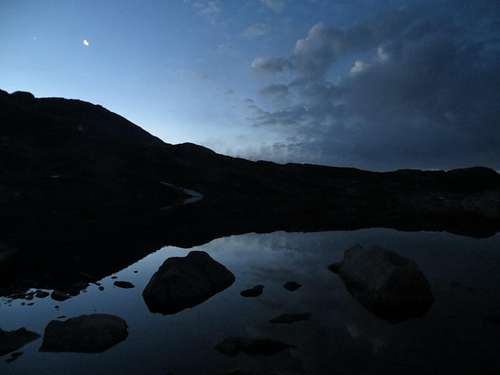
![Cathedral Spires reflection]() Reflection of The Spires
Reflection of The Spires | ![Coolest animals ever]() Mountain goats near camp
Mountain goats near camp |
August 4th, 2013
We decided to sleep in, and as the morning progressed, all ambitious plans of climbing either Cairn Mountain or one of The Spires before hiking down went out the window. I was completely satisfied with the previous day's events, and while Matt wanted to get another route in for his guidebook, neither of us had motivation to do anything. Instead we leisurely got up, packed up camp, and hiked back down to the trailhead. We had perfect weather yet again, and even though my legs were feeling it on the way down, I highly enjoyed retracing our steps through what Matt called an "alpine paradise." Indeed it was.
We got back to the car in the late afternoon, and drove into Cooke City so that I could see it for the first time, and so that Matt could get his typical half-gallon of milk (which he then consumed in ten seconds as we drove over Beartooth Pass). We then booked it back to Red Lodge, where we happily consumed a large pizza and ice cream at the Red Lodge Pizza Co.
All in all this was an amazing trip with a great climbing partner, and one that I will remember forever. One of the things I enjoy most in life is exploring new places, and the Beartooths rank up there as one of the most beautiful mountain ranges I have ever seen. Thanks for reading!


Comments
Post a Comment