
-
 9833 Hits
-
 74.51% Score
-
 5 Votes
|
|
Route |
|---|---|
|
|
39.71050°N / 105.4715°W |
|
|
Hiking |
|
|
Spring, Summer, Fall, Winter |
|
|
Half a day |
|
|
Overview
A nice route up a gentle mountain | March 2013
A moderately short route with modest elevation gain and fairly easy route finding, this is a great option to save for deep snow season. Much of the route is protected from winter winds by dense trees and the navigation is straightforward.
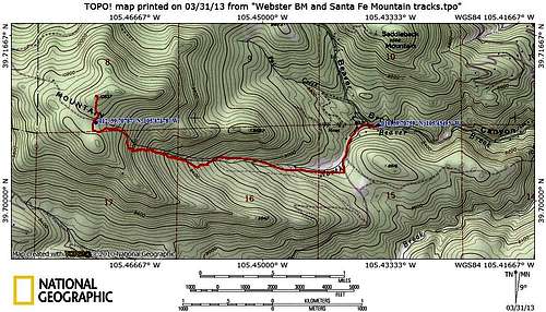
Roundtrip Distance: 6 miles
Elevation Gain: 2025 feet
Area Map: Trails Illustrated #100 Boulder | Golden
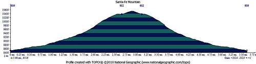
The saddle is marked as a waypoint on this profile | March 2013
Getting There
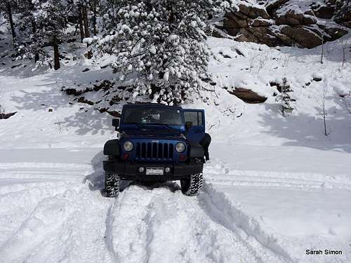
Parking in snow season
Small parking area on the right side of the road
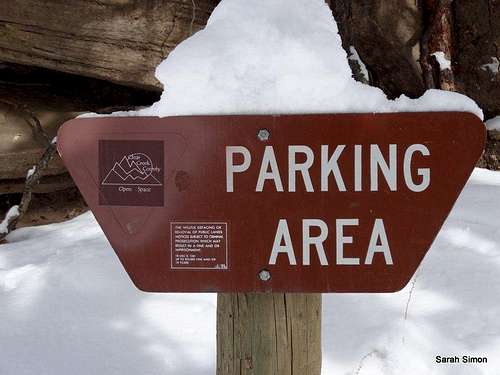
Parking area sign
· From I-70, take the Beaver Brook exit #248 and head west on US 40 (frontage road)
· Cross the bridge south over the interstate and look for signs for Beaver Brook Canyon Road
· Turn left as if going to Clear Creek Highschool (185 Beaver Brook Canyon Rd, Evergreen, CO 80439)
· Carefully follow the road, paying close attention to street signs, as it winds its way through a residential area then enters Beaver Brook Canyon
· Look carefully for a pull-out on the right (north) side of the road; a sign may indicate “Parking Area” for Clear Creek County Open Space.
Note that 4x4 is not necessary to reach this trailhead, but it will be either nice-to-have or need-to-have in winter snow conditions, depending on time of day / road maintenance / plowing. During our visit the morning immediately following a fresh dump of snow, we found 4-low necessary to get in and out of the parking area.
Route Description
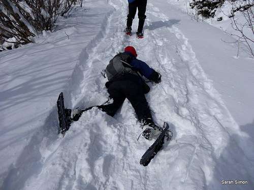
The REAL Splattski
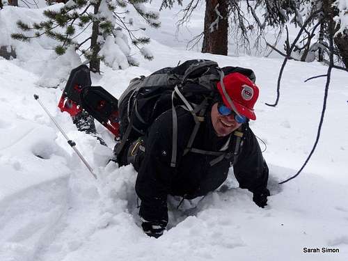
Snowshoes work better when you stand
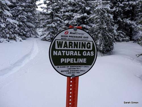
Follow the pipeline
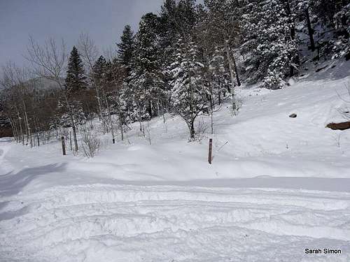
A few twists and turns at the start
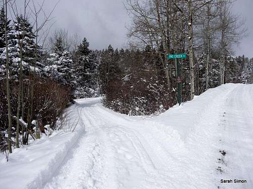
· Carefully cross Beaver Brook Canyon Road and head up-canyon (west / northwest) briefly to Pat Creek Road
· Walk left (south-ish) onto this street. It may feel awkward / like you are trespassing, but Open Space signs should indicate for you that you are in the right place.
· Follow open space signs as the trail heads south for about ½ mile toward a broad valley.
· Head west up a broad trail (indicated as a Jeep road on some maps) that follows a gas pipeline up the valley.
· Follow this pipeline route for 2 ½ miles to the gentle saddle just south of the summit. (As the route steepens toward the saddle, depending on snow conditions, it may not be optimal to follow the gas pipeline – pick your own route of least resistance to minimize side-hilling and stepping over dead fall.)
· From the saddle, strike off-trail north to the true summit, indicate by a angled Class 2 summit boulder. Views are, unfortunately, limited.
Essential Gear
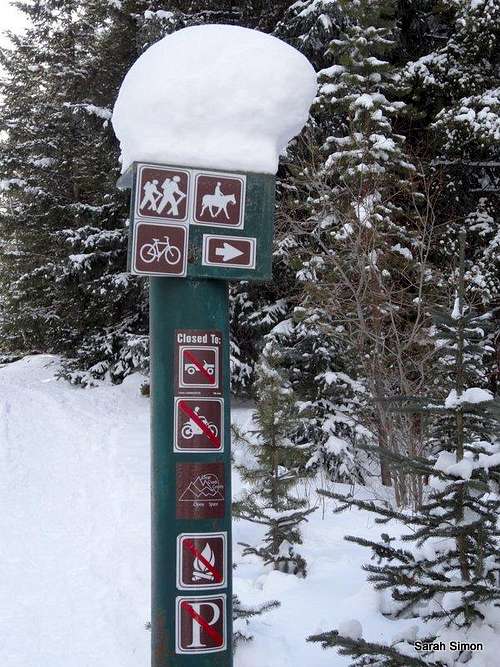
Follow the signs
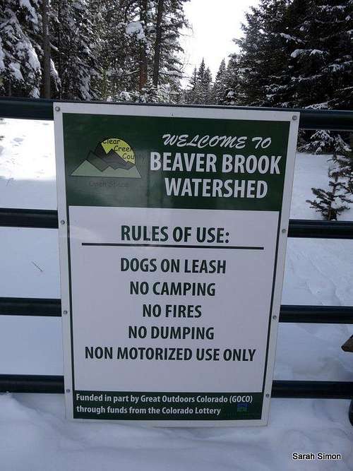
Rules and Regs
•Map & compass and/or GPS
•Comfortable hiking boots or shoes
•Outerwear appropriate to the season
•Snowshoes for flotation in snow season
•Water and snacks
•A camera to save memories of the high country views
•First aid kit
•Other standard day hike essentials
External Links
Feel free to bring to my attention any trip reports or other useful outside links to add to this section of the page.