Albion Basin - Wasatch Paradise
Finding quality hikes in the Wasatch is easy since there are so many close ones to choose from (I can reach the Devil’s Castle trailhead in less than an hour’s drive from my house), but Devil’s Castle is special since it offers one of the best scrambles around in such a short distance from the trailhead (takes just 3.6 roundtrip miles and 1,520 feet of elevation gain to get to the top and back). Nestled at the back of Little Cottonwood Canyon above the Alta Ski Resort, its dark north face rises forebodingly over Albion Basin, challenging anyone brave enough to scale it.
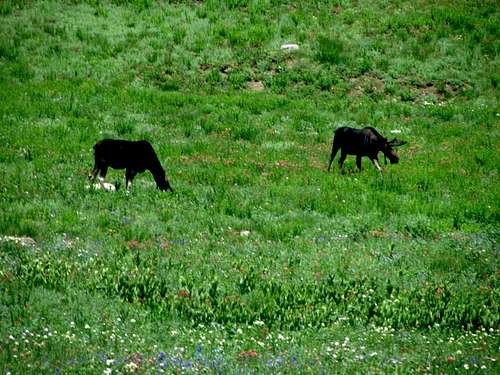
![Albion Basin moose]()
Albion Basin moose
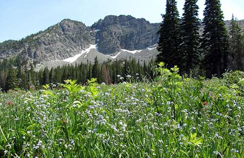
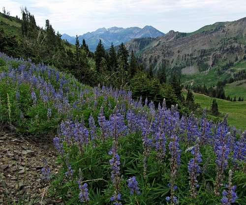
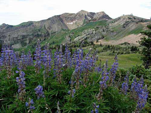
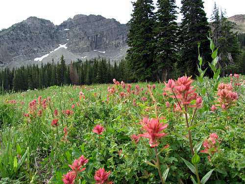
Along with doing the nearby Brighton Lakes Trail and Catherine Pass Trail which also have trailheads at relatively high elevations, hiking to Cecret Lake was one of my family’s favorite late-summer activities (usually have to wait a bit longer for all of the snow to melt here, since the area gets one of the deepest winter snowpacks of any spot in the range), and in fact we had visited the lake just over a week before. Despite the early part of the summer being very hot and dry, Albion Basin was beautiful and green, with all sorts of wildflowers, as well as some moose which are commonly seen in the area (I had seen at least two of them in each of my past four consecutive visits).
![Cecret Lake wildflowers]()
Cecret Lake wildflowers
![Albion Basin wildflowers]()
Albion Basin
Seeing Devil’s Castle up close and personal again made me want to do it right and get to the top of the highest middle summit. The only other time I’d been near the top was when I scrambled up to the west summit, but since I was with my wife at the time and she didn’t want to do any scrambling, I only quickly tagged that shorter summit before making my way back to where she was waiting below on the west ridge. The remaining scramble to the middle summit had looked scary, but for my return trip several years later I was sure it would seem easy.
Scaling the Castle Walls
David and I met at the mouth of Big Cottonwood Canyon, and then drove along Wasatch Boulevard and up into Little Cottonwood Canyon. The plan was to do Devil’s Castle and then drive back down and up to the Butler Fork Trailhead in Big Cottonwood Canyon to do Mount Raymond (another fun mountain I hadn’t yet summited), but later on we would decide that starting even just a half day hike later around noon when it was already almost 90 degrees in the valley below wouldn’t be as fun as just leaving it for another cooler early morning instead.
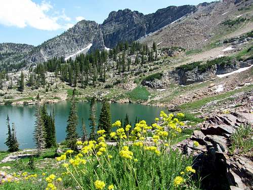
![Sugarloaf Peak over Cecret Lake]()
Sugarloaf Peak reflection
![Cecret Lake]()
Cecret Lake
![Mount Superior from Devil's Castle trail]()
Mount Superior
We quickly made it to the trailhead at Albion Basin, and the wildflowers were even more impressive this time around. My family and I had to take the shuttle when we came up a couple Saturday’s previous, but since it was a weekday we wouldn’t have to do that, and it was early enough that there were only a couple other cars at the trailhead, which is usually packed. It was nice and overcast, which made it nice and cool on our way up. It had rained the previous night as well, which left the air a little damp and humid.
![Devil's Castle from steep trail]()
Devil's Castle from steep trail to saddle
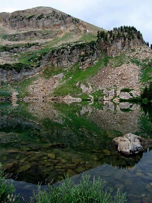
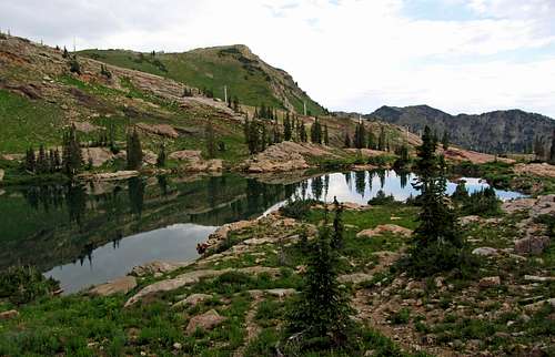
We made it up to Cecret Lake in short time, and then walked across the logs and boulders along the east side of the lake to continue up the steep trail leading up to the saddle between Devil’s Castle and Sugarloaf Peak. Since it was my first summit hike of the summer I got a little winded trying to go up the steep trail too quickly. David had done more hiking recently, but his marathon hike of Mount Whitney and three other Sierra summits in a single day just a few days prior meant tired legs for him as well. The nice thing was that we gained the 900 or so feet of elevation from the lake to the saddle in less than half a mile though, so it was over quickly. The views of Devil’s Castle improved as we made our way closer.
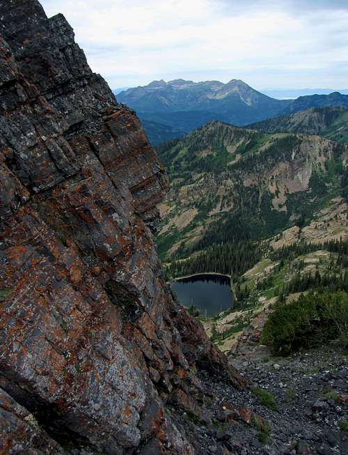
![Mount Timpanogos over Pittsburg Lake]() Mount Timpanogos over Pittsburg Lake
Mount Timpanogos over Pittsburg Lake
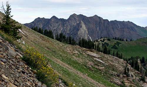
Making our way past a little rock shelter, we could now see Mount Timpanogos off to the south, and the start of the easy scrambling on Devil’s Castle’s west ridge. Winding around some short but hardy evergreen trees along the ridge, we came to a spot next to the remains of a dead tree with a nice view of the west summit, where we decided to leave our packs.
![Devil's Castle west ridge]() Devil's Castle west ridge
Devil's Castle west ridge
![Devil's Castle west summit]()
Devil's Castle west summit
![View north below Devils Castle west summit]()
View south
![View north from below Devil's Castle west summit]() View north
View north
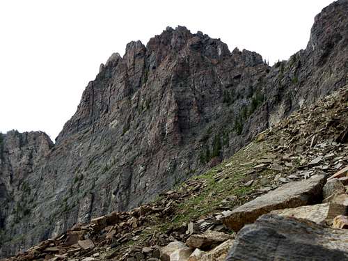
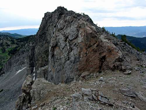
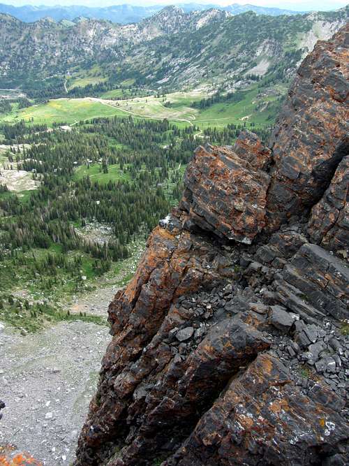
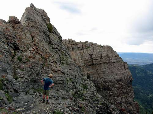
At this point, we traversed along the south side of the ridge, until coming up to some steeper walls a couple hundred feet below the west summit. There was some loose rock in a little gully leading up to the top, but there were enough solid holds that it wasn’t difficult. Just below the top of the west summit we crested the ridge again, and could now see straight down the north face into Albion Basin below. About 15 feet below the west summit we had to make one short class 4 move, but there were lots of solid holds so it was easy.
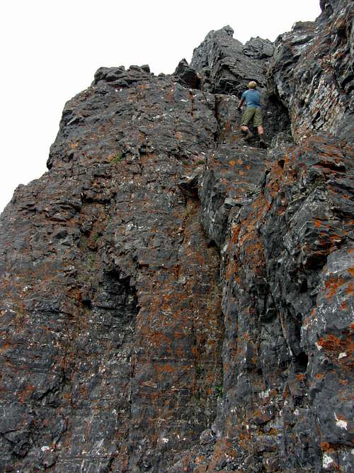
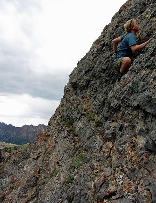
![West summit climb]() David on the steep scramble ...
David on the steep scramble ...
![Devils Castle steep west summit]()
... leading up to the west summit
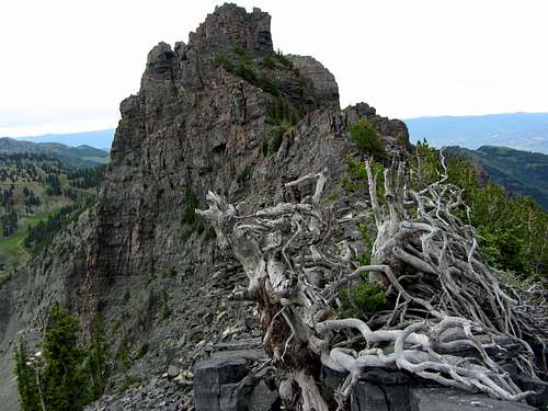
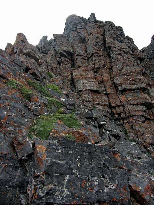
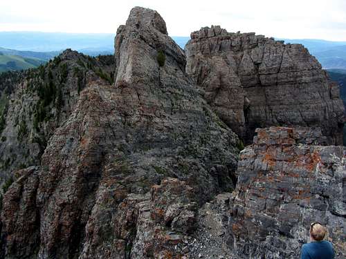
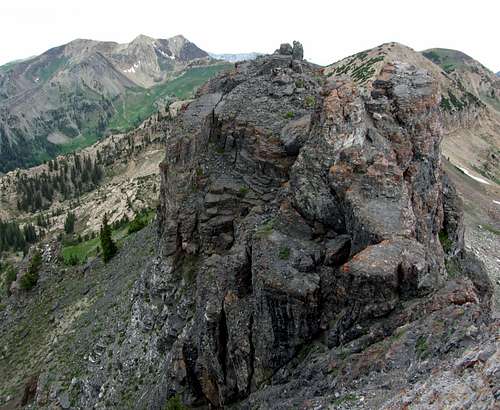
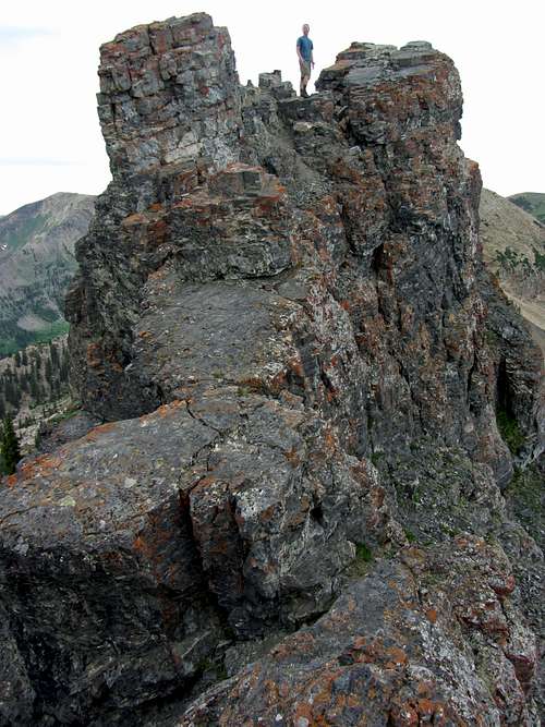
Looking to the east we could now make out what would be the most fun part of the hike, with the steepest drop-offs on both sides. After surveying the terrain we descended from the west summit and made our way east towards the higher middle summit. Partway between the two summits we regained some elevation and went through a cool little walkway, which really made it feel like we were scaling the towers of some ancient castle (the peak has a very fitting name). We then came up to what would be the most difficult part of the route.
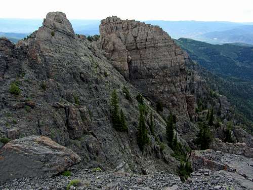
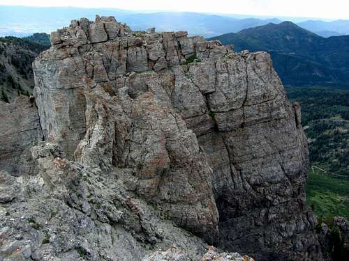
![Devils Castle middle & east summits]()
Middle (left) and east (right) summits
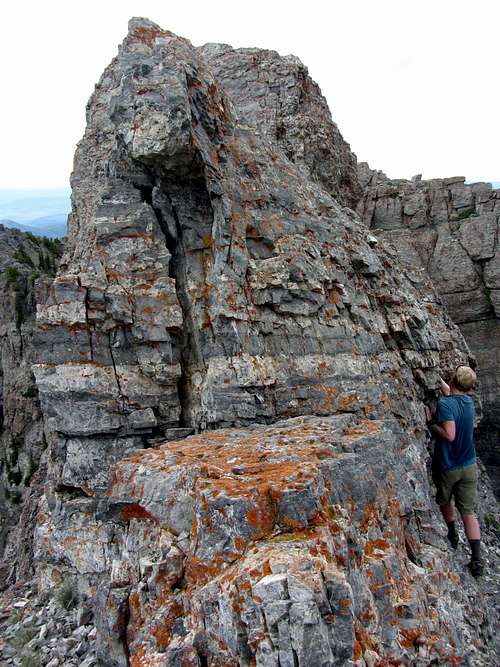
![Navigating the castle walls]()
Navigating the castle walls
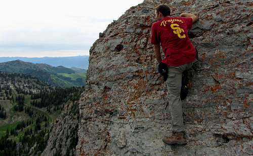
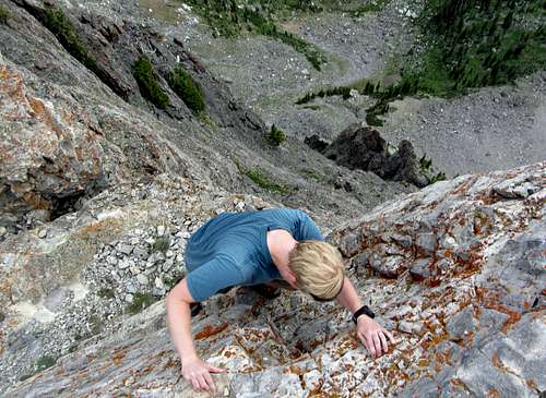
At the first part of the knife edge I decided to go straight over the top, which was pretty exhilarating, while David went around on the right (south) side. The ridge quickly narrowed though, at which point I decided to join David in scrambling up the south side instead. Here we ran into a second class 4 section, which was slightly longer and more exposed than what we’d seen below the west summit. A fall would have sent us bouncing down the rock slopes to the south, so we carefully made our way up. It was actually pretty easy scrambling, except for one small spot above a little shrub/tree just below the summit where going up along a small crack there weren’t as many obvious places to grab the stone or place our feet. Using some friction by pressing hard into the rock, I got past the crux and was soon on top.
![Contemplating middle summit approach]()
Contemplating the easiest way to the top of the middle summit
![Devil's Castle knife edge]() David on the knife edge
David on the knife edge
![Middle summit crux]() The crux
The crux
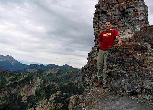
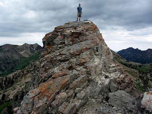
At the middle summit we spotted a mailbox, so since we had successfully made it to the top of one of the more technically difficult summits in the Wasatch (despite also having short class 4 moves as well, I think the standard route scrambles on Broads Fork Twin Peaks and Lone Peak were slightly less exposed) we decided to sign the register. From this vantage point, the west summit definitely looked lower, although the eastern summit didn’t really appear lower. I had heard that the section between the middle and east summits required 5th class climbing though, and since I wasn’t familiar with how to descend the east ridge of Devil’s Castle back down into Albion Basin and we had already reached the top, we decided this was as far as we’d go.
![Devils Castle east summit]()
East summit
I descended a little bit to the east to get a better view of the middle summit for some summit hero shots. This was such an awesome place that I found it hard to believe the car was so close down below. I looked around at the various spires, imagining where all of the best spots would be for setting up archers or snipers to defend the impregnable castle (yeah, I watch too many movies).
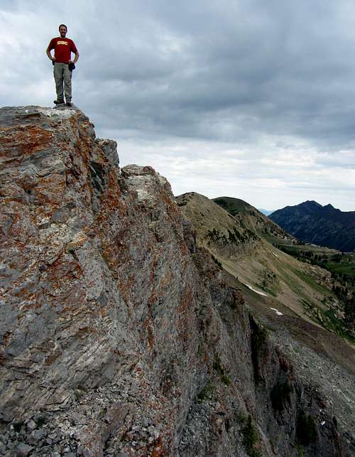
![David on Devil's Castle summit]()
David on the summit
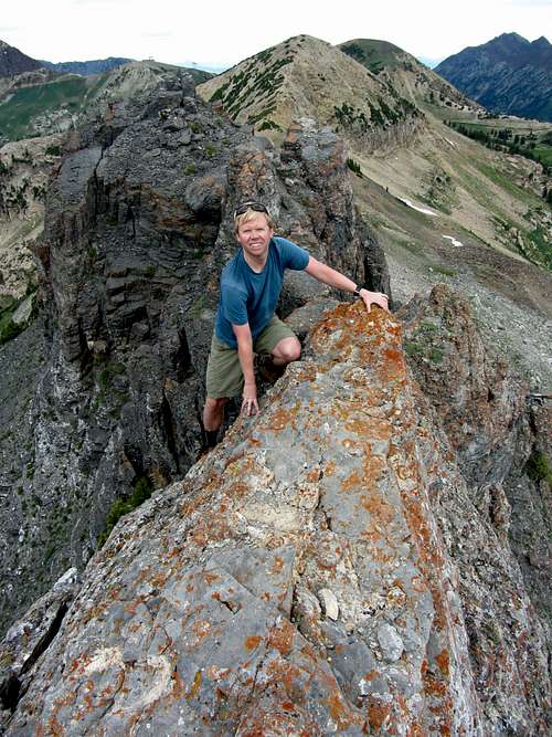
![Brandon on Devil's Castle summit]()
Brandon on the summit
Going back over the crux took a little more time and thought going down than it did coming up, but after our long class 4 traverse of Buck Mountain’s east ridge in the Tetons last summer, this was easy in comparison. It’s funny how your comfort level changes over time as you do harder hikes and scrambles, because I know that just a few years ago something like this would have freaked me out. We continued back through the tower ramps section between the two summits, to the west summit, and back down the west ridge, and before we knew it the scrambling was over. If there’s one thing that’s too bad it was that the scrambling seemed too short (maybe this wouldn’t have been the case if I was confident enough to try the whole traverse instead of stopping at the middle summit).
![Downclimbing middle summit]()
Down climbing the highest middle summit
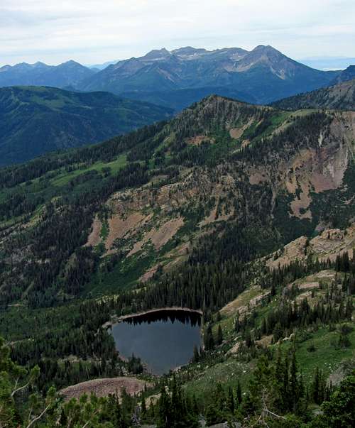
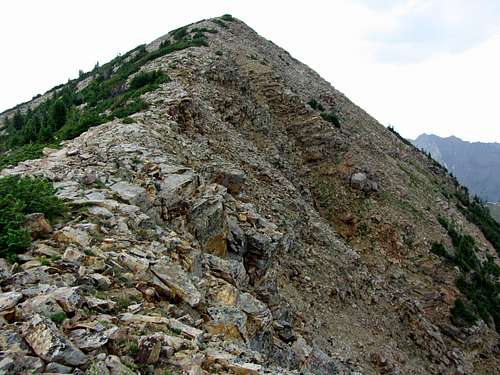
It had just been overcast until now, but after collecting our packs and making our way back along the ridge to go for the summit of Sugarloaf Peak as a bonus, it started to drizzle. I was expecting the east ridge of Sugarloaf to have a trail but it mostly required boulder hopping on our way to the top. Since the rocks were now slick I was glad it hadn’t started raining when we were on Devil’s Castle. From this summit just over 11,000 feet we could now see more of the Alpine Ridge to the west. One of our favorites, the Pfeifferhorn, wasn’t visible from here (it is visible from Mount Baldy, though), but we could see most of the other major peaks above Little Cottonwood Canyon.
![West summit]()
View back to the west
![Castle ramparts]()
Walkway between castle towers
We decided to take the longer descent route down the west side of Sugarloaf Peak since it would give us some different scenery by going in a loop (if we’d left out Sugarloaf Peak and descended to Cecret Lake the way we came up, the hike probably would have taken around 3 hours, but this way it ended up taking 4 hours, which is still a pretty short time to be able to experience such awesome mountain surroundings). After walking past the top of the Sugarloaf chair lift we made our way down a trail which converged with a service road and groomed ski slope at one point (there was some light green netting on the ground which I’m guessing is there in the summer to prevent erosion), and then continued back down towards Cecret Lake back to the east.
![Sugarloaf Peak]()
East ridge of Sugarloaf Peak
There were now more people at the lake, but the crowds weren’t as bad as they would have been on the weekend. We hadn’t seen any moose on the way up, so right on cue, a mother moose and her calf (smallest I’ve seen) made an appearance closer down near the campsites. Since the mother seemed a bit agitated and was stomping around quite a bit, we gave them some time to move off before walking past along the trail.
![Timp from Sugarloaf/Baldy saddle]()
Mount Timpanogos ...
![AF Twins from Sugarloaf/Baldy saddle]()
... and American Fork Twin Peaks seen from the Sugarloaf / Baldy saddle
Doing this hike cemented my opinion of Devil’s Castle as being the best bang for your buck peak in the Wasatch. I know of no other place where you can drive from downtown Salt Lake City up to a trailhead in a beautiful basin over 9,000 feet in less than an hour and scramble to the top of an awesome peak in just a few more hours. If you like exposed scrambling (overall I’d rate it as class 3+, since there were only a couple short class 4 moves) and have a few free hours around Salt Lake City, do it. You’ll be glad you did.
![Albion Basin pink/red wildflowers]()
Albion Basin wildflowers
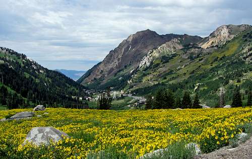
![Mount Superior from Albion Basin road]()
Mount Superior behind field of wildflowers
Devil's Castle & Sugarloaf Peak Stats
DISTANCE: 5 miles roundtrip
CECRET LAKE TRAILHEAD: 9,400 feet
DEVIL’S CASTLE SUMMIT ELEVATION: 10,920 feet
SUGARLOAF PEAK SUMMIT ELEVATION: 11,051 feet
ELEVATION GAIN: 1,820 feet
DIFFICULTY: Class 3+
TIME: 4 hours
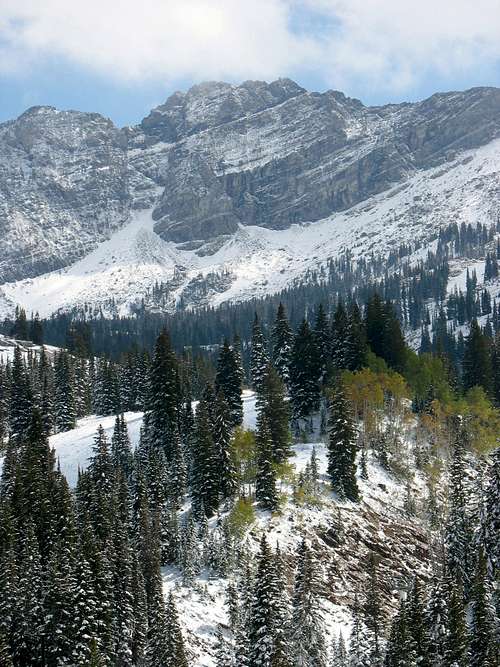
![Fresh snow at Albion Basin]()
Albion Basin after the first fall dusting of snow


Comments
Post a Comment