
-
 7983 Hits
-
 74.73% Score
-
 5 Votes
|
|
Route |
|---|---|
|
|
39.71000°N / 105.92°W |
|
|
Mountaineering, Scrambling, Skiing |
|
|
Spring, Fall |
|
|
Most of a day |
|
|
Class 3 |
|
|
Intermediate Snow Climb, Advanced Ski Descent, D8 |
|
|
II |
|
|
Overview
Hagar Mountain lies on the Continental Divide north of Loveland ski area, southwest of "The Citadel" and northeast of Coon Hill. Hagar's southeast face offers many great snow climbs and ski descents. Perhaps the most aesthetic is the Boomerang Couloir, named by SP member iskibc. Boomerang Couloir should only be attempted during times of lowest avalanche danger, such as in the spring when the snowpack has consolidated.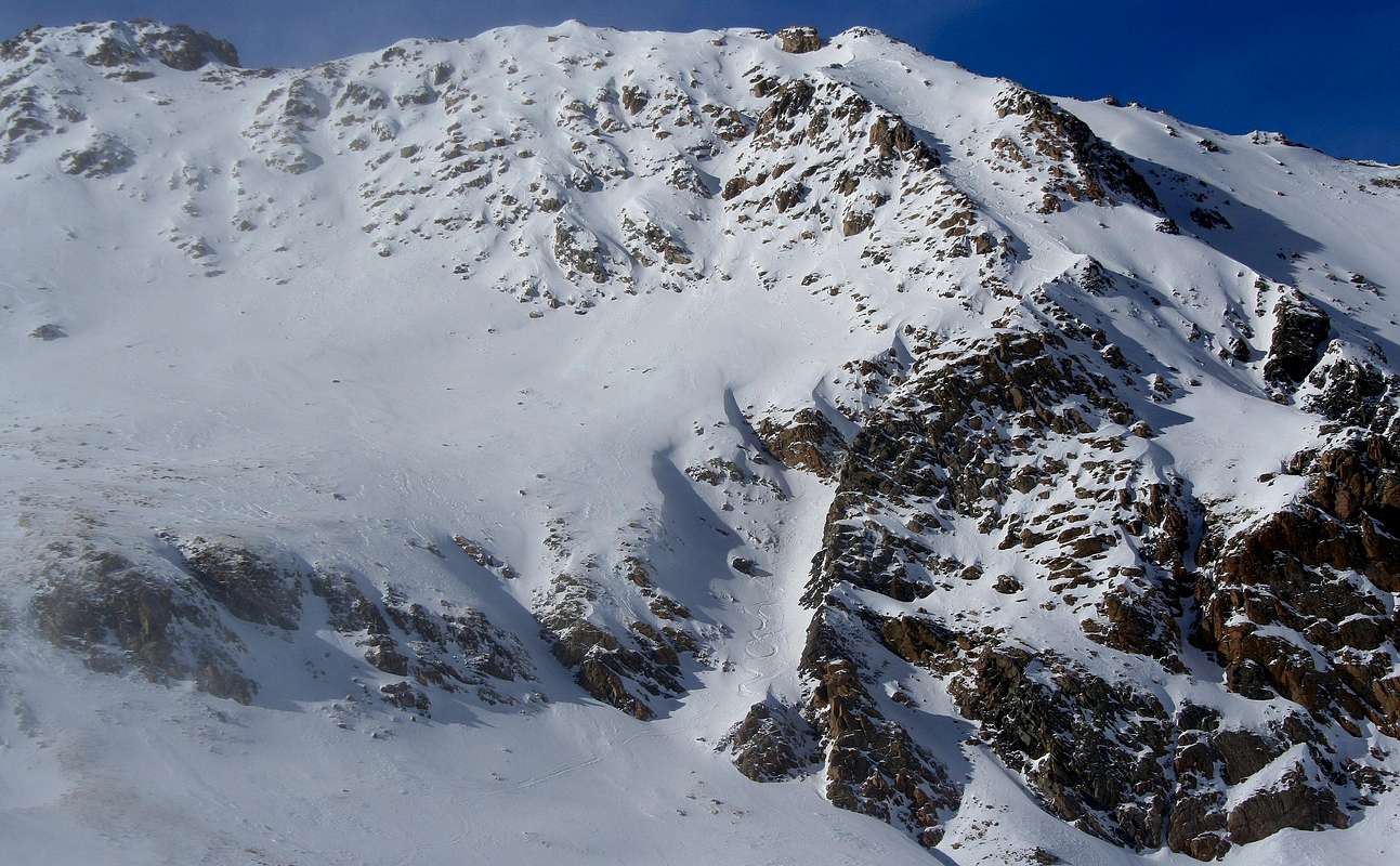
Boomerang Couloir. Photo: Luke Kroiss
Getting There
Take exit 216 off of I-70. Follow a dirt road east on the north side of I-70 to a gate. With snow, you may not be able to drive to the gate. See GETTING THERE section on main page for more information.Route Description
Follow Dry Gulch to the base of the Boomerang Couloir. During times of snow cover, it is best to stay in the base of the gulch, as indicated on the map. Climb the Boomerang Couloir to Hagar Mountain's north summit. About halfway up, there is a prominent kink. Head left (west) at this point. Once at the top of the couloir, scramble along the ridge to the higher south summit. Descend the southeast slopes or the Boomerang Couloir. The slope angle of the Boomerang Couloir approaches 40 degrees and is rated a D8 on the D Scale.
Boomerang Couloir via Dry Gulch