
-
 2963 Hits
-
 74.92% Score
-
 5 Votes
|
|
Route |
|---|---|
|
|
41.78900°N / 117.553°W |
|
|
Mountaineering |
|
|
Spring, Summer, Fall |
|
|
Half a day |
|
|
Class 3 |
|
|
Overview
 Buckskin Mountain West Face Route
 |
Climbs a sub ridge up the west face directly to the green lichen stained “cockscomb” pinnacle, a very distinctive feature of the band of cliffs that line the top of the face as seen from the road.
The route then traverses the base of the cliffs in order to exit onto the friendlier east slopes and meets the road from Windy Gap from where it's about an hours walk to the top.
Getting There
Since this is an early season objective the roads around the high points you would have to cross if approaching from the south on NV 290 - Hinkey Summit and Windy Gap - will be closed. Approach, therefore from McDermitt, NV to the northDrive 19 km/12 miles south from McDermitt on US 95 and find “Buckskin Canyon Road” on the left. The official designation of the road is FR 084. Drive FR 084 for 16 km/10 miles and park right at the bottom of the first switchback by Buckskin Creek at N41 46.225 W117 33.938 at an altitude of about 1,800 metres. There’s a nice open spot for 3 or 4 vehicles and you could probably camp there too.
Route Description
From the convenient parking spot at the bottom of the switchbacks on FR084 walk the road ~ 2 km/~ 1.2 miles and find a shallow grassy gully heading due north up the hillside to the sub ridge above at N41 46.259 W117 33.474.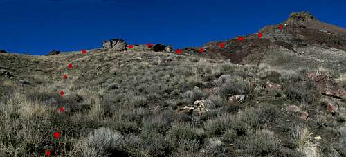
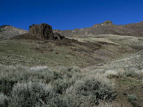
W Face Route looking west as you leave FR084
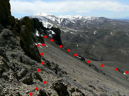
West Face route looking SW from S Ridge
Once at the base of the cliffs (some might appreciate a helmet – although I saw nothing fall) turn left/northeast up a ramp at the base of the cliffs and then make a rising traverse 500 metres map distance across steep slopes to the point where the cliffs taper into the ridge crest. There is some exposure, lots of loose rock and some Class 3 here and there. If you find an earlier point to get through the cliff band, go for it and avoid unnecessary side hillling.
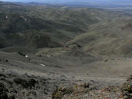
W Face Route looking south from S Ridge
Descend by reversing the route or by walking down the roads to Windy Gap and 5 km from there down FR084 to your car.
There is neither marking nor signs of travel on this route nor did I leave any. As always on SP my descriptions come with a GPS ready tracklog that’s available to all for the asking. Just send me a PM or email if you want to do this route.
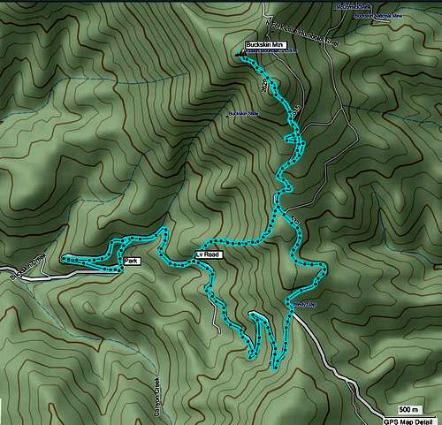
Buckskin Mountain tracklogs