
|
|
Mountain/Rock |
|---|---|
|
|
46.90137°N / 121.71376°W |
|
|
Hiking |
|
|
Summer, Fall |
|
|
7828 ft / 2386 m |
|
|
Overview and Route Description
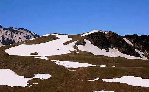
3rd Burroughs Mountain from 2nd Burroughs
Burroughs was formed by an ancient lava flow, which explains why it's relatively flat. The park service explains that the vegetation on Burroughs is similar to some arctic tundra where the growing season is short, just like the hiking season at this elevation--mid-July through September.
Burroughs Mountain is an excellent day hike from the Mount Rainier Sunrise Visitor Center. The park service provides a map to its first two summits, "First Burroughs," and "Second Burroughs." These two objectives require 4-5 miles, 1200-1300' of effort, with outstanding views the whole way.
However, climbers won't be satisfied with anything less than ascending "Third Burroughs," a 7828' summit overlooking the Winthrop Glacier. On a clear day, you might study the ridge heading toward Steamboat Prow, wondering if this might be an easier climbing route than starting at the 4400' White River campground, and hiking through Glacier Basin and up the Inter Glacier.
Third Burroughs is a nine mile, 2600' (2000' to summit, 600' return) trip, and well worth the extra effort. Some of the trails cross steep slopes that can remain snow covered until late summer, especially the traverse up the Northwest side of First Burroughs. Check with the rangers to make sure the conditions are safe for your group.
From Second Burroughs, you can see the route ahead. After losing about 400', you pass the left turn that heads down into Glacier Basin. Stay right (straight) on the unmarked trail to Third Burroughs. Here's our route, along with a couple of the other Sunrise trails.
Getting There
Sunrise is located in the Northeast quadrant of Mount Rainier National Park.Google maps
Click on "Get directions", and enter "sunrise, wa" in the "End address" box, and your starting location, e.g. "seattle,wa", in the "Start address box". Click on the "Get Directions" button.
If you enter "seattle,wa" here's what you get:
Drive: 94.2 mi – about 2 hours 12 mins
1. Head northeast on James St toward 5th Ave 486 ft
2. Turn right at 6th Ave 463 ft
3. Take the I-5 S ramp on the left to Portland 0.6 mi 1 min
4. Follow signs for Airport Way 322 ft
5. Keep left at the fork, follow signs for I-5 S and merge onto I-5 S 10.0 mi 11 mins
6. Take exit 154A on the left to merge onto I-405 N toward Renton 2.0 mi 2 mins
7. Take exit 2 to merge onto WA-167 S toward Auburn 12.3 mi 13 mins
8. Take the WA-18 E exit toward Auburn 0.4 mi 1 min
9. Keep left at the fork to continue toward WA-18 E and merge onto WA-18 E 1.2 mi 1 min
10. Take the WA-164 E exit toward Enumclaw 0.2 mi
11. Turn left at Auburn Way S/WA-164
Continue to follow WA-164 9.9 mi 15 mins
12. Slight left at SE 436th St 3.1 mi 4 mins
13. Slight left at SE 440th St/Griffin Ave
Continue to follow Griffin Ave 1.7 mi 5 mins
14. Turn left at Roosevelt Ave 1.5 mi 3 mins
15. Continue on SE Enumclaw-Chinook Pass Rd/WA-410
Continue to follow WA-410
This road may be seasonally closed 35.7 mi 43 mins
16. Slight right at Sunrise Rd
This road may be seasonally closed 15.4
Red Tape
You need to have a Mount Rainier visitors' pass. This can be purchased when you drive through the White River entrance.Camping
Camping is available at Sunrise.You can also stay at the Crystal Mountain ski resort. It's a 45 min drive from Sunrise.