
-
 2356 Hits
-
 82.48% Score
-
 15 Votes
|
|
Mountain/Rock |
|---|---|
|
|
45.00545°N / 6.47983°E |
|
|
Cerces, Hautes-Alpes |
|
|
Trad Climbing, Sport Climbing |
|
|
Spring, Summer, Fall |
|
|
7382 ft / 2250 m |
|
|
Overview
Chemin du Roy
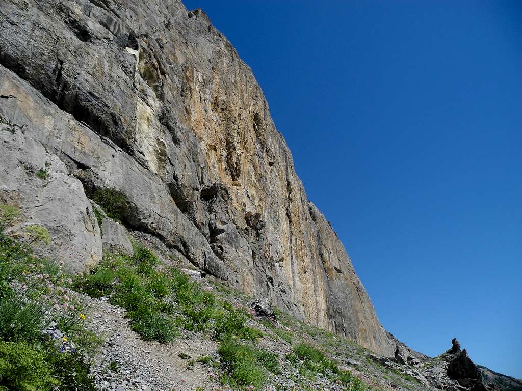
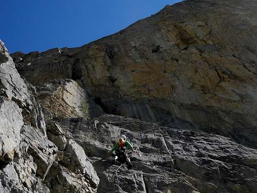
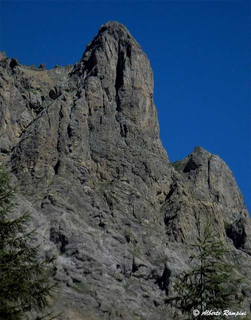
A series of beautiful rock structures, showing a compact grey and reddish colored limestone, dominates in its upper part the right side of the road joining Briançon and Col du Lautaret. Alongside the most famous, high and impressive Tour Termier, Aiguillette du Lauzet and Tete de Colombe the Chemin du Roy often goes unnoticed.
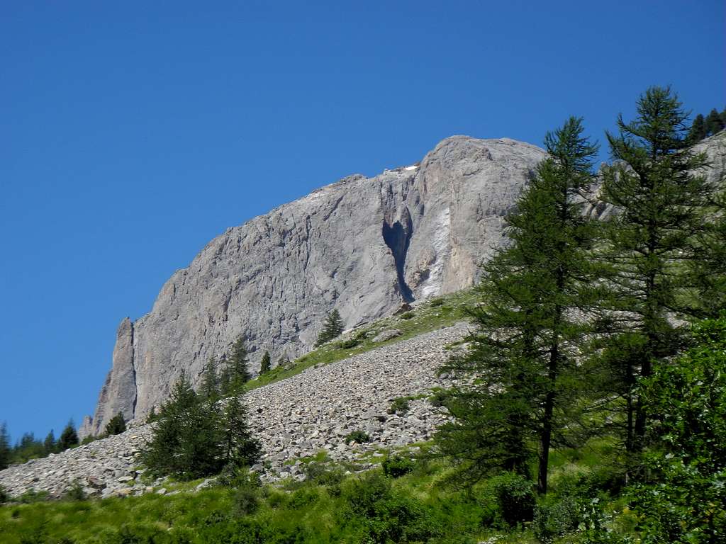
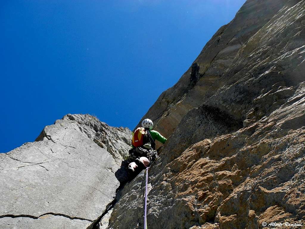
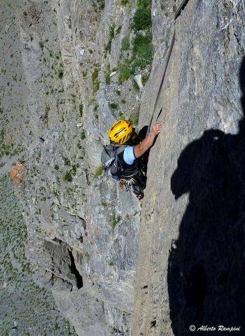
Actually it is a beautiful limestone cliff of excellent quality about 150 meters high which presents about 15 multipitch and also several single pitch on often beautiful rock. Both facilities are recommended for days of uncertain weather or when time is short, given the convenience of access. The sun comes in the late morning. The wall is divided into two sectors, separated by a waterfall. The left sector, named Eperon de la Route, was the first to be explored. It's less high and here you will find the most accessible routes. The right sector, named La Lauziere, began to be explored in 1992, and here the routes are more difficult.
Getting There
Road access
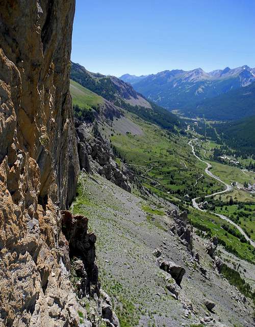
- From Turin follow the road to Colle del Monginevro on Italy-France border, then the road N94 to Briançon, reaching the town. Carry on the road N91 running along the Guisane Valley in the direction of Col du Lautaret and connecting Briançon to Grenoble, pass Monêtier-les-Bains towards Col du Lautaret, reach Le Lauzet and then park the car about 1 km upstream from the little hamlet of Pont de l'Alpe, at point 1757 m.
- From Grenoble follow the road to Col du Lautaret, reach the col, then down along Guisan Valley toward Briançon, reaching the parking above Ponte de l'Alpe.
Walking access
Upstream from the Point de l'Alp parking area a steep track starts climbing among the larches and in twenty minutes reconnects to the path named "Le Chemin du Roy". Turning left at the crossroads you will soon reach the sector Eperon de la Route; continuing instead to the right you skirt the vast wall called "La Lauziere" (30 or 40 minutes depending on the sector chosen).
Sector Eperon de la route
It is the left sector, where the it's located the first itinerary traced on the wall, the Eperon de la Route, which gives its name to the structure.
- Du miel et des abeilles 5b, 100 m
- Tete de Cuvée 6b, 6a obbl. 100 m
- Che Gevaraux 6a, 100 m
- Voie des Quarantes 5b, 120 m
- Le Fossile et le Marteau 5b, 100 m
- Eperon long de la route 5b, 120 m
- Eperon de la route 5a, 100 m - This one is the first route on the face, a classic route that is not too demanding
Descent: in this sector the most recommended descent is on foot. From the top, cross west to take a path that leads back to the base. However, abseiling is also possible.
Sector La Lauziere
It's the right sector.
- Le Renard et le Petit Prince 6b+, 110 m
- La voie des Boulette 6c, 6a obbl, 150 m
- Orion 6a (a short move) , 150 m
- Le Retour des Pinsutes 6c, 6a obbl. 150 m
- Hélène et les Garçons 6b, 6a obbl., 150 m
- A la recherche de Peter Pan 7a+, 6a+ obbl., 150 m
- Tête en bas a3, IV, 90 m
- L'enveloppe est belle mais l'interieur est pourri 7c, 7a obbl. 90 m - An intense and engaged climb requiring the mastery of the grade
Descent: the most convenient descent is by abseiling
Sector de couennes (Single pitches)
The single pitch sector is located at the far right of the wall and features 11 routes from 6b to 8a
Red Tape
No particulary restrictions in climbing and hiking.
When to Climb
The best time is from late spring to early autumn
Accomodation
The accommodation possibilities are numerous in Val Guisane or in Briancon
Meteo
Guidebooks and maps
Oisans Noveau, Oisans Sauvage”, Book East by Jean Michel Cambon