-
 5403 Hits
-
 74.01% Score
-
 4 Votes
|
|
Route |
|---|---|
|
|
46.55860°N / 11.80940°E |
|
|
Download GPX » View Route on Map |
|
|
Via Ferrata |
|
|
Summer, Fall |
|
|
Less than two hours |
|
|
Easy rock climb, Medium hard ferrata |
|
|
Rating the Route (By Hiking Standards)
0. General: 2121 m to 2592 m, marked and secured rock route - ferrata. UIAA I. Take care of falling stones (mountaineers above).
1. Effort: 470 m, 1 h 30 min.
2. Power: 3 - medium.
3. Psyche: 3 - medium (exposed, rockfall danger).
4. Orientation: 1 - no difficulties.
Approach
The trailhead starts on Passo Gardena / Groedner Joch, 2121 m.
Route Description
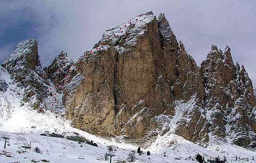
From the pass you take a good road (closed for public traffic) towards north, but when the road starts tending towards right (towards Rif. Clark) you leave it and go by the marked path directly upwards. You can't miss the distinct ravine left (west) of the main summit.
The ravine is easy. In many turns the path gains altitude, just at the end of it you must use hands on a few places. But when this ravine closes, marks lead you towards right, over steep rocks out of it. These passages are secured by steel cables and pegs.
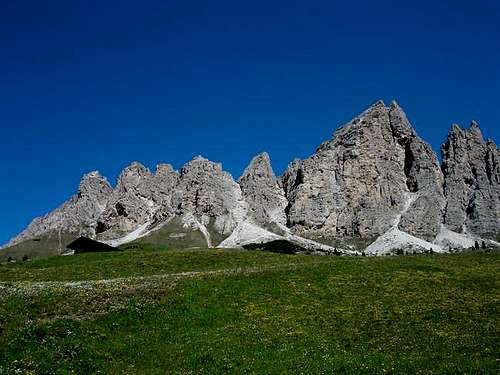
After the walls above the ravine are below us, the slope gets less steep. It's surprising how on this side of the mountain rocks are not as steep as they look from the Passo Gardena. Actually the summit has a kind of a steep roof, over which we ascend almost without climbing. The only danger are falling stones of mountaineers above us. This way we reach the top.
Essential Gear
Good shoes, eventually ferrata equipment.


