
-
 6699 Hits
-
 74.01% Score
-
 4 Votes
|
|
Route |
|---|---|
|
|
58.30035°N / 134.29243°W |
|
|
Download GPX » View Route on Map |
|
|
Hiking, Mountaineering |
|
|
Summer, Fall |
|
|
Most of a day |
|
|
Class 3 |
|
|
Overview
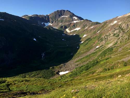
The Clark Traverse encompasses the summits of Gastineau, Roberts, Sheep and Clark over 13.53 wonderful miles. This route can be hiked in either direction and can be used as an out and back for all of the above peaks. For this article, I will describe a counterclockwise loop which will be the most common direction.
Getting There
The start of the loop leaved from the Mt. Roberts Trailhead. A shortcut is taking the Mt. Roberts Tram and saving about 1,750' of elevation gain, but having to walk a bit extra at the end of the loop (downhill). To get to the trailhead, leave Downtown Juneau on Gold Street and head uphill to Basin Road. Follow Basin Road till a yellow seasonal gate is reached. The Trailhead is on the right side of the road just before the gate.
Route Description
From the Mt. Roberts Trail Head, head up the well-marked trail and gain 1,750' over 1.6 miles to the tram. From here continue uphill on either trail. They intersect after about 0.3miles and the trail is the one that continues uphill. Eventually the trail steepens and a saddle between Gold Ridge and Gastineau peak is reached. An obvious trail snakes along the ridge to the Right headed to Gastineau Peak. Continue to the bottom of the saddle and up to the summit of Gastineau at 3,666' after 3.84 miles of hiking.
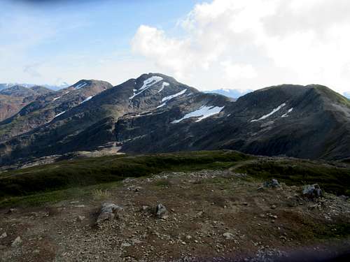
From here you can simply turn around, or continue the traverse. The next peak is Mt. Roberts at 3,810' and another 0.9 miles of ridge hiking. Simply head down to the bottom of the saddle and climb up the next hill. This is the last 'easy' peak and the trail becomes faint and the terrain a bit more rugged. To continue the epic adventure of the Clark Traverse, continue down the back side of Mt. Roberts and again generally follow the ridge. There are a few rocky sections and the lowest point of the saddle is particularly rocky.
After 1.44 miles the summit of Sheep Mountain at 4,238' is obtained! The backside of Sheep Mountain is glaciated and crampons are useful later in the year. Head down the snow and start hiking up Clark Peak.
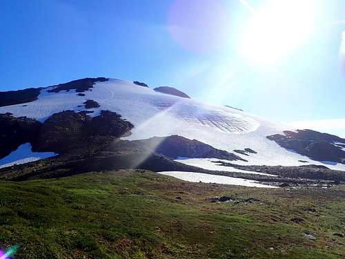
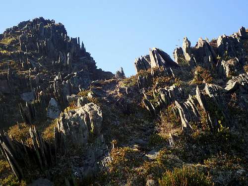
There is a rocky steep section on the way up, but it can be avoided on climbers right. The summit of Clark Peak is another 0.86 miles down the ridge. On the backside of Clark Peak, you will be greeted with another glacier. Slide down this one (but not too far) and look at the obvious bench running across the mountain to the Left. Intersect the base of this bench after crossing a bit more snow and scrambling over some rocks. This is the hardest part of the climb as the rocks here are loose and steep.
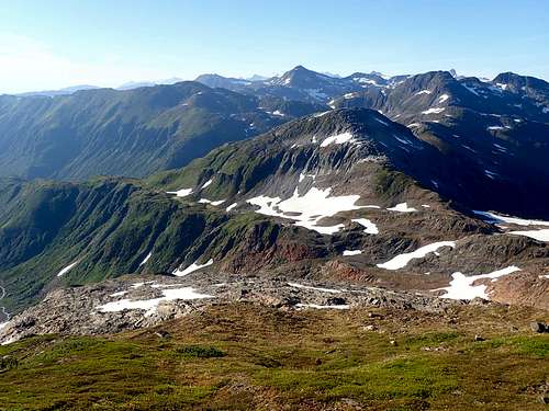
Once the bench is reached, follow it right along the side of the mountain until you hit the ridge at just under 3,000'. Looking downhill along the ridge, the left side is Perseverance Basin, and the Right is Granite Creek. Head right down the steep grassy (or snowy) gully about 1,000' down to the meadow below in Granite Basin and intersect the well-established Granite Creek Trail.
At this point you're at 9.25 miles and it’s all downhill from here. Follow the Granite Creek Trail downhill for 1.5 miles to the intersection of the Perseverance Trail. Follow this right back to the perseverance Trail Head and hike the road to the Mt. Roberts Trailhead.
See attached .gpx for an exact route or check out the Juneau Hikes and Summits CalTopo page.
Essential Gear
Mountaineering boots or stiff waterproof boots are necessary and gators help keep your socks dry. Having a SPOT or InReach is a great idea. Bring extra dry/warm stuff. Crampons and ice axe could be useful if a icy patch is encountered.