Wyoming Peak, (The Beginning)
I just read a great article about the 1963 expedition on Everest that lead to the the first summit of the West Ridge route. One of the points that was made was how the West Ridge wasn't even one of the original objectives, but as the team traveled to Base Camp this proposal took hold and eventually the team decided to add it to their objectives. To me, this shows how important it is to be flexible and willing to think creatively in our adventures.
This story isn't so much a trip report as it is a compilation of experiences on a remote, unheralded mountain in western Wyoming. These experiences are not yet finished, and the goals have changed as the "project" evolves. The description of Wyoming Peak on this website is probably an understatement when it refers to the amount of traffic that this mountain and range receives, "Because paved roads do not penetrate the range and because the range is isolated from the Grand Teton-Yellowstone area that attracts most of attention in the region, human visitation is relatively light. A climb of Wyoming Peak and of virtually any other peak in the range is a delightful excursion into a realm of rugged beauty and far-ranging
vistas of mountains and semiarid basins".
Although I spent the fist 24 years of my life living within 80 miles of this peak, I had never seen it until 2009. Up until my freshman year in HS, we lived in and around the Jackson Hole area, and I spent a lot of time in the mountains and northern peaks in the Wyoming Range, namely Ramshorn, Hoback and Claus peaks. My family had ranches in the Hoback area and so as a kid I spent a big percent of my life hiking and riding horses in that area. I don't think I am unique in my lack of familiarity with this remote corner of our world, even amongst the "locals".
I don't remember when the fascination with Wyoming Peak begin to take hold, but it was originally conceived as part of a grandiose plan to ride a mountain bike along the entire Wyoming Range National Recreation trail, and include a summit of Wyoming Peak as part of the trek. In 2009, I convinced my son-in-law, Phil Clemens and my brother-in-law, Mike Geslin to make the trek. Our support team was my son, Taylor and my Dad, (they were there to fish, cook and drive the "chase" vehicles). The plan was to hit Wyoming Peak the first morning, then ride north towards McDougal Gap. The more we studied the route and read beta on it, we realized that this was probably too aggressive. As a result, I had the first major adjustment and evolution of my "goal". We decided that we would just do a two day trek which would be a climb / ride of Wyoming Peak on day one and a ride of the Monument Ridge / Little Cliff Creek trails in the northern part of the range on Day two.
The First Ascent - Lost & Confused
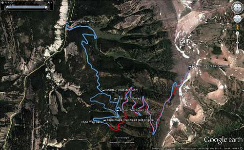
On the morning of September 10, 2009 we set off from my parent's place in Cokeville, Wyoming and traveled to Wyoming Peak via US 89 North and the Smith's Fork Road to the Tri-Divide Basin, where we then accessed the Grey's River Road. We had determined that we would start the ascent from the mouth of Kinney Creek and follow the Forest Service Road to the trail head. The image below tells the story of what happened next.
About an hour into the ride, we made a decision that set a chain reaction of bad decisions in motion. As the road neared the elevation of the trail head it began to basically follow the contour of the mountain. We were anxious to get on the trail and we thought that drainage that we were in was the next one to the south. There was no trail, but that didn't alarm us because we didn't expect one here. Here was the problem; as you can see from the red trail marked on the image, which was the data from the topo sources, the original trail head had been moved and was now ACTUALLY in the drainage that we thought we were in. (I had this original data in my GPS unit). Anyway, we thought we only had a few hundred yards of bushwhacking and we would be on the single track trail and heading for the summit. In reality we were far too low in elevation and in spite of our efforts, (all on foot pushing the bikes around), we did not find the trail. We knew that the actual trail head was south of our location, and so we finally decided that the shortcut was what most shortcuts turn out to be, a bad idea.
After recognizing that we needed to reset and get back to the road. We headed south towards the next drainage, and here is an ironic twist of fate, we were finally on "a trail" that looked like it could be the "real thing". The problem with this was that at this point we didn't trust our own senses. The Topo data indicated that the trail head was further to the south and the trail should be above us. Off we went to the trail head that I had entered in my GPS unit. After getting there and seeing that all signs of the trail had vanished, we realized that we had indeed discovered the REAL trail head by accident. This little episode cost us 2 hours of time and a ton of wasted energy.
Once we got back to the real trail head the real climb was fairly uneventful. I had to push the bike a lot more than I would have liked, due to cramping, and the trek was slow going. Phil, being younger and in much better shape was able to ride his bike all the way to the saddle about 400 feet below the summit. At that point, we pushed our bikes to the summit, signed the register, took some photos and headed down on our bikes. The upper section is steep and technical, but we rode the entire trail back to the vehicle.
![Map of First Ascent-Descent]() Lost on Wyoming Peak.
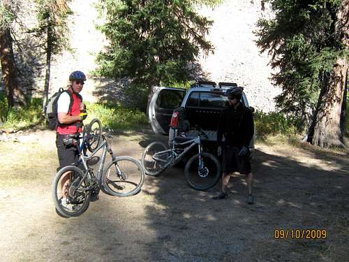
Lost on Wyoming Peak.![Getting Ready]() Mike and Phil getting ready for the climb!
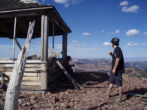
Mike and Phil getting ready for the climb!![Phil and Cody Summit]() Phil and Cody on the summit. (The old lookout has since collapsed).
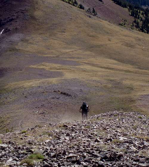
Phil and Cody on the summit. (The old lookout has since collapsed).![Phil Descends]() Phil descending the steep upper section.
Phil descending the steep upper section.The Second Ascent - We Are Not Alone!
In 2011 Phil and I decided to do another summit of Wyoming Peak. I had a new GoPro camera and was excited to get some footage of the descent. This time, we drove from Boise to Alpine on a Friday evening, spent the night in one of the little motels and got a good early start on Saturday morning. We drove the 50+ miles to Kinney creek and repeated the 2009 route, minus the "lost and confused" section.
The climbing was much easier for me, due to the absence of all the bushwhacking! With the exception of a few short sections on the lower part of the trail, and the upper climb, I didn't have to do any "push-a-bike". As we started to climb the upper section, we looked up and saw someone with a bike just starting the down climb. He turned out to be a local climber/rider who had made the climb with his bike on the east route. I believe that the east route requires far more hiking than biking, but I haven't ever done that side. We visited briefly and then went our separate ways.
At the summit, I got the GoPro ready and was very excited to try it out. But when I pushed the power button, nothing happened. After a few minutes of fiddling around with it, I finally figured out the problem. I had been messing with the SD-card the day before and failed to insert it back in the camera! You can imagine my frustration and disappointment at that snafu. But the good news was that we had a great ride down AND I knew I would be back!
The Third Ascent - Climbing with My Wife and Daughter
After the second ascent/descent, I begin to lay out the plan for a new set of objectives. The new goal is to now climb and descend Wyoming Peak using three separate human powered modes of travel:
- Mountain biking
- Hiking
- Skiing
In September of 2012, I put phase 2 into action. Recruiting my wife and daughter, we decided to climb Wyoming Peak from the west side, but we would drive to the trail head as described in the Wyoming Peak Getting There section on this website. This trip turned out to be a blast and we all had a great time. This was the highest summit that either my wife or daughter had ever been on and they loved the experience. Here are some of the photos of our climb.
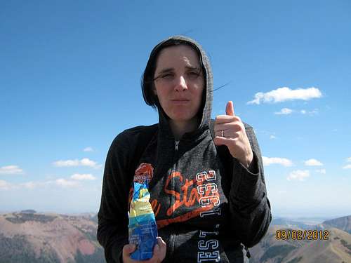
![Valerie summit]() Valerie enjoys a snack on the summit
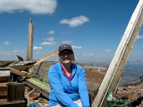
Valerie enjoys a snack on the summit![Ann Summit Wyo Peak]() Ann enjoying the summit of Wyoming Peak.
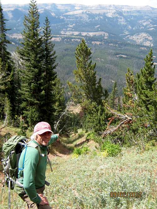
Ann enjoying the summit of Wyoming Peak.![Long ways down]() Cody points out our finish. The Explorer looks smaller than a matchbox toy from here.
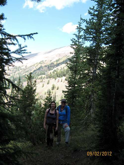
Cody points out our finish. The Explorer looks smaller than a matchbox toy from here.![Ann and Valerie]() Ann and Valerie on one of the switchbacks on the climb up. View is to the north.
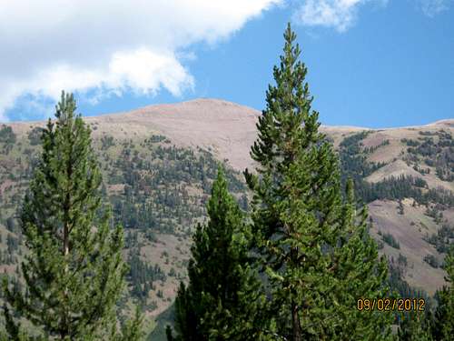
Ann and Valerie on one of the switchbacks on the climb up. View is to the north.![Wyoming Peak]() A view of Wyoming Peak summit from FS041.
A view of Wyoming Peak summit from FS041.The Fourth Ascent - Finally the GoPro Works
A couple of weeks after the successful summit via hiking, Phil and I went back up for another bike ride. This was the third time on bikes and the saying, "the third time's the charm" definitely applied here! The climb that we had completed earlier by driving to the trail head via the Shale Creek entrance opened up a much more appealing approach for this ride. Instead of starting at Kinney Creek, we parked at the Shale Creek intersection and started the ride there. This was a perfect warmup/cool-down section to complement the single track and the difficult climbing and ride down. It is important to note that although this climb is not "technical" for hikers or mountain bikes, if you are on a bike, the downhill is fairly risky depending on how fast you dare to travel. I have documented the the route alternatives on my Hi-Adventure Wyoming Peak TR. This page includes the downloadable GPS data for the routes to the summit from the West approach. Here is the GoPro Video of the DH highlights, (even though this is shot from the mountain bike, it gives the viewer a great idea of the terrain on this climb/hike):
https://www.youtube.com/watch?v=HLsGE_0b1yI
The Odyssey - To Be Continued
Wyoming Peak, and the entire Wyoming Range for that matter, is a truly great place to recreate and enjoy the beauty of nature! One of the unique things about this peak is that it is so remote, and yet it offers this cool array of options to ascend / descend the summit. How many other peaks of this prominence offer this range of human powered options? I don't know how many more times I will summit this peak, but by this time next year, (2014) I want to have attained the summit and skied the west route. Then I will have completed my personal tri-fecta of climbing, mountain biking and skiing from the summit of the same peak. When I set out to ascend Wyoming Peak, that certainly wasn't the objective. The magnitude of this goal is miniscule in comparison to something like the Everest team did in 1963, but for me it is a satisfying and worthy goal that helps keep me invigorated and looking forward to continued adventures!
Comments
No comments posted yet.