2008
The Mirror Lake Highway bisects the western Uintas of Utah as it runs from Kamas, Utah to Evanston, Wyoming. It tops out at Bald Mountain Pass at over 10,700' and also goes over Hayden Pass (10347'). Once the snow starts falling, it is closed and gated between Mile Markers 14.6 and 48.7, leaving the 34.1 miles in between to be a snowmobilers paradise. However, snowmobilers aren't the only individuals that can enjoy its scenic beauty, an occasional x-country skier ventures forth as well, but most only go a few miles.
My first experience with skiing the highway was in March 2008. After a 7 hour strenuous back country ski tour through the woods starting at the Kamas end gate, the organizer led us back to the highway. I had an OMG moment when I discovered that we were 9.5 miles from our car and the organizer thought nothing of it. It took another 2.5 hours to get back to the car but at least it was still light when we got there.
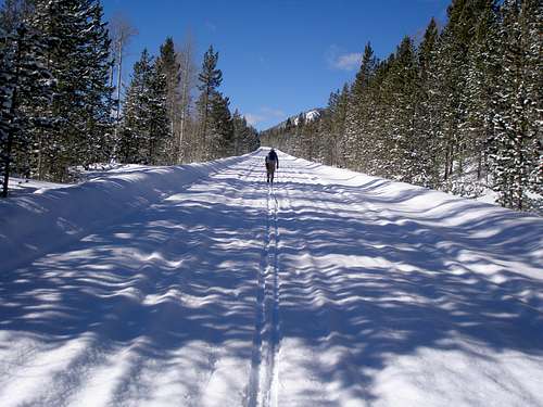
Since then I've appreciated the wisdom of finishing a long ski tour by going back on the highway because you know what you are going to get, a nice wide, well packed down, direct path that is easy to ski in the dark, with no route finding, no trees to step over, and no chance of getting lost. Plus, there are the convenient mile markers at the side so you know at all times just how far you have to go.
2009
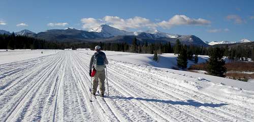
In 2009, I thought it might be fun to try the highway with light weight waxable touring gear. Under the right conditions, waxable skis are much faster than no wax skis with scales on the bottom that slow you down. Unfortunately, the only days I could find to do it were just after big storms and when I showed up early in the parking lot the snow on the highway was pristine, there was nary a snowmobile track to ski on. The first time I went about 22 miles round trip just to see what it was like. Well, it was slow. I had to break trail for a couple of hours until the snowmobiles showed up and even after that with fresh snow, their tracks were so soft that it still felt like I was breaking trail. I had skied up 1800 vertical feet in 11 miles, but that wasn't anywhere near steep enough to get a good glide in fresh snow and I had to stride going down all but the steepest grades. It seemed impossible that something that appeared so steep in a car seemed so flat on skis.
After this, I had my mind set to ski all the way to Bald Mountain Pass and climb some minor peaks off the side of the road, Murdock and Cardwell. I'm quite sure these peaks see few winter ascents since I'd have to ski about 15 miles one way on the highway just to get near them. Unfortunately, it snowed the day before this endeavor. I knew it was a bad day to do them as it seemed stupid to spend time breaking trail on a heavily snowmobiled road, but that was the day I had available to me and there wasn't anything else I felt like doing so I went even though I knew it would be slow going. At the beginning there were only 2 sets of snowmobile tracks. One peeled off pretty quickly and the other only left a faint track for its runners. But it too was gone within 3 miles and I had to break trail for a while until a new crop of snowmobilers showed up.
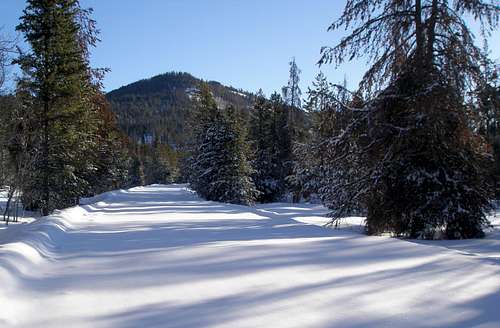
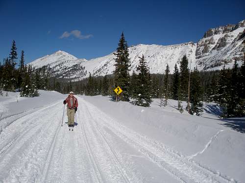
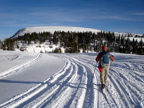
![Mirror Lake Highway]() 9:05am--Pristine snow on the Mirror Lake Highway
9:05am--Pristine snow on the Mirror Lake Highway
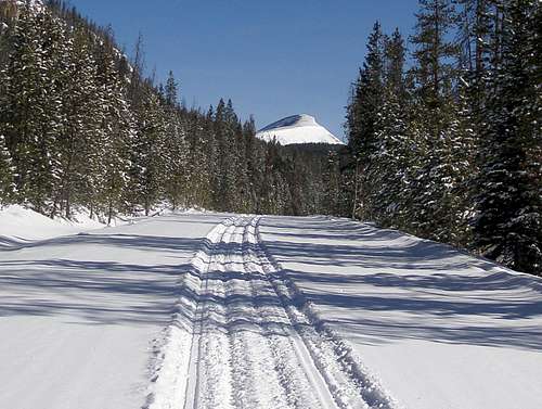
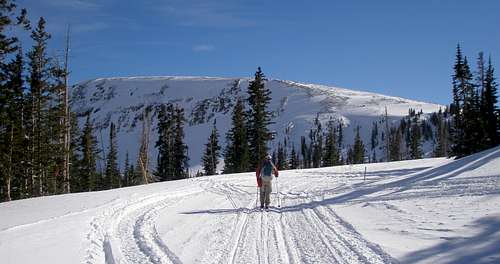
![Mirror Lake Highway]() 10:41am--Finally, someone shows up (Bald Mountain, 11943')
10:41am--Finally, someone shows up (Bald Mountain, 11943')
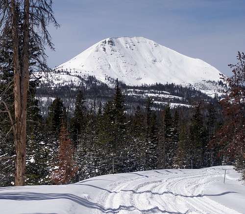
![Mount Watson]() 1:16pm--Lots of tracks now (Mount Watson, 11521')
1:16pm--Lots of tracks now (Mount Watson, 11521')
I skied almost all the way to the pass, but left the road shortly before MM 29 and made a beeline for Murdock. From Murdock I skied through the Wasatch County Highpoint, over to Cardwell, and then back to the highway at about MM 28, and then back to my car at MM 14.6. The whole thing was about 32 miles round trip and took just over 12 hours. Again I had to push on the way down on the road even though I had over 2,500' of descent. It was quite cold and dark by the time I got back to the car at 8:25PM.
2012
At this point I vowed I would never ski on the highway again in bad conditions, but I got the notion in my head that I would someday ski the whole thing, 34.1 miles from one gate to the other, over Hayden Pass (10347') and over Bald Mountain Pass (10720'), with a side trip to Murdock Mountain (11212') thrown in. Ideally it would be from the Evanston end to the Kamas end since the Evanston end is 500' higher, 8300' vs 7800'. After 3 years of forgetting how slow my previous descents had been I was ready to try it in 2012. However, the day I had available was even worse than my two previous trips, not only would there be new snow, it would start out snowing, and was supposed to be very windy as well. I knew the conditions would be crappy, but again, there was nothing else I felt like doing, so I gave it a shot. I was realistic however, and didn't think I'd make it so I started at the Kamas side since that is an hour's closer drive. I had a SPOT that my husband was monitoring and if indeed I went over the pass, he'd pick me up on the other side. I got started at 7:30 and had to break trail until 10:20 when the first snowmobile showed up.
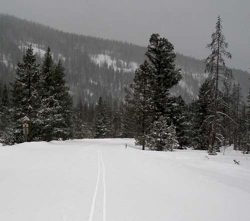
![Mirror Lake Highway]() Dismal day, looking back at my track at 10:13am
Dismal day, looking back at my track at 10:13am
As before, it still felt like I was breaking trail while in their tracks, but it was much better than if they hadn't been there at all. It took 6 hours and 25 minutes to ski the 15.5 miles to Bald Mountain Pass. The wind was howling and the snow was blowing and long before I got there I had given up any thought of climbing Murdock or continuing down the other side. The problem is that you don't go just down, there is another lesser pass, Hayden Pass, about 5 miles from the first pass that you have to go over too and it would probably be nasty the whole way in between. It took a very slow 3 hours to get back to the car.
2014
So this time, I really, really vowed not to ski the highway again unless the conditions were absolutely perfect, old slick snow, minimal wind, not too cold, not too warm, and a weekday to minimize snowmobiles. My friend Glen was interested in doing it too, but had no waxable skis, lightweight or otherwise. I volunteered my husband's gear and fortunately the boots fit. I don't know anyplace that rents waxable skis anymore so renting was not an option. Glen, like most people, was otherwise occupied Mon-Fri, so my weekday plan went out the window. In Utah, Saturday is the day most people recreate, since many of the local population spend 3 hours in church every Sunday. I drew the line at going on a Saturday, fearing it would be one snowmobile after another the whole way, so Sunday it was. The problem was that both of us had Sundays tied up until February 9, and 31 inches of snow fell between the 7th and the 9th. I may be stupid, but I'm not that stupid. The next day we could both make was the 23rd, and in between the two dates, there was really no day when conditions were good anyway. It was either snowing, too warm for good glide, or too windy. The 23rd didn't look all that good either, but it was warming up so fast I was afraid that if we didn't do it then, we wouldn't find a cold enough day for the snow to refreeze for the descent.
There are 5 terms I have seen the National Weather Service use to describe wind speed--calm, light and variable, breezy, windy, and blustery. On the 22nd, they had the 23rd pegged as blustery. Well, there went my minimal wind condition. There had been a small chance of some light snowfall the day before so I was keeping an eye on the snotels. Things looked good, things looked good, and then boom it started snowing late in the day through the night, managing to pile up 5 inches at 10,000', with presumably more above. Grrrrrr! Oh well, so much for the old slick snow. It for sure wasn't going to be too cold, but the high was supposed to be 40 at the lower elevations on the road and if it didn't refreeze, it was going to be a long slow slog downhill.
Glen and I were supposed to meet at 6:10am, but I was a little late because every minute or so on the way there I had to rummage through my stuff to make sure that I hadn't forgotten something. Glen drove because my martyr of a husband, Joe, was going to pick us up at the Kamas end and then we would all shuttle Glen back to his car on the Evanston side. Joe would monitor our SPOT track to figure out when to leave our house and to make sure that we didn't turn back and actually needed picking up. There is no cell phone coverage in the area. We got to the trailhead about 8:10 and even though there were a few cars parked, there was no one else around. We were at the gate ready to go at 8:30, welcomed by a fresh inch of dry powder, not enough to have to trail break through, but enough to slow down the glide.
![Mirror Lake Highway, Evanston End]() The start at the Evanston end
The start at the Evanston end
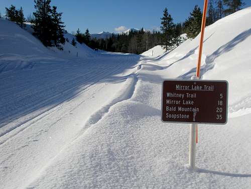
And so we began our 34 mile trek. The sign said 35, but they were off by one. The road started out almost completely flat, and we had about 5 very easy miles. The Evanston end has some nice views at the beginning, unlike the Kamas end where you have to go at least 10 miles to see much besides trees.
![Mirror Lake Highway]() We are headed 15 miles past the mountains ahead.
We are headed 15 miles past the mountains ahead.
An hour into it, we were passed by our first group of snowmobilers, but they quickly turned off onto a side road. It was a couple more hours before anyone else passed us as the snow started to deepen and Glen expressed some concern at what it would be like at the pass. I told him that surely someone would get there before us, and finally one crop of snowmobilers after another passed us. They were all very nice and most waved. Yet, now the snow was choppy and not really any easier to go through than before.
![Mirror Lake Highway]() A nice forested stretch
A nice forested stretch
![Mirror Lake Highway]() Unnamed peak 11340
Unnamed peak 11340
After about 10 miles the grade steepened and our pace slowed a little. Up to now we had been doing better than 20 minute miles but now it was more like 22 minutes. The day had started cold, in the low teens, but now it was pretty warm and my wax was starting to slip even though Glen had no complaints. I had to stop twice to put on some stickier wax and those were two very slow miles, taking almost 1/2 hour each. Glen waited for me at each mile marker and he was in front 99.9% of the time on the road. I would have guessed 100%, but I found the picture below. I think I said "Hey, let me get in front of you to take your picture."
![Mirror Lake Highway]() Kletting-Hayden Ridge
Kletting-Hayden Ridge
I kept expecting it to get super steep as we neared Hayden Pass (about MM 34.5) since it seemed so steep in a car, but it never did. It was all moderate, and with the right wax, our skis gripped fine. There was no going back now. No matter what it would be easier to press onward. The downhill from Hayden Pass was not much of a downhill and certainly not the effortless glide that had been hoped for, as it wasn't very steep at all and the snow was quite soft. Yet, the next 4 miles went by relatively fast as they were either slightly downhill or close to flat. Mile markers 34 and 32 must have been buried under snow because we never saw them. As the trees thinned out it started to get windier and windier, but because it was so warm, it wasn't so bad.
![Mirror Lake Highway]() Murdock lies ahead.
Murdock lies ahead.
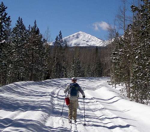
After a moderately steep uphill, we finally reached Bald Mountain Pass, the highpoint of the road at about 10,700'. It was pretty windy and Glen was somewhat indifferent to doing Murdock, saying he was okay either way, but I really wanted to do it. After all, this is summitpost, not x-country ski post, so I had to get a summit in somehow. We skied to a small clump of trees to get out of the wind and put our 50mm kicker skins on. I sensed Glen wasn't really into it since he asked "how far is it?" (.7 miles) and "how much do we have to climb?" (500'), but he was a good sport. Our skinny 60mm skis did just fine through the new snow. There were no snowmobile tracks to help us here. I led the way and it seemed like we were there in no time at all. The summit is typical Uinta style with a large flat area so it was kind of hard to tell where the actual top was, but we made our way to both a cairn and what looked like a slightly higher little clump of trees. It had taken 7 hours and 45 minutes to get here and we had traveled about 20 miles. We kept our skins on for the rocky part of the descent and then it was a delightful ski down through soft powder back to the road.
![Hayden Peak]() Kletting, A-1, Hayden, E Hayden, and Agassiz from Murdock
Kletting, A-1, Hayden, E Hayden, and Agassiz from Murdock
![Bald Mountain]() Bald Mountain from Murdock
Bald Mountain from Murdock
![Mirror Lake Highway]() Heading down towards Kamas from Bald Mountain Pass
Heading down towards Kamas from Bald Mountain Pass
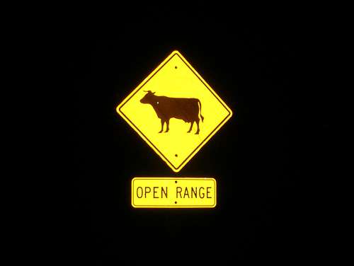
Now was the moment of truth, would the remaining 15 miles down 2900' from the pass be fun, or would they be a tiring slog? The sun was still shining brightly on the road so at first the glide was a little slow. We took a break to let things cool off a bit. When we started up again it was still a little slow, but once the sun was off of the highway it froze up fast and we made good time. In a couple of steeper sections I even had to snow plow, but looking at Glen's track, he appeared to just have his skis pointed straight downhill. The last few miles were in the dark, and I had given up looking for the mile markers. Instead, I was looking for a picture of my favorite cow which was positioned shortly before the gate, and finally, there it was and I knew I'd be at the gate in minutes.
![My favorite cow]() My favorite cow
My favorite cow
Now I had to wonder, did SPOT work and would Joe be there waiting. It would be pretty grim if he wasn't as we'd have a 14 mile walk in ski boots to town and there is no cell phone coverage until you get there. There he was, hallelujah! It was 7:30pm, 11 hours after starting. It's always nice to complete a trip that you've thought about doing for years. Conditions weren't perfect, but they were good enough.
So, will I ever do this again? Sure, if there's old slick snow, no wind, perfect temps, a weekday, and I'll throw in one more condition, that I'm the first person to hit it after the once a week grooming.


Comments
Post a Comment