|
|
Route |
|---|---|
|
|
33.38736°N / 116.95549°W |
|
|
Hiking |
|
|
Most of a day |
|
|
Class 1 |
|
|
III |
|
|
This is the most common route to Eagle Crag. Almost the whole route is on good trail. However, there are a couple of (thankfully marked) tricky junctions you need to pay attention to, or you could end up in a bad place. The hike is 18.5 miles long, with about 4,200 ft of elevation gain.
A very strong hiker could finish in 7-8 hours. Most reasonably fit and experienced hikers (i.e. the average SP reader) will take 9-11 hours. Someone who is not fit may take 12-13 hours with perseverance.
Overview
This is the main route to Eagle Crag. It is a buggy, poison oak-filled mess. But it will get you to the top of this wonderfully remote peak with the least amount of effort.
Getting There
From wherever you are, you need to get to the Cutca Trail TH. On Highway 79, turn onto Forest Road 8S05. As of 2018, the beginning of the road is paved and forms the entrance to the Rancho California resort. Continue to 5.4 miles to the trailhead, which is at an elevation of 3,794 ft.
The road turns into dirt after it passes the resort. 4x4 is helpful but unnecessary. High clearance is strongly recommended. Along the way, you will hit a gate; most of the time it is open, but if it is closed, you will have to hike up the road (or turn around). If you choose to hike up the road, it adds about 1,100 ft of elevation again and 5 mrt to your hike.
Route Description
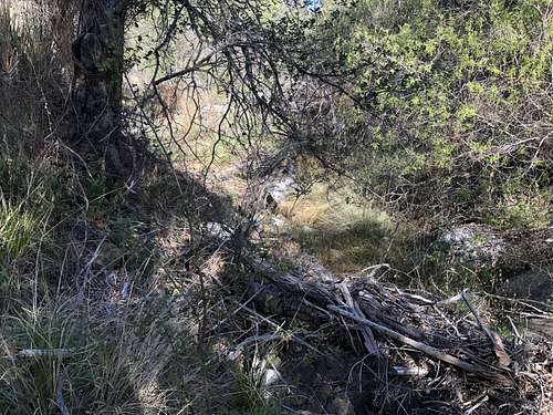
From the trailhead, follow the trail down to Cottonwood Creek. The trail then undulates its way over to an obvious trail junction. There may be signs here. Continue west, then northwest into the Cutca Valley. Here you are walking along a wide road. Before long, hit another highly visible (but less obvious) junction. There may be a sign here as well. Head slightly southwest into a drainage. This drainage would be pretty if it weren't for all the poison oak, bugs, and deadfall. Follow the trail to the top of drainage. At some point the bugs and poison oak will become less of a problem, and the riparian foliage will be replaced with manzanitas and other chaparral plans. Pines will start to appear. A lengthy climb will bring you to a big junction with the Palomar Divide Road.
From this junction, continue west for about 1000 feet. There is a big gully here marked with a big cairn. Go up this gully, following an obvious use trail. The gully levels out onto a big sloping plateau. Look for a high point to the west-southwest containing a lone tree on top, and make your way there.
Return the way you came.

Essential Gear
Bring your 10 Essentials, and enough supplies to last you a whole, strenuous day, and possibly more. Trekking poles may help with the descent down.
