|
|
Route |
|---|---|
|
|
52.99185°N / 4.01962°W |
|
|
Hiking, Scrambling |
|
|
Spring, Summer, Fall, Winter |
|
|
Most of a day |
|
|
Overview
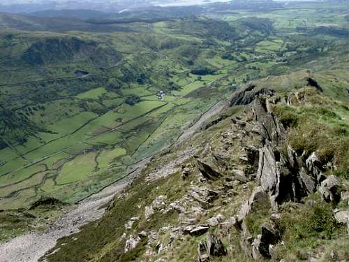
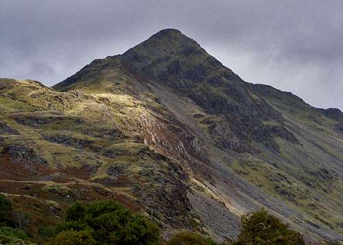
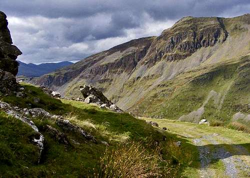
| Cwm Croesor is arguably one of Snowdonia’s finest valleys. Nestled in the south western Moelwynion, it is overlooked by the dramatic forms of Cnicht and Moelwyn Mawr, which although not large mountains, have a prominence that belies their short stature. The Cwm Croesor Horesehoe takes you up the former of these peaks, and the latter can be bagged too, if you are willing to add an unaesthetic dogleg to the route. The ascent of Cnicht is in fact a worthwhile objective in its own right, with its south-western ridge offering a satisfying mixture of trail and easy scrambling. This is a landscape that felt the brunt of the industrial revolution; a bustling slate mining industry once thrived here, the relics of which are now being slowly subsumed by nature. Today, the area is far more tranquil. The industrial detritus gives it an eerie quality and as you tread this route you, will be aware of the countless lives that were made and broken here. This is probably the route’s strongest quality, as it takes you through an area of unique character. |
|
|
|
Peaks and archaeology are not the only attractions this route has to offer; Cwm Croesor is home to one of Wales’ two Osprey (Pandion haliaetus) breeding sites and in the summer month’s there is a reasonable chance of spotting the birds. There is therefore much to recommend this route, especially to those who have an interest in Wales’ industrial heritage. Even if you have no such interest, the chance to lap up the area’s unique character and innate tranquillity should not be missed. |
Getting There
|
Cnicht is located in the southern Moelwynion, between the valleys of Nantmor and Gwynant in the west and Cwm Croesor in the east. The route starts in Cwm Croesor. The Cwm may only be reached from the south. If you’re coming from the east therefore, leave the A487 in Penrhyndeudraeth (SH 611 389) and take the A4085 north in the direction of Beddgelert (SH 590 481). Just after the village of Garreg (SH 612 416), there is a right hand turn (SH 614 420), which is signposted for the village of Croesor (SH 630 447). The village is reached after around 3km. Park in the small National Park run car park in the village. The route starts and ends here. |
Route Description
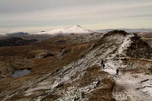
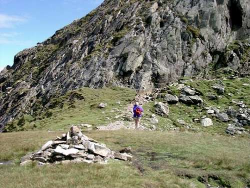
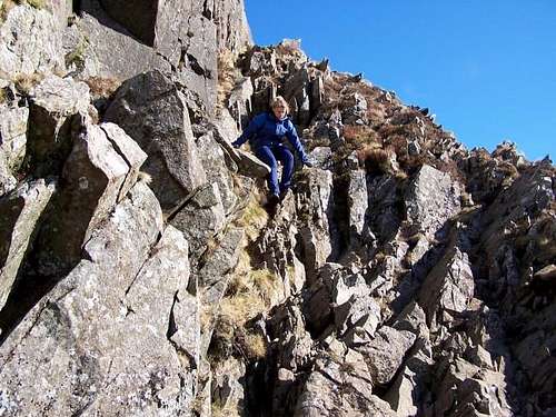
Leave the car park and turn right to walk through the village, pass an old chapel on your right and continue up the road until it ends at an iron gate and s stile (SH 629 448). Cross the stile and follow a gravel track, which after about 300m will bring you to a fork (SH 628 450). Take the right hand track and follow it for around 700m, crossing two ruined drystone walls. Just before the track crosses a third wall, a footpath shoots off rightwards from the track (SH 632 455). This is the path that follows Cnicht’s southwestern ridge and it is this path you need to take. The path has a relatively shallow gradient at first but steepens and becomes less distinct as you climb. The navigation is not however difficult as all you have to do is follow the apex of the ridge directly to the summit (SH 629 448). The ridge is a mixture of walking and easy scrambling and is a joy to ascend. The summit is reached after about 1.5km and is the highest point on the route.
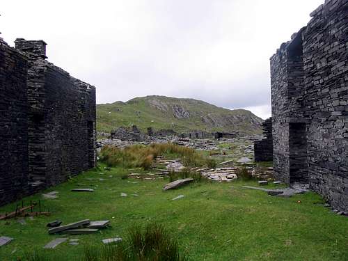
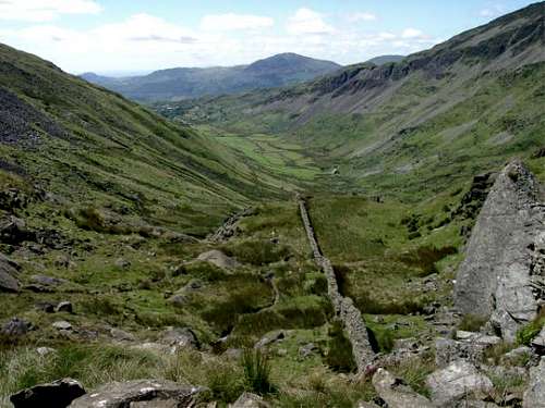
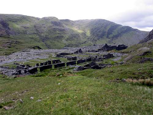
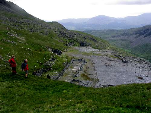
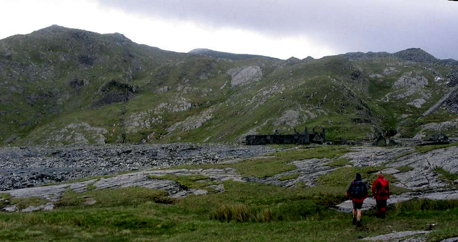
Take this path, turning right to walk in a southwesterly direction around the headwall of Cwm-y-foel. Follow the path, passing the small lake of Llyn Cwm-corsiog (SH 663 470) on your left. After about 2km you will reach the former Rhosydd Slate Quarry (SH 665 462). The Rhosydd Slate Quarry is an incredible place and in terms of archaeology is the highlight of the route. Here you will find ruined buildings, former tramlines and abandoned adits and even the mangled, rusting remains of engines and machinery. Mining first began in the 1830s, though the mine was not seriously worked until the 1850s when the Rhosydd Slate Company was established. Operations finally ceased in the 1930 when the quarry was mothballed, though it would not be until 1948 that the machinery was scrapped and from 1949 to 1954 slates were made from the demolished walls of the remaining buildings.
Croesor Quarry was mined between 1850s and 1878, and from then between 1895 and 1930. After its closure underground chambers excavated for their slate were used for the storage of explosives until the 1970s. Today only the ruins of the mill and the incline drumhouse survive. There is also a World War II era type 26 pillbox just above the quarry, which can be seen from the path.
|
Essential Gear
|
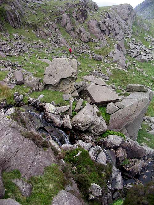
The route can be done at anytime of the year, however in poor conditions it may be best avoided as Cnicht is very exposed to the elements. April to September offer the most reliable conditions and one will need all the equipment one usually carries for a day in the mountains, which in Wales means full waterproofs and sturdy boots as a minimum. If you’re lucky enough to climb the mountain in winter conditions then an ice axe and crampons would be very useful. |
|
| Rhosydd Quarry and Moelwyn Mawr behind (Photo by Nanuls) |
Maps
Guidebooks
|
|


External Links
Snowdonia National Park Authority Association of National Park Authorities Royal Commission on Ancient & Historical Monuments in Wales Hiking, Climbing and Mountaineering Organisations and Companies British Mountaineering Council Plas y Brenin National Mountain Centre Weather Tourist Information North Wales Tourism Partnership Local Information from Gwynedd.com Local Information from Snowdonia Wales Net Travel Welsh Public Transport Information Accommodation Youth Hostel Association in Wales Maps and Guidebooks Cordee Travel and Adventure Sports Bookshop Wildlife and Conservation |