-
 19356 Hits
-
 87.31% Score
-
 24 Votes
|
|
Route |
|---|---|
|
|
46.37976°N / 12.05304°E |
|
|
Trad Climbing |
|
|
Summer |
|
|
A long day |
|
|
5.10a (YDS) |
|
|
ED, VI+ |
|
|
40 |
|
|
Overview
Diedro Philipp - Flamm (Punta Tissi)
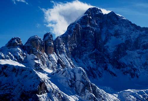
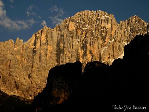
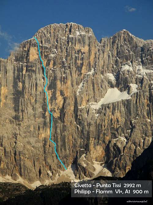
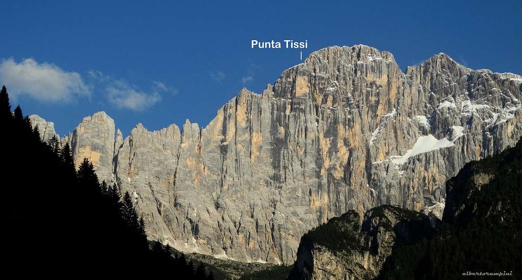
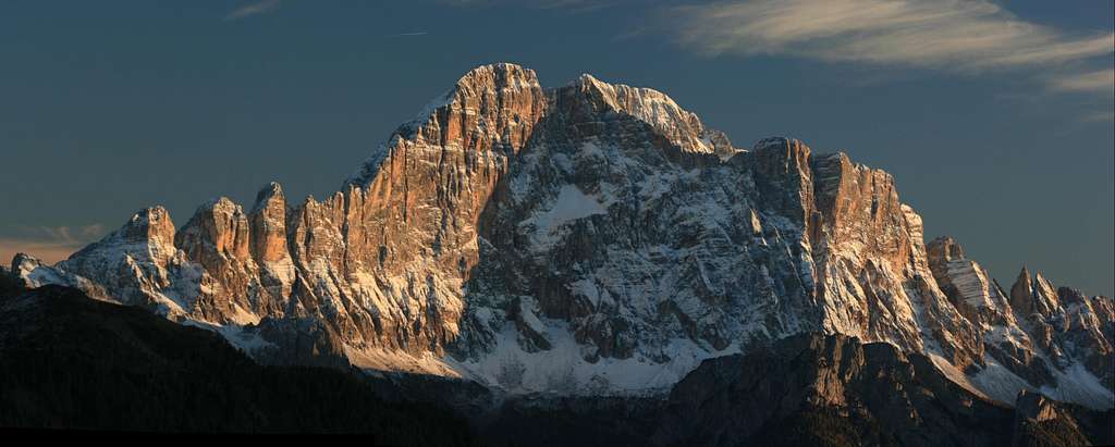
The majestic North-West wall of Civetta, best known as "the wall of walls" and located in the extensive Civetta group, projects a protruding pillar ending on a marked shoulder along Civetta North ridge. This high pillar forms with the main wall a huge dihedral 900 meters drop, which become famous as Diedro Philipp-Flamm or simply Philipp-Flamm.
It was the famous enterprise accomplished by the two Austrian climbers Walter Philipp and Dieter Flamm in 1957 - for decades considered one of the most daring and challenging climbs of the Dolomites and the entire Alpine region - to give importance to this shoulder, which is now considered as an autonomous peak called Punta Tissi 2992 m. A huge dihedral gives the line of the route, divided into three main parts: the lower one is a succession of cracks on the right wall of the main dihedral, the middle runs along the bottom of the wide dihedral, the upper one climbs a deep chimney. The route is considered a true milestone in the history of mountaineering. Even today it remains a great challenging route, which must be reserved to skilled teams and absolutely climbed with favorable weather forecast and good condition of the wall, as most of the routes running on Civetta North-West wall.
History
From 5th to 7th September 1957 the Austrians Walter Philipp and Dieter Flamm realized one of the symbolic routes on the great North-West wall of Civetta and of the whole Dolomites: Diedro Philipp-Flamm, following a fantastic dihedral which affects the middle part of Punta Tissi. Some hystoric info about:
First ascent: Walter Philipp and Dieter Flamm, 1957 5th to 7th September
Second ascent: Claude Barbier and Ernst Steger 1961, September 4th-5th
First solo ascent: Reinhold Messner, 1969 August 2nd

|

|
Getting there
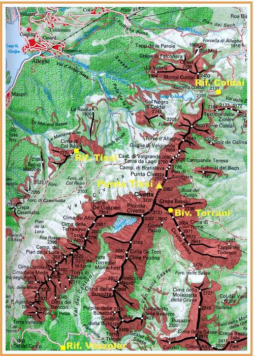
The starting point to approach the wall is the Rifugio Coldai 2132 m or alternatively the Rifugio Tissi 2262 m. Starting from Rifugio Coldai is maybe the most convenient way to approach, but there is the disadvantage of not being able to observe the conditions of the wall, not visible from this hut.
Road approach
- From Belluno to Forcella Staulanza – Take the road S51 towards Pieve di Cadore and Longarone; here leave the main road and follow on the left the road S251 towards Forno di Zoldo, Zoldo Alto, Palafavera and Forcella Staulanza (55 km. from Belluno).
Walking approach to Rifugio Coldai 2132 m
- From Forcella Staulanza: from the col descend along the Zoldo side to the first hairpin, where it starts a dirt road (marked 568) getting to Casera del Vescovà. Follow the path n. 561 to Forcella d'Alleghe, Casera Pioda, then the path 556 to the shelter (1,45 hours).
- From Palafavera: follow the gravel road (n. 564) starting near the camping and rising with some hairpins to Malga Pioda m. 1816, then a good path (n. 564) leading to the shelter (2 hours from Palafavera).
Route Description
Philipp-Flamm route report - UIAA SCALE
Summit altitude: m. 2992
Climbing length: 1000 m. + 150 m. on the summit ridge
Equipment: the pegs at belays are on site, as well as some pegs along the pitches, needed quick protections to integrate
Exposure: North-West
First ascent: Walter Philipp and Dieter Flamm, 1957 5th to 7th September
Starting point: Rifugio Coldai or Rifugio Tissi
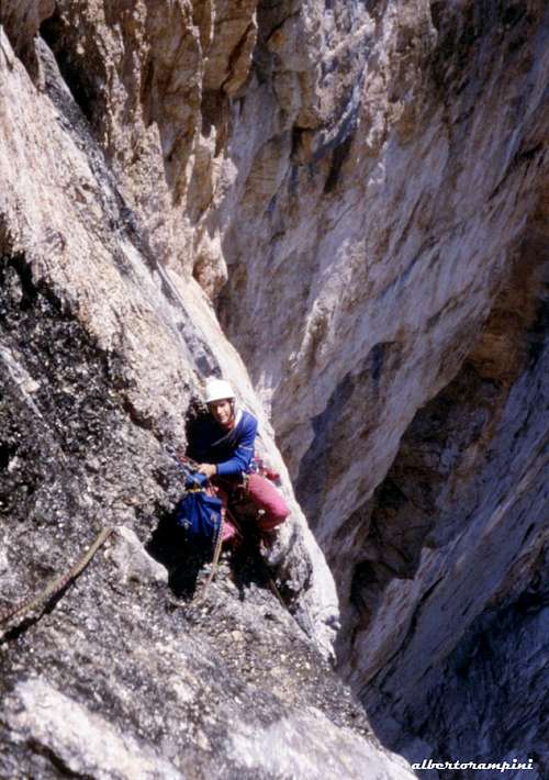
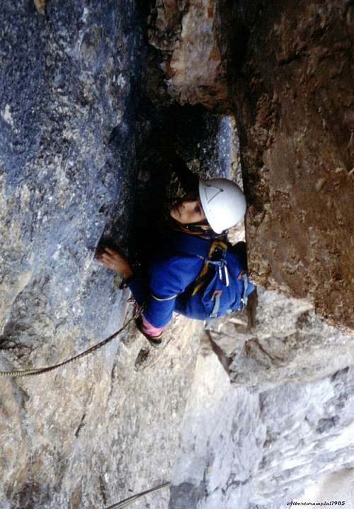
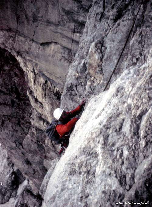
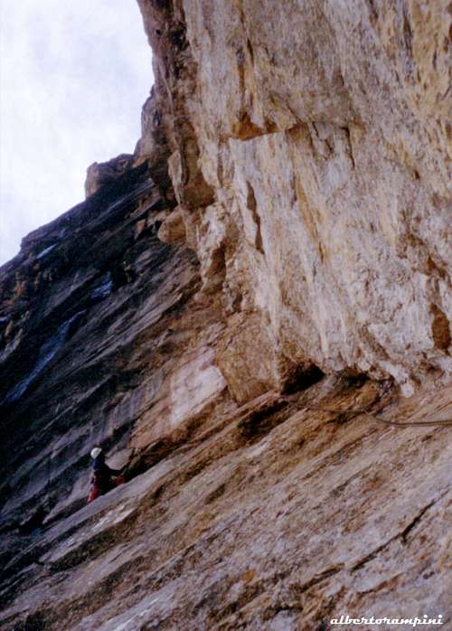
A long long challenging climb and one of the greatest exploit of the Dolomites! The route begins slightly to the left of the Messner, following a line of yellow-black dihedral for about 1000 meters with long stretches of VI and VI+ UIAA to the summit of Punta Tissi. Here it's reported the full description of all the 40 pitches of the route.
Approach to the route
From Rifugio Coldai cross the Forcella Coldai 2191 m and descend into the basin where it's located the Lago Coldai. Bypassing the small lake on the left, climb up to another saddle and then to Forcella di Col Negro 2249 m, continuing along the path that mostly horizontal crosses the scree slope below the huge wall. Getting below Punta Tissi leave the trail and climb up along the steep scree, heading towards the base of a gully rising leftwards to a large cave (1.30 hours from the refuge). Climb up the gully with some move grading IV UIAA, 85 m
L1 - Traverse a bit leftwards, pass an overhang and continue on a dihedral-crack, IV+, V, 40 m. L2 - Up the dihedral again, then climb a slab and a chimney, IV, V, 35 m L3 - Climb a crack, then up a ramp covered with debris, IV+, 30 m L4 - At first head to the left, then up a chimney on a pinnacle, IV, 35 m L5 - Traverse leftwards, getting the huge dihedral, follow it about 10 meters, then traverse rightwards on a corniche to reach the crack and climb it, IV, V, 30 m. L6 - Up the crack again, then slanting left come back to the diheedral above some steps, IV, V, 30 m. L7 - Slanting right up to a terrace, IV, IV+, 30 m L8 - Slanting left along a series of chimneys, overcoming an overhang, IV+, V+, 30 m L9 - Up another chimney, then traverse right to an edge and heading right reach a terrace, IV, V, 25 m. L10 - Up on the right of chimney for about 15 m, then cross the bottom of the chimney, climb a parallel crack and slanting left reach a stance, V, IV, 40 m
L11 - Up on the left of the dihedral, then climb the same dihedral, V, IV, 30 m L12 - Follow again the dihedral, V, V+, 15 m L13 - Follow the dihedral, then a chimney, V+, VI, 30 m L14 - Climb the chimney, then the dihedral and bypass an overhang on the left on a slab V, VI, 30 m L15 - Climb the dihedral just under a large roof, V, VI, 25 m - First ascent bivy L16 - Traverse to the left under the roof, then up a chimney, VI, V+, 20 m L17 - Move slanting left, then up a thin crack on the left of the main dihedral to a deep horizontal niche, V+, A2, 35 m L18 - Climb to the right of the niche, then traverse leftwards along its yellow border, V+, VI, 30 m L19 - A thin crack slanting left leads inside a gully, V+, A1, 25 m L20 - To the right up a pinnacle, II, III, 25 m
L21 - Slanting right heading to a big roof located 50 meters above, IV, 40 m. L22 - 25 m. slightly downclimb along a crack, then slanting right in the direction of the roof, then leftwards inside a gully, V+, VI, 25 m. L23 - Slanting right then climb some steps below a chimney, III, IV+, 25 m L24 - Slanting left follow a corniche to a spur, III, IV, 20 m L25 - Up a series of chimney, III, IV, 20 m pitch in common with route Comici L26 - Again chimneys, V, IV, 15 m. another pitch in common with Comici L27 - Again chimneys, III+, IV, 25 m. a third pitch in common with Comici L28 - Still follow the chimney, V, IV, 15 m L29 - Horizontally under a roof, then to the right to get a stance, V, IV, 25 m L30 - Up the chimney, V, IV, 25 m L31 - Pass under the embedded blocks (characteristic hole), V-, 15 m L32 - Climb a slab, then a dihedral, reaching a ledge, V-, V, 25 m L33 - The chimneys forks, follow the right branch to an overhang, then traverse rightwards to a niche, V+, V, 20 m L34 - Traverse right on reddish rock to a chimney, IV+, 20 m L35 - Overcome an overhang above a block, V, V+, 30 m. L36 - Climb the left dihedral for about 15 m, then traverse left to take the rib that divides the two chimney-gullies, IV+, 30 m. L37 - Climb the rib, then enter the nearby gully that leads to a large roof, III, IV+, 15 m. L38 - Follow a thin crack rising slanting right, bypass the roof to the right and then back to the left in the gully, A1, A2, V+, 15 m L39 - A slab and a dihedral inside the gullyreach a ledge, IV, V, 30 m L40 - Up a slan to the left of the dihedral and overcoming some blocks reach the summit, IV+, 40 m.
Descent - Long, but not challenging. Just below the summit of Punta Tissi, we find the "Via Ferrata Alleghesi", following this route we descend the East side and reach the Tivan path. Following the trail we come back to the Rifugio Coldai.
Essential Gear
In addition to the normal complement mountaineering gear, bring an hammer and an assortment of pegs, stoppers and friends
Red Tape
There are no particular restriction in climbing.
Hut
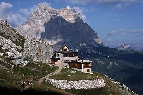
- Rifugio Coldai 2132 m - The hut is situated at the Northern end of the Civetta Group on Val di Zoldo side - C.A.I. Venezia, 83 beds, open from June 20th to September 20th
- From Forcella Staulanza: from the col descend along the Zoldo side to the first hairpin, where it starts a dirt road (marked 568) getting to Casera del Vescovà. Follow the path n. 561 to Forcella d'Alleghe, Casera Pioda, then the path 556 to the shelter (1,45 hours).
- From Pala Favèra (m. 1505) – Follow the gravel road starting near the camping and rising with some hairpins to Malga Pioda m. 1816, then a good path leading to the hut (2 hours from Pala Favèra) – It’s the shortest way to get the hut
- From Alleghe – Follow the road to Piani di Pezzè (m. 1470), then the narrow gravel road rising to Forcella d’Alleghe and to Malga Pioda m. 1816. From Malga Pioda follow the same path as the previous approach (3 hours).

- Rifugio Tissi 2250 m - The hut is situated on Col Reàn, in a panoramic position over the NW wall - C.A.I. Belluno, 45+20 beds (+12 in the winter shelter), open from June 20th to September 20th in summer and autumn
- From Masaré (Alleghe) 1009 m - Take the path 563 to Casera and Forcella Casamatta, then Cresta del Col Reàn (3-3.30 hours)
- From Refuge Coldai - Take the path n. 560 to Forcella Coldai, Lago Coldai and Forcella di Col Negro 2203 m. and before reaching Forcella di Col Réan take on the right the path 563
When to climb
Best season goes from the end of June to middle September
Meteo
Guidebooks and maps
- Guidebooks
The late complete and updated guidebook is:
"Civetta" by Ivo Rabanser - Collana CAI-TCI Guide dei Monti d'Italia, 2012 june
Other historycal guidebooks:
"Civetta" by Oscar Kelemina - Scuola di Alpinismo C.Capuis, CAI Mestre, 1984
"Civetta-Moiazza" by Vincenzo Dal Bianco - Giovanni Angelini - Tamari Editori, Bologna 1984
- Maps
- Tabacco map 1:25000 n. 25 "Dolomiti di Zoldo, Cadorine e Agordine"
- Kompass map 1:50000 n. 77 "Alpi Bellunesi"
External Links


