Overview
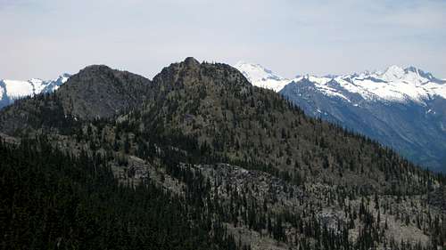
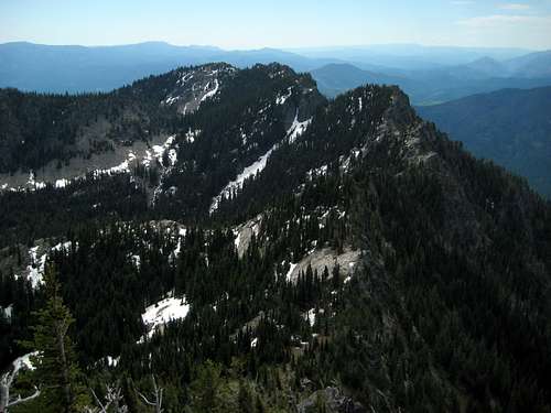
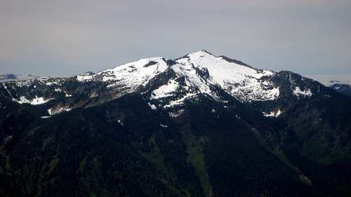
![Dirtyface Peak and Point 6223 from Dirtyface Lookout site]() Dirtyface Peak and Point 6223 from Dirtyface Lookout site
Dirtyface Peak and Point 6223 from Dirtyface Lookout site
Well, after putting it off for years, I recently decided to have a go at Dirtyface Peak. Reading trip reports had made the options for scaling this peak sound so offensive that I kept making excuses for not doing the scramble (despite the impressive 3360' of prominence). It seemed that the only reasonable options were the hike up from Lake Wenatchee and traverse (huge elevation gain), or what has become known as the Northeast Route and its variations (a maze of brushy logging roads).
Certain that there had to be a better way, I consulted several different maps (along with Google Earth), and found some possibility in approaching the Dirtyface trail from logging roads on Pole Ridge. Initial inspection on the morning of our climb verified that all but the last mile of road on Pole Ridge was in good condition, with only the last mile requiring four wheel drive.
When all was said and done, the route we chose put us on the summit in less than 2.5 hours, with mostly class 2 scrambling. Additionally, elevation gain was modest when compared to the 'normal' routes. I am fairly certain that this is the easiest and simplest route up Dirtyface Peak, until someone convinces me otherwise.
Getting There
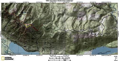
![The 'Easy Way' up Dirtyface]() The 'Easy Way' up Dirtyface
The 'Easy Way' up Dirtyface
From Coles Corner on US2 (14 miles 'west' of Leavenworth), follow Highway 207 north for 4.5 miles to the Chiwawa Loop Road. Turn right on Chiwawa Loop Road, and and follow it for 1.2 miles to Chiwawa Road. Turn left on Chiwawa Road, and follow it for 2.4 miles to FR6300. Follow FR6300 for 2.2 miles to FR6305. Follow FR6305 west up Pole Ridge, ignoring spurs, for 5.2 miles. At this point (N47 51.208 W120 45.641 Elev. 3740'), you will find a poor quality spur turning off to the left - if you arrive at a locked gate on FR6305, you have gone a few hundred feet too far. At this point, drivers of normal passenger vehicles will want to park. If you are fortunate enough to have four wheel drive, continue on the spur for one mile (stay right after 0.3 miles) to the end of the road (N47 51.420 W120 46.719 Elev. 4180').
Route Description
From the end of the road, continue straight ahead to the northwest, where you will locate a footpath. This unofficial trail will curve to the left, until heading southwest to join the Dirtyface Lookout trail. After several hundred yards, the trail will begin to fade in and out (a fire swept through this area some years ago, causing blowdowns to obsure the trail in spots). As the terrain is fairly free of brush, this is not much of a problem. The idea is to simply contour around at 4200' for one-half mile. Keep your eyes open for frequent flagging tied to the trees, and you should do a fairly good job of staying on route. Just before joining the Dirtyface trail, the path will angle up, joining on a switchback at 4240' (N47 51.166 W120 47.121).
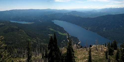
Continue up the Dirtyface trail until reaching a path leading off the switchback at 5480' (N47 51.443 W120 47.602). Follow this path to the crest of the ridge at 5500', where a helicopter landing zone has been cleared (N47 51.477 W120 47.579) - probably to maintain the weather station at the lookout site. If you feel that you must go to the lookout site, refer to the yellow line on the route map above. Note that this option will add about 500' of elevation gain to your day. From the lookout site, you do get a fairly nice view of Fish Lake and Lake Wenatchee.
![Fish Lake and Lake Wenatchee from Dirtyface Lookout site]() Fish Lake and Lake Wenatchee from Dirtyface Lookout site
Fish Lake and Lake Wenatchee from Dirtyface Lookout site
From the helicopter LZ, cross to the other side of the ridge, and make an oblique traverse to the west, dropping about 100' into a creek basin. From this point, continue northwest to an obvious saddle (N47 51.531 W120 48.178 Elev. 5580'). Descend the other side of the saddle - it will be necessary to drop about 200'. As soon as you are around the cliff bands, traverse around the basin above Dirtyface Lake, generally heading in a northwest direction. As you approach the other side of the basin, begin angling uphill, aiming for a point about 0.3 miles southeast of Point 6223 (N47 51.854 W120 48.665 Elev. 5680'). From this point, drop down along the ridge about 30', then back up to the ridge crest and saddle just southeast of Point 6223. If desired, one can make an easy, class 2 scramble up Point 6223 from the saddle.
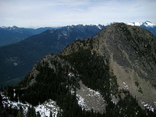
![Dirtyface Peak from Point 6223]() Dirtyface Peak from Point 6223
Dirtyface Peak from Point 6223![Dirtyface Lookout site from Point 6223]() Dirtyface Lookout site from Point 6223
Dirtyface Lookout site from Point 6223From the saddle, make a traverse on the south slopes of Point 6223 at 5750'-5800'. Once around Point 6223, continue northwest along the ridge towards Dirtyface Peak. It is certainly at your discretion, but I recommend starting this last traverse on the southwest side of the ridge, with a transition to the northeast side at the halfway point. The final scramble up Dirtyface Peak has numerous variations possible, all of which will involve some class 3. Nothing too difficult, just choose your route carefully, and watch for loose rock.
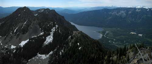
![Point 6223 and Lake Wenatchee from Dirtyface Peak]() Point 6223 and Lake Wenatchee from Dirtyface Peak
Point 6223 and Lake Wenatchee from Dirtyface Peak
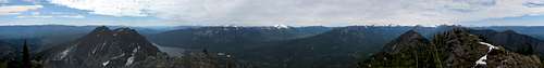
![Dirtyface Peak summit pano]() Dirtyface Peak summit pano
Dirtyface Peak summit pano
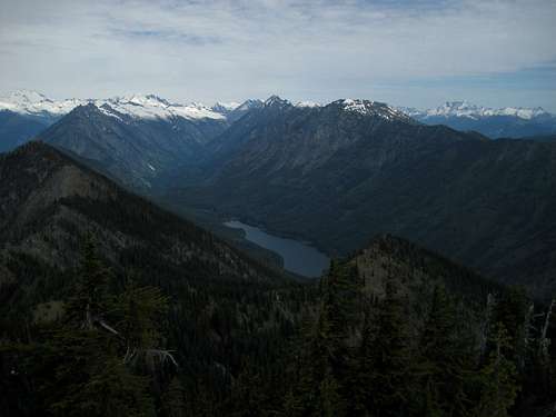
![Twin Lakes from Dirtyface Peak]() Twin Lakes from Dirtyface Peak
Twin Lakes from Dirtyface Peak
![Mount Howard and Mount Mastiff from Dirtyface Peak]() Mount Howard and Mount Mastiff from Dirtyface Peak
Mount Howard and Mount Mastiff from Dirtyface Peak