I left with Joanna on July 27th at 6:00 am from Lynnwood to the North Fork Sauk trail-head with the intention of camping at White Pass where we part ways, climbing Indian Head the next morning, moving to Red pass in the afternoon and then attempt the Painted Traverse counter-clockwise to Black Mountain the following day. The last bit didn't work out since I felt unsafe without snow in the gulley on Black but overall it was a great time out.
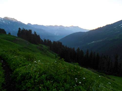
I hadn't had any sleep the previous night since I was talking with my brother Josh and Matt Lemke who had just returned from a long trip in Peru and also some personal stuff I wanted to take care of. The trail miles seemed a little slower since I hadn't been used to packing for multiple days in a while. We arrived at Mackinaw around 10am and took a brief water break before marching up the hot switchbacks to White Pass. I was very surprised to see how many wild strawberries there were all the way up the trail in sunny clearings. They are ripening and very much sweeter than store-bought. We encountered a few people heading out from Glacier peak discussing the amount of snow and flowers up high. The heat slowed me down more than usual but we made the pass by 2pm and took some photos before parting ways. She lent me her satellite phone since I would be solo the rest of my journey and might need help getting back in the odd chance I was alone at the trail-head. Thank you very much for that.
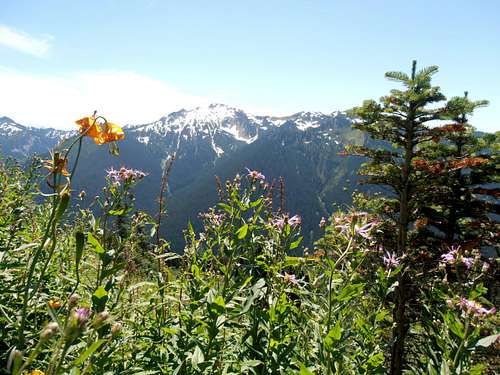
![Flowers and Johnson]() Flowers and Johnson
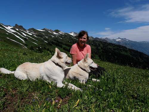
Flowers and Johnson | ![Joanna at White Pass]() Joanna at White Pass
Joanna at White Pass
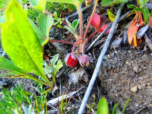
| ![Ripe Strawberries at nearly 6000']() Ripe Strawberries at 6000'
Ripe Strawberries at 6000'
|
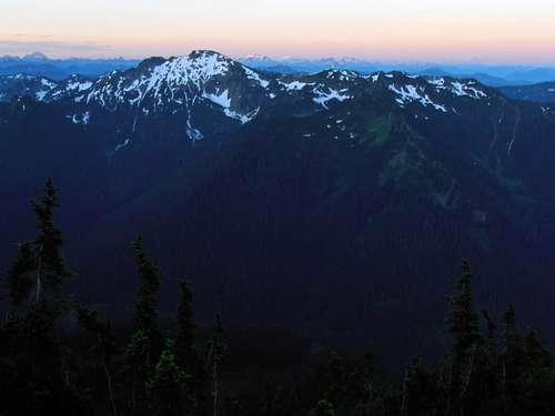
I set up camp and slept the rest of the afternoon waking briefly for supper then sleeping again to catch up on the previous night. The breezes were warm and light. The following morning I awoke about an hour before sunrise and had a quick breakfast of donuts and dried fruit. The suns rays sliced into the earth's shadow in interesting patterns but unfortunately my photography was limited by both my paltry skill and very low battery power. I grabbed a coat, water and Shot blocks and went strait for Indian Head hoping to beat the heat and hide behind it's Western slope on the way up. I enjoyed this section of PCT which had little tarns and sweeping views amongst the trees but few places of running water. I realized it was a mistake not to bring more and hoped there would be some on Indian head.
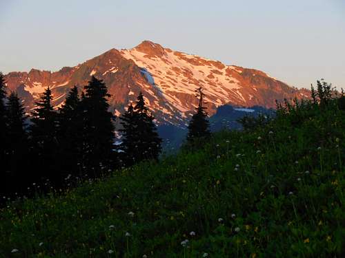
![Johnson sunrise alpenglow]() Johnson sunrise alpenglow
Johnson sunrise alpenglow
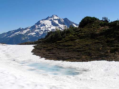
| ![DaKobed blocking sun]() DaKobed blocking sun
DaKobed blocking sun
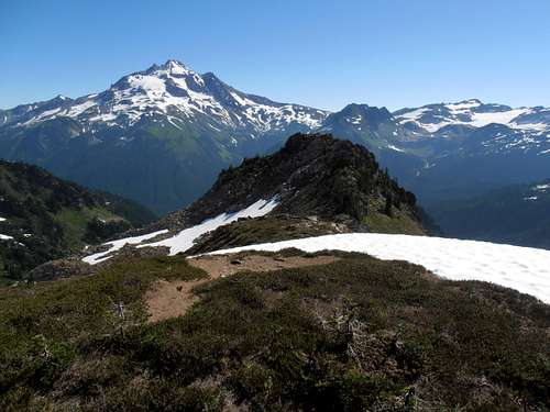
| ![Approaching Indian Head]() Approaching Indian Head
Approaching Indian Head
|
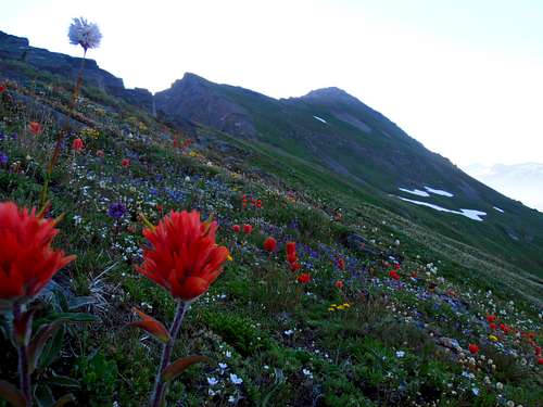
The beginning of the West ridge left on a spur trail that disappears about 100 feet or so up heather and sedge slopes. At first I thought perhaps I was off-route and had a few false starts before committing and gaining the first shoulder at about 6000'. At its junction with the next one it becomes a little knifey with some class 2 and some exposure before melding back into easy flowers or broken rock all the way to the summit. Occasionally on the way I'd be close to some snowfields and, having run out of water, would fill up my bottle with snow. Thankfully it melted rapidly and I did pretty decent with what I had. Flowers were much more vibrant here than at White pass, especially Indian Paintbrush.
![Indian Paintbrush on Indian Head]() Indian Paintbrush on Indian Head
Indian Paintbrush on Indian Head
| ![Indian Head summit looking East]() Indian Head summit looking East
Indian Head summit looking East
|
I poured over the summit register placed by the Mountaineers looking for familiar names and considered another sub-peak to the East that looked like it was potentially higher. After considering my next day's plan I decided against it and headed back to the first shoulder where I detoured heather by glissading down easy snow. I was pretty thirsty and the mountain's shadow was just about no longer providing cool shade so I was very delighted to discover a spring near the spur trail a little North of where I began.
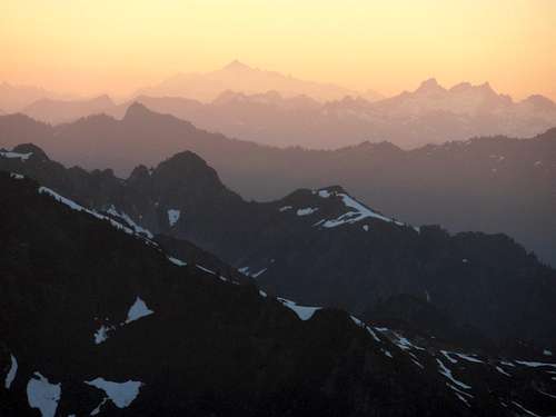
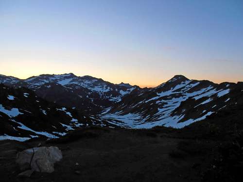
On the way back to White Pass I encountered a PCT section hiker who was headed South for Snoqualmie. He didn't provide much conversation so I assume he was seeking the solitude or wanted to maintain momentum. I looked instead to the company of wildlife. Plenty of whistling marmots and I would occasionally try to whistle back (I can't seem to get that high note though!) There were a few deer that ran away before I could take a blurry picture of them and the heat began to pick up so I just soaked in a creek and lay in my tent with the intention of doing nothing until sunset. At one point it was too hot to think and the bugs began to add to my misery anytime I left the safety of my nylon fortress. I was desperate for a breeze that never came. When the temperature finally subsided a little, I packed up camp and slowly made my way to Red Pass collecting more water on the way.
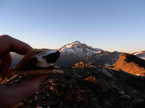
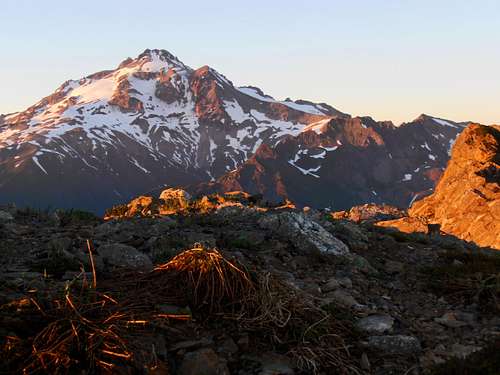
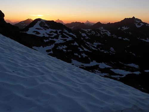
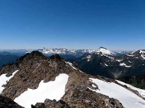
The going was slow in the sun but the setting made me happy enough to get through it. At Red Pass there was noone else camped but since I didn't feel trashed yet I decided to continue to the other side of Portal to give me a head start for the next day. I just needed to find a nearly level and barren rocky spot with snow nearby (conscious of heather and flowers). It took a little searching but eventually I found my perch and pitched camp at a col to Portal's North. The sunset was fantastic and I made s'mores and ramen to celebrate. A quick call to Joanna confirmed my plans and alleviated some of the worries about the next day before I went to sleep. As the stars came out meteors also streaked by in the Southern sky adding to the beauty of the glaciers and green meadows afar. This made sleep a little difficult but it was not unwelcome. Unfortunately I could not photograph it but I have decided I must make a painting of the scene when I can afford the time.
![S'more and Glacier]() S'more and Glacier
S'more and Glacier
| ![Kololo alpenglow from Portal]() Kololo alpenglow from Portal
Kololo alpenglow from Portal
| ![Glacier Peak sunset from Portal]() Glacier Peak sunset from Portal
Glacier Peak sunset from Portal
|
![East from Portal]() East from Portal
East from Portal
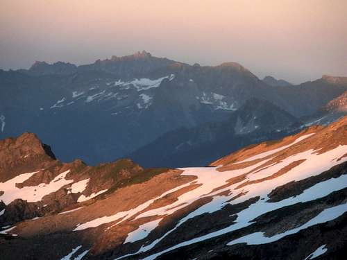
| ![Purples ridges to Shuksan]() Purples ridges to Shuksan
Purples ridges to Shuksan
| ![Painted Traverse Sunset from Portal]() Painted Traverse Sunset from Portal
Painted Traverse Sunset from Portal
|
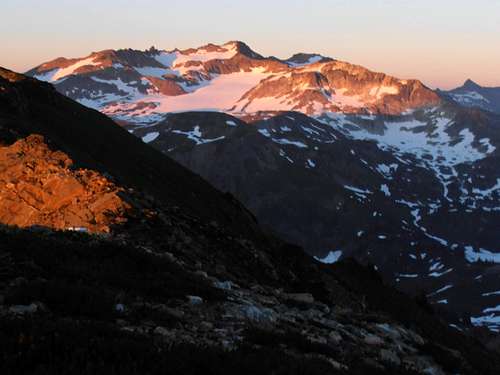
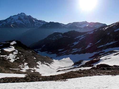
The next day I awoke at predawn and broke down my tent after some more donuts, threw some rocks on it in case of a wind gust and began my traverse over to Black Mountain. My feet were beginning to be in pain and I suspected I was not quite adapted to multi-day travel. At first I was a little nervous about whether following Portal's NW ridge would connect to Purple without becoming technical but it was one of those "things look better when you're right there" situations and turned out to be all easy heather. The suns rays began to cut across the White Chuck Glacier and drew my attention to a giant waterfall coming from one of it's new lakes. I began up Purple on easy snow and followed deer tracks to its summit. Going down the other side started off easy enough and I was happy about my progress until I reached the "easy class 3" which was all down sloping and mossy holds over a 20' drop to precipitous snow. I was not feeling good about it and after spending a few minutes trying to down-climb it I lost my nerve and scrambled back up convinced I needed to find a different way. Unfortunately I had to re-climb the peak to gain a snow field that looked like it would connect to the col on the other side of the 3rd class step and help me bypass it. Going down was quite fun with a several hundred foot glissade and easy snow traverse to the col. Looking back, though I was worried I wouldn't be able to re-climb the snow in the hot afternoon with microspikes.
![Glacier and Kololo from Portal-Purple Gap]() Glacier and Kololo from Portal-Purple Gap
Glacier and Kololo from Portal-Purple Gap
| ![Kololo from Portal-Purple gap]() Kololo from Portal-Purple gap
Kololo from Portal-Purple gap
| ![Route south to Purple]() Route south to Purple
Route south to Purple
|
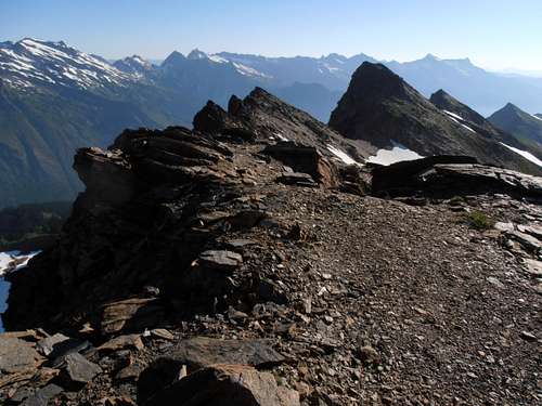
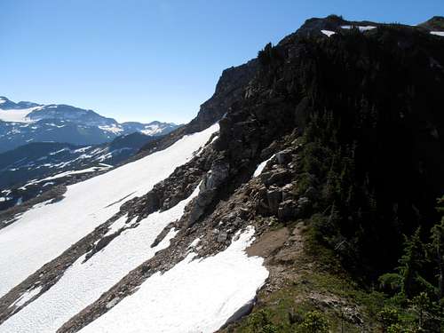
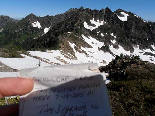
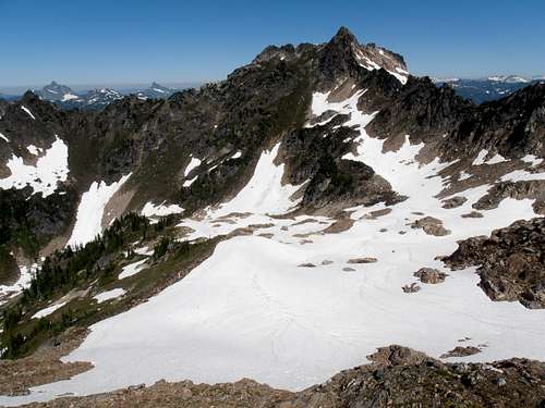
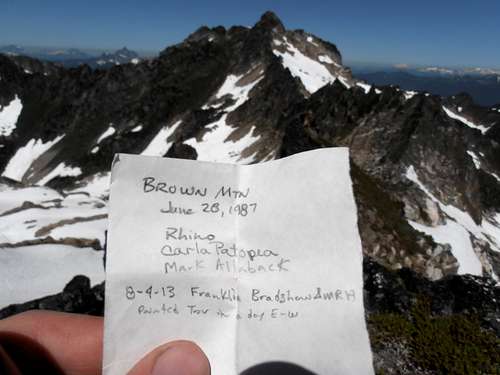
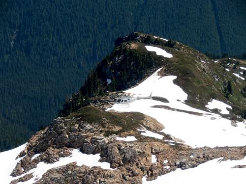
Skullcap was a very easy walk up the hill and over some snow to a heather and rock outcropping that contained a register, to my surprise, full of names. I continued walking North and turned back to take a photo trying to make Skullcap look like a mountain. It's a bit of a challenge since it's tucked between more massive objectives. On the way towards Brown I kept looking at this one rocky section on the ridge up 6844' hoping it wasn't as bad as it looked but when I got right underneath it my fears were realized. Looking back now, I probably should have bypassed it to the left but I chose steep heather slopes to the right to regain the ridge. This was time consuming for me since I don't enjoy side-hilling on the Green Death. As I was nearing the top, I could hear the steady chug of helicopter blades and noticed it was circling around Black, Brown and Skullcap. It kept this up the next hour and half while I glissaded down to the basin over to Brown. Walking up was easy with very slight class 2 but more annoying were the wasps prowling the cool snow breeze. Once on the summit I had a lunch of jalapeno bagel, summer sausage and dried fruit in the shade of the summit block. There was a tiny film bottle register placed there in 1987 with only two entries. One, 1987, was a party of three: Rhino, Carla Patopea, Mark Allaback; the other was Franklin Bradshaw in 2013. It seemed real special. I don't know how much was the exhaustion or remoteness but I let out a few tears upon reading it.
![View NE from Skullcap]() View NE from Skullcap
View NE from Skullcap
| ![View SE from Skullcap]() View SE from Skullcap
View SE from Skullcap
| ![View West from Skullcap]() View West from Skullcap
View West from Skullcap
|
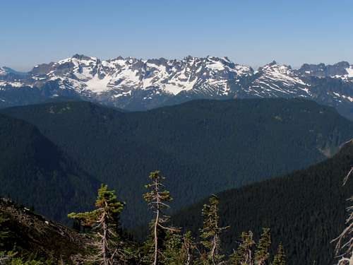
![Glacier peak from Skullcap]() Glacier peak from Skullcap
Glacier peak from Skullcap
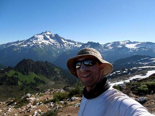
| ![Me on top of Skullcap]() Me on top of Skullcap
Me on top of Skullcap
| ![Skullcap Summit Register]() Skullcap Summit Register
Skullcap Summit Register
|
The surreal moment didn't end there as the helicopter was still doing donuts around me and occasionally got very close so I decided to photograph it with what little battery was left. I glanced over at Black mountain and really considered giving it a go. It was my overall objective, but I did not like the looks of the rock or heather and especially to do it solo. I considered that if the gully was filled with snow and I had crampons I probably would have went for it but since I hate steep heather, it was plain to me that I'd have to wait for another time. So I gathered my things, fought off some wasps and kicked steps in snow back to 6844'. Going down the steep heather on the other side was a lot easier but once I got to the ledges that went under the steep rock I had trouble navigating back. I ended up going a slightly different way over the top moat of a dwindling snow-patch and pulled myself up 60 degree sedge grass slopes with my ice-axe. Glad to be past that part I continued up and over the easy hill that is Skullcap and noticed the heat was beginning to wear me down.
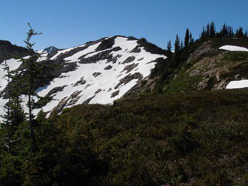
![Skullcap]() Skullcap
Skullcap
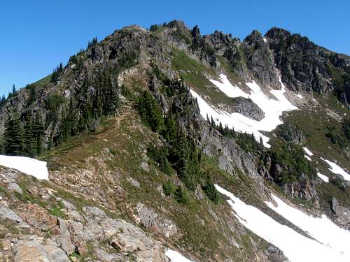
| ![Brown Route]() Brown Route
Brown Route
| ![Black from West Brown]() Black from West Brown
Black from West Brown
|
![View West from Brown]() View West from Brown
View West from Brown
| ![Brown Register]() Brown Register
Brown Register
| ![Get to the Choppa!]() Get to the Choppa!
Get to the Choppa!
|
My water supply was dwindling so I refilled at some snowbank run-off and tried to mentally prepare for the last unfriendly part on Purple. I looked back at my snow route and considered that it might be too dangerous since if I could not arrest in time I would run out over a waterfall. I had to man up and go for the class 3 step. I started to work my way up it but again lost my nerve and had to back down. I took a few steps back and noticed some excellent holds to the right but it was vertical travel and much more like class 4. I figured it was much safer and went for it, breathing hard as I fought against the adrenaline, topping out on top of a massive block. I felt very satisfied about the decision and continued to Purple's summit. I recalled on the way in that there was no register and so I collected a few rocks for a cairn and put some papers and a pen in a bottle I had brought up, marking it as "point 6910". Perhaps some people will not like this but it is an interesting summit and probably sees visitors every now and then.
Walking back to my camp on Portal was somewhat challenging as the heat picked up but I made it before 4:30pm. Aside from the Helicopter, I did not see a soul all day, human or otherwise. Some clouds were building to the East and I wondered if more forest fires had sprung up in the Entiats. My water was depleted so I boiled some water and prepared for my most anticipated meal of macaroni and cheese mixed with cattle drive chili. Posh by most aristocratic circles' standards, it was a fantastic feast for my hungry palate. After preparing gear for the next day I watched the sun set again and went to Portal's summit to call Joanna about my day. Not seeing anyone all day planted some doubt about whether I'd be able to secure a ride home but she was confident, and rightfully so, that there would be no problem. I slept a little cooler this night as a breeze remained constant until dawn. I slept light but enjoyed the random rousing to a spectacular meteor shower and the Milky Way stretched over Portal's summit.
![PCT up to Red Pass predawn]() PCT up to Red Pass predawn
PCT up to Red Pass predawn
| ![Johnson in predawn light]() Johnson in predawn light
Johnson in predawn light
|
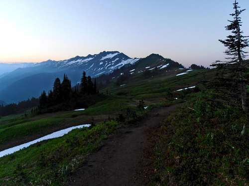
On my final day I awoke very early at 3:45am and gathered my stuff into a surprisingly light pack. This made no difference to my feet, though, which were protesting my every step up and down the mountain. Just above Red Pass I consumed the last of my donuts and Shot blocks to the barking of a fellow camper's dog. Normally this would be irritating but I enjoyed the not-so-benign company which let me know I was not alone. I apologized for waking their dog and continued on my way, hobbling down and hoping to beat the sun to Mackinaw. Strawberries were still out in force so I picked a few along the way and they were very delicious. I eeked out the last few ounces of power in the camera on the Pilot Ridge and continued my march until just before Mackinaw where I bumped into an enormous trail crew. Their loads were twice the size of my measly pack and I had to thank them profusely for their charitable work on one of my favorite trails in the nation. At Mackinaw I sat in a daze for a few minutes then continued on with hopes of getting to the Trail head before 11am. On the way I crossed paths with many people headed for the pass or Glacier Peak. One of them was hoping to go up sans-rope and I reminded them of the pitfalls of unprotected crevasse travel. We discussed a possible route that goes over Disappointment Peak that a lot of trail runners do that may reduce the danger but would be chossy without adequate snow-cover. I recalled that there was decent snow and wished them a safe journey. After that my responses to passers by were mainly, "I am just tired/beat." Once back at the trail head I was glad to note that there were 7 people in the register planning on leaving today and it was certain I would meet one of them.
After a couple hours eating the last of my food and re-hydrating a man named Ray, who had just finished the Pilot Loop obliged to take me to Darrington and after we got to talking decided on Lynnwood Park&Ride since it was on his way. He generously purchased a drink for me in Darrington and I returned the favor later by allowing him an important phone call from my cell (for some strange reason his wasn't working). We had some interesting conversations about hiking and the unfriendly aspects of scrambling. Of course my brother Josh Lewis came up, which opened many more stories of adventure and misadventure. It was sad to say farewell upon arriving in Lynnwood but I promised I would put up a decent report partly in gratitude for the ride home. Thank you Ray. And thanks Joanna. I intended on going on this trip to eliminate morbid thoughts and after facing some real potential it certainly helped.


Comments
Post a Comment