
|
|
Mountain/Rock |
|---|---|
|
|
37.77493°N / 119.23042°W |
|
|
Summer |
|
|
Trip Report: Donohue Peak
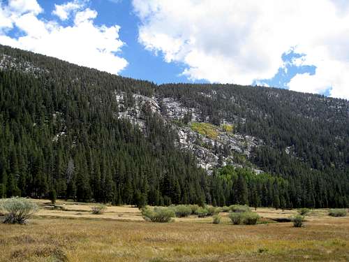
Fig 01. The hillside we climbed to get to Kuna Meadows from Lyell Canyon.
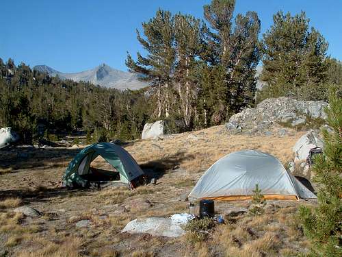
Fig 02. Camp in Kuna Creek Meadow.
As part of a longer backpacking trip, we camped in the Kuna Creek meadow at an elevation of 10,350 ft. overlooking Lyell Canyon (37.790956,-119.244729). Even though it was a severe drought year, the creek was flowing nicely. There is no trail up to the Kuna Basin, so we were definitely off the beaten path (Fig 01). Signs of bear abounded: fresh tracks, scat and large rocks mysteriously moved from position. During the day deer leaped as we passed by and at night the coyotes howled. We intended for this camp (Fig 02) to be a launching point for trips to Donohue, Mt. Andrea Lawrence and the Lost Lakes. However, because climbing Donohue took longer than we had hoped, we forwent the other objectives.
The Hike
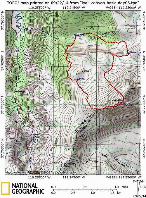
Fig 03. Donohue peak day hike, GPS track.
A fire was burning in Little Yosemite and atmospheric conditions were hazy. Nevertheless, we enjoyed the wonderful views in every direction. Especially compelling were the views of Banner Peak (12,945 ft.) and Mount Ritter (13,143 ft.) to the south - jagged gems, ringed in a setting of gorgeous glaciers and lakes. Just east is the newly-named Mt. Andrea Lawrence (Figure 16).
We descended, heading north towards a high subalpine meadow from which we hoped to follow a stream and locate a break in the cliff that goes roughly east-west and defines the southern wall of the Kuna Creek meadow. A very pleasant walk to the edge where the stream spilled over led us to a cliff, so we headed a bit further east on this wide bench and down-climbed through a steep boulder field (37.78672,-119.22926). The boulders were recently scratched, chipped and broken, which was a bit eerie. We bushwhacked through the Kuna drainage, arriving back at camp at 6:20 PM. Round trip according to my Garmin Etrex was 5.12 miles with an elevation gain of about 1600 feet.
Reflections
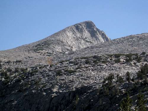
Fig 04. Donohue Peak as seen from the Pacific Crest Trail.
We also made the climb unnecessarily difficult by trying to ascend the west ridge of DP. It would have been easier to go east from the pond until reaching a position northwest of DP and then ascending. There are sandy and flat spaces on that part of DP which are easier to navigate than the bouldering along the west ridge.
The GPS device came in handy on this trip – we used it frequently. It’s very difficult to tell which part of the summit ridge is really the summit. The GPS saved us time and energy in getting to it. As noted previously, there are no trails in the Kuna Basin. The GPS was a good back-up in case we had trouble finding our way back to camp visually.
We rate one move within about 100 feet of the summit as class 3 because you have to pull yourself up using your arms and there is also a bit of exposure. Remember how you came up for the climb down.
Additional Figures
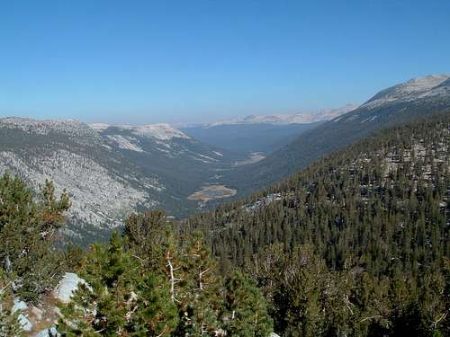
Fig 05. Looking NW into Lyell Canyon at start of Donahue hike.
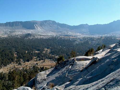
Fig 06. Looking N over Kuna Creek Meadow with Kuna Crest in distance.
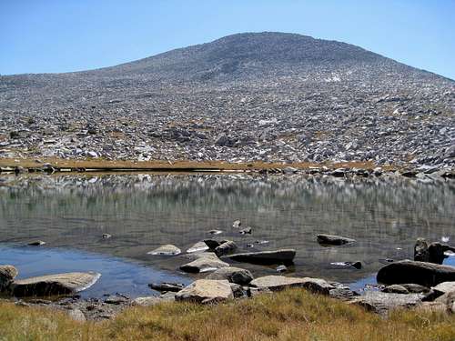
Fig 07. Donahue Peak as seen from pond to NW of the Peak.
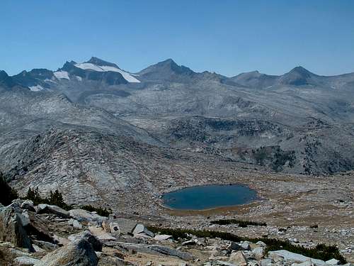
Fig 08. A different pond to SW of DP with Mt. Lyell in the background. Seen from the west ridge of DP.
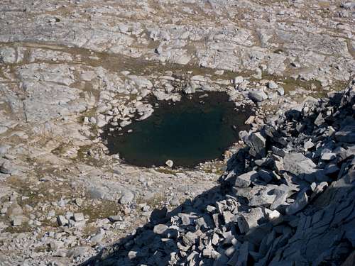
Fig 09. Pond to the NW of Donohue Peak as seen from above.
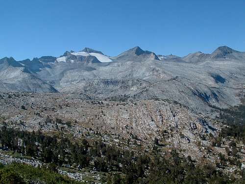
Fig 10. Looking SW towards Mt. Lyell (with glacier) and Mt. McClure just to the right.
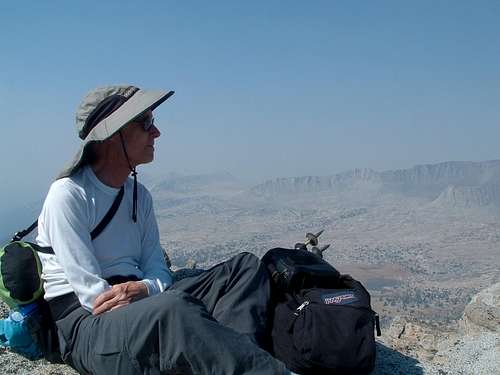
Fig 12. Rosenclimber on top of Donohue Peak, Kuna Crest in background, smokey atmosphere from various fires.
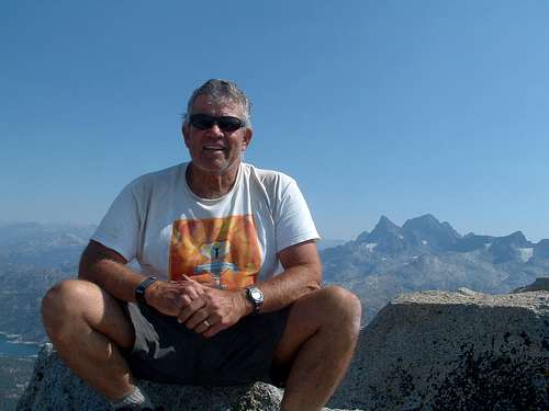
Fig 11. Jobrux on top of Donohue Peak.
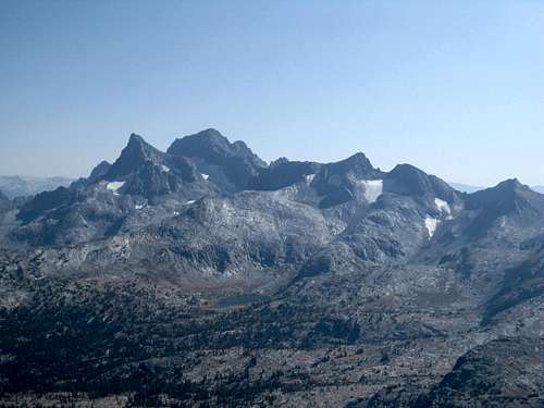
Fig 13. Closeup of Ritter and Banner from Donohue through the haze.
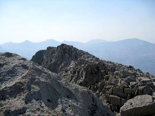
Fig 14. Looking West from Donohue Peak towards false summit.
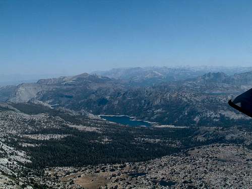
Fig 15. Looking south from Donohue Peak towards Waugh Lake.
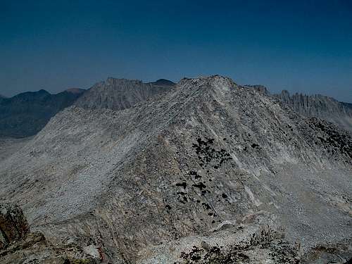
Fig 16. Mt. Andrea Lawrence from atop Donohue Peak.
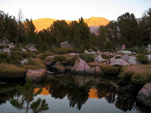
Fig 17. Mt. Andrea Lawrence reflected in Kuna Creek.