-
 10576 Hits
-
 70.83% Score
-
 1 Votes
|
|
Route |
|---|---|
|
|
38.06060°N / 107.5103°W |
|
|
Mountaineering, Scrambling, Skiing |
|
|
Spring, Summer, Winter |
|
|
Most of a day |
|
|
Class 3 |
|
|
Advanced Snow Climb; Extreme Ski Descent, D13 |
|
|
III |
|
|
Overview
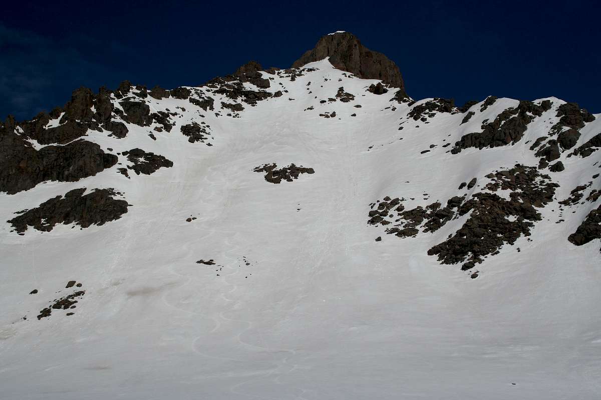
Wetterhorn Peak's East Face is a classic snow climb and ski descent as well as a beautiful snow face. The snow climb is aesthetically pleasing and the skiing is even better! Below the steep face, 2,000 vertical feet of moderately angled bowls can be enjoyed on the way back to the trailhead. If planning on skiing the east face, you should go earlier in the season; usually no later than May. The ski descent is rated as a D13 on the D Scale. If only climbing, you can probably climb into the summer and can descend the Southeast Ridge.
Wetterhorn Peak's East Face
Getting There
Matterhorn Creek Trailhead:Follow Henson Creek/Engineer Pass Road 9.1 miles from Lake City.
Take a right onto the North Fork Henson Creek Road for 2 miles.
Take a right onto the Matterhorn Creek Road for 1 mile to the TH or as far as possible due to snow closure.
Statistics with a start from the Matterhorn Creek Trailhead:
Distance: ~6.5 miles
Elevation Gain: ~3,420'

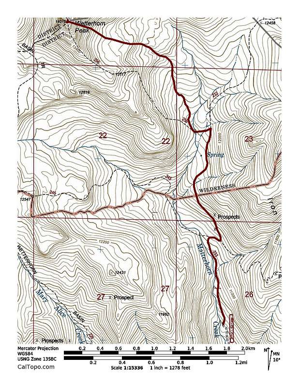
Wetterhorn Peak's East Face from Matterhorn Creek Trailhead
Route Description
Follow the old Jeep Trail into Matterhorn Basin until you are below Wetterhorn's East Face. Climb it to the base of the summit block. Traverse left on snow to the base of the summit block pitch. Drop your skis and climb the summit block.
Wetterhorn Peak's East Face
Essential Gear
Crampons. Ice axe if uncomfortable on steep, frozen snow.External Links
http://www.gb4mfg.com/mtn/Wetterhorn_05-20-06.htmlhttp://skithe14ers.com/p-wetterhorn-peak.php
http://www.wildsnow.com/biography/lou_fourteeners.htm

