
|
|
Route |
|---|---|
|
|
38.93000°N / 107.244°W |
|
|
steep hike/routefinding issues |
|
|
Half a day |
|
|
class 2+ |
|
|
Approach
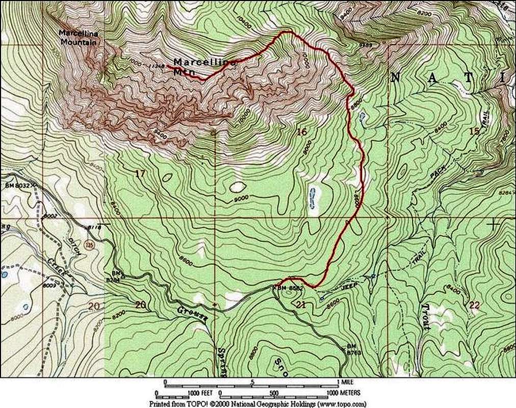
Round Trip-6 miles and 2,996-ft of Vertical Gain
This route is completely off trail, please refer to submitted topo map and use it with the following route description. I also recommend the use of a GPS.
Starting at the Ruby/Anthracite Trail at 8,596-ft, follow the jeep road a quarter mile to the signed trailhead. Continue on the jeep road another 100 yards and look sharp for a spur trail that ascends slightly to the northeast. If you do not locate this faint game trail, don’t spend too much time looking for it, just start heading north; in time you will find a few trails that will aid your progress through the aspen trees.
Route Description
At .88 miles, locate a talus slide tucked away in some aspen trees; from here you can preview the steep couloir that you will need to ascend to get to Marcellina’s east ridge. Ascend this talus slide via a faint trail and continue contouring north another .65 mile to a rib on the west side of the couloir. From here it is possible to drop down into the couloir and ascend it but I recommend staying on the rib for some solid class 3 slab climbing. You can pretty much ascend this rib 2000 feet to the east ridge.
Once on the ridge, follow the ridge crest to .84 mile to the summit.
Essential Gear
GPS is recommended.
Miscellaneous Info
If you have information about this route that doesn't pertain to any of the other sections, please add it here.