
-
 5358 Hits
-
 71.06% Score
-
 1 Votes
|
|
Route |
|---|---|
|
|
40.29220°N / 105.68°W |
|
|
Scrambling |
|
|
Summer |
|
|
Most of a day |
|
|
Class 2 |
|
|
Overview
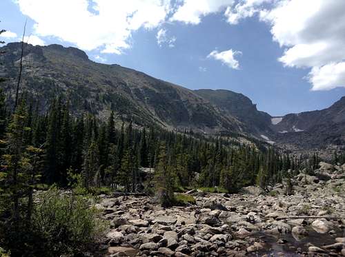
Otis Peak is most often climbed via the Flattop Mountain Trail. But if you are looking for some scrambling on solid boulders, some solitude, as well as some incredible scenery, then the East Ridge Route on Otis Peak might just be up your alley.I became interested in this route in August of 2014 when I made my first hike out to Lake Haiyaha. From the lake it just seemed more logical to try and reach the Continental Divide via the East Ridge of Otis as opposed to making the long – and busy – hike up the Flattop Mountain Trail, or to deal with the ascent of Andrews Glacier. The main Mountain Page for Otis Peak references the route in Lisa Foster's Rocky Mountain National Park: The Complete Hiking Guide. I searched out her book and found that it doesn’t give much beta. Fortunately the route is pretty straightforward, which I discovered after taking a quick look at the topo, as well as taking a close look at some of my pictures from when I was at Lake Haiyaha. Bottom line, this is a fun Class 2 scramble on solid boulders and mostly solid talus.
Route Description
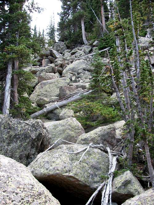
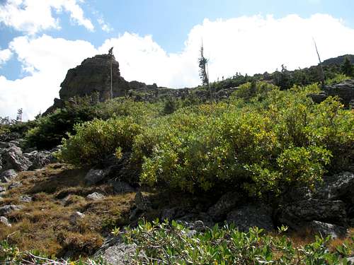
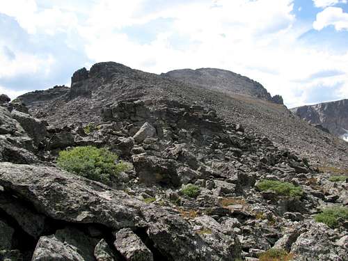
From the Bear Lake Trailhead hike 2.1 miles to reach Lake Haiyaha. As you near the lake, probably no more than 25 feet from the shores of Lake Haiyaha, there is a spur trail that cuts off to the left. Follow this trail for a very short distance and the upward slope of very large boulders will greet you on the left.Start scrambling up the boulders and quickly gain elevation. The pictures below show the typical terrain on these boulders and talus.
 | 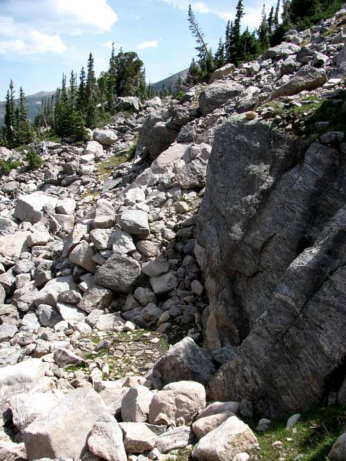 |  |
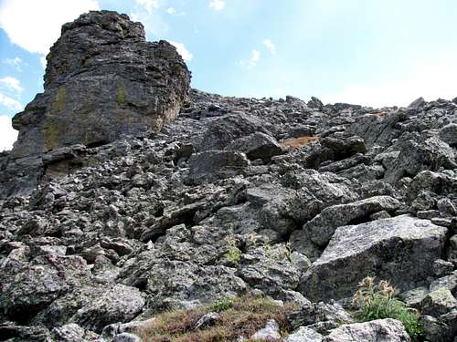
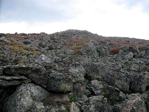
Before long, several towers on the summit ridge will become visible. Continue heading up the boulders and talus aiming to the right of the tower on the far left, and end of the ridge. As you get closer to the summit ridge additional towers will come into view. Continue heading up the boulders and talus aiming to the right of these towers.
 |  | 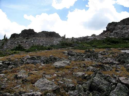 |
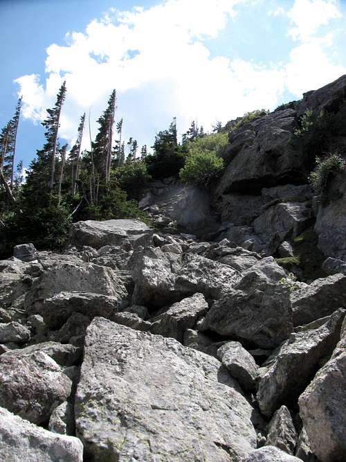
Once on the summit ridge staying below the towers will ease passage. Eventually a number of false summits will come into view, before finally getting a good view of the actual summit.
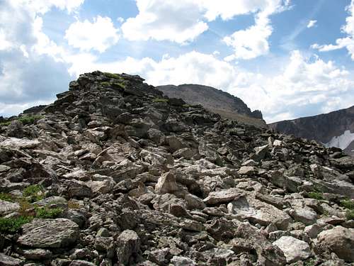 |  |  |
The terrain is essentially solid boulders and mostly solid talus all the way to the summit.
I do not know the exact distance from Lake Haiyaha to the summit, but it took me 2 ½ hours to reach the summit from the lake, and I do not consider myself a fast hiker/scrambler.
To descend, you can obviously return the way you came, or you can make a loop hike out of the route and descend via the Flattop Mountain Trail or Andrews Glacier. Of course once up to the Continental Divide, you have numerous peak bagging options available, with Taylor, Powell and Hallett all near at hand.
If you descend the East Ridge it is critical to not start descending too early as the cliffs of Otis Peak and Chaos Canyon would make for difficult terrain. While I did not descnd this way, use Lake Haiyaha as a reference point for when to begin descending from the ridge.
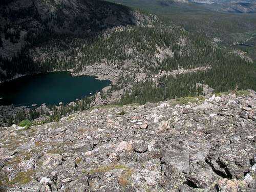 Lake Haiyaha (L) - Bear Lake (R) | 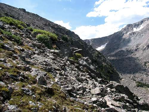 Cliffs of Otis Peak and Chaos Canyon |