Saddling Up - June 7th, 2014
Brett contacted me looking to do some Idaho peaks. He was thinking another multi-peak day circling around the Oxford/Sedgwick/Old Tom areas but I had more ambitious (ie higher/more northerly) plans. Recent snow forecasts and trip reports showed early summer conditions for Saddle Mountain in the Lemhi’s, and a strenuous 5000 ft day up the Middle Canyon route would allow for both a good conditioning exercise and a chance to get a head start on my northern Rockies list in what little time I had left out west.
I met Brett in Pocatello and we carpooled north in the 4Runner. I was eager to show off Idaho, which had been really growing on me of late; Brett had done a lot of Utah peaks and some southern Idaho P2K’s, but this would be his first taste of the northern Rockies, and I was happy to do the requisite hazing.
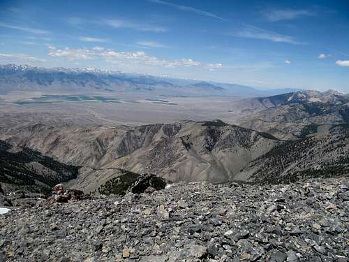
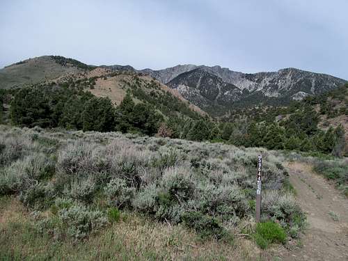
Brett napped and studied up on his grad school textbooks while I drove through the Ohio-ish landscape of the Snake River Plain. Saddle’s prominence grew closer to Arco, where the side road to Howe makes last minute jump east and rounds Jumpoff, a minor Lost River hillock, to the center of the small clump of farms at the base of the Lemhi’s.
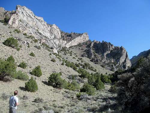
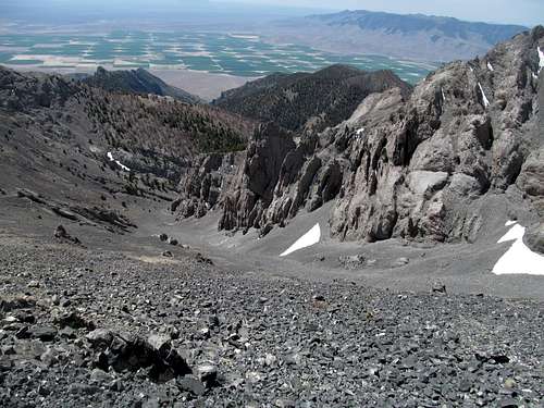
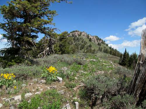
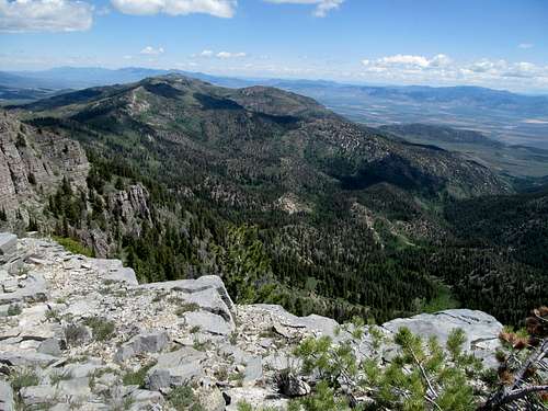
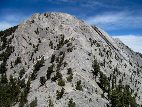
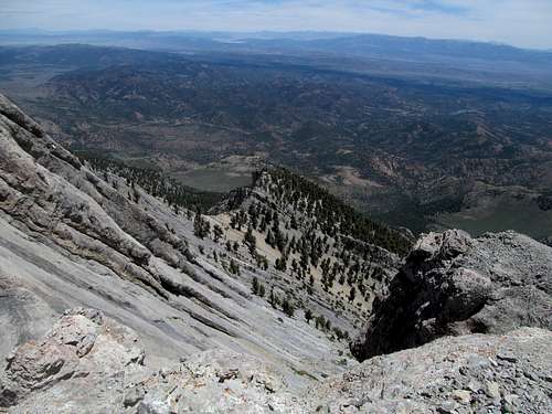
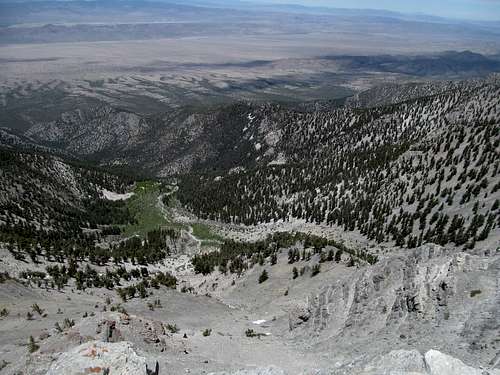
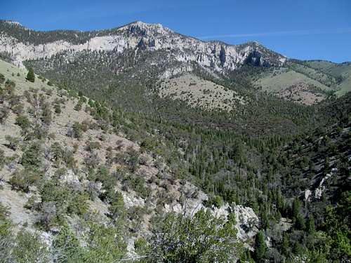
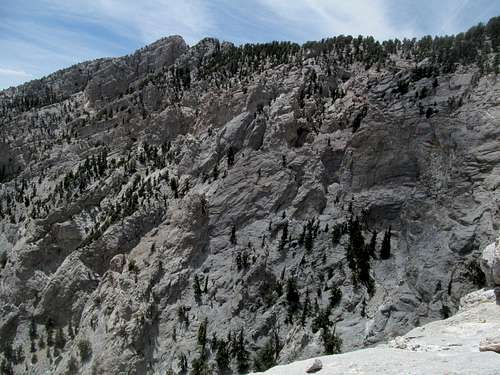
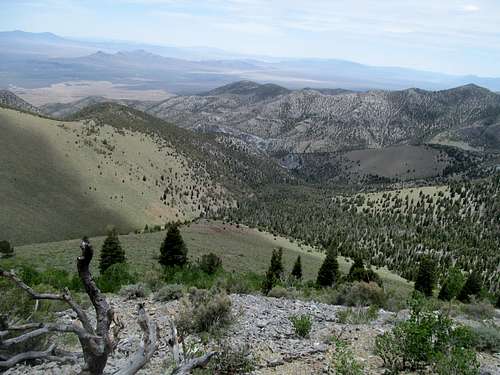
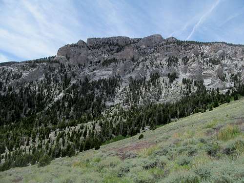
Middle Canyon was as neck-craning as advertised, the high limestone cliffs making for an approach more scenic than the mean. A small climbers trail wound intermittently through the canyon, sometimes fading through short and moderate patches of brush.
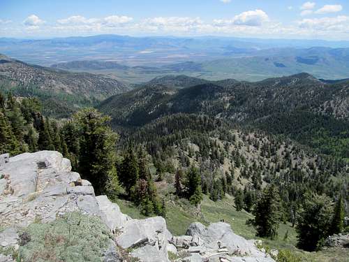
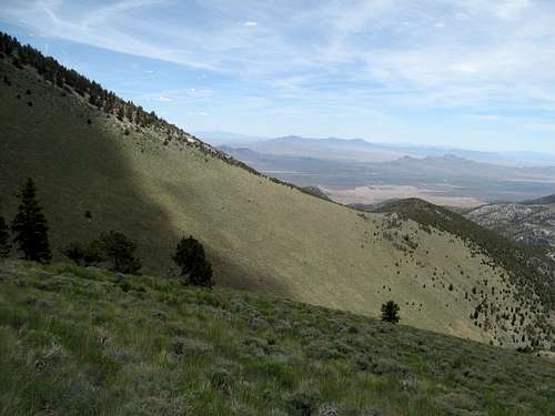
Yet the long spring had already been chock full of spectacular canyons and cliffs for me, and what I craved now was pristine alpine scenery. Thus impatience creeped those last few miles up the canyon, which alternated flat brush, slight inclines with good trail, intermittent steep sections of talus, and further up, aromatic evergreens.
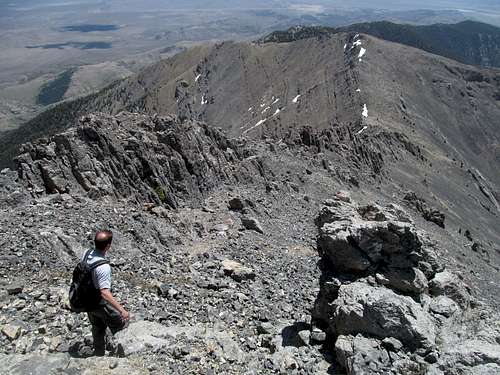
Brett and I had marked similar spots to leave the canyon and spur right to aim for the southeastern ridge approaches to Saddle. We ascended very steeply through burn areas, making approximately the same pace in, what I noticed, with very different techniques. Brett plodded up in a fast and steady manner, aiming in a straight line one step at a time as if ascending the world’s largest stairmaster, while I zigged and zagged, going at a slightly faster pace while inventing a million little switchbacks through good backcountry terrain.
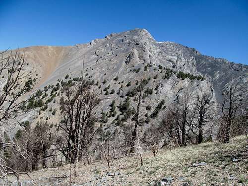
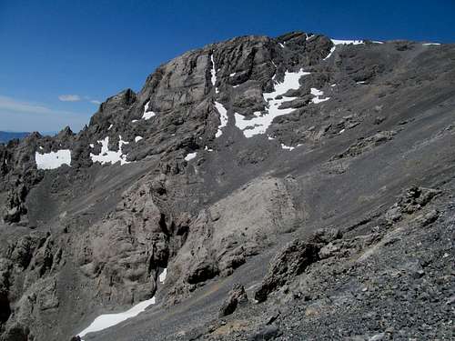
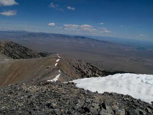
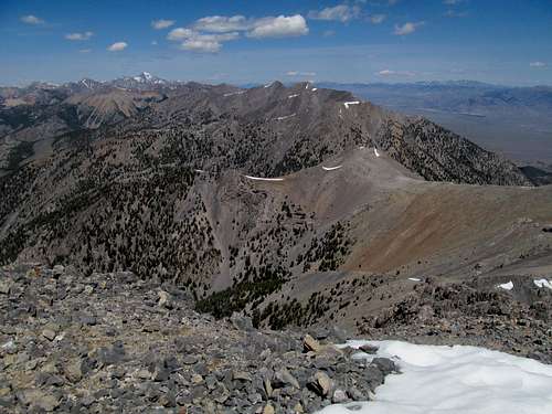
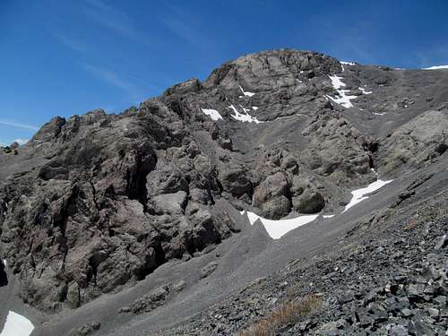
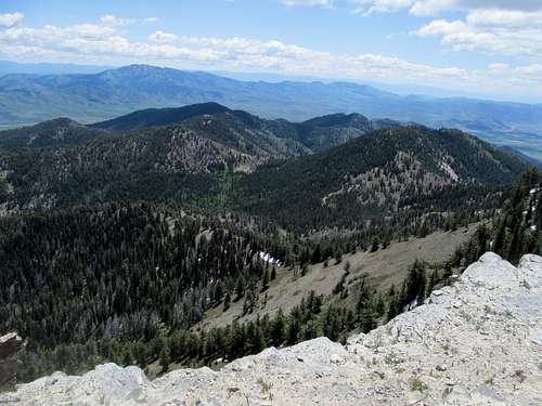
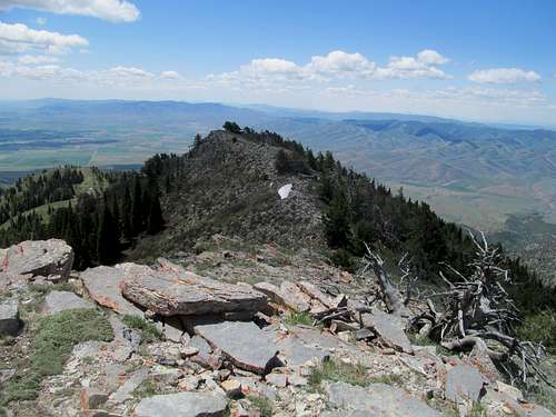
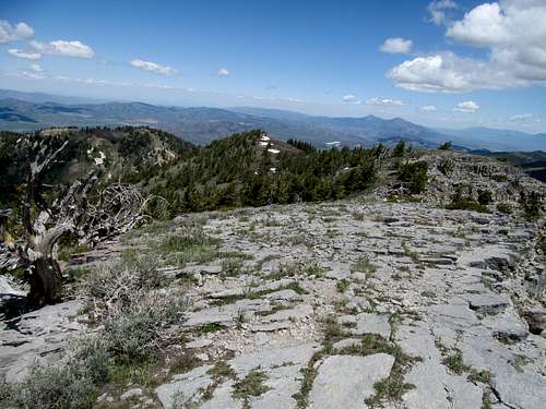
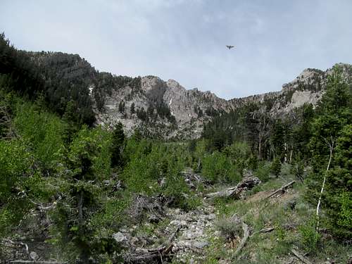
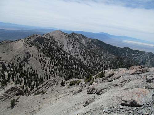
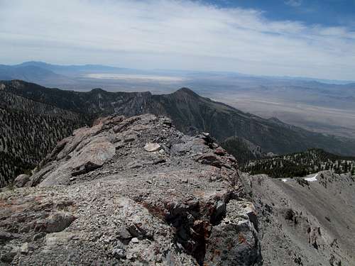
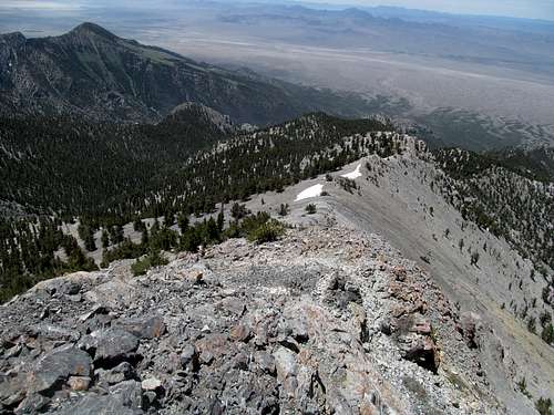
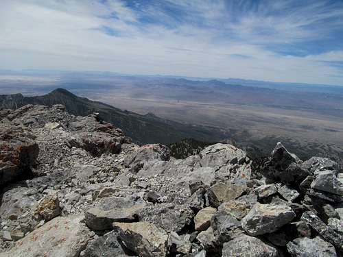
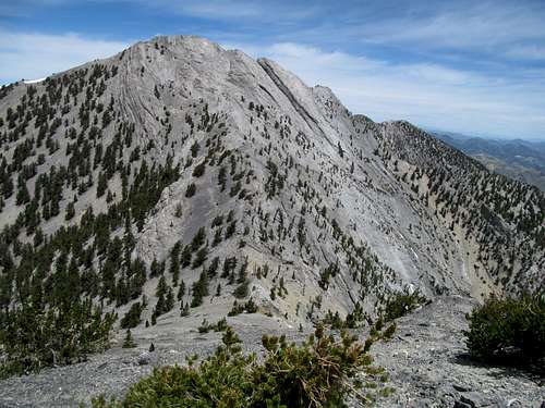
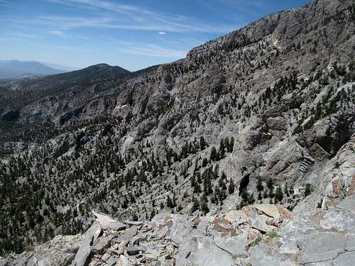
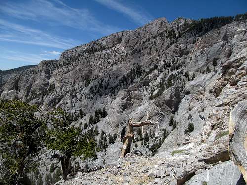
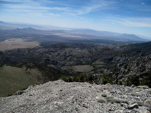
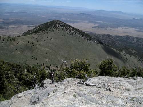
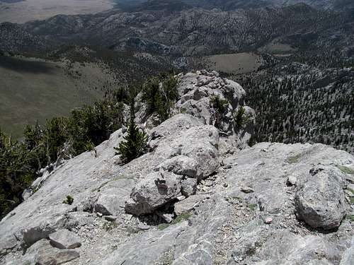
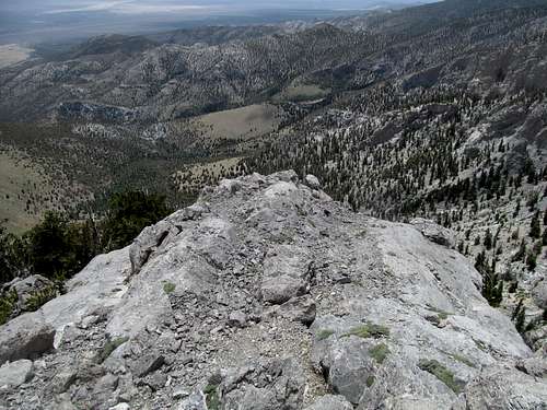
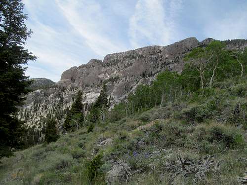
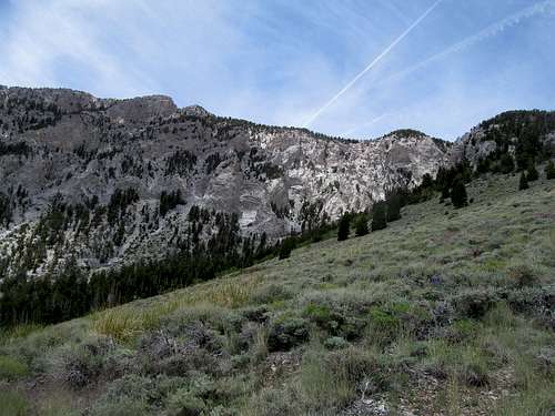
Near timberline we approached the start of the summit ridges, some light scrambling up a few ledges leading to a wide, rocky, and open ridge with solid views of the aptly named summit above us.
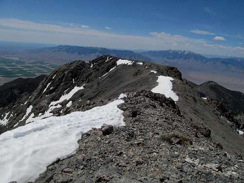
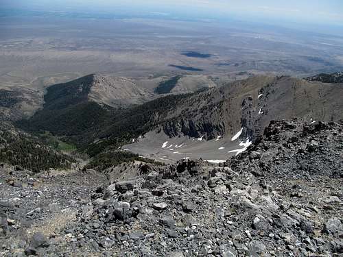
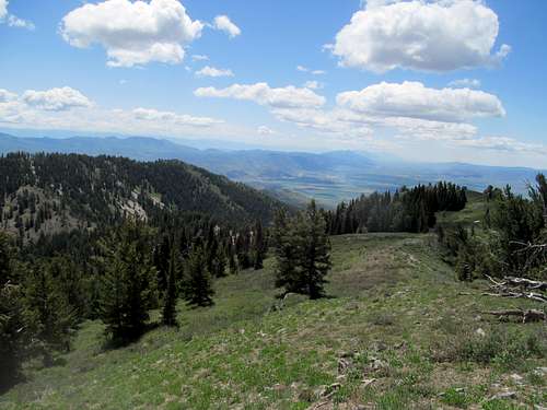
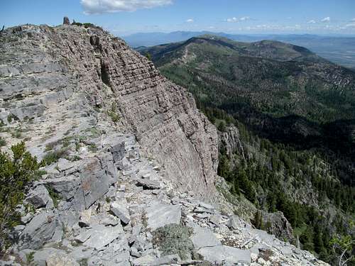
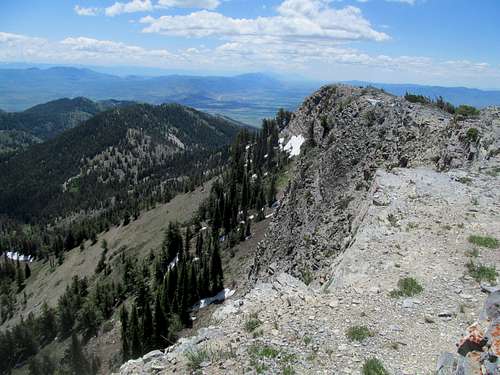
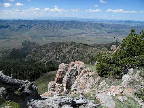
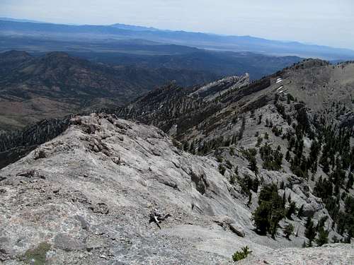
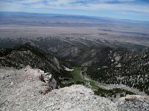
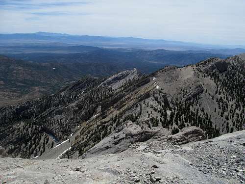
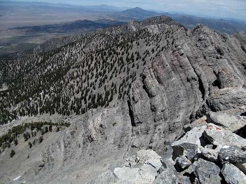
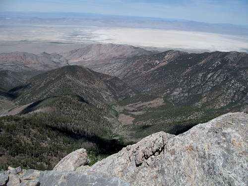
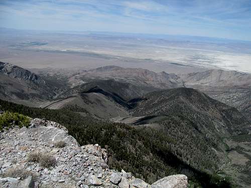
Climbing the ridge to the saddle southeast of Saddle was highly enjoyable, with great views back down into the narrow cleft of Middle Canyon; to the left below us we saw the narrow head of the canyon, where it disappeared into Idaho’s version of a slot canyon before emerging as the massive scree chutes below Saddle’s south face.
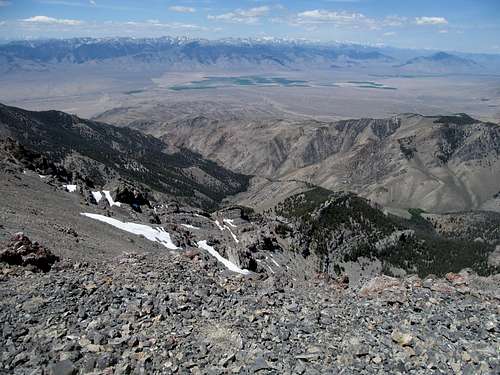
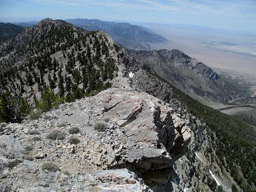
We followed a slight sidehill cutting left of a small bump (pt. 10,248) to cut down as much as possible to descend down to a lower saddle (the second one) directly below the last, southeast ridge.
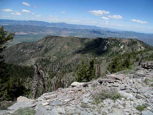
The Idaho scree was starting to wear Brett down a bit, but a steady and active spring and much experience with Idaho terrain made the last 800 or so feet relatively easy going for me.
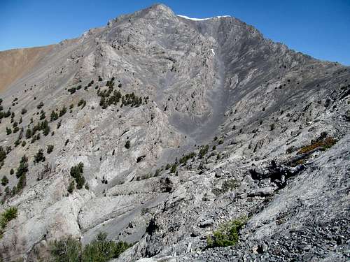
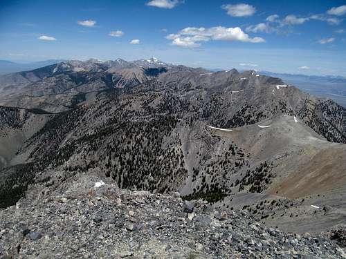
My first 5000 feet day of the year, and I felt good, encouraged by how strong my legs and muscles still felt, and exhilarated by my first taste of Northern Rockies scenery since Mt. Sheridan the past September. Getting a major Idaho/Lemhi summit so early in the season felt extra special, like it was a bonus peak.
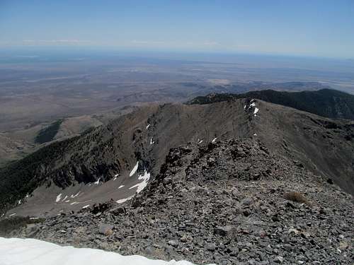
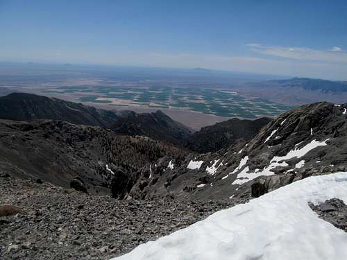
I looked on at Diamond, happy to have gotten that one done the past Labor Day weekend, then we started carefully down the scree.
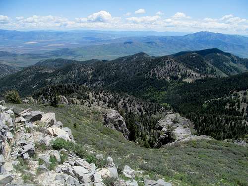
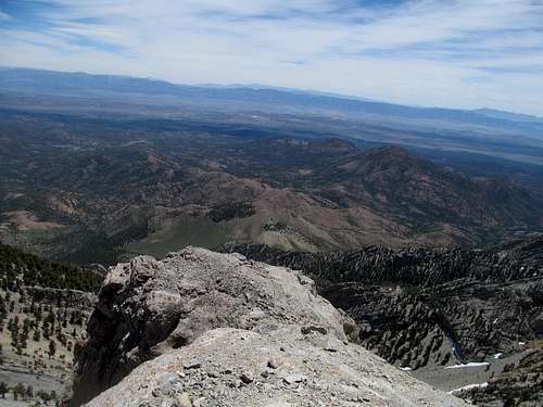
The descent was mostly easy and pleasant, fast going coming down the steep shit, and the same minor difficulties trying to route find back through the canyon.
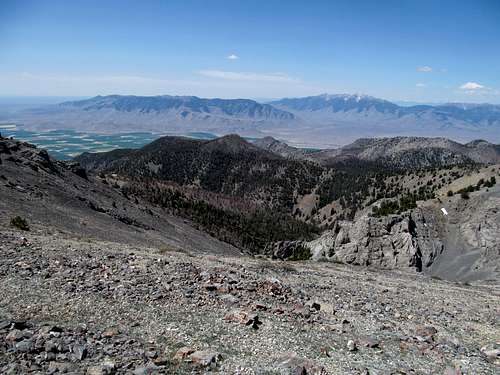
Clouds covered the plains as we exited out of the canyon after a most rewarding early season summit.
I dropped Brett off in Pocatello; he would go on and finish his main goal of the summer, getting Wheeler in Nevada and eventually Whitney in California. As for me, crutches or not, I would have plenty of Idaho peaks left.
Ambushed by Elkhorn - June 6th, 2014
The one the very next day was, to be honest, a bit of a letdown. That’s probably because mountaingazelle here on this website puts up such great pages with impossibly bright and perfect lighting for all her pictures to the point where I probably had impossibly high expectations for Elkhorn Peak.
After another night in Pocatello I anticipated a quick, easy and pleasant Sunday. Not starting up the trail until around 10 AM, I quickly felt the intensity of the June sun and humidity bearing down on me.
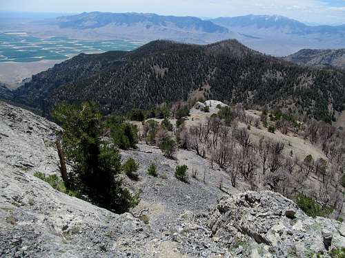
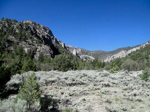
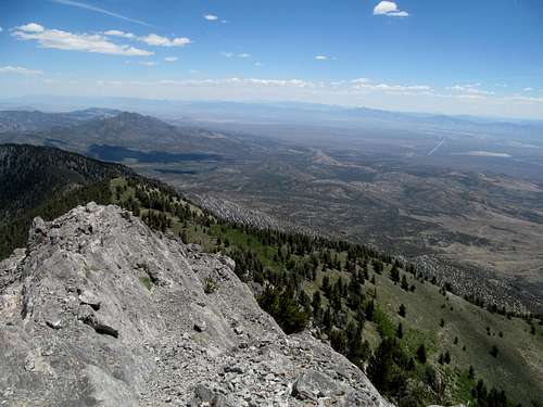
There is a uniqueness to the type of terrain that manifests itself at just sub-alpine levels in the Wasatch and continues up at the 8000-9000 ft level further on through minor ranges such as the Bear Rivers up through the higher Southern Idaho peaks, and even at times up to the Snake River Range. It’s hard to describe, with lush yet stunted forest, vast swathes of often prickly yellow-green brush, rocky terrain without being alpine, and steep dry grassy slopes occasionally garnished by a light bluegrass hue.
I’m a sucker for loops and decided to ascend the southeast ridge, then descend the north. The SP route description leaving the trail/creekbed/occasional jeep track as it rounds the southeast aspects of the peak, ascending cross country to the top. Not realizing how much it varied, I ended up using Dennis Poulin’s GPS track on peakbagger to mark my waypoints as his route description seemed to avoid the cliffs mountaingazelle talked about. What it lacked in loose rock it made up for in brush, unfortunately.
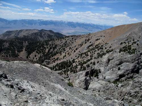
The part time jeep track ends at an open saddle north of Kent Peak, with great views both towards Elkhorn as well as offering a good window at some rugged ranges on the other side. So disorienting this area apparently was, that I thought initially that I was looking west at the Black Pine Range area, only to eventually realize on the summit that it actually faced Oxford and the Bear River Ranges southeast.
The summit looked real close from but the traverse across the north face of Kent was the worst part of the ascent. Already disoriented, the thick brush lining the steep slopes made for tricky progress and navigation, and I must admit that without my GPS I’d probably be heading the opposite direction into the next valley. The short traverse seemed to last forever and, not knowing about a lower saddle ahead, I ascended when I could only to find myself descending several hundred feet to a long saddle southeast of Elkhorn’s south ridge, which apparently turned out to be my actual ascent route.
The homestretch featured some steep stuff and occasional brush that could mostly be avoided. The coolness of the peak never faded though, the upwards portions concluding with a steep grassy ramp through two rocky gates to reach the long summit ridge.
Great views, cool cliffs, one-of-a-kind cairn, and perfect weather but in terms of the suffering of the day this was just the eye of the hurricane.
Any thoughts I had of returning the route I came were brushed away by the icky nature of the route, and I started down the north ridge enjoying the mild summit sights and terrain and expecting a cakewalk down. You know what they said about the best laid plans…lower down the trail faded through spots of brush and woods, and I wasn’t progressing as quickly as I would’ve liked. After a couple minor yet exhausting uphill bumps I spotted a wide dirt road switchbacking through the canyon to the northeast. That was the proper route, butinstead of continuing north to the saddle between Elkhorn and Wakley to join the road, upon seeing several more bumps I decided instead to straight shot it northeast towards the jeep track. Big mistake. More brush, more deadfall, more shitty terrain awaited me on the shortcut.
The rest of the return trip along a good trail and dirt road was easy yet somewhat unpleasant due to the afternoon heat and boot chafeage per usual. Still, the scenery was sublime as expected, and at the end of the day I couldn’t complain about getting ahead of schedule on a productive Idaho weekend.
Keeping Currant - June 21st, 2014
I spend the next weekend in Salt Lake, getting Dry Mountain Saturday and (allegedly) hiking Durst Sunday. Thoughts of going north the following weekend were dashed by weather, and instead I found myself driving into Nevada Saturday morning, hitting up Ely one last time for now (I’m sure I’ll be back).
My ongoing sports talk related group text with some friends from home had wandered on to soccer talk, with the World Cup coming up and all. I made some soccer jokes, then found out that in the years I'd been in Utah things had changed, soccer was now in, and jokes about it less so apparently. Well, as someone who goes with the flow I had to be in on the World Cup action and keep up on things as the tournament kicked off earlier in the week and Team USA beat Ghana in 90 minutes plus of marginally exciting action.
Which meant that I had to plan my Nevada weekend around USA’s game (or match, as the Brit blokes speak) against Portugal on Sunday. Saturday I drove straight through Ely down US-6, cresting over the Ward range and inched ever closer to the impressive eastern cliffs of Currant Mountain.
Greg had gushed to me many times about this peak. It was probably his favorite in the entire state, and he kept badgering me about why I had yet to climb it. Well, no longer.
Well, maybe a little bit longer, at least until I find the trailhead.
As usually, the road in was great until it wasn’t. Not that I missed the turnoff, but not entirely sure it was the right one, I continued left at a flat marshy area 7,650’ up into some grassy foothills east of Currant, eventually realizing via my topo-less GPS screen that I was overshooting way too south relative to the peak. I returned to the junction and drove the narrow, rocky road to near its terminus.
Supposedly you could continue down a jeep track past a switchback and then eventually reach the main ascent drainage. I guess you’re supposed to head west down the road. Not knowing this, I was aiming based on what I remembered from the Google Earth shots directly towards the ascent drainage, likely paralleling the road on its south through scrubby and brushy woods.
A low cloud cover blanked the sky over the Duckwater range on my drive in, but the slow emergence of the mid-June mid-Nevada sun just as I dodged the brush and the ticks made things incrementally miserable. But the sun still stayed mostly elusive, and I used what cool fresh air I had left in the fading morning to try and make quick progress up the drainage, which I eventually located through the woods, as possible, a route finding error notwithstanding, near 8,500 where I missed the proper ascent drainage left and continued up a neighboring one. I would have continued up this were I certain of the route, but not having read any beta on it I couldn't be sure it didn't turn technical further up.
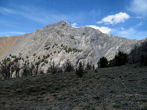
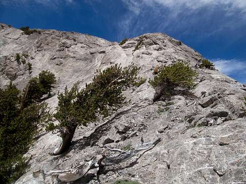
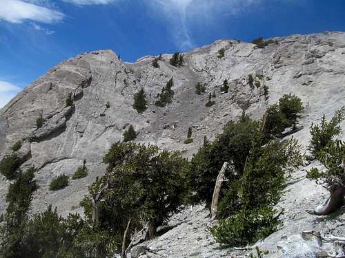
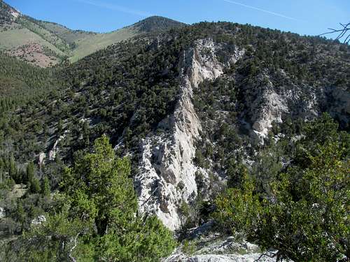
The drainage down low was kinda clogged and dirty, but not overly brushy, and the rocks and boulders unpredictable enough to keep you guessing. The incline was sufficient for me to crane my neck looking for small signs of granite hidden behind small aspen groves further up. The cliffs around me began to open, and I started to see glimpses and traces of Greg’s gushing descriptions extols.
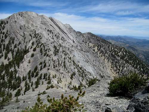
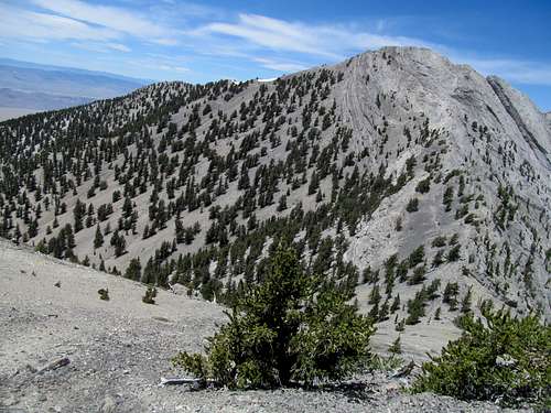
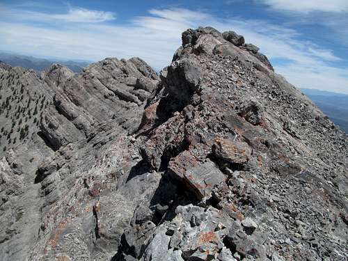
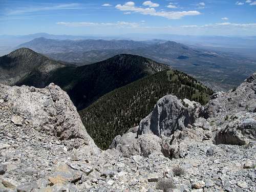
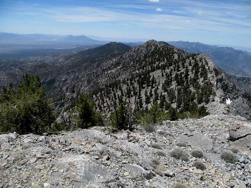
The skies cleared as I hopped up steep ledgy steps approaching the Sierra-lite headwall of the drainage, and I then exited right up the excruciatingly steep scree to make the ridge crest just south of Currant’s south saddle. I found a loose gully and mildly reasonably terrain ascending through one of the denser and coolest bristlecone forests I’d ever seen, made more remarkable by the steep, loose and unforgiving terrain in which they clung. At the crest, the classic views of the peak made it hard to resist repeated clicks of the camera, or deny the veracity of Greg's descriptions.
I descended down to the saddle and started up a solid ridge which featured delightful scrambling until it ended abruptly below the summit face.
Here the ridge abruptly dropped twenty thirty feet or so at a rough dirt saddle, oddly reminding me of Kneeknocker Pass in the Gores of Colorado. Apparently there’s a decent class 2 descent off the ledge but I missed it…perhaps it was further to the right, perhaps I passed it before dropping down some sketchy downclimb moves with some slight overhangs and drops requiring a bit of reaching of the legs on the way down.
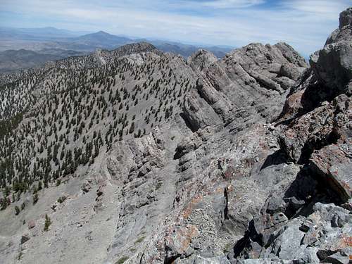
Then the summit shortly, and the spectacular views of this forgotten corner of Nevada, dime a dozen in this one hinterland of many. The smoothly grooved ridge north towards Duckwater Peak was fascinating and terrifying, and I had no plans to do any sort of loops or traverses.
I chose to descend the steep scree directly down the south face following the downclimber’s right rather than follow the ridge and climb the crux, though it probably wouldn’t have been too much of a challenge.
The scree was not as easy as you’d think, hard and slippery and making it difficult to plunge step down. I returned to my original route at the south saddle, the remaining descent down the steep scree slightly better.
Descending the main drainage was just as choppy as the ascent, frequently requiring rock hops over uneven boulders. There was another drainage parallel to my left, which I had accidentally wandered maybe a quarter of a mile or more on the ascent before backtracking. Some mild wooded terrain filled the space between the two drainages though, and upon viewing it all trip I decided to exit the drainage prematurely left around 9,200', hooking through it and finding pleasant open woods and even the occasional trail until the two routes joined around 8,500' and I hit level ground west of the trailhead. Still not finding the dirt track, which turned up to be further to the north, I bushwhacked my way back following the GPS tracks until I reached the 4Runner, completing the trip door to door in about five hours and 45 minutes.
Storming the Walls of Troy - June 22nd, 2014
I opted not to get my usual Ely drink on, instead sleeping early seeing that I had a long ways to drive for Troy the next day.
I had driven these roads before en route to Quinn Canyon back in 2013 and navigated the now familiar gravel roads past curvy sections near the Kirch Reservoir. From certain angles, John Muir's alleged favorite Great Basin peak looks like a rather dull and typical desert ridge, others the high and ginormous monarch of this part of the desert it is in reality. The approach roads offered both categories of vantage points, though the most disconcerting one would be that of the infamous road surface leading into Scofield Canyon, the trailhead proper.
The road is indeed bad the moment it drops into the wash, a typical streambed Nevada rock track. And further down it does indeed take a turn for the much worse, a deep and wide jeep-emasculating rut large enough to swallow a Camry whole, and foolhardy to try in my 4Runner or even something 10 times sturdier. I made it to somewhere around 6,400-6,600’, close to where most people with 4WD seem to park, and started a road walk that seemed to take forever until it dragged deceivingly through wide open area resembling a trailhead, then continued just a tad further to the actual (once upon a time) trailhead.
Once past the wilderness boundary things got sketchy. It seems like Troy Peak invites its share of routefinding struggles that you can read about on various websites, occuring before and after my visit last June. I certainly wasn’t immune, despite having downloaded GPS trax in advance. The road splits quickly after the trailhead, and not looking at the GPS, I followed the seemingly wider left track.
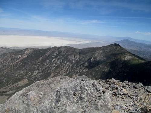
Well when I finally decided to look at my GPS 5-10 minutes later I realized I was way off route, and needed to contour north 200 feet up a small hill to reach the parallel wash and correct route nearby. The very steep descent back into the correct wash was rough, but actually worth it considering I got some good and rare shots of the peak, as well as the neighboring high ridges to the south.
The next part was the roughest: trying to follow the jeep track after it cuts north and disappears very intermittently through a very thick, narrow and brushy drainage; it sucked. But things got better once I hit open ground and a wide beige drainage, the sheer and thousand pocked east face of the range revealed, and the entire rest of the route seemingly visible to the naked eye.
Steep as shit it was, and I tried to mark progress by reaching pockets and groves of brush and aspen along the way. Finally the true climbing started at the base of the aspen lined cliffs around 9,700’. Dennis Poulin’s TR said follow the cliffs right, but I actually found a good opening and easy scrambling near the left terminus of the cliffs. The terrain between here and the knife edge crux was steep, with scrambling but jawdropping views of the Troy/Duckwater caves and cliffs along the right edge on the left, or wooded but loose and occasionally ledgey terrain on the right.
The crux is supposedly class 3 but, as a knife edge, had some mild exposure. It requires a move to get onto the edge, and several to cross the edge to make it to the summit side of the route.
You think you’re close now, but you’re not, and the climb sucked balls for over 1,000 feet of some of the steepest, most tortuous, monotonous, and loose terrain this side of Ely, with an occasional climber’s trail that helped only to the extent that assumed you didn’t waste more time trying to locate it when it inevitably disappeared.
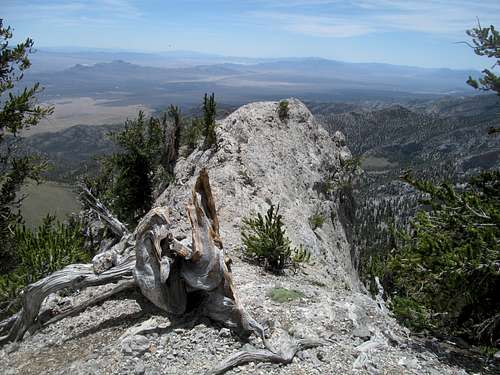
You really can’t even see the summit until you’re right there, which makes it discouraging the entire slog, but sweet beyond belief when you arrive at the top, or slightly to the south of it like I did.
Perfect weather, perfect views, perfect light breeze, and I didn’t want to leave and maybe would’ve dallied a little longer than I already did if it weren’t for soccer…soccer??? Oh right, that god damned USA Portugal game.
The last 1,700 feet of unrelentingly steep terrain was awful to climb but once more was pretty sweet on the descent; GPS was pretty essential here, as otherwise it’s tough to keep track of your bearings and ascent route with the tree cover, sparse as it is.
The crux required a bit of caution on the descent but nothing major, and mild walk down the open meadows past Sidehill Springs amid sublime lighting, clouds, and shadows was some next level shit.
I proved a little better at locating the jeep track through the lower gully, through the brush sucked nearly as bad.
At the end of the day, including the routefinding errors, I measured 11.4 miles round trip, calculated around 4,900 (steep) feet of gain, and car to car in around six and a half hours.
All that routefinding trouble near the beginning of the hike didn’t help my soccer spectator timetable though, and I sped down NV-318 towards the junction with US-6 hoping to catch the end of what appeared to be a barnburner (albeit probably a slow burning flopping barn).
Who the fuck stations a cop in the middle of the desert, with barely a half dozen cars every hour, hiding behind a billboard, just to catch me blow by a stop sign at a T-intersection with literally zero traffic 95% of the time? He got me on using my cell phone (to check the score) to boot, and with the triple whammy of two tickets and having to wait the usual eternity during the ticket stop meant that my last score update told me about the disappointing last minute tie pulled from the jaws of victory while I was gassing up after finally arriving in Ely.
So I consoled myself with enchiladas and a margarita at Margaritas north of town, and made my final drive down US-93 and 93-A back to Wendover, then Salt Lake. I consoled myself with at least the satisfaction of two major peaks finally in the bag, no ticks, and much of summer still ahead.


Comments
Post a Comment