
-
 8303 Hits
-
 0% Score
-
 2 Votes
|
|
Route |
|---|---|
|
|
39.83700°N / 105.78600°E |
|
|
Hiking, Skiing |
|
|
Winter |
|
|
Half a day |
|
|
Hard Skinning |
|
|
I |
|
|
Overview
This route is only recommended in the winter because there is no established trail and snow prevents environmental impact.Getting There
First Creek intersects US 40 about 4 miles north of Berthoud Pass on US 40. It is the third turnoff after Berthoud Pass and the first after Mary Jane ski area. Berthoud Pass is at mile marker 243 on US 40. Berthoud Pass can be accessed from the north via Winter Park and Fraser or from the south via Empire. To access Berthoud Pass from the south, exit I-70 at exit #233. Park on the east side of Berthoud Pass. US 40 is plowed regularly allowing easy year-round accessibility.Route Description
Roundtrip Distance: 3 milesElevation Gain: ~1,620 feet
Follow First Creek northwest and take its north fork staying east of the obvious Elevation Point 11,527'. At about 11,200', the Twin Cones will be directly in front of you. Head west to gain a broad ridge south of the southern Cone avoiding steep, avalanche prone slopes and runouts. Continue north on the ridge to the Twin Cones.
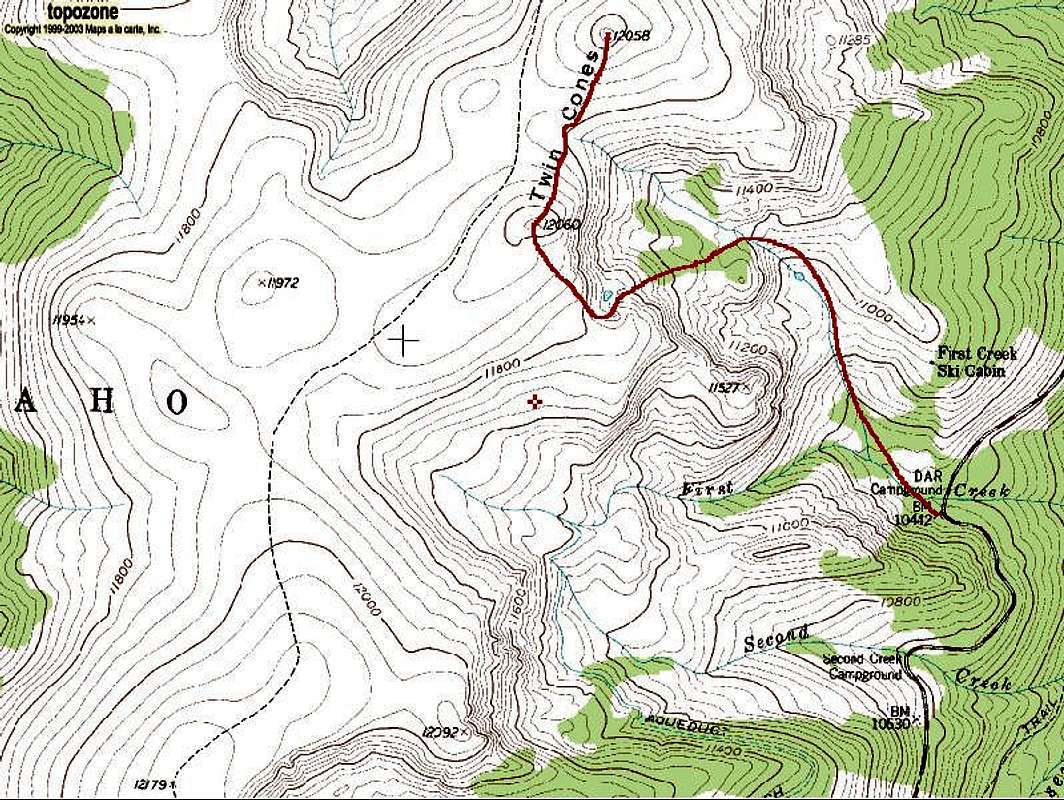
Twin Cones' First Creek Route