You primarily seem in ice tall around 600/650 meters high and revolt toward the Valsavarenche Valley and hemmed by two edges: the N-NE Crest if to the left and her W-NW Ridge to the right; the average or middle inclination amongt the various streets in ice is 60°~, having varied since 45°/50°~ of the by n° 2 Route to the 75°~ of the by n° 8 Route (in the old times and actually to the beginning of the '900 also to 90°/95°~ (slope) and perhaps over of inclination, as from B&W pictures of the epoch; historical route and in the street of inexorably non-existence). ALL the STREETS from Northern, EXPOSED here, they ask for a very good training, excellent conditions meteo and a suitable and efficient equipment. To abdicate case of uncertain time or, worse, bad. Recently a misfortune for these factors has caused four corpses among various ropes Czechoslovak, engaged him, despite the very bad time, on the Crest N-NE of it. Together with the NE (by Lino Binel and Amilcare Crétier) and NW Face (by Lino Binel, Albert Deffeyes, Remo Chabod and famous Valtournanche's mountain guide Luigi Carrel also called "Carrellino") of The Grivola, N Walls of the Roccia Viva (by Giuseppe Delmastro-Carlo Pol) and Gay's Becca (F. Nagele, G. Perugini and Toni Usmiani), it constitutes one of the slopes in ice more renowned, binding and fascinating than the homonym group. Her conquest from the rope "valdotains", formed by Luigi Bon and by the famous Academicians of the Italian Alpine Club Amilcare Crétier and Renato Chabod in the '30 belong to the History of the ascensions of the great glacial walls characterized and proper of the end of the Twenties/Thirties in Aosta's Valley and French and Swiss surroundings: from the triptych also "trittico" (Red Sentinel, The Major, The Poire Routes) of T. Graham Brown to the Brenva's Face of Mount Blanc, to the N Wall of the Aiguille Blanche of Péuterey, from Renato Chabod-Aimé Grivel, to the Couloirs-Gulllies Piero Filippi-Piero Ghiglione-Francesco Ravelli of the E Face of the Tacul's Mount Blanc and Varying Direct of left Giusto Gervasutti-Renato Chabod, to the N Wall of the Aiguille of Triolet of the strong Swiss ice-climbers Robert Gréloz and André Roch, to the Ns and NE Faces of the Mont Dolent, respectively of the consorts Mr & Mrs Golay/Schonenberger and of the legendary rope Chamonix Marcel Couturier, Armand Charlet and Alfred Simond, to the SW Wall of the Great Combin de Grafeneire, by a the group of roped "valdotains" climbers Amilcare Crétier-Lino Binel-Michele Baratono-Alberto Deffeyes, to the N Face of the Dent d'Hérens, of Eugen Allwein together with the famous Willi "Willo" Welzenbach, to the great exploit/enterprise on the Northerly of the Matterhorn also Cervino, his/her brothers' masterpiece Franz and Toni Schmid, to the W Wall of the Western Breithorn (E. R. Blanchet together with the renowned ice-climber of epoch Kaspar Mooser), to the W (Giorgio Brunner and Zermatt's mountain guide Bernard Biner) and N-NE (E. R. Blanchet, Kaspar Mooser and Josef Aufdenblatten) Walls of the Western Lyskamm and finally in the streets of the great routes of the Mount's Rosa E Face (Gnifetti Point: NE Central Ribbing "French's Route", authors Lucien Devies-Jacques Lagarde; Of it "Right Nervation/Ribbing", of Massimo Migliola, Giuseppe Mosca; Cesare Pironi with Zaverio Zurbriggen; NE "Central Variation", by Remo Minazzi, Dario Palazzolo and Arturo Peirano, Punta Zumstein: O Face also "Mooser Route", by the same with E. R. Blanchet and Josef Aufdenblatten and, to end, Colle Zumstein from "Great Crest Ettore Zapparoli" and through the immensely enormous E Face, by the group of mountain guides of the "Valtornenza" Alberto Bich, Amato Bich, Battista Maquignaz, Camillo Maquignaz and Casimiro Bich).
Parete prevalentemente in ghiaccio alta circa 600/650 metri e rivolta verso la Valsavarenche ed orlata da due creste: la N-NE a sinistra e la W-NW a destra; la pendenza media tra le varie vie in ghiaccio è di 60°~, variando dai 45°/50°~ della Via n° 2 ai 75° della Via n° 8 (nei tempi antichi e sino all'inizio del '900 anche a 90°/95°~ e forse oltre di pendenza, come da foto in B&N dell'epoca; itinerario storico ed in via di disparizione). TUTTE le VIE da N, qui ESPOSTE, richiedono ottimo allenamento, buone condizioni meteo ed un'adeguata ed efficiente attrezzatura. Rinunciare in caso di tempo incerto o, peggio, cattivo. Recentemente una disgrazia per questi fattori ha causato quattro morti tra varie cordate Cecoslovacche, ingaggiatesi, nonostante il tempo pessimo, sulla Cresta N-NE. Insieme alle due Pareti NE (ad opera di Lino Binel e Amilcare Crétier) e NW (Lino Binel, Albert Deffeyes, Remo Chabod e la celebre guida di Valtournanche Luigi Carrel detto il "Carrellino") della Grivola, N della Roccia Viva (Giuseppe Delmastro-Carlo Pol) e N della Becca di Gay (F. Nagele-G. Perugini-Toni Usmiani), costituisce una delle salite in ghiaccio più rinomate, impegnative ed affascinanti dell'omonimo gruppo. La sua conquista da parte della cordata valdostana, formata da Luigi Bon e dai celebri Accademici del C.A.I. Amilcare Crétier e Renato Chabod nel '30, appartiene alla Storia delle ascensioni delle grandi pareti glaciali proprie della fine degli Anni Venti/Trenta in Valle d'Aosta e sulle cime circostanti Francesi, nonché Svizzere: dal trittico (Sentinella Rossa, Major e Poire) di T. Graham Brown alla Brenva, alla N della Blanche di Péuterey, da parte di Renato Chabod ed Aimé Grivel, ai Canaloni Piero Filippi-Piero Ghiglione-Francesco Ravelli e Variante Diretta di sinistra di Giusto Gervasutti-Renato Chabod alla E del Mont Blanc de Tacul, alla N del Triolet dei forti ghiacciatori svizzeri Robert Gréloz ed André Roch, alle N e NW del Mont Dolent rispettivamente dei coniugi Golay/Schonenberger e della mitica cordata "Chamouniarde" Marcel Couturier, Armand Charlet e Alfred Simond, alla SW del Grand Combin de Grafeneire, ad opera della cordata "valdotena" Amilcare Crétier-Lino Binel-Michele Baratono-Alberto Deffeyes, alla N della Dent d'Hérens, di Eugen Allwein insieme al famoso Willi "Willo" Welzenbach, alla grande impresa sulla Nord del Cervino, capolavoro dei fratelli Franz e Toni Schmid, alla Diretta O sul Breithorn Occidentale (E. R. Blanchet insieme al famoso ghiacciatore dell'epoca Kaspar Mooser), alle Pareti Ovest (Giorgio Brunner e la guida di Zermatt Bernard Biner) e N-NE (E. R. Blanchet, K. Mooser con Josef Aufdenblatten) del Lyskamm Ovest ed infine alle vie della grande Parete E del Monte Rosa (Punta Gnifetti: NE via Centrale dei "Francesi", autori Lucien Devies-Jacques Lagarde; NE "Nervatura" di destra di Massimo Migliola-Giuseppe Mosca-Cesare Pironi-Zaverio Zurbriggen; NE "Variante Centrale", di Remo Minazzi-Dario Palazzolo-Arturo Peirano. Punta Zumstein: Parete O o Via Mooser di questi con E. R. Blanchet e Josef Aufdenblatten e, per finire, Colle Zumstein dal Crestone Ettore Zapparoli e per l'immensa ed enorme Parete E, da parte del gruppo di guide della "Valtornenza" Alberto Bich, Amato Bich, Battista Maquignaz, Camillo Maquignaz con Casimiro Bich).
First ascents
N-NE CREST:
N-NE Crest (from Piccolo Paradiso Pass): F. T. Wettered with mountain guides Laurent Proment and Eliseo Jeantet, (Jul 20th, 1876).
N-NE Crest (integral from Frassy Point): E. Javelle with mountain guides J. Mooser and F. Fournier, (Jul 29th, 1876).
N-NE Crest (integral from Montandayné Pass): Unknown.
NORTH WEST FACE:
NW Face and N-NE Crest: Aldo Bonacossa and Vitale Bramani, (Jul 28th, 1930).
NW Face (Left "Ribbing"): Luigi Bon, Amilcare Crétier and Renato Chabod, (Jul 11th, 1930). *** first winter: Franco Garda and Sergio Giometto, (Jan 20th, 1957).
NW Face (Mixed Route 1958/1930): Ilario Antonio Garzotto and Osvaldo Cardellina, Vito Favre and Giuseppe "Pino" Trevisan, (Jun 22th, 1969).
NW Face (entirely in ice): Corrado Bertolone, Franco Cappa and Gino Giorda, (Jul 06th, 1958). * First Replay: Franco Garda and Sergio Giometto, (Jul 13/14th, 1958).
NW Face (Mixed Route 1936/1961/1958): Renato Quendoz and Ruggero Busa, Vito Favre and Osvaldo Cardellina, (Jul 07th, 1968).
NW Face (Direct Route): Kurt Diemberger and Kurt de Hesselle, (Jul 1961). ** First Lone: G. Gazziano, (Jun 09th, 1975).
NW Face (Super Direct or of Seracs Route): Ugo Manera and P. Rossetti, (Jun 25th, 1978).
NW Face (Right Route): Gian Carlo Grassi and a French équipe, (Aug 1977).
NW Face (Western Spur): Enrico Adami and Paolo Ceresa, (Jul 15th, 1935). * First ? Replay: Alessandro Casalegno and Maurizio Castellan, (Jul 1982).
NW Face (Western Spur Glacial Variant): Luigi Cantono and Primo Momo, (Aug 13th, 1939). * First Replay: Maria Celeste-Vally Viano-Ferdinando Bauchiero-Giovanni Miglio-Giorgio Viano, (Jun 12th, 1955).
NW Face (Ribbing of Quota 3.882m): F. Locatelli, Ugo Manera, Carlo Sant'Unione, Comotto, Foglia, Leccese and Mancini, (Jun 23th, 1974).
W-NW GREAT RIDGE:
W-NW Ridge: E. Abbate and G. Zoppi, G. Gadin and G. Melica, (Aug 22th, 1884).
W-NW Ridge (integral from base): A. Treves and C. Zucconi with Valsavarenche mountain guides U. Dayné and E. Dayné, (Jul 23th, 1912).
W-NW Ridge (South Edge of the rocky basic triangle): brothers Enrico Camanni and Mario Camanni, (Sep 16th, 1978)
Getting There
BY CAR:
From Torino, Milano, etc: Motorway A5. Exit at Aosta Ovest. Drive to the near Aymavilles. Follow the directions for Valle di Cogne or Pont di Valsavarenche.
From Switzerland: through the Grand Saint Bernard Tunnel or the namesake Pass. Drive to Aosta, then follow the direction for Courmayeur on SS.26. Just after Sarre, turn to the left, in the direction of Valle di Cogne or Pont di Valsavarenche.
From France: through Mont Blanc Tunnel or Petit St. Bernard Pass. It isn't necessary to take Motorway A5: you can drive on SS.26, in the direction of Aosta. Before arriving at the Village of Sarre, turn right following the sign for Valle di Cogne or Pont di Valsavarenche from Villeneuve Village.
BY PLANE:
Aeroporto "Corrado Gex" Saint Christophe (Aosta).
At Routes Approachs
To NW Wall and W-NW Great Ridge through Valsavarenche Valley:
A) - the ascent to Northern Routes of the Gran Paradiso is generally done in two stages: on the first day you follow the normal route to Gran Paradiso and gain 880/90m~ of elevation from the fork on main road (1.829m; small earth parking, immediately afterwards the Camping Great Paradise) to Renato and Federico Chabod Refuge (2.810m). The ascent happen by path n° 5/10A passing through Previou (1.869m), Lavassey (2.194m) Pastures and crossing under the Savatère Coastline (2.575m), by a difference in level about 900m (E; 1h'30/2h'00). The second day is spent on the climb to the Summit: from hut, by same standard route to "Granpa" on Lavec(c)iaù Glacier with deviation at quota 3.300m, to various routes of the North-western Face and to of the Great Ridge West-Northwest (numerous crevices; look out!) reaching the routes at 3.400/50m.
A) - tutte le vie del Versante Settentrionale del Gran Paradiso vengono generalmente percorse in due giorni: primo giorno partendo da Pont Valsavarenche (bivio 1.829 m con piccolo parcheggio in terra subito dopo il Camping Gran Paradiso) ed appoggiandosi al Rifugio Renato e Federico Chabod (2.810 m). La salita avviene tramite il sentiero n° 5/10A, passante per le Alpi e transitante sotto la Costa Savatère (2.575 m) e con un dislivello di circa 900 m (E; 1h'30/2h'00). Secondo giorno: dal rifugio, con la stessa via normale per il "Granpa" sul Ghiacciaio di Lavec(c)iaù e deviazione a 3.300 metri circa verso le vie della Parete NW o del Crestone W-NW, raggiungendole sui 3.400/50~ metri.
B) - even using the two (Old and New) Vittorio Emanuele I° Refuges, the all ascents to Northern Routes of the Gran Paradiso is usually done in two stages: on the first day you follow the normal route to Gran Paradiso and gain 770m~ of elevation from Pont (1.960m) to two Refuges Vittorio Emanuele (2.734m) and (2.745m). From great ground park, nearby the Camping Pont-Breuil 1.952m) cross the Savara Stream (abounding signs and panneaux for the path n° 1) through a wooden bridge and, by South direction and along the same torrent, continue as far as the 1.991m pasture, in renovation stage; doubling this in right go up on upper promontory by dint of hairpin bends and cross over the Chanté Alp (2.372m, ruins). Through a final diagonal overcome the about 770 meters difference in level reaching the two huts (E; 1h'15/2h'00). The second day is spent on the climb to the Summit. From Vittorio Emanuele II° Refuge: through normal route traces behind the hut, go up North direction on lateral right moraine of the Gran Paradiso Glacier and join the Montcorvé Rise in quota about 3.170/80m. Easily cover to Northeast and at quota 3.431m go down 100 meters up Laveciaù Glacier to opening of the various routes.
B) - anche utilizzando i due rifugi (Vecchio e Nuovo) Vittorio Emanuele I°, tutte le vie del Versante Settentrionale del Gran Paradiso vengono generalmente percorse in due giorni partendo da Pont Valsavarenche (1.960 m) ed appoggiandosi agli stessi: nel primo giorno partendo dal grande parcheggio in terra battuta, vicino al Camping Pont-Breuil (1.952 m), con direzione S si sale dapprima con la Mulattiera Reale lungo il Torrente Savara (abbondanti segnalazioni e pannelli indicanti il sentiero n° 1) doppiando a sinistra l'Alpeggio 1.991 m, in fase di ristrutturazione; poi superando il soprastante promontorio, a furia di tornanti, passando sopra l'Alpeggio diroccato di Chanté (2.372 m) e con un diagonale finale, si vincono i 770~ metri di dislivello raggiungendo i due rifugi (2.734 m e 2.745 m); E; 1h'15/2h'00). Secondo giorno: dal Rifugio Vittorio Emanuele II°: con la traccia della via normale retrostante al rifugio risalire la morena laterale destra del Ghiacciaio del Gran Paradiso e tramite direzione NW raggiungere (un breve passaggio appena impegnativo) il dosso di Moncorvé a quota 3.170/80 m~. Percorrerlo facilmente verso NE ed a quota 3.431 m scendere per circa 100 metri a N sul Ghiacciaio di Laveciaù ed all'attacco delle varie vie.
To E-NE Crest through Valsavarenche and Cogne Valleys:
C) - from Chabod Refuge (See above Approach A): by East direction, reach the frontal moraine and the little Montandayné Glacier in quota 3.159/3.200m. To cross and go up towards Montandayné Pass (3.718m), by the great couloir between Vaccarone Point (South) and Montandayné Becca (North) and keep to the left, more and more nearby the W-NW Eperon/Spur of the last (3h'30/4h'30, along variable; dangerous for rocks and ice fallings).
C) - dal Rifugio Chabod (Vedi sopra l'Avvicinamento A): con direzione E raggiungere la morena frontale nonché il susseguente piccolo Ghiacciaio di Montandayné verso I 3.150/3.200 metri circa. Attraversarlo e risalire al soprastante ed omonimo colle (3.718 m) attraverso il gran canalone compreso tra la Punta Vaccarone (a S) e la Becca di Montandayné (a N) tenendosi sempre più vicino al Contrafforte/Sperone W-NW di quest'ultima (3h'30/4h'30, molto variabile; pericolo di cadute di pietre e ghiaccio).
D) - from Lionello and Lucio Leonessa Bivouac: First day from Cogne (1.534m) one quickly reaches the Village of Valnontey (1.666m) where parking is available in the large square near the center of the village. Start, through the path n° 22, the ascent on the orographic right (climber's left) of Valnontey. Once past the Hamlet of Valmiana (1.728m), reach the Erfaulets Bridge at (1.830m). Cross the bridge and continue along the trail until a fork at (2.080m)(1h'40/2h'00). Quite inverting the direction in right (Northwest) and through the path n° 22G, take the right branch, cross a small bridge and climb along a winding path to the "Casolari dell'Herbetet" at (2.435m) Here you will find a hut of the Gran Paradiso National Park. Continue along the steeper winding trail that climbs the grassy slopes. Once in the upper Herbetet Valley, keep slightly left; once across the Herbetet Brook, climb again in the direction of the morainic ridge surmounted by the East Ridge of Herbetet. (Follow the signs!) In its vicinity you will find the fixed Bivouac named after the brothers Lucio and Lionello Leonessa (2.910m) sleeps-12, (4h'15/4h'45 from Valnontey). Be warned that in summer the bivouac may be crowded and that it may be hard to find in the dark or in the fog. Second Day: Go to the South toward the Morains of Tsasset and of Tribolazione and pass it getting the Tribolazione glacier; along it first in the SW, near the rocks to pass over the seracs, then, at 3.100m~, in the SE trying to find the best track (changing every year due to the flow of the glacier) to get the upper plain of the Tribolazione Glacier at about 3.500m~. This step, paying attention to the falling stones, can be passed also more to the West, near the walls between the Becca di Montandaynè and the Piccolo Paradiso. Now, always toward S after climb the slopes toward the E-NE Wall as far as quota 3.577m~ and climb to East snowy/icy Slope to of the pass summit.
D) - dal Bivacco Lionello e Lucio Leonessa Primo Giorno: dall'abitato di Cogne (1.534 m) in bus o in auto sino a Valnontey (1.666 m), ove si parcheggia nel grande piazzale sito quasi al centro della frazione, iniziare tramite il sentiero n° 22 la salita sul versante della destra orografica e superato l'ameno Alpeggio di Valmiana (1.728 m). Si giunge al Ponte dell'Erfaulets (1.830 m); lo si attraversa e si prosegue per il sentiero sino al bivio 2.080 m (ore 1h'40/2h'00). Invertendo completamente direzione in NW seguire il sentiero n° 22G verso destra, oltrepassare un ponticello e superare gli ultimi balzi che portano ai Casolari dell'Herbetet (2.435 m), dove è sita la casa del P.N.G.P. Continuare a seguire il sentiero che risale il dosso erboso e, giunti sulla parte superiore del Vallone dell'Herbetet, tenersi leggermente sulla sinistra e, dopo aver attraversato un piccolo torrente, riprendere a risalire in direzione del dorso morenico dominato dal Costone Est dell'Herbetet nelle cui vicinanze è posto il nuovo bivacco del C.A.I. Lionello Leonessa (2.910 m), 12 posti letto. (ore 4h'15/4h'45 da Valnontey). Attenzione nella bella stagione il bivacco può essere affollato da numerosi alpinisti e escursionisti ed è inoltre difficile da trovare al buio o con la nebbia. Secondo Giorno: Dirigersi a S verso la Morena di Tsasset e quella della Tribolazione e scavalcarla toccando l'omonimo ghiacciaio; salire appoggiandosi dapprima a SW contro le rocce per superare le seraccate, poi a SE a quota 3.100 m~ e destreggiandosi (il percorso varia molto negli anni con il movimento dei ghiacci) raggiungere il pianoro superiore del Ghiacciaio della Tribolazione a quota 3.500 m~. Questo tratto a volte, ma facendo molta attenzione alle scariche di pietre, può essere più conveniente percorrerlo più a W contro la bastionata tra la Becca di Montandaynè ed il Piccolo Paradiso. Sempre con direzione S dapprima risalire il pendio nella direzione della parete E-NE sino a quota 3.577 m~, poi abbandonando quest'ultima a sinistra (S) portarsi alla terminale sotto il Colle di Montandayné (3.718 m) e risalirne lo scivolo ghiacciato E sino al sommo dello stesso.
E) -first day: with departure from the Tourist Village of Cogne (1.534m), through bus or through the auto always in the road for Valnontey small Village (1.666m). Cars can be parked in the great square next to the center of the country. To begin the slope of the Valnontey Valley on its orographic right side (climber's left and by the path n° 22). Go past the pleasant Pastures of Valmiana (1.728m) and reaching the little Erfaulets Bridge (1.830m), to cross it and to actually continue along the run to an alternative (2.040m, 1h'15/1h'30h), where he takes the branch of left. Only on the other side of quota 2.100m~, leaving left (Southeast) the deviation to Alessandro Martinotti and Stefano Borghi Bivouacs (paths n° 22E, 22F), continue on a less marked trace before by Southwest direction, after South, and follow the left bank of the a secondary stream and afterwards among the various ramifications of the Torrent Valnontey Sources. Head for the moraine called "Barma des Bouquetins" (= ledge/shelter for steinbocks also called ibex) (2.698m). Climb the moraine's ridge in its entirety reaching a hump. Follow this relief to a large snowfield, at the end of which you can discern a ledge going left. Climb on a faint, exposed trail for the entire length of the ledge; turn right and reach a small hanging valley. Head for the opposite side, and climb to a glacial dell between two spurs, cross it in the direction of a distinct rock gully. Climb the gully with circumspection, for the rocks are often covered with "verglass" and gravel. Past the gully, you'll get to the top of the spur, where one are installed next to the other the two you camp out fixed: Carlo Pol (3.183m, sleeps 6) and Marcello Gérard - Ettore Grappein (3.200m, sleeps 9) (5h'30/6h'30 h from Valnontey).
E) - primo giorno: con partenza dal Villaggio Turistico di Cogne (1.534 m), tramite bus oppure per mezzo dell'auto sempre sulla strada per il piccolo Villaggio di Valnontey (1.666 m). Le auto possono essere parcheggiate nel grande piazzale vicino al centro del paese. Iniziare la salita della Valnontey sul suo lato destro orografico (ovvero a sinistra per chi sale e con il sentiero n° 22). Superare i pascoli piacevoli di Valmiana (1.728 m) ed, arrivando al piccolo Ponte dell'Erfaulets (1.830 m), attraversarlo e proseguire lungo il percorso sino ad un bivio (2.040 m, 1h'15/1h'30h), dove si prende il ramo di sinistra. Appena oltre ed a quota 2.100 m~, lasciando a sinistra (SE) la deviazione per i Bivacchi Alessandro Martinotti e Stefano Borghi (sentieri n° 22E, 22F), seguire su di una traccia meno marcata prima con direzione SW, poi S, la riva sinistra di un torrente secondario e successivamente continuare tra le varie ramificazioni delle Sorgenti del Torrente di Valnontey raggiungendo la testata della valle per la morena chiamata "Barma des Bouquetins" (= cengia/ricovero per gli stambecchi)(2.698 m). Risalirla nella sua interezza raggiungendo un dosso/promontorio. Seguire questo rilievo fino ad un grande nevaio, al termine del quale è possibile scorgere una sporgenza ed andarne a sinistra. Salire su di una vaga traccia di sentiero esposto per tutta la lunghezza della sporgenza; girare a destra e raggiungere una piccola valle pensile. Dirigersi verso il lato opposto, e salire in direzione di una valletta glaciale posta fra due speroni; la si attraversa in direzione di un roccioso ed evidente canalone/burrone. Salirne la gola con circospezione, perché le rocce sono spesso coperte di "verglass" e ghiaia. Oltrepassato il canalone, si arriva sulla sommità dello sperone, dove sono installati uno vicino all'altro i due bivacchi fissi: Carlo Pol (3.183 m 6 posti letto) e Marcello Gérard - Ettore Grappein (3.200 m, posti letto per 9) (5h'30/6h'30 dal Villaggio di Valnontey).
E) -second day: from Carlo Pol and Gerard Grappein Bivouac: from Carlo Pol and Gerard Grappein Bivouacs: from both the bivouacs cross in Northwest the Tribolazione Glacier (very dangerous route at your own risk and danger, numerous crevasses raison, variant year and year; sometimes non recommended); at base of the Montandayné Pass rejoin with precedent route of the Leonessa Bivouac.
E) - secondo giorno: dai due Bivacchi Carlo Pol e Gerard Grappein: con partenza da entrambi I bivacchi, attraversare il Ghiacciaio della Tribolazione verso NW (percorso pericoloso a proprio rischio e pericolo con numerosi crepacci e varianti di percorso da definire di anno in anno; in alcuni casi sconsigliabile); alla base del Colle di Montandayné ricongiungersi con l'itinerario precedente proveniente dal Bivacco Leonessa.
Routes Description
1) - N-NE Ridge: great crest watershed among the Valleys of Cogne (to East) and of Valsavarenche (to West) it comes down, with sinuous "trend", toward North from the Peak of the Gran Paradiso, stings culminating of the whole group mountainous and only completely Italian top in the Valley of Aosta of over 4.000 meters, and fit to separate the two important valleys. Form, road doing, numerous, magnificent and important mountains like the Piccolo Paradiso (3.926m) with his numerous and jagged summital steeples, Peck at her of Montandayné (3.838m), the elegant and triangular pyramid of the Herbetet (3.778m), the Grand Sertz also Grand Serre (3.553m) covered by the glaciers, for finally to rise again herself, after the frequented with the Lauson Pass (3.296m), to the splendid and famous pyramids of the Grivola (3.969m) and of the Grand Nomenon (3.488m) to finally finish on the Central Valley of the Dora (= Dora Baltea Stream, the most important of the Aosta Valley)) Baltea in a district amongst the Communes of Valsavarenche, Aymavilles and Cogne, towards the entrance of the two valleys "valdotaines" of the Gran Paradiso Mountain Chain. The sector most specific essay go up from the Pass of Montandayné to the Gran Paradiso, even if in tightened sense the part really related to the N-NE Crest of the mountain has beginning from the Pass of the Piccolo Paradiso (3.877m) as far ass to the maximum Peak (4.061m). * HISTORICAL NOTE AND TECHNIQUE: it results to be the first street traced on the Northern Slope of the mountain (forehead to the Valsavarenche and on the watershed Valsavarenche/Cogne Valleys) and it slightly possesses a controversial history and brightly unraveled by the authors of the Guida C.A.I./T.C.I. "GRAN PARADISO Parco Nazionale" Emanuele Andreis-Renato Chabod-Mario Carlo Santi, Edit for the first time in 1939 and with reprints of 1963 and 1980. Synthesizing: the first slope of the crest belongs to the rope formed by the mountain climber English F.T. Wethered accompanied by the guides Laurent Proment and Eliseo, respectively of the Villages of Cormayeur and Cogne in date Jul 20th, 1876. The same, taking the movements from Cogne and through the Glacier of the Tribulation, it went up again the slope it is of the Pass of the Little Paradise, but it didn't reach it immediately landing instead on the snowy great shoulder to South of the same; from there it continued in crest meeting the only serious difficulty in the overcoming of the Quota 3.975m , faced on her Western side. After it always continued on the thread of crest lending well attention to the big frames, then surely of others and greater dimensions. Nine days later Emile Javelle with J. Mooser and F. Fournier the it referred but departing from the Southern Points of the Little Paradise (Nord 3.926; South 3.925m) or also said Point Frassy, reached always by the Tribulation through the Wall Of it and the Crest it is since in highest of the snowy shoulder 3.919m. Unaware to have been preceded by the party Wethered they attributed the first ascension and so it resulted for a lot of time: : "… for this street that we have perhaps crossed for the first ones, the ascension is of an impressive beauty, she remembers the crests of the Weisshorn and the Dent Blanche. From this point where they are found some rather thin and fragile snowy frames, an only passage introduces some difficulties; a rocky point that raises him to half route... there is not more than to follow a beautiful crest of snow, formed here and there of the frames that lean toward Cogne and on which needs to proceed with great precautions... " (note of George Yeld in "Alpine Journal" IX, page 363 from the "Book of the Travellers" of the hotel Royal of Courmayeur by remarks of Emile Javelle; the same unpublished annotations were revisited in 1938 by the compilers of the guide above mentioned and quote in the 1939, First Edition. Very probably you are already been viewed and sifted by the magazine of mountain "Alpinismo" 1937, page 74, that it already lifted doubts on the result to be this the first ascent of the N-NE Crest.). From Montandayné Pass enough easily go up toward the Little Paradiso, formed particularly by various steeples, spires, pinnacles and summits, with three in particular evidence: to scramble toward her/it before also called Stings Luigi Vaccarone Point (3.872m), but revolving on the left (East) a more binding plate (slab more difficult (II°+/III°-; see the second photograph in her "lace") and cross in South overcoming over the Central or Farrar Point (3.919m) es the two Southern also called Frassy Points (NW Summit 3.926m; South Summit 3.925m) reaching before the Quota 3.903m and with swiftness the Little Paradiso Pass (3.877m). Through a terminal partially snowy, with a more aerial terminal line, to grab in the final part the true North Ridge of the Gran Paradiso before to Real Summit and, immediately afterwards (short passage in descent of II°; sometimes delicate for covered with snow), to reach the Little Virgin Mary Statue on Traditional Summit (PD+/AD-; recommended period: half Jul/Aug/Sep; 4h'00/6h'00).
1) - Cresta N-NE: grande cresta spartiacque tra le Vallate di Cogne (ad E) e di Valsavarenche (ad O) discende verso Nord dalla Vetta del Gran Paradiso, punto culminante dell'intero gruppo montuoso ed unica cima completamente italiana in Valle d'Aosta di oltre 4.000 metri, ed atta a separare le due importanti vallate. Forma, strada facendo e con andamento sinuoso, numerose, magnifiche ed importanti montagne come Il Piccolo Paradiso (3.926 m) con le sue numerose e frastagliate guglie sommitali, la Becca di Montandayné (3.838 m), l'elegante e triangolare piramide dell'Herbetet (3.778 m), il Grand Sertz o Grand Serre (3.553 m) ricoperto dai ghiacciai, per infine rialzarsi, dopo il frequentato Col Lauson (3.296 m), alla splendide e famose piramidi della Grivola (3.969 m) e del Grand Nomenon (3.488 m) per terminare sulla Valle Centrale della Dora Baltea in un circondario comprendente i Comuni di Valsavarenche, Aymavilles e Cogne, all'imbocco delle due valli valdostane della Catena del Gran Paradiso. Il settore più specifico trattato và dal Colle di Montandayné al Gran Paradiso, anche se in senso stretto la parte realmente relativa alla Cresta N-NE della montagna ha inizio dal Colle del Piccolo Paradiso (3.926 m) sino alla Vetta massima (4.061 m). * NOTA STORICO/TECNICA: risulta essere la prima via tracciata sul Versante Settentrionale della montagna (fronte alla Valsavarenche e sullo spartiacque Valsavarenche/Valle di Cogne) e possiede una storia leggermente controversa e brillantemente dipanata dagli autori della Guida C.A.I./T.C.I. "GRAN PARADISO Parco Nazionale" Emanuele Andreis-Renato Chabod-Mario Carlo Santi, Edita per la prima volta nel 1939 e con ristampe del 1963 e del 1980. Sintetizzando: la prima salita della cresta appartiene alla cordata formata dall'alpinista inglese F.T. Wethered accompagnato dalle guide Laurent Proment ed Eliseo, rispettivamente dei Villaggi di Cormayeur e di Cogne in data 20 Luglio 1876. La stessa, prendendo le mosse da Cogne ed attraverso il Ghiacciaio della Tribolazione, risalì il versante E del Colle del Piccolo Paradiso, ma non lo raggiunse approdando invece sullo spallone nevoso subito a Meridione dello stesso; da lì proseguì in cresta incontrando l'unica seria difficoltà nel superamento della Quota 3.975 m, affrontata sul suo lato Occidentale. Dopo di ché continuò sempre sul filo di cresta prestando ben attenzione alle grosse cornici, allora sicuramente di altre e maggiori dimensioni. Nove giorni dopo Emile Javelle con J. Mooser e F. Fournier la ripercorse ma partendo dalle Punte Meridionali del Piccolo Paradiso (Nord 3.926; Sud 3.925 m) o anche detta Punta Frassy, raggiunta sempre dalla Tribolazione tramite la Parete NE e la Cresta E sin in sommo della spalla nevosa 3.919 m. Ignari di essere stati preceduti dalla comitiva Wethered, se ne attribuirono la prima ascensione e così risultò per molto tempo : " … per questa via che abbiamo percorso forse per i primi, l'ascensione è di una bellezza impressionante, ricorda le creste del Weisshorn e della Dent Blanche. Oltre qualche punto ove si trovano delle cornici nevose piuttosto sottili e fragili, un solo passaggio presenta delle difficoltà; una puntina rocciosa che si eleva a mezza via ... non v'é più che da seguire una bella cresta di neve, formante qua e là delle cornici che strapiombano verso Cogne e sulle quali bisogna procedere con grandi precauzioni ... " (note di George Yeld in "Alpine Journal" IX, page 363 e tratte dalle annotazioni di Emile Javelle nel "Libro dei Viaggiatori" dell'Hotel Royal di Courmayeur; le stesse inedite annotazioni furono rivisitate nel 1938 dai compilatori della guida sovra menzionata e citate nella Prima Edizione del 1939. Molto probabilmente erano già state visionate e vagliate dalla rivista di montagna "Alpinismo" 1937, pagina 74, che sollevava già dubbi sull'esito di essere questa la prima salita della Cresta N-NE.). Dal Colle di Montandayné salire abbastanza facilmente verso il Piccolo Paradiso, formato da varie guglie, pinnacoli e sommità con tre in particolare evidenza: arrampicare verso la prima o Punta Luigi Vaccarone (3.872 m), ma aggirando sulla sinistra (E) una placca più impegnativa (II°+/III°-; vedere la seconda foto nella "stringa") ed attraversare in direzione S, scavalcando le Punte Farrar o Centrale (3.919 m) e le due Punte Frassy o Meridionale (NW 3.926 m; S 3.925 m) raggiungendo prima la Quota 3.903 m e con una breve discesa subito dopo il Colle del Piccolo Paradiso (3.877 m). Con un tratto finale più aereo, afferrare nella parte finale la vera Cresta N del Gran Paradiso adducente alla Vera Cima; dopo una breve e facile discesa (II°; a volte delicato per la presenza di innevamento), raggiungere la Madonnina della Vetta Tradizionale (PD+/AD-; periodo consigliato: Luglio/Agosto/Settembre; 4h'00/6h'00).
2) - NW Face and N-NE Ridge: by atypical and probably more repeated, it consists in an attempt not succeeded of ascension of the real Wall NW of the Gran Paradiso; realized with a direct and central attack in the frozen wall, gone up again for around 200 meters but then interrupted for the bad conditions of the ice, and in a long and certainly not easy crossing on the left climbing over the two following rocky "groins". A further wall in ice in the sector most Oriental, even if less steep, it conducts not without difficulty to the N-NE Crest, near the small tower 3.975 but and through this to the peak with the last part of the itinerary n° 1. * HISTORICAL NOTE AND TECHNIQUE: first serious and known approach towards the great Wall NW of the Gran Paradiso, that had already attracted the eye of the best mountain climber of beginning century XX°; the attempt is brought by two names of the Italian mountaineering: Aldo Bonacossa that you has marked with a lot of new streets of the classical style the decade of the Twenties and Vitale Bramani, famous inventor and "tester" of the sole in rubber VIBRAM as from his initials of full name. It is accustomed to that, you apply to the boots, they supplanted the old spiked shoes or "Tricouni" revolutionizing completely the way of climbing and to go to mountain. The rope, departing from the Shelter Vittorio Emanuele II°, it attached to the dawn of 28 June of 1930 actually climbing vertically at the base of the inferior serac, then of well other dimensions; the conditions of the ice (in comparison to the available equipment to that times) they convinced the two mountain climber to abdicate the slope of the real wall forcing them to look for to the left a street of escape (N-of it). They also went beyond the ribbing of left (what few days I approach you would have allowed the first slope of the same one the Academicians of the C.A.I. Amilcare Crétier and Renato Chabod together with Luigi Bon; you see her Route n° 3) and, with a long diagonal, always on the left, they were addressed toward a second and less important rib, coming from her Quota 3.975m on the Crest N-NE. Climbed over her, they concluded out along the most oriental sector of the wall going out to the left immediately of finishing in Peak with the crest watershed aforesaid. Theirs the first historical attempt remains however and served as warning sign to the result from there to few days of the rope Aosta Valley. From bergsrunde, by a long left diagonal (NE), reach the Little Paradiso Pass (3.877m) and, by an aerial and exposed N Edge, after the small tower Quota 3.975m, with snowy route (in North, to Tribolazione Glacier, frames) to Summit. As it regards the technical and historical notes to see even the underlying one Route n° 3) (AD; best time: end June/July; 4h'00/5h'00).
2) - Parete NW e Cresta N-NE: via atipica e probabilmente mai più ripetuta, consiste in un tentativo non riuscito di ascensione della vera e propria Parete NW del Gran Paradiso; realizzata con un attacco diretto e centrale nel muro ghiacciato, risalito per circa 200 metri, ed in una lunga e certamente non facile traversata sulla sinistra scavalcando i due successivi costoloni rocciosi. Un ulteriore parete in ghiaccio nel settore più Orientale, anche se meno ripida, conduce non senza difficoltà alla Cresta N-NE, nei pressi del torrione 3.975 m e tramite questa alla vetta con l'ultima parte dell'itinerario n° 1. * NOTA STORICO/TECNICA: primo approccio serio e conosciuto nei confronti della grande Parete NW del Gran Paradiso, che già aveva attratto l'occhio dei migliori alpinisti di inizio secolo XX°; il tentativo è portato da due nomi dell'alpinismo italiano: Aldo Bonacossa che ha segnato con molte vie nuove di stile classico il decennio degli Anni Venti e Vitale Bramani, famoso inventore e collaudatore delle suole in gomma VIBRAM come da sue iniziali di nome e cognome. Suole che, applicate agli scarponi, soppiantarono le vecchie scarpe chiodate o "Tricouni" rivoluzionando completamente il modo di arrampicare e di andare in montagna. La cordata, partendo dal Rifugio Vittorio Emanuele II°, attaccò all'alba del 28 Giugno del 1930 salendo verticalmente sino alla base del seracco inferiore, allora di ben altre dimensioni; le condizioni del ghiaccio (rispetto all'attrezzatura disponibile a quei tempi) convinsero i due alpinisti a rinunciare alla salita della parete vera e propria obbligandoli a cercare una via di fuga più a sinistra (N-NE). Oltrepassarono anche la nervatura di sinistra (che pochi giorni appresso avrebbe permesso la prima salita della medesima agli Accademici del C.A.I. Amilcare Crétier e Renato Chabod insieme a Luigi Bon; vedi la Via n° 3) e, con un lungo diagonale, sempre sulla sinistra, si indirizzarono verso una seconda e meno importante costola, proveniente dalla Quota 3.975 m sulla Cresta N-NE. Scavalcatola sulla sinistra, conclusero lungo il settore più Orientale della parete fuori uscendo, subito ancora sulla sinistra della medesima, e terminando in Vetta con la cresta spartiacque suddetta. Rimane comunque il loro il primo tentativo storico e fece da prodromo alla riuscita da lì a pochi giorni della cordata valdostana. Dalla crepaccia terminale con un lungo diagonale a sinistra (NE) raggiungere il Colle del Piccolo Paradiso (3.877 m) e per l'aerea nonché esposta Cresta Nord, dopo aver superato il torrione Quota 3.975 m tramite percorso in neve o ghiaccio (cornici generalmente verso E ovvero sul Ghiacciaio della Tribolazione) abbastanza agevolmente alla Vetta. Per quanto concerne le note tecniche nonché storiche, vedere anche la sottostante Via n° 3) (AD; periodo consigliato: fine Giugno/Luglio; 4h'00/5h'00).
3) - NW Face (Left "Ribbing"): the first entire ascent and almost complete of the wall. Historically it is not the first attempt of slope of the same one, since the 28 of June of the same year the rope Aldo Bonacossa-Vitale Bramani it reached the inferior serac for then to divert with a long diagonal toward left. After having doubled the "nervature" of the Street Amilcare Crétier and Companions, he directed to the left dark even toward the following rib and descending from the Quota 3.975m; after the traverse of the same still on the left of it directed to the n-NE Crest, for which concluded in Peak you (see the Route n° 2). The first replay is work of a stranger Austrian rope, while the first winter is worth of the two guides of the Aosta Town Franco Garda and Sergio Giometto in date January 20th, 1957 (sixth absolute ascension of the wall). * HISTORICAL NOTE AND TECHNIQUEfrom the " Alpine Diary Ascents in Aosta Valley 1921-1933" of Amilcare Crétier, Edit Nuovi Sentieri with Section of the Verrès C.A.I. and of Verrès Library on July 1993: "... Left the shelter at 3 o'clock, me always only, dreaming, in before, we reach the first bergsrund at 9 o'clock. to the shelter... To the second terminal crevasse we reach 6.30 o'clock. ... To the first rocks we reach at 8.20 o'clock. ... Meanwhile the time has gone spoiling. In peak it already blows a few of snowstorm:... In the last 190-200 meters, to overcome the dome of alive ice, in the middle of the quess (= blizzard, note by author), me, in kind, I have to work a great deal with the ice axe Grivel, to cut: breadths and comforts stairs because any insurance is possible. I cut with a lot of a will, vigor and energy, and... Chabod, last, ago of the mathematical calculations on the probability of our fall, if he falls in a channel, rather than in the other, where it fights, where hope there is to arrive etc... Arrival, also benefiting me of a small longitudinal crevasse, on the crest at 10.55 o'clock. Is not seen anything... " To attach at the base of the "nervature" of left overcoming a first bergsrunde, after a very steep initial frozen slope not (45°/48°) to reach a second of it; to climb the following slide of greater steepness (actually to 60° and over) bringing himself against the rocky rib that is undoubled to the base (possibility to find a lower case letter crack in the ice, very useful to do safety inserting you an only leg). Go up by solid granite and non difficult rocks (from II° as far as III°-), but often with "verglass" (III°+, in this situation) get out on N-NE Ridge about 90/100 meters from Summit (D+; best time: end June/July/August; 4h'00/6h'00, much variable in base of snowy conditions of the rocks).
3) - Parete NW (Nervatura di sinistra): la prima salita vera e propria e quasi completa della Parete. Storicamente non é il primo tentativo di salita della stessa, poiché il 28 di Giugno dello stesso anno la cordata Aldo Bonacossa-Vitale Bramani raggiunse il seracco inferiore per poi deviare con un lungo diagonale verso sinistra. Dopo aver doppiato la nervatura della Via Crétier e Compagni, si diresse verso la successiva costola ancora più a sinistra e discendente dalla Quota 3.975 m; attreraversatala oltremodo sulla sinistra (NE) di diresse alla Cresta N-NE, per la quale concluse in Vetta (vedi la Via n° 2). La prima ritetizione é opera di una sconosciuta cordata austriaca, mentre la prima invernale é merito delle due guide aostane Franco Garda e Sergio Giometto in data 20 Gennaio 1957 (sesta ascensione assoluta della parete). * NOTA STORICO/TECNICA: dal "Diario Alpinistico Ascensioni in Valle d'Aosta 1921-1933" di Amilcare Crétier, Edit Nuovi Sentieri da parte della Sezione del C.A.I. di Verrès e della Biblioteca di Verrès nel Luglio 1993: "... Lasciato il rifugio alle 3, io sempre solo, sognando, in avanti, arriviamo alla prima bergsrund alle 9. al riparo ... Alla seconda bergsrund arriviamo alle 6.30. ... Alle prime roccie perveniamo alle 8.20. ... Intanto il tempo si é andato guastando. In vetta soffia già un pò di tormenta: ... Negli ultimi 190-200 metri, per superare la cupola di ghiaccio vivo, in mezzo al quess (= tormenta, nota dell'autore), io, in specie, devo lavorare assai con la picozza Grivel, a tagliare: larghi e comodi scalini perché nessuna assicurazione é possibile. Taglio con molta lena, e ... Chabod, ultimo, fa dei calcoli matematici sulla probabilità della nostra caduta, se si cade in un canale, piuttosto che nell'altro, dove si batte, dove c'é speranza di arrivare ecc... Arrivo, anche giovandomi di una piccola crepaccia longitudinale, sulla cresta alle 10.55. Non si vede niente ... ". Attaccare alla base della nervatura di sinistra superando una prima crepaccia e, dopo un pendio ghiacciato iniziale non molto ripido (45°/48°), raggiungerne una seconda; scalare lo scivolo successivo di maggior ripidezza (sino a 60° ed oltre) portandosi contro la costola rocciosa, che alla base si sdoppia (possibilità di trovare una minuscola crepa nel ghiaccio, molto utile a far sicurezza infilandovi una sola gamba). Risalirla su rocce a gradoni non difficili, ma spesso coperte da "verglass" (II°+/III°- e III°+, in questo ultimo caso). Uscire sulla Cresta N-NE a circa 90/100 metri dalla Vetta (D+; periodo consigliato: fine Giugno/Luglio/Agosto; 4h'00/6h'00, molto variabile a seconda delle condizioni di innevamento della roccia).
4) - NW Face (By Mixed Route in left '58/'30): these three streets (see the Routes n° 4), n° 5) and n° 6) they are not very dissimular, even if the various combinations introduce and propose some interesting technical solutions, without a break. Very different street not from that of the '58; but while the mixed street n°4 develop him more toward the left climbing, the others two are respectively held and progressively to the right. Go up side by side '58 route and not very distant from the by over mentioned route, but more in left bordering on the rocky rib of the Crétier Route (55°/65°; 1 ice screw Stubai); to insert im on this last in the final part with a rather delicate traverse through a short gully putting forward to very often iced ledge-slab. To overcome a brief cliff (III°+/IV°-; 2 rock nails: 4 meters) bringing herself on the 1930 street and they govern this to conclude for snowy of acute and small crest that "dies" on N-NE Crest. * HISTORICAL NOTE AND TECHNIQUE: slope realized in the '69 to avoid the rocks of the Crétier Route covered by dusty snow, after recent snowfall, and I return on this street in the final line for danger of slavine falling of badly in worse, because of an exit in the terminal part (70/80m) really very dangerous. From the "Alpine Diary 1964-1969" of Ilario Antonio Garzotto (unpublished): " Saturday 21 to the of we bring us to the Rif. V. Undecided Emanuele on the to make himself. Time of the is not beautiful. After long discussions we decide to go on her "Crétier" Route of the Gran Paradiso NW Face ... We salt to the dark the long moraine that brings us to the beginning of the glacier. Here we tie us (Osva and I, Vito with Pino) And the dawn (4.30). We begin the crossing under the Wall N-or of the Gr. Paradiso. We easily overcome a of the seracs fall, thanks to the abundant snow. At 6'00 o'clock we are to the terminal one and we immediately attach ... Here however we labor to advance, since the rocks are with "verglass" and covers of snow. All of a sudden I have to overcome a small precipice to continue. Luckily we can make sure a lot of spikes good and to very solid nails. A sharp small crest of soft snow and a last slide of ice (1 ice nail, the only used) they bring out us (11.45). We wait for Vito and Pino that go out half hour after us. We go off some photos, we refresh there a short time and then (13.00) following the sharp small crest formed by the Walls Northwest and East of the G. Paradiso, brings us in peak (14.00). You see various photos. (AD+/D -; pitons utilized 2 + 1 ice screw Stubai; best time: June/July; 5h'00/6h'00; 5h'45 in first ascent '69).
4) - Parete NW (Via Mista di sinistra '58/'30): queste tre vie (vedere le Vie n° 4), n° 5)- ed inoltre la Via n° 6)- non sono molto dissimili, anche se le varie combinazioni presentano delle soluzioni tecniche interessanti, senza soluzione di continuità. Via non molto differente da quella del '58; ma mentre la via mista n°4 si sviluppa più verso la sinistra salendo, le altre due si tengono rispettivamente e progressivamente a destra. Salire parallelamente e non molto distante dalla via succitata (55°/65°; 1 chiodo a vite Stubai), ma più a sinistra, rasentando la nervatura rocciosa della Via Crétier ed inserirsi su quest'ultima nella parte finale con una traversata piuttosto delicata tramite un corto canalino adducente ad una cengia/placca spesso verglassata. Superare un breve strapiombo (III°+/IV°-; 2 chiodi da roccia: 4 metri) portandosi sulla via del 1930 e con questa concludere per una crestina nevosa affilata che "muore" sulla Cresta N-NE. * NOTA STORICO/TECNICA: salita realizzata nel '69 per evitare le rocce della Via Crétier coperte da neve polverosa, dopo recente nevicata, e ritorno su questa via nel tratto finale, per pericolo di slavine, cadendo di male in peggio a causa di un'uscita nella parte terminale (70/80 m) veramente pericolosa. Dal "Diario Alpinistico 1964-1969" di Ilario Antonio Garzotto (inedito): "Sabato 21 ci portiamo al Rif. V. Emanuele indecisi sul da farsi. Il tempo non é bello. Dopo lunghe discussioni decidiamo di andare sulla "Crétier" alla N - O ... Saliamo al buio la lunga morena che ci porta all'inizio del ghiacciaio. Qui ci leghiamo (io ed Osva, Vito con Pino) E' l'alba (4.30). Iniziamo la traversata sotto la Parete N-O del Gr. Paradiso. Superiamo agevolmente una seraccata, grazie all'abbondante neve. Alle 6'00 siamo alla terminale ed attacchiamo subito... Qui però fatichiamo ad avanzare, poiché le rocce sono verglassate e coperte di neve. Ad un certo punto devo superare un piccolo strapiombo per proseguire. Per fortuna possiamo assicurarci molto bene a spuntoni ed a chiodi molto solidi. Una crestina affilata di neve molle e un'ultimo scivolo di ghiaccio (1 chiodo da ghiaccio, l'unico usato) ci portano fuori (11.45). Aspettiamo Vito e Pino che escono mezz'ora dopo di noi. Scattiamo alcune foto, ci ristoriamo un pò e poi (13.00) seguendo l'affilata crestina formata dalle Pareti NW ed E del G. Paradiso, ci portiamo in vetta (14.00) ... ". Vedere le varie fotografie (AD+/D-; chiodi da roccia utilizzati 2 + 1 vite da ghiaccio Stubai; periodo consigliato: Giugno/Luglio; 5h'00/6h'00; 5h'45 nella prima ascensione del '69).
5) - NW Face (completely in ice): before slope of the wall completely in ice and also first really integral slope of the Face NW of the Gran Paradiso; he develops entirely in the frozen central sector of the same one, but it doesn't directly face the walls of ice or existing seracs and to the epoch really notable and consistent (also the equipment of the time would not have granted him if not with an artificial scaling to fury of nails and small "ladders" e, as it happened for the Street Chiara to the Ciarforon). The solution of the problem of this street (you see n° 8 Route) she will be resolved by the of Turin rope alone in 1978, thanks to the new technique of progression. * HISTORICAL NOTE AND TECHNIQUE After a try by a group of roped climbers Renato Chabod-Aldo Bonacossa on 1936, interrupted below the first serac for bad weather and ensuing return to hut. The rope composed by Corrado Bertolone-Franco Cappa-Gino Giorda is assumed so the worth of the first integral ascension of the wall, succeeding in the slope the 6 of Jul 1958. Considered for a long time and a simple variation, has amiss been climbed totally instead to itself separate and completely in ice from the base actually to the peak. The glacial structure of the epoch, well different from the actual one, it made rather besides her more binding than not how much him is nowadays; to it retries of this the first repetition of the guides Aosta Town Franco Garda-Sergio Giometto forced to camp out, cause the bad weather, and however happened in two days, 13 and the 14 Jul of the same year, already experienced of the wall having completed the first winter of it in the preceding year along her 1930 Crétier Route. Notable the first descent through ski happened Jul 13th, 1975 for worth of the High Adige Heini Holzel-Sieglinde Walzl-Helmuth Vitroler. Go up nearby Crétier Route or Route n° 3) on rocky "rabbing"; from and up stairs of the last and upper serac swerve to the right then the coach climbed the terminal part of the face directly to Summit (D+; best time: Jun/half Jul; 4h'00/6h'00, much variable).
5) - Parete NW (completamente sullo scivolo di ghiaccio): prima salita della parete interamente in ghiaccio e pure prima salita veramente completa ed integrale della Faccia NW del Gran Paradiso; si svolge completamente nel ghiacciato settore centrale della medesima, ma non affronta direttamente i muri di ghiaccio o seracchi esistenti ed all'epoca veramente notevoli, nonché consistenti (anche l'attrezzatura del tempo non l'avrebbe concesso, se non con una scalata artificiale a furia di chiodi e scalette, come avvenne per la Via Chiara al Ciarforon). La soluzione del problema di questa via (vedi n° 8) sarà risolto dalla cordata torinese solo nel 1978, grazie alla nuova tecnica di progressione. * NOTA STORICO/TECNICA: dopo un tentativo della cordata Renato Chabod-Aldo Bonacossa nel 1936, interrottosi sotto il primo seracco, causa il cattivo tempo e conseguente ritorno al rifugio. La cordata composta da Corrado Bertolone-Franco Cappa-Gino Giorda si assume così il merito della prima ascensione integrale della parete, riuscendo nella salita il 6 di Luglio 1958. Considerata a lungo ed erroneamente una semplice variante, é invece salita totalmente a sé stante e completamente in ghiaccio dalla base sino alla vetta. La struttura glaciale dell'epoca, ben diversa dall'attuale, inoltre la rendeva alquanto più impegnativa che non quanto lo sia oggigiorno; a riprova di ciò la prima ripetizione delle guide aostane Franco Garda-Sergio Giometto costrette a bivaccare, causa il maltempo, e comunque avvenuta in due giorni, il 13 ed il 14 Luglio dello stesso anno, già esperte del muro avendone compiuto la prima invernale nell'anno precedente lungo la Via Crétier 1930. Notevole la prima discesa tramite sci avvenuta il 13 Luglio 1975 per merito degli alto atesini Heini Holzel-Sieglinde Walzl-Helmuth Vitroler. Salire lo scivolo tenendosi a non molta distanza della costola rocciosa di sinistra (Via Amilcare Crétier/Luigi Bon/Renato Chabod, secondo la giusta composizione della cordata, o Via n° 3) e dai pressi del seracco più elevato deviarne a destra e quindi direttamente alla Vetta (D+; periodo consigliato: Giugno/prima metà di Luglio; 4h'00/6h'00, molto variabile).
6) - NW Face (By Mixed Route of right '61/'58): street combined that it faces faces under since in the first part the Diemberger/de Hesselle Route 1961 or Route n° 7) to the superior serac in the line of triangular and terminal wall to conclude on the left with her Corrado Bertolone's and Company Route 1958 or Route n° 5), near the Crest N-of it. * HISTORICAL NOTE AND TECHNIQUE From the " Alpine Diary 1964-2019" of Osvaldo Cardellina (unpublished): "... Three or non difficult four lengths of rope bring us behind the crevasse that limits the wall and that we find enough open, so much that we turn her on the right attaching so the direct variation Andreis-Chabod... then we arrest there under a serac and Renato it begins to chisel on the alive ice; for half hour rest alone in this small terrace dug in the ice... and scratching on the two anterior points of the crampons I rise to the left me with the spite in the right and the hammer; I so immediately understand because has had to labor and fatigue so much Renato to climb: the inclination wanders on the 60° - 65° and the hard ice has taken the place of the snow... From this point the wall discloses under its true face and the slopee to my feet it appears in all of its inclination... following the example of Roger and Renato, what time 80 ms. they climb more aloft among a whirl of snow. Above their heads 160 ms. it runs away more aloft the final crest... the continuous slope for the slide of ice between the big serac and the terraces rocks of the Crétier... I acknowledge me the steepness of the wall when it is my turn to extract the beak of the ice axe that she remains inserted being too much long; I am often me to be unbalanced out of the vertical one..." . Accomplished slope chiseling ice-footholds about 80 meters in ice glass ("verglass"), by the side of and above the superior serac in the line of intersection among the Bertolone Route '58 and the Street Diemberger '61. To see various photographs extant (D+; ice nails or ice screws used Stubai: 3; recommended period: Jun/half Jul; 4h'30/6h'30, very varying).
6) - Parete NW (Via Mista di destra '61/'58): via combinata che affronta nella prima parte la Via Diemberger/de Hesselle 1961 o Via n° 7) sin sotto al seracco superiore nel tratto di parete triangolare e terminale per concludere sulla sinistra con la Via Bertolone/Cappa/Giorda 1958 o Via n° 5) presso la Cresta N-NE. * NOTA STORICO/TECNICA: dal "Diario Alpinistico 1964-2019" di Osvaldo Cardellina (inedito): " ... Tre o quattro lunghezze di corda non difficili ci portano a ridosso della crepaccia che limita la parete e che troviamo abbastanza aperta, tanto che la giriamo sulla destra attaccando così la variante diretta Andreis-Chabod ... poi ci arrestiamo sotto un seracco e Renato incomincia a gradinare su del ghiaccio vivo; per mezz'ora resto da solo su questo terrazzino scavato nel ghiaccio ... e grattando sulle due punte anteriori dei ramponi mi innalzo con la picca nella destra ed il martello a sinistra; comprendo così subito perché abbia dovuto faticare tanto Renato a salire: la pendenza si aggira sui 60° - 65° ed il ghiaccio duro ha preso il posto della neve ... Da questo punto la parete svela la sua vera faccia e lo scivolo sotto ai miei piedi appare in tutta la sua inclinazione ... seguendo l'esempio di Ruggero e Renato, che ora 80 metri più in alto salgono tra un turbinio di neve. Sopra le loro teste 160 metri più in alto fugge la cresta finale ... la salita continua per lo scivolo di ghiaccio tra il grosso seracco e le rocce a gradoni della Crétier ... Mi accorgo della ripidezza della parete allorquando mi tocca estrarre il becco della picca che rimane infilato essendo troppo lungo; mi trovo sovente ad essere sbilanciato fuori della verticale ..." . Salita effettuata gradinando, a lato e sopra il seracco superiore, 80 metri in ghiaccio vetro nel tratto di incrocio tra la Via Bertolone del'58 e la Via Diemberger '61. Vedere le varie fotografie nella "stringa" di riferimento (D+; chiodi da ghiaccio o viti Stubai utilizzati: 3; periodo consigliato: Giugno/mezzo Luglio; 4h'30/6h'30, molto variabile).
7) - NW Wall (Direct Route or Kurt Diemberger Route): for better entirely specifying the evolution of the glacial routes on the Wall NW, as well as the attribution of a possible first directed slope is deserving of reading: * HISTORICAL NOTE AND TECHNIQUE" In 1961 the rope Diemberger (what we could follow with the binoculars in the superior half of the wall, from the Tramouail de Djuan) it reached the peak toward the 15, after to have followed an it. rather different from that Bertolone Route and so to have held a great deal more distant of the small crest of... aiming at the base of the superior hump (serac, remark by author), that coasted along then and it turned on the left (climbing). The rope Diemberger has not opened besides any new street on the wall, of which she has repeated... " (From the Guide of the Great Paradise in the Necklace Drives some Mountains of Italy, Edit Italian Alpine Club/Italian Touring Club, "GRAN PARADISO Parco Nazionale", to work of Emanuele Andreis-Renato Chabod e Mario Carlo Santi, over cited). Similar route with 1958 route, but more in right. Go up side by side 1958 route or Route n° 5); hug a wall, but non overcome the two seracs of the ice wall, formed by middle serac and by that upper on terminal triangle of the face. Therefore for Kurt Diemberger and his company partially new route, but only most direct variation of the Bertolone and Company 1958 or n°5) Route (MD-; best time: Jun/half Jul; 4h'00/6h'00).
7) - Parete NW (Via Diretta o Via Kurt Diemberger): per meglio precisare l'evoluzione delle vie interamente glaciali sulla Parete NW, nonché l'attribuzione di un'eventuale prima salita diretta é meritevole di lettura: * NOTA STORICO/TECNICA: " Nel 1961 la cordata Diemberger (che potemmo seguire con il binocolo nella metà superiore della parete, dal Tramouail de Djuan) raggiunse la vetta verso le 15, dopo di aver seguito un it. alquanto diverso da quello Bertolone e così essersi tenuta assai più lontano della crestina di ... puntando alla base della gobba superiore, che poi costeggiò e girò sulla sinistra (salendo). La cordata Diemberger non ha peraltro aperto alcuna nuova via sulla parete, di cui ha ripetuto ... " (Dalla Guida del Gran Paradiso nella Collana Monti d'Italia, Edita dal Club Alpino Italiano/Touring Club d'Italia, "GRAN PARADISO Parco Nazionale"", ad opera di Emanuele Andreis-Renato Chabod-Mario Carlo Santi sovra citata. Via non molto differente da quella del 1958 o Via n° 5), ma che risale maggiormente sulla destra anche se non supera e risolve i due successivi muri glaciali, costituiti dal seracco intermedio e da quello superiore nel triangolo finale della parete. Quindi per Kurt Diemberger e compagno solo una variante più diretta rispetto alla Via Corrado Bertolone e Company o Via n° 5) del 1958 (MD-; periodo consigliato: Giugno/metà di Luglio; 4h'00/6h'00).
8) - NW Wall (Superdirect Route or Ugo Manera/P. Rossetti 1978 Route): it faces and it overcomes by and large directly the center of the street in her line inclination, also overcoming for the first time the central two walls of ice, however already meeting places to pronounced humps by a modern technique of "piolet-traction". In every case an ascension remains of "wrist" and as such he must be considered, implying a good preparation and a good technique of base. Dedicate to an energetic and a firm ice climbers. * HISTORICAL NOTE AND TECHNIQUE It is up to this of the Turin City rope the worth of the execution of the very Direct Route on the Wall NW overcoming both the seracs or, at least, what of it stays them from there. This street constitutes the final synthesis of the Route n° 5), of the Mixed Via n° 6) of 1968, as well as of the presumed direct or Route n° 7 of 1961 from the Austrian rope. To tell the truth the two walls of ice, to the present dating, they were rather reduced in comparison to how much him were not in the past; to the beginning of the century they were even" resounding", as they show the photos in black and white of the epoch. To surmount directly the two following seracs (remains, above all regard the lower), placed in centre of the icy wall by a technique of piolet-traction, these years typical and in continue evolution from the half of the Seventies. Interesting icy and hard ascent, but the seracs years and years in recession and more and more to retreat. As to Chiara Route in Ciarforon(3642m) North ice Wall (near and in South respect the Gran Paradiso and consisting with the same and nearby, even more and more in South, North Face of the Monciair Becca(3.544m)a interesting glacial trilogy for ice-climbers (all three routes through departure from Vittorio Emanuele I° Refuge). Itinerary that would seem destined to not more to exist in the future, the actual progressive and constant withdrawal of the ices persisting; is destined to inexorably non-existence (MD+; best time: end June/July/August/September, by tech. piolet-traction; 6h'00/7h'00, a lot variable second the icy conditions).
8) - Parete NW (Via Direttissima o Via Ugo Manera/P. Rossetti 1978): affronta e supera direttamente il centro della via nella sua linea di massima pendenza, superando per la prima volta anche i due muri di ghiaccio centrali, però già ridotti a gobbe pronunciate, tramite la tecnica moderna del piolet-traction. In ogni caso rimane un'ascensione di "polso" e come tale va considerata, presupponendo una buona preparazione ed un'ottima tecnica di base. Dedicata a ghiacciatori energici e tosti. * NOTA STORICO/TECNICA: spetta a questa cordata torinese il merito dell'esecuzione della Via Direttissima sulla Parete NW superando entrambi i seracchi o, per lo meno, ciò che di essi ne resta. Questa via costituisce la sintesi finale delle Vie n° 5), della Via Combinata n° 6) del 1968, nonché della presunta diretta o Via n° 7 del 1961 da parte della cordata austriaca. Ad onor del vero i due muri di ghiaccio, alla presente datazione, erano alquanto ridotti rispetto a quanto non lo fossero nel passato; all'inizio del secolo erano addirittura "clamorosi", come dimostrano le foto in bianco e nero dell'epoca. Vincere direttamente i due susseguenti seracchi (per quel che ne resta, soprattutto per l'inferiore), posizionati centralmente alla faccia glaciale, grazie alla moderna tecnica del piolet/traction in evoluzione dal 1974/75. Salita interessante e dura, ma i seracchi vanno sempre più disparendo; come per la Via Chiara al Ciarforon ((3.642 m), subito a S del Gran Paradiso e costituente con la Parete N della Becca di Monciair(3.544 m), ancora più a S, una bella trilogia per gli appassionati delle salite in ghiaccio (tutte e tre le pareti con possibilità di partenza dall'Emanuele). Itinerario che parrebbe destinato a non più esistere nel futuro, perdurando l'attuale progressivo e costante ritiro dei ghiacci (MD+; periodo consigliato: fine Giugno/Luglio/Agosto/Settembre, con tecnica piolet-traction; 6h'00/7h'00, alquanto variabile, secondo le condizioni).
9) - NW Face (Glacial Variant of the Western Eperon/Spur): it constitutes a completely glacial variation to the Street E. Adami-P. Ceresa of the 15 Jul, 1935; it immediately goes up again the slant a left the smaller and shorter rocky ribs of the sector Southerner of the wall going out in her of over further quota 3.882 meter and it continues toward him the of through of Peak W-NW Great Crest. * HISTORICAL NOTE AND TECHNIQUE Authors the climbers Luigi Cantono and Primo Momo on Aug 13 th, 1939 completely ascent by ice in the left (Northeast) of the rocky "nervation". An only results to have been repeated turned by the mountain climbers of Turin City Maria Celeste-Vally Viano-Ferdinando Bauchiero-Giovanni Miglio-Giorgio Viano, in June 12th, 1955 (to see the note/remark in Guide of the Italian Mounts "GRAN PARADISO Parco Nazionale", by Emanuele Andreis/Renato Chabod/Mario Carlo Santi, page 220; Edit. C.A.I./T.C.I., 1963 and 1980). Begin in left side immediately in right (West) respect the number 8) Route (1978 year) by the icy considerable and progressive slope (50°/55°/60°) more in Northern exposed therefore with, in late season, more frequently possibility of encounter with glacial difficulties, motive "verglass" presence extant. In final part to met a small rocks interrupted by a snowy ramp in diagonal left/right; through the same exit out on Great W-NW Ridge, large in this point. Alternatively ending about 50 meters more in high by the same granite rocks (See various pictures, with outline a schema). Probably non repeated route (AD+/D-; best time: half-end Jun/Jul; 4h'00/5h'30).
9) - Parete NW (Variante Glaciale allo Sperone di destra od Ovest): costituisce una variante completamente glaciale alla Via E. Adami-P. Ceresa del 15 Luglio, 1935; risale il pendio subito a sinistra della minore delle due costole rocciose del settore più Meridionale della parete uscendo in alto oltre la quota 3.882 m e prosegue verso la Vetta tramite il Crestone W-NW. * NOTA STORICO/TECNICA: salita completamente su ghiaccio a sinistra (NE) della costola rocciosa, realizzata come variante da parte della cordata Luigi Cantono-Primo Momo il 13 Agosto del 1939. Ad oggi risulta un'unica ripetizione da parte degli alpinisti torinesi Maria Celeste-Vally Viano-Ferdinando Bauchiero-Giovanni Miglio-Giorgio Viano, nel mese di Giugno del 1955 (vedere la nota in una relazione di itinerario in Guida dei Monti d'Italia "GRAN PARADISO Parco Nazionale", di Emanuele Andreis/Renato Chabod/Mario Carlo Santi, pag. 220; Edit. C.A.I./T.C.I., 1963 e 1980). Attaccare sul lato sinistro (O) della parete, rispetto alla Via numero 8) - del '78, sullo scivolo ghiacciato con notevoli e progressive pendenze (50°/55°/60°) maggiormente rivolte a Settentrione e di conseguenza, soprattutto in stagione avanzata, sicuramente più soggette a produrre difficoltà glaciali per la formazione più rapida di "verglass". Nella parte finale si incontrano delle roccette inframmezzate da una piccola rampa nevosa con direzione sinistra/destra, tramite la quale si fuoriesce sul Crestone W-NW, in questo punto largheggiante. Alternativamente uscire in cresta una cinquantina di metri più in alto tramite le stesse rocce di granito (Come nella tracciature sulle fotografie). Via, probabilnente, non più ripetuta (AD+/D-; periodo consigliato: metà-fine Giugno/Luglio; 4h'00/5h'30).
9/10bis) - NW Wall (Variant "Endurance" Route or Gian Carlo Grassi/French Group 1977 Route): consisting to start on point more low of the face and at extreme left (Southwest) in quota about 3.400m, go up on the initial icy "slide" by a right little rocky rib; briefly climb by the same and cross left (NE) in ice wall, also to Variant n° 9) of the 1939 year. Conclude, no as this up the Great Ridge W-NW, but continuing again through the wall more in left and to overcome the final part, by the triangular icy slope side by side and in right of the "Seracs Route" Manera/Rossetti 1978. Long, indirect, atypical and open street extremely probably to purpose of games and didactic. * HISTORICAL NOTE AND TECHNIQUE" ... and this way scoring the most long route into the face, by a beginning more and more in low ... ". Surely more repeated. (See Guide Italian Mounts "GRAN PARADISO" Parco Nazionale, by Emanuele Andreis/Renato Chabod/Mario Carlo Santi, page 220; Edit. C.A.I./T.C.I., 1980). (D/D+; best time: half-end Jun/Jul; difference in level about 650m; 6h'00/8h'00; a certain amount of variability in conformity with conditions).
9/10bis) - Parete NW (Variante "Endurance" Route o Via Gian Carlo Grassi insieme ad una E'quipe Francese 1977): consiste nell'iniziare nel punto più basso ed all'estrema destra (SW) della parete a quota 3.400 m circa, risalire lo scivolo iniziale e, per breve tratto, la più piccola delle nervature rocciose di destra per poi appoggiarsi allo scivolo ghiacciato alla sua sinistra (NE), ovvero alla Variante n° 9) del '39; concludere, non come questa sul Crestone W-NW, bensì continuando ancora in parete e superando il ghiacciato triangolo terminale parallelamente ed a destra della "Via dei Seracchi" Manera/Rossetti '78. Via oltremodo lunga, indiretta, atipica ed aperta probabilmente a scopo ludico/didattico. * NOTA STORICO/TECNICA: " ... e così aprendo la via più lunga della parete, attaccata nel suo punto più basso ... "; sicuramente non più ripetuta (vedere in Guida dei Monti d'Italia "GRAN PARADISO Parco Nazionale", di Emanuele Andreis/Renato Chabod/Mario Carlo Santi, pag. 220; Edit. C.A.I./T.C.I., 1980). (D/D+; periodo consigliato: metà-fine Giugno/Luglio; dislivello 650 metri circa; 6h'00/8h'00; alquanto variabile in base alle condizioni).
10) - NW Face (Western E'peron/Spur): it deals with the smallest of the two ribs that go down in parallel in the right sector of the wall; it slightly has origin above her quota 3.882m of the Great W-NW Crest, where this rooms to the Peak with an elegant snowy profile. Long around 180m scarce ms and of form semicircular, goes almost to lose herself with rocks more and more thinned in the basal frozen slide. Ascension of indifferent mixed ground not high with probabilities to meet of the "verglass." Along her more oriental side she has been open a completely glacial variation (you see Route n° 9), while another street crosses her for brief line (you see Route n° 9/10bis). * HISTORICAL NOTE AND TECHNIQUE Is the first ascent of the right sector of the NW Face; realized by the renowned of the Piedmont mountaineers Luigi Adami and Paolo Ceresa, on July 15th, 1935. An only results to have been repeated turned by the mountain climbers of Aosta Town Alessandro Casalegno and Maurizio Castellan, in July 1982. To "attack" on right side of the face (terminal crevice large and difficult, year in year) and go up about 280 meters on ice by snowy slope to rocky ribbing upper regard the quota 3.882m. Climb by very steep rocks (hardly always with "verglass") and finish in quota about 3.900m; by the final part of the great Crest W-NW conclude to Summit (D; 4h'00; best time: July/half August; 6h'00, 7h'15 from bergsrunde to Summit in first ascent; more and more variable and same remarks of the previous routes).
10) - Parete NW (Sperone di destra od Ovest): si tratta della più piccola delle due costole che scendono in parallelo nel settore destro della parete; ha origine leggermente sopra la quota 3.882 m della Gran Cresta O-NO, dove questa sale alla Vetta con un elegante profilo nevoso. Lunga circa 180 metri scarsi e di forma quasi semicircolare, va a perdersi con rocce sempre più assottigliate nello scivolo ghiacciato basale. Ascensione di terreno misto non indifferente con alte probabilità di incontrare del "verglass". Lungo il suo fianco più orientale è stata aperta una variante completamente glaciale (vedi Via n° 9), mentre un'altra via la attraversa per breve tratto (vedi Via n° 9/10bis). * NOTA STORICO/TECNICA: certamente risulta quale prima ascensione nel settore destro della Parete NW; la realizzazione avvenne ad opera dei famosi, per l'epoca, alpinisti piemontesi Luigi Adami e Paolo Ceresa, nel 15 di Luglio '35. Ad oggi risulta una prima, e forse unica, ripetizione da parte degli alpinisti aostani Alessandro Casalegno e Maurizio Castellan, nel mese di Luglio del 1982. Attaccare sulla parete, lato di destra (terminale spesso larga e difficile), e risalire per circa 280 metri in ghiaccio in direzione della costola rocciosa subito a monte della quota 3.882 m. Arrampicare le rocce molto ripide ("verglass", quasi sempre) uscendo a circa 3.900 metri di quota e concludere tramite la parte terminale del Crestone W-NW alla Vetta (D; periodo consigliato: Luglio/metà di Agosto; 4h'00/6h'00, 7h'15 dalla terminale alla vetta per i primi salitori; stesse annotazioni delle precedenti vie).
11) - NW Face (Right Spur to Quota 3.882m): according to great and more pronounced groin that descending by her quota 3.882m of the Great W-NW Crest; the most elevated part is formed from a great pillar of reddish granite, tall over 200 ms; then the stumpy bastion grows thin going down for other 150 meters around, with more slender rocks and routs, itself in the initial frozen slide. Ascension lasts and complex for strong and well prepared mountain climbers. * HISTORICAL NOTE AND TECHNIQUE Difficult and hard ascent realized by seven ice climbers (the most well-known Ugo Manera of the Turin City) on June 23th, 1974. Surely the most binding street results from the technical side, on the Wall NW, even if at the same time it is the more short of it, "declining" to the quota 3.882 ms on the shoulder of the great Crest W-NW and therefore with exit to 180 ms from the Summit of the Gran Paradiso. To start easily in right (West) of the precedent Route n° 10) and go up left diagonal by snowy slope about 200 meters at base of the Red Spur, below the Quota 3.882m. Climb with difficulty (III°/IV°/IV°+/V °-, two passages V°), by very good rock (granite). Through a last 40 meters in mixed ground (rocky-snowy-icy) and reach the route of the (see under) W-NW Great Crest (MD+; best time: July/August/September; 6h'00/8h'00; utilized 8 pitons).
11) - Parete NW (Via della nervatura di destra alla Quota 3.882 m.): secondo grande e più pronunciato costolone che discente dalla quota 3.882 m della Grande Cresta O-NO; la perte più elevata é formata da un grande pilastro di granito rossiccio, alto oltre 200 m; poi il tozzo bastione si assottiglia scendendo per altri 150 metri circa, con rocce più esili e rotte, perdendosi nello scivolo ghiacciato iniziale. Ascensione "dura" e complessa, rivolta ad alpinisti forti e ben preparati. NOTA STORICO/TECNICA Ascensione "dura" e difficoltosa realizzata da sette ghiacciatori (il più a noi noto il torinese Ugo Manera), il 23 Giugno 1974. Sicuramente risulta la via più impegnativa dal lato tecnico sulla Parete NW, anche se nello stesso tempo ne é la più breve, "declinando" alla quota 3.882 m sullo spallone della grande Cresta W-NW e quindi con uscita a 180 m dalla Sommità del Gran Paradiso. Attaccare leggermente più a destra (O) della precedente Via n° 10) e salire in diagonale a sinistra per 200 metri circa sino alla base dello Sperone Rosso che porta direttamente alla Quota 3.882 m. Salire con difficile arrampicata (III°/IV°/IV°+/V°-, due passaggi V°), su di un ottimo granito. Con un'ultima lunghezza di una quarantina di metri e su terreno misto si raggiunge la via (vedi sotto) del Crestone W-NW (MD+; periodo consigliato: Luglio/Agosto/Settembre; 6h'00/8h'00; utilizzati 8 chiodi).
12) - W-NW Great Ridge: great edge of right of the Wall NW, that seen by North appears in form of great eagle with the wing of left unfolded in direction of the Little Paradiso and that of right, note in matter, lowered above the two final tongues of the Glacier of Laveciaù. In effects, while the N-NE Crest is projected long toward North, the Great Crest W-NW it results end to himself, after a first air and snowy part, with a rocky triangle of red granite getting inside the aforesaid glacier to quota 3397m . Challenging, hard and long ascent to mountaineers splendid satisfaction. The route depending on conditions and, very often, to rely on NW Wall. * HISTORICAL NOTE AND TECHNIQUE: great ascension type classical, such not to have anything to envy NW of the Gran to the most famous Wall Paradiso. The first partial run was realized the 22 of August, 1884 from the mountain climbers E. Abbate-A Zoppi, with the guides G. Gadin-G. Melica: departing from the Shelter Emanuele the party reached the Peak employing around 7 hours. The same brought him to the attack with the same street of approach for the Wall NW surrendering her to 3.500m around, where this goes down on the glacier addressing herself to the itineraries of the wall; it went up again the tongue instead most southern of the same bringing herself toward the rocky clog of base 3.649m. It climbed therefore along the Wall SW of the granite triangle to go out as soon as above her quota 3.882m and to conclude with the Great Crest W-NW. This street doesn't result repeated (see Bollettino del C.A.I. XVIII° - Bulletin of the Italian Alpine Club XVIII°, pages 192/197). The integral run, departing from the base of the same to quota 3.397m, he was realized by A. Treves-C. Zucconi, with the mountain guides of the Valsavarenvhe U. and E. Dayné in 12 hours from the shelter, but unprovided of crampons! (see the Rivista Mensile del C.A.I - RM or Monthly Review of the C.A.I. 1913, pagg. 4/9)The street was repeated by Camillo Bianco-Aldo Chabod-Emilio Parato later only 30 years, or the 18 August of 1942 and from little other ropes in the years to follow (see "GUIDA GRAN PARADISO Parco Nazionale"). It doesn't result yet crossed in winter. In more recent times the edge of right or South of the rocky triangle of base he has also been crossed with a modern and very binding slope from the of Piedmont mountain climbers, as well as brothers, Enrico Camanni-Mario Camanni, September 16th, 1978 (to see the magazine of mountain " Monti e Valli" 1979, 7, pages 20-21). Start at the quota 3.397m passing the terminal crevice in the right; go up before by easy rocks, after more difficult to great crest, changed in robust rocky granite triangle. By hard passages (III°+/IV°-) reach a small snowy shoulder and on edge or doubling right join, at quota 3.887m, a second snowy shoulder with little rocky prominence. The final part is iced and merge into the NW Face (D-; best time: July/August/half September: 6h'00/9h'00).
12) - Crestone W-NW: grande orlo di destra della Parete NW, che vista da Settentrione appare in forma di grande aquila con l'ala di sinistra dispiegata in direzione del Piccolo Paradiso e quella di destra, appunto in questione, abbassata sopra le due lingue finali del Ghiacciaio di Laveciaù. In effetti, mentre la Cresta N-NE si proietta lunghissima verso Nord, il Crestone W-NW risulta fine a se stesso e decade, dopo un primo aereo tratto nevoso, con un triangolo roccioso di rosso granito eaurandosi dentro il suddetto ghiacciaio a quota 3.397 m. Ascensione impegnativa, lunga e di grande soddisfazione. Il percorso dipende dalle condizioni e, spesso, bisogna appoggiarsi sulla Faccia NW. * NOTA STORICO/TECNICA: grande ascensione di tipo classico, tale da non aver nulla da invidiare alla più famosa Parete NW del Gran Paradiso. Il primo percorso parziale venne realizzato il 22 di Agosto, 1884 dagli alpinisti E. Abbate-A. Zoppi con le guide G. Gadin-G. Melica: partendo dal Rifugio Emanuele la comitiva raggiunse la Vetta impiegando circa 7 ore. La stessa si portò all'attacco con la medesima via di approccio per la Parete NW abbandonandola a 3.500 m circa, dove questa scende sul ghiacciaio indirizzandosi agli itinerari della parete; risalì invece la lingua più meridionale dello stesso portandosi verso lo zoccolo roccioso di base 3.649 m. Arrampicò quindi lungo la parete SW del triangolo granitico per uscire appena sopra la quota 3.882 m e concludere con il Crestone W-NW. Questa via non risulta ripetuta (vedere Bollettino del C.A.I. XVIII°, pagg. 192/197). Il percorso integrale, partendo dalla base dello stesso a quota 3.397 m, venne realizzato da A. Treves-C. Zucconi con le guide alpine della Valsavarenvhe U. ed E. Dayné in 12 ore dal rifugio, ma sprovvisti di ramponi! (vedi Rivista Mensile del C.A.I. 1913, pagg. 4/9). La via venne ripetuta da Camillo Bianco-Aldo Chabod-Emilio Parato solo 30 anni dopo, ovvero il 18 Agosto del 1942 e da pochissime altre cordate negli anni a seguire (vedi "GUIDA GRAN PARADISO Parco Nazionale"). Non risulta ancora percorsa in inverno. In tempi più recenti é stato percorso anche lo spigolo di destra o Sud del triangolo roccioso di base con una salita moderna e molto impegnativa da parte degli alpinisti piemontesi, nonché fratelli, Enrico Camanni-Mario Camanni, il 16 Settembre 1978 (vedere la rivista di montagna "Monti e Valli" 1979, 7, pagine 20-21). Attaccare a quota 3.397 m. passando a destra la terminale e salire per rocce prima facili e poi più impegnative sul crestone che diviene un robusto triangolo roccioso di granito. Con passaggi difficili, ed a volte complicati, (III°+/IV°-) raggiungere una prima piccolo spalla nevosa e, sul filo o aggirando a destra, una seconda con piccolo promontorio roccioso a quota 3.887 m. La parte finale è in ghiaccio e si perde nella Parete NW (D-; periodo consigliato: Luglio/Agosto/mezzo Settembre; 6h'00/9h'00).
Essential Gear
Mountaineering equipment, including rope, helmet, iceaxe, crampons, screws and ice screws.
Da alta montagna, corda, casco, picozza, ramponi chiodi da roccia e ghiaccio.
Parents refers to a larger category under which an object falls. For example, theAconcagua mountain page has the 'Aconcagua Group' and the 'Seven Summits' asparents and is a parent itself to many routes, photos, and Trip Reports.

 27683 Hits
 90.81% Score
 33 Votes
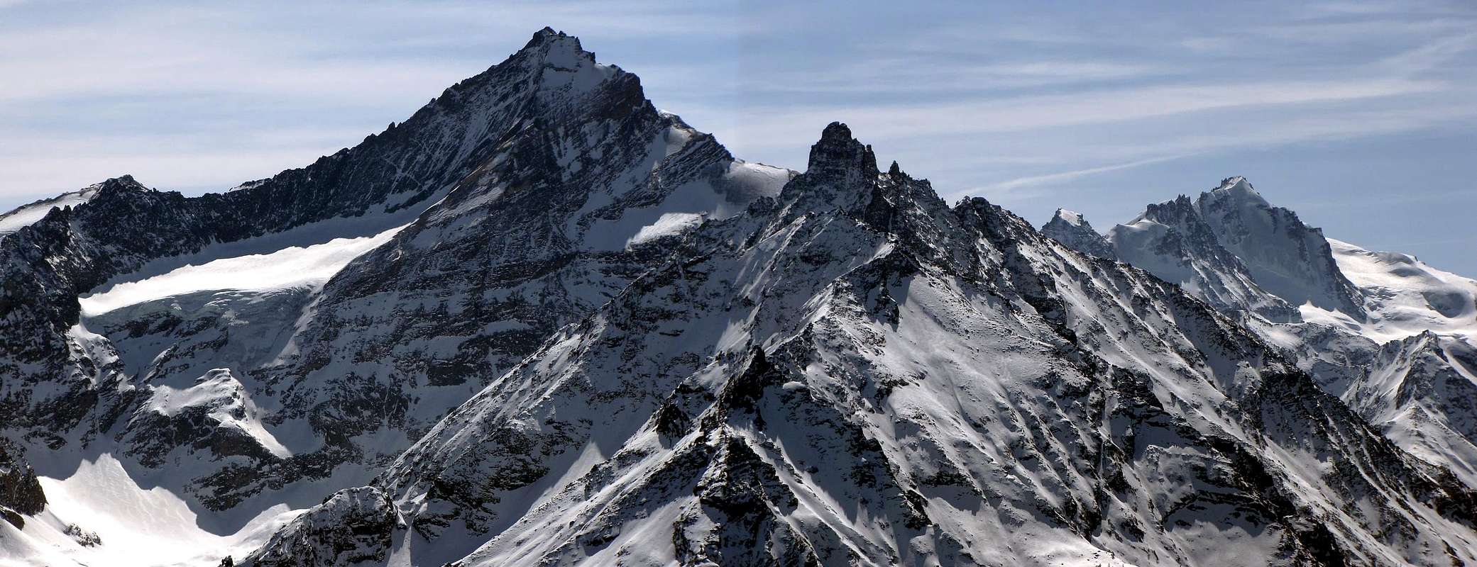
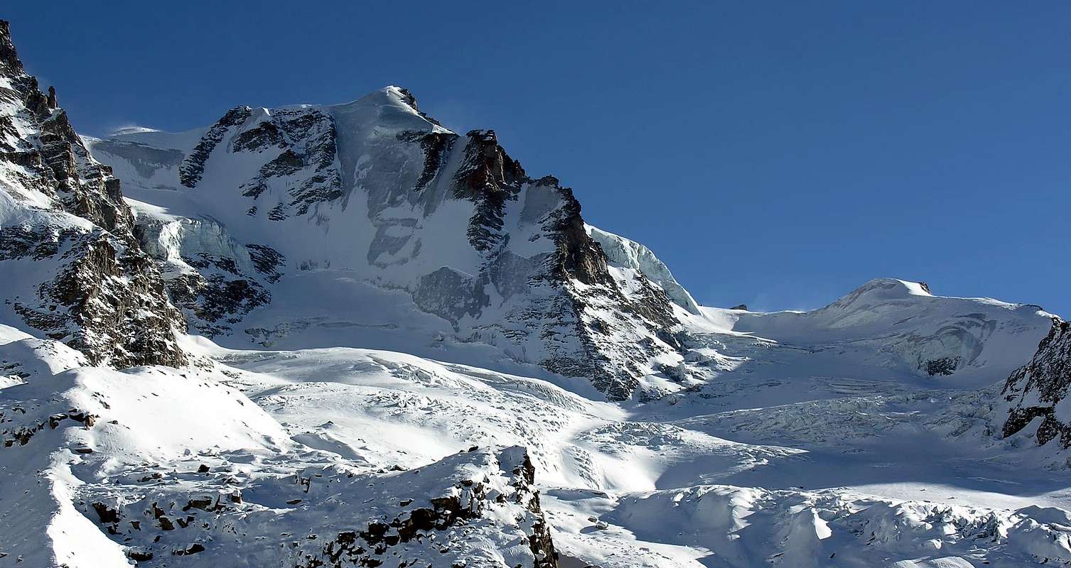
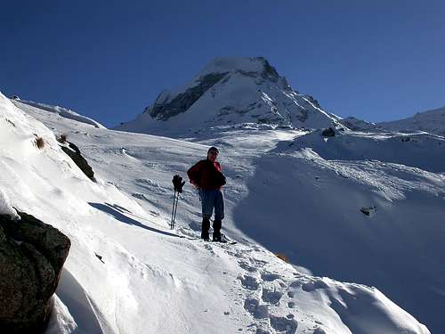
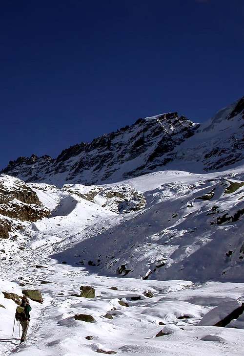
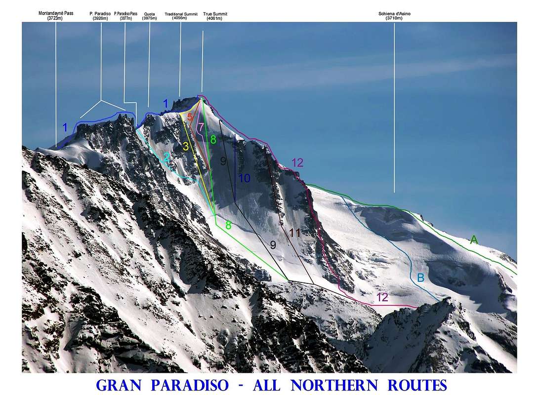


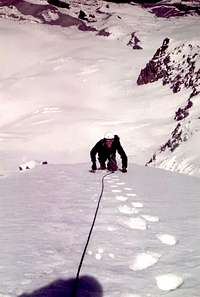


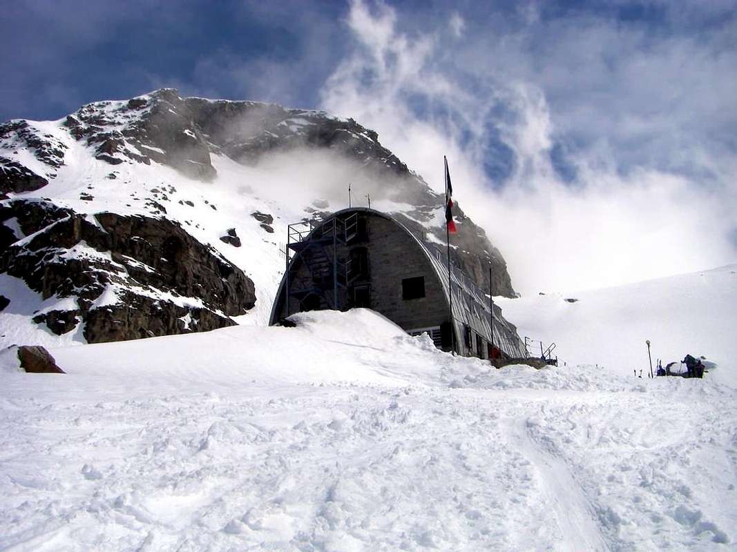
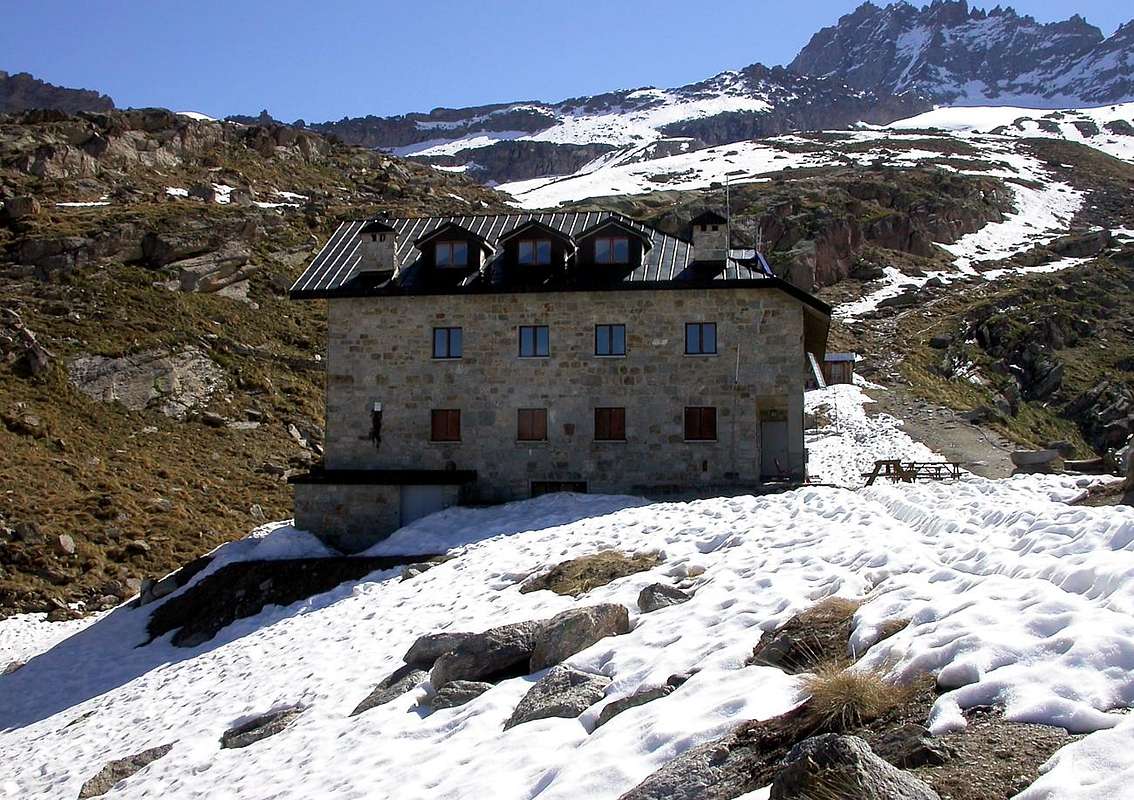
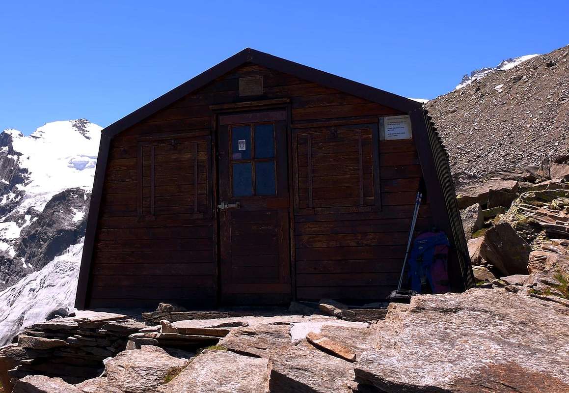
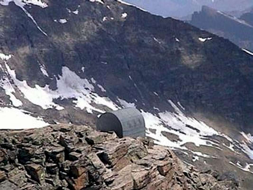
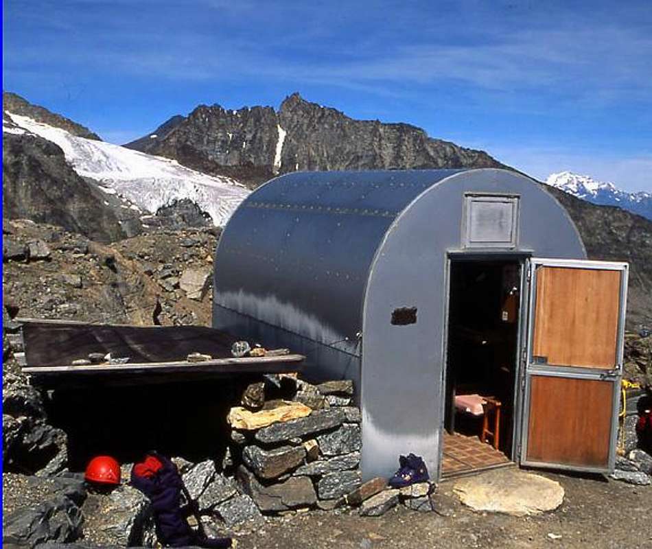
asella - Sep 12, 2023 9:40 am - Hasn't voted
First ascent of NW Face and N-NE crest (Jul 28th, 1930).NW Face and N-NE Crest: Aldo Bonacossa and Vitale Bramani, (Jul 28th, 1930). (Not Angelo Bonacossa as previously stated).
Antonio Giani - Sep 12, 2023 10:34 am - Hasn't voted
OkGrazie!!!