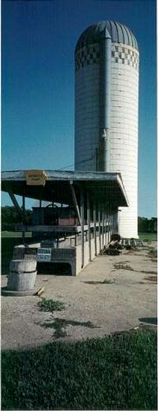
![Look for the silo on the...]() Iowa high point
Iowa high point
The previous day, I climbed Harney Peak (7242'), the highpoint of South Dakota. I drove down I-90 that night, through South Dakota and Western Minnesota. I stayed in Worthington, Minnesota for the evening. The next morning I made my way down route 59, then got on route 60. After I hit the Iowa border on route 60, it was five miles until I saw a sign pointing to the highpoint. I then made a left on to 130th street. I parked my car at the side of the road, and the sight of the farm structures looked familiar to what I had seen on the web at www.highpointers.org.
Iowa is very flat, and it is nearly impossible to distinguish the highest point, except for the marker itself. However, I admire the highpoint aspect of Hawkeye Point. It is just a little quaint piece of land on a farm, yet is has this significance that it wouldn't have otherwise. I get a kick out of that. Frankly, this is the FLATTEST highpoint, flatter than delaware, flatter than Kansas, flatter than Indiana, and flatter than Florida.
On my excursion, I walked about 200 yards to the right from the road, towards a silo. There was no sign on the property pointing to the highest point, but I noticed the structure, and behind the silo, was the sign. I took a complementary key chain in the shape of Iowa, that says:
"Hawkeye Point
Elev. 1670 feet
Merrill Sterler Farm."
I still have that keychain to this day.


Comments
Post a Comment