Greece to Montenegro
After a long day on Olympus (24 km and 2200 m elevation gain) we decided to take a rest day, heading to the beach and visiting an archeological site near Litochoro.
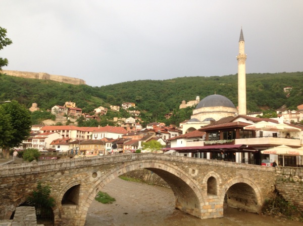
The next morning we drove from Litochoro, Greece to Prizren, Kosovo. Taking the same route of toll roads from Katerini, past Thessaloniki to the Makedonian border at Evzonoi, and to Skopje, we took the A4/E65 to Kosovo. In Kosovo we drove through Kačanik heading towards Ferizaj. We meant to turn onto R-115/115 at Gornja Gabrica but after seeing the state of the road and the heavy horse and cart traffic, decided to continue to Ferizaj and take M25-3/M25/E-851 (I note all of the names due to the inconsistent and occasionally contradictory signage along the route). After getting out of the rough dirt roads and numerous construction sites in Ferizaj the road was pretty smooth. There were relatively few horse-drawn carts, but many military convoys that slowed things down. Routefinding was easiest by just following the flow of local traffic rather than reading unreliable or nonexistent road signs.
We followed the M25-3/M25/E-851 and cut to the toll road (R7) at Therandë (Suva Reka) via R-117. From there we planned to drive to Prizren and take R107 into town. The signage was bad and/or the exit was blocked and we ended up in a dirt road driving through fields, but eventually made it into town.
After getting a place to stay we drove to downtown to get some dinner. Ramadan had just started so it was difficult to find a place that would serve before the sun went down. Eventually we found a spot, and opted for an menu oddity: a cheeseburger. I wouldn't usually mention meals in detail but it sums up how 'out there' it felt when we got a block of cheese in bread-- no burger. I suppose burgers and McDonalds will make it to Prizren, but the concept is not yet completely understood. Still, it was great to have something other than Ćevapi and Gyros.
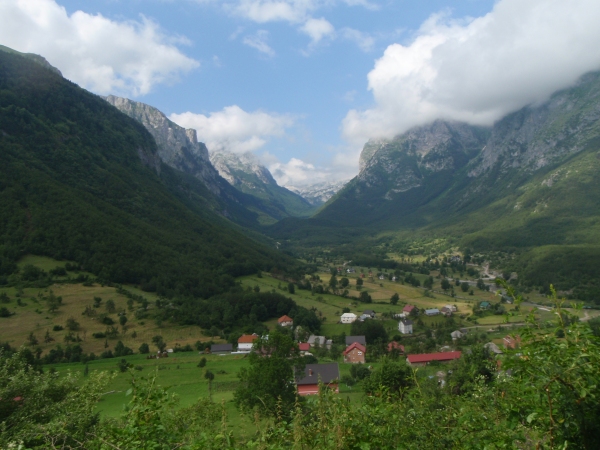
The next day we continued from Prizren, on R107 through Gjakovë (Gjakova) to Peja (aka Pejë or Peć). After a few loops around the city that was devoid of street signs, we found R106 to the Montenegrin border. The Kosovo exit control was about 20 km from the Montenegrin entry control, so we drove through a mountainous no-man's land which is also a national park. It looked like great hiking though I wonder about the presence of landmines.
From the Montenegrin border we descended into a valley into Rozaje and drove along E65/E80/2 to Berane and then South to Plav, which would serve as our base for attempting Kolata in the nearby Prokletije Mountains. Plav is on Plavsko jezero, a lake that was significantly enlarged from recent snowmelt.
Attempt on Kolata
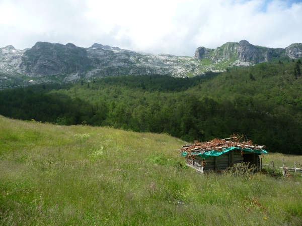
The next morning we drove around the West side of Plavsko jezero through Gusinje. After leaving Gusinje the road deteriorated. With the recent warm spell the 'road' (more of a track, really) was under about a foot of water, but the driving got easier when the 'road' climbed a hill. After parking at a strange blue building, possibly school or abandoned military barracks, we began the hike. A hundred meters North of the blue building, on a corner with a mosque, we located a hiking trail sign that pointed the trail to Kolata as heading East along a road.
After hiking for a few minutes we passed a few guys who began speaking to us in English. One of them lives in New York City, but was visiting his family in Vusanje... small world.
The road continued with rough pavement for nearly 1 km, then turned to dirt. The track split a few times passing by farmhouses and then became a single trail through a clearcut section of the valley. It was very hot and the mosquitos were brutal. Plus, with the heat and being tired from weeks of traveling and hiking, my motivation was waning. My dad dragged me on.
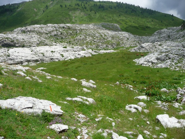
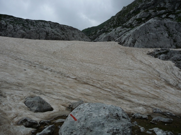
As we gained altitude the forest thinned and we found ourselves in karst. The trail at this point was red dots spray-painted on the limestone, and we quickly got off track. After passing two shepherds playing cards I spotted a sign surrounded by a herd of cattle. From the sign we turned South towards the Albanian border and the saddle from where we would climb the final 400 m summit pyramid.
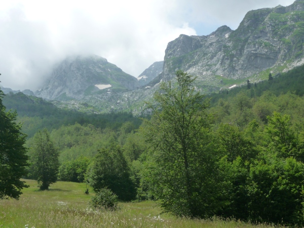
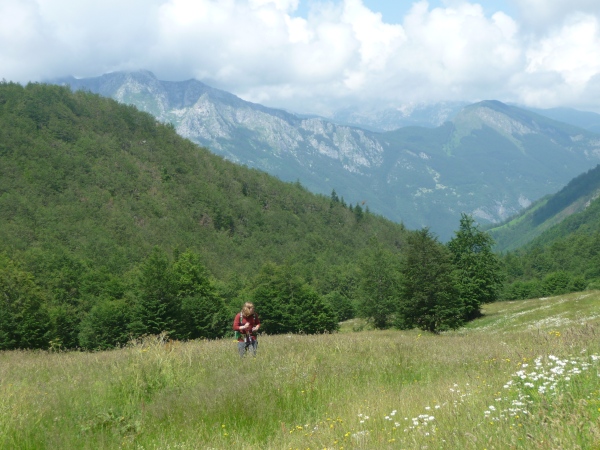
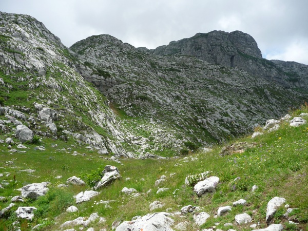
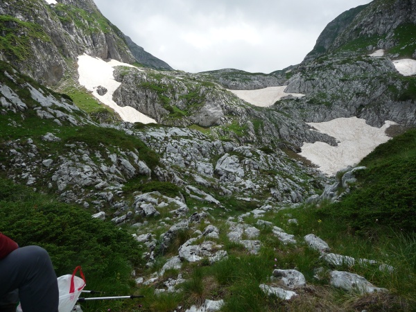
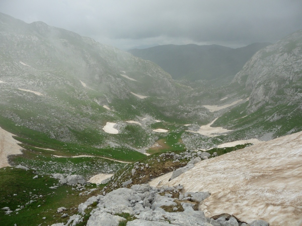
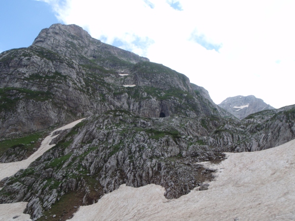
Surprisingly, the trail improved and we made it to the saddle easily. We took a break at the saddle, on the Albanian border, and clouds began rolling in. From there the trail basically ends and we turned East to finish of the last 400 m of ascent. On the North side is a cliff that we were mindful to avoid, and above us another cliff that we had to keep South to avoid. I was feeling quite a bit better, seeing how close we were to the summit.
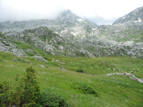
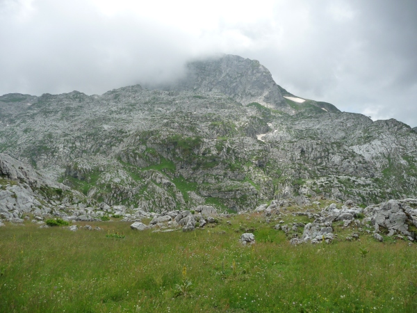
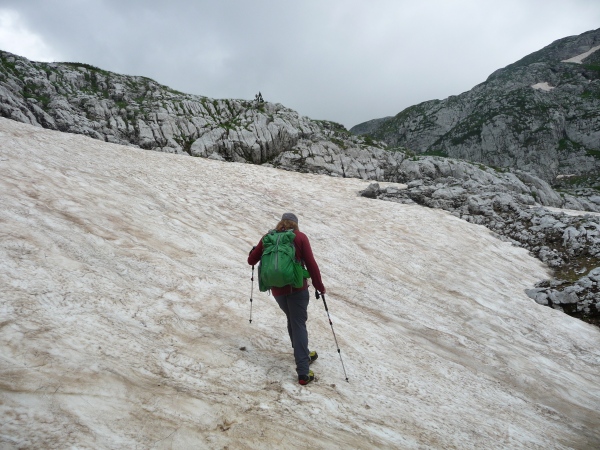
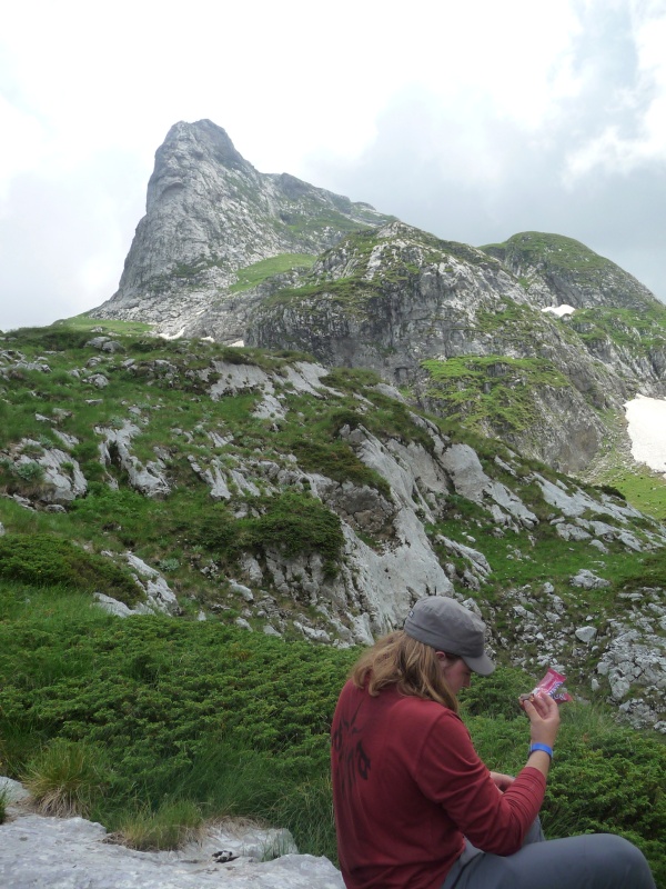
While I was attempting to find a way around a section of rotten rock, I heard a huge crash and a cooler-size rock (perhaps 75 cm cubed) fell above me on my left. I heard my dad call "Andrew, I think I've broken my finger." I remember replying "Are you sure?" I thought he might be overreacting. I climbed up to him and saw that to say it was broken was an understatement.
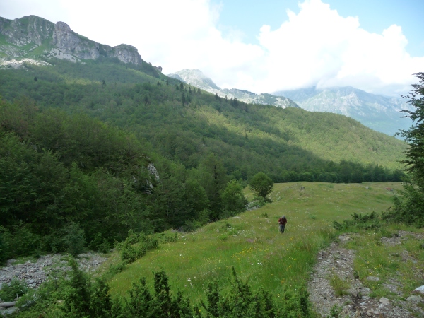
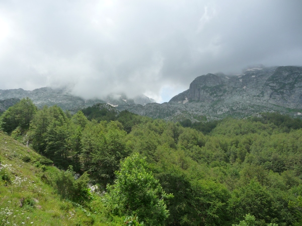
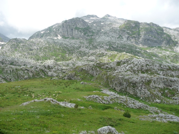
These three pictures were taken just before the rockfall and are probably about the highest point we achieved:
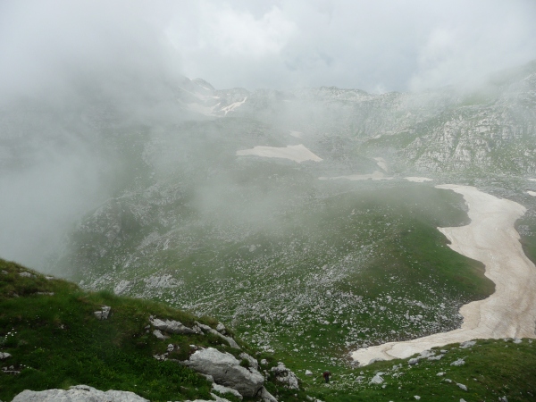
The rock that flew past me had crushed my dad's right index finger. He was lucky it didn't hit him in the chest or head, or it would have injured him and knocked him off the cliff on the North side of the ridge. His finger had an open fracture, and massive gashes running the entire length of both the top and underside of the finger. The finger was bleeding all over the place and a few bone fragments were working their way out of the finger. My first aid kit was back in Plav (this being the only hike of the trip I had not brought it on), so I took a pen out of my pack and cut it to length for a splint and wrapped it up with a handkerchief.
My dad felt a bit dizzy so I had him drink a little water and carried his pack and helped him down the steep section to the saddle. From there I helped him down the rocky sections and set a quick pace back to Vusanje.
I turned out to be a 16.2 km day with 1191 m of gain.
Link to GPS track.

Aftermath of attempt on Kolata
I offered to drive but my dad insisted on driving because I was not on the rental contract, so he drove back into Plav to the 'bolnice' or hospital. One guy spoke a little English and by using a little English and a little Czech we got the point across to them. They opened the handkerchief and after looking at the finger a bit puzzled, said, "You must go to Berane for operation." With that they retied the handkerchief around the mangled finger and showed us to the exit.
Using paper to avoid getting blood on the steering wheel and upholstery, we drove to Berane and found the hospital, parking the car outside a nearby bar.
Inside, the hospital facilities did not inspire confidence. The walls were a sterile neon yellow that glowed green in the dim fluorescent light, and corridors a painted in a bright pink that was pealing to reveal concrete and rebar. The ceilings leaked water (at least I hope it was), and the floors inside the building had potholes. The entire building was deserted except for the occasional nurse or doctor smoking in the hall and the intermittent yells and cries from rooms with patients.
About an hour after arriving we saw a doctor who cleaned the finger up with iodine and a clean bandage. He said the finger would require an operation and we would be sent to another place after an x-ray. A nurse took us down a corridor and my dad got an x-ray. Before printing it the x-ray technician asked for 7€ in cash. We paid the fee (or possibly beer money for the tech) and the tech developed the plates. The x-ray came out quite small-- about the size of a postcard. On it there were two images from different angles, and what appeared to be one break.
After waiting a couple hours a nurse asked whether we wanted to wait a couple hours for the best surgeon to do the operation or have another doctor do it immediately. We opted to wait, and at about 11 pm they took us upstairs to an operating room.
I signed a release in Montenegrin and my dad went in the room next door. I wandered around in the hall and hung out in a room, peeking in the operating room to make sure they hadn't chopped the finger off [with gardening shears] yet. After about 90 minutes they put my dad in a room and gave him an IV. He was awake and fine, they had given him just a local anesthetic. After the bottle had drained they told us we were free to go and to return in two days to get the bandage changed. We also got two prescriptions to fill with painkillers and an antibiotic. By this time it was nearly 1 am and the local anesthetic was wearing off, but as the pharmacies were closed and the hospital didn't have anything, my dad gritted his teeth and we drove the two hours back to Plav. The manager of the hotel was relieved to see us, she thought we must have been in trouble on the mountain, and a Czech guest who died on a solo attempt last year was on her mind.
The next morning we had planned to drive to Žabljak, in the Durmitor of Northern Montenegro. From there we were to climb Bobotov Kuk, the other (disputed) country highpoint. We had to return to the hospital, so had to cancel it all. We picked up prescriptions in Plav and returned to the hotel after lunch to find a veteran's gathering going on at the hotel. The whole place was packed with people in their 40's and 50's, all of them with red uniform shirts with various Bosnian cities printed on the back. A live band played Pink Floyd and Led Zeppelin covers all afternoon, along with hits from Yugoslav legends Bijelo dugme.
Driving to Split with one hand
Because we had to catch a flight from Split to Prague, we had to drive from Plav in Southern Montenegro to Dubrovnik, Croatia in one day. We left Plav early and stopped into Berane to get the bandage on my dad's finger changed. I hadn't seen the whole finger yet after the surgery, and was a bit shocked by what I saw. The surgeon was there and kept saying, "It was very late, not my best work, but it will do."... The finger had about 40 rough stitches forming an "X" on top of the finger and a line of stitches on the bottom. The doctor said the bone began fragmenting when he tried to put a pin in, so he put in a wire. Well, the wire looked like a coat hanger, and stuck out the tip of the finger a half-inch with a 90 degree bend where it stuck a half-inch forward. We joked that it was not dissimilar to Captain Hook. In Germany my dad got another x-ray and found that the pin was not attached to any bone, and it had just been skewered through flesh.
We continued driving through Mojkovac, and continued South to Podgorica to avoid driving curvy mountain roads. With my dad's finger driving on those difficult roads would not have been easy. Still, the main roads were pretty tough. We drove through Nikšić and crossed into Southern Hercegovina, passing through Trebinje before crossing into Croatia at Dubrovnik.
After not seeing a single tourist for two weeks, except a few in Greece, it was a shock to see the tour buses and herds of sheeple in the Old City of Dubrovnik.
The next day we drove from Dubrovnik to Split, spent the night there, and finished off the road trip by dropping the car off at the airport and flying back to Prague.
Trip stats: 14 days total, 4 days hiking, 2881 km driving (~3500 km total including in-town driving, going to dinner, getting lost, etc), 71 km hiking, 3 country highpoints climbed (and a fourth attempted), 5151 m total elevation gain.

The points are not all places we stopped--there were so many points that Google Maps ran out of letters after 'Y.' The letters are just junctions so the correct route could be mapped.
Note
This post has been adapted from my blog at
http://adventuretraveling.wordpress.com/


Comments
Post a Comment