|
|
Trip Report |
|---|---|
|
|
63.99023°N / 19.05954°W |
|
|
Jun 25, 2017 |
|
|
Hiking |
|
|
Summer |
Hiking the Laugavegur and Fimmvörðuháls trail
South Iceland’s Laugavegur trail, alternatively connected with Fimmvörðuháls trail is rated as one of the most beautiful hikes you can do. The nature shows its beauty and strength in so many types of landscape that you can hardly believe that it’s not a dream.
https://www.youtube.com/watch?v=gLZXP9Gc5XA&t=5sOur short trip to Iceland was a quick and a bit unexpected decision. Our week vacation was planned for the end of june with no flexibility in dates. Originally we planned to do some mountaineering in the Alps, but the weather forecast was getting worse and worse. On thursday the decision came: no way to climb in the Alps next week. But what can we do? Let’s check flight tickets offer. Luckily there was a direct flight to Reykjavík. Iceland has always been on the list of dream destinations and now the chance was here. When I saw pictures from Laugavegur trail, I had a destination. The logistics is pretty easy. There are buses from Reykjavík to both starting and final destinations Landmannalaugar and Skogar. We decided to go north to south as most of hikers do, but it’s not a problem to do opposite direction.
Laugavegur trail itself is a 55 km long route between Landmannalaugar and Thorsmork, which is also reachable by bus. Other 25 km are called Fimmvörðuháls and would be a pity to miss them. There are huts and campsites all along the hike after maximum 15 km of distance. Huts need to be booked in advance, unlike sleeping in own tent, for which there is usually plenty of space. You can split hiking into up to 6 days from Landmannalaugar to Skogar. Laugavegur is usually described for 4 days and Fimmvörðuháls other one or two. We did everything in 3 days and we felt pretty far from being in a hurry. The neverending midsummer daylight just makes you a bit confused when to go to sleep.
It was the beginning of hiking season here, so we expected lots of snow above 1000 metres. Huts have officially opened only a week ago. I was also afraid of crossing unbridged rivers with too much water, but it showed to be easier than I had expected. Anyway hiking poles help a lot to keep your stability in a freezing current that makes your feet insensitive.
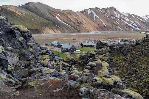
As I have said before, we started in Landmannalaugar, which is a commonly visited place for its hot springs. Many people just come here to soak in the sulphur flavoured hot water and enjoy the view of wonderful mountains around. To get here you definitively need a 4WD car. After crossing the last river on the road, there are few small huts, information center and facilities for day visitors.
The hot bath is at the other side of a green meadow over a small wooden bridge. There the hot stream mixes with a cold one. It takes some effort to find a relaxing position without having one foot boiled and the other one frozen.
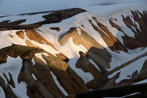
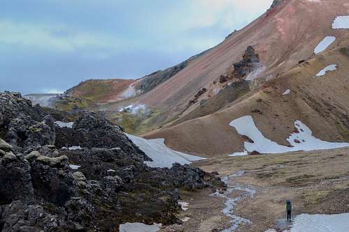
The hike starts very easy on a well maintained footpath. Crossing lava field with fantastic black stone formations together with enjoying views of multicolored rhyolite mountains is just amazing. We are slowly getting higher and higher around slopes of Brennisteinsalda mountain with some sulphur steams coming out of the earth.
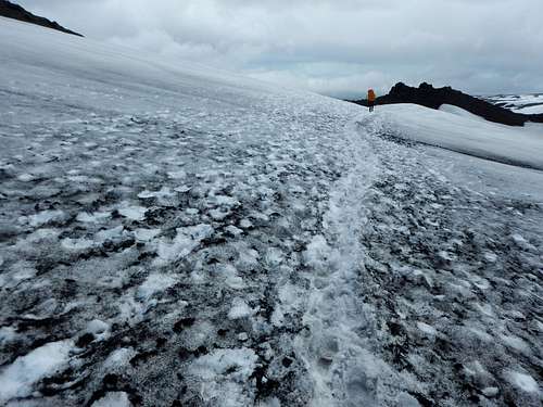
Getting higher and higher through a stony landscape, green moss is disappearing and we start to cross snow fields. The route is well marked all the way. You can see wooden sticks with coloured top along the footpath which is also visible in the terrain in most places. Orientation can become tricky in upper parts in mountains around Hrafntinnusker when a foggy weather comes (which happens very often). It happened also to us that for a part of the hike we saw not further than tips of our shoes. Following the trail in the snow is not difficult, but a map with compass or a GPS navigation might be very helpful.
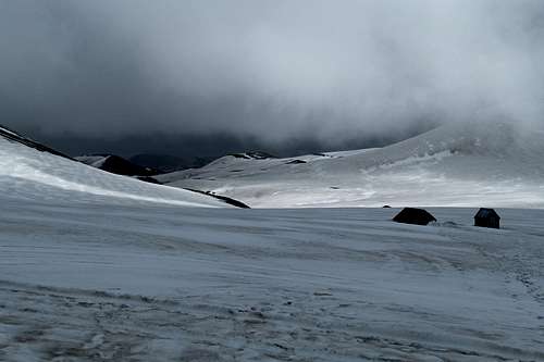
After passing the small hut of Hrafntinnusker, there is a vast snowy plateau to cross. Marking sticks are elevated by putting on the top of heaps of black obsidianic stones. Glossy volcanic rock looks like a black glass. Even walking on white snow you can sometimes feel the devil’s smell of sulphur steams.
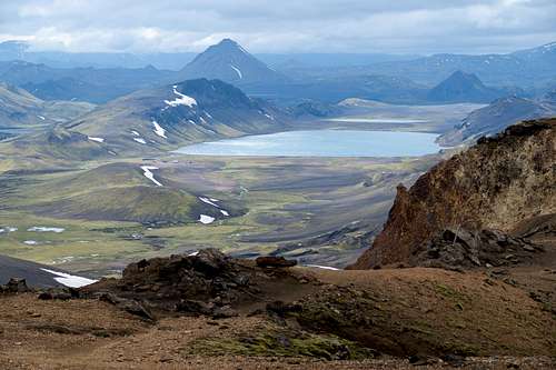
When we get to the next horizon, an unforgettable view opens. Dark rock formations above green hills and a wide valley with river. Next to the glittering water of Alftavatn lake we spot small huts. But it takes some time to descent all the way down to get there. First part is steep with loose stones. Than it becomes flatter and grassy along the river which we have to cross before getting to the camping. There is not a bridge, but this one is less than knee deep and requires just few steps in the cold water.
There is a sign in the camping: “If you want a less windy site, go 5 km more to Hvangill”, which we finally do. After crossing another river (wider than the first one but not deeper) and climbing over a mild grassy hill, the vegetation disappears again. Hvangill camping is the last grass for another part of the hike.
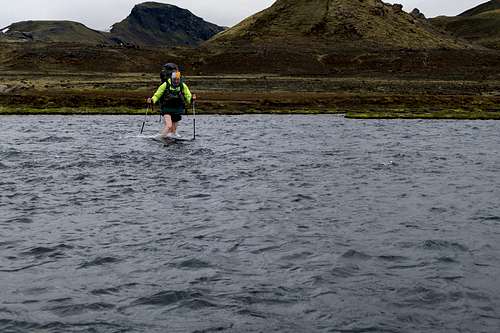
Soon after leaving the campsite, there are two rivers to cross. First one is wild with a small waterfall over a basalt rock step. Luckily it has a wooden footbridge. The second one needs to be forded. It is the deepest in our trip. The water is above knees, which means trousers off, but the current is not too strong.
Out of the water, the trail follows the road through a black lava desert. We were told that we could experience a sandstorm in dry and windy days. Luckily it’s not our case. Even on this sandy flat area there are some streams to cross. Small enough to just jump over stones.
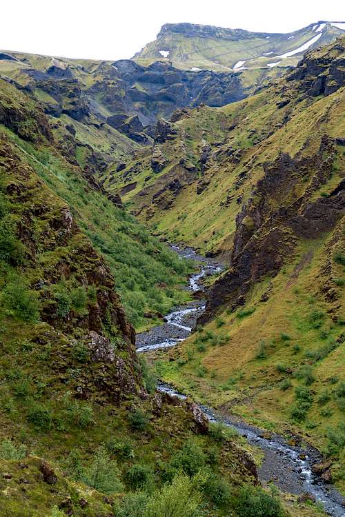
From a small hill by the road another magnificent view opens. Deep valley broken with rugged rocky canyons. After a short descent to the left we get to the Botar hut of Emstrur. Here the trail just can’t go straight as it does most of the way. The high overhanging cliff of the Emstruá river canyon requires a detour. Before getting there we cross a small river over a wooden plank used as a bridge. The trail winds down to the rugged canyon. There is a stable wooden bridge over wild river Emstruá. Then you climb again to the rim of the canyon, back to the original direction.
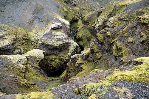
Crossing two beautiful ravines with small streams we can admire the geological diversity of columnar basalt rock formations. On the following long grassy plateau surrounded by mountains we can spot some birds.
As we are approaching Thorsmork, the variety of vegetation is getting wider. After crossing river Pröngá, a knee deep stream in a wide gravel riverbed, forest suddenly starts. Walking through a low subarctic forest with violet flowers feels like being in a jungle. As we don’t want to end here, there is no need to come to Húsadalur hut. The trail continues over a forested hill and descents to another hut by the river. Many hikers take a bus from here, but it would be a pity not to continue over another snowy mountains.
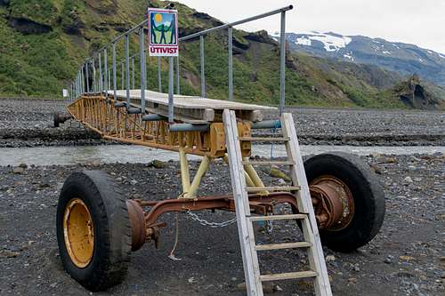
There is a very wide stony river basin. Water makes its way where it wants. Strongest streams can be crossed over mobile footbridges. After Basar hut on the other side, the climb starts again. Trees are becoming rare and we are getting to a sharp ridge between two valleys. Incredible rock formations below and all around us make the phantasy running. Don’t think about vertigo, just enjoy the view.
Grassy hill becomes a steep uphill to a perfectly flat stony plateau. The vegetation suddenly disappears and we have a breathtaking view of deep blue and grey glaciers of Mýrdalsjokul. The trail climbs between Eyjafjallajökull and Mýrdalsjökull mountain glaciers. This area is called Fimmvörðuháls ("five cairns pass") and gave the name to this part of hike. There is an info sign in the pass with a map of new lava field formed by Eyjafjallajökull eruptions in 2010. We remember the collapse of air transportation caused by an ash cloud spread in the air.
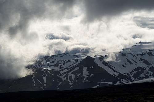
We are almost running uphill, because a storm with rain from the valley is chasing us. In addition we are above 1000 metres again which means walking on the snow. Luckily we got only few drops. Dark lava rocks contrast with snow. The stripe of blue sky doesn’t fit into this black-and-white world. Not even us in colorful waterproof clothes.
Every horizon seems to be the last before we get to Baldvinsskáli emergency bivac hut. It’s a small hut with a tent-shaped shiny metal roof. The bigger Fimmvörðuskáli hut also owned by Útivist (one of the Icelandic hiking associations) sits on a sharp ridge several hundred meters west of the trail.
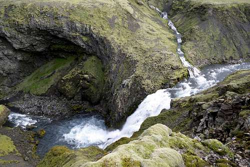
From Baldvinsskáli bivac we follow a rocky road descending for about 5 km until a footbridge over a wild river. Here the trail leaves the road and for last 8 km follows the left bank of Skogá river. One beautiful waterfall followed by another in a rugged gorge. Black basaltic rock is covered by green moss and white birds are flying above clouds of water spray.
In the distance we see a sharp line between black coast and blue ocean. Sheeps on surrounding meadows are greeting us. As a great finale of an incredible natural show, last waterfall is the biggest one. The river drops 60 meters with a reverberating noise to end on a flat meadow with a parking close to the main road.
Crowds of tourists means that we are at the end of this beautiful hike. The Skogar village is a short stop for most of visitors driving the main ring road. For us it is a hard comeback co civilisation after few days in an incredibly beautiful nature.


