
-
 7416 Hits
-
 0% Score
-
 0 Votes
|
|
Route |
|---|---|
|
|
69.47032°N / 19.79668°E |
|
|
Skiing |
|
|
Spring, Summer, Winter |
|
|
A long day |
|
|
Overview
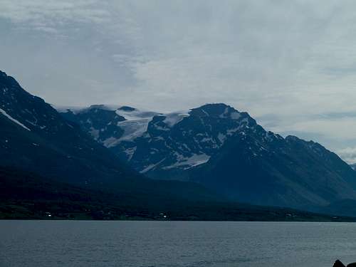
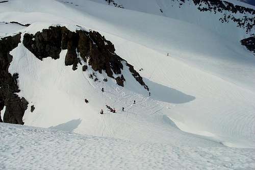
Holmbukttind right of center. The traverse to Jiehkkevarri continues to the left.

Getting There
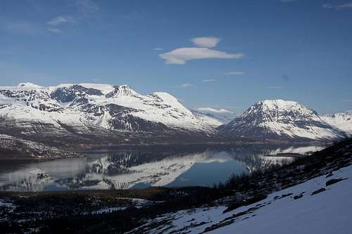
From Tromsø: Head out of town on E8, the main highway. Drive past Ramfjord, through Lavangdalen, and out to a Balsfjord. After driving along the shoreline of Balsford for less than 10 minutes there is a sign for Jøvik in a little bay called Laksvatnbukta. There is a Mobile Bunker Oil gas station (unmanned) here, that's the easiest way to know where to turn off. Follow this road past Lakselvsbukt, a small village with a school and church directly below Lakselvstind (A big multisummited peak).Drive a few kilometers further, to coordinates N: 69.46948 E: 19.69855 This is at a small river called Govelva. There are places to park on both sides of the road, and both sides of the river. Most popular is a short wood cutters track which makes the first few minutes easier. The terrain is fairly flat and open at the start so it isn't so important. Blåisen (glacier) should be visible from the road, that's a sure sign you have begun in the correct valley.
Driving time is about 1:20 from Tromsø.
Route Description
From the parking area, follow up the valley toward the Blue Ice Glacier (Blåisen) which is almost visible from the road. Keep the river to your right as you ascend.


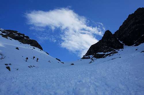


Continue up the valley, which curves to the right, and head for the lowest point to reach the col. This can be tiring with skins on skis, but is usually doable without having to boot pack. In late season however, many parties opt for boot packing with ice axes, and in very late season crampons.
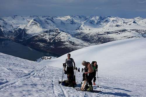


After reaching the col, make a sharp right turn to follow the ridgeline to the summit of Holmbukttind. The ridge becomes more defined as the summit nears, and, depending on conditions, can be exposed before reaching the summit. Some are tempted to drop off the left hand side of the ridge to traverse over to Jiehkkevare, but it really is easier to just continue on to the summit and descend from there.


After summiting, descend the east ridge toward the col. Skirt around the edge of the glacier, keeping to the left of the ridge crest until reaching the col. From the col, a short but steep ascent gains the plateau. Gradually ascend along the plateau for 4 kilometers or so until finally reaching the final hump that is the summit of Jiehkkevari. There are some high points that can be skirted to the right on the ascent, or they can simply be skied over without any difficulties.
Return via the same route, or, better, continue on to Kvieta and descend either Fornesbreen or Fugledalsbreen.
Essential Gear
Avalanche rescue equimpent.Randonee or Telemark skis and skins.
If continuing on to Jeihkkevarri, glacier travel equimpent: ice axe, ropes, ascenders, may be neccessary depending on conditions.