Flatland Highpointing
Hoosier Hill Indiana:
The Indiana Highpoint was really easy to get to, only a few minutes off of I-70. There are a few small turns but nothing crazy. Here are directions to the highpoint courtesy of Summitpost.org, however I just plugged "Hoosier Hill" into the GPS on my IPhone and it brought me right there.
Hoosier Hill is about a mile from the Ohio border. From Indianapolis, Indiana take I-70 East until you get to Richmond, Indiana. Take route 227 North up to Franklin Township. Go about 10 miles, and then take a left on Bethel Road, follow it for about a mile, and then take a right on Elliot Road, and head north for almost a mile. There is the short trail to the top that is well marked.
The highpoint is found on a small rise just off the side of a farmers field in a small wooded area. To help you find it there is a really convenient green sign posted right at the corner of the field.
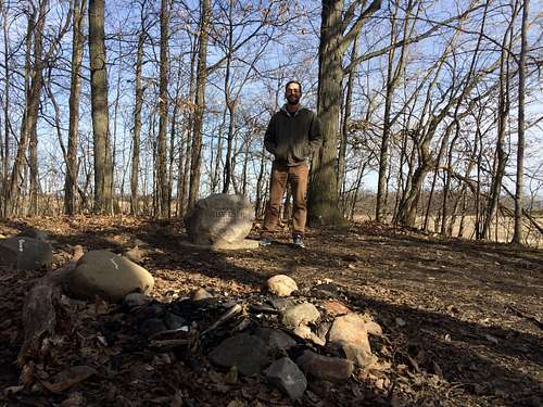
Once at the actual highpoint after a lofty summit attempt I stopped to take a few pictures and then hit the road again. The highpoint was actually really nice considering it was such a small one. there was a mailbox with a register (which I dutifully signed) and some cool information from highpointers on this highpoint and the highpoint club in general. There were also a couple of picnic tables and an engraved stone marker marking the highpoint. Pretty cool.
You can see my full trip report with Photos on my Blog here: http://outdooroutlier.blogspot.com/2015/03/flatland-highpointing-in-indiana-and.html


