A Challenging MacIntyre Range/Mt Colden Loop Hike
I missed the turn-off trail for Iroquois Peak last year and I only required it to finish off the MacIntyre group, thus, this was my main objective originally. However, I also knew that this wouldn't fill my day and I like to make the most of my days out in the mountains. I studied my map and thought about mileage, terrain and overall elevation gain when I came up with the idea to try a loop hike of the MacIntyres and Mt Colden from ADK Loj. I decided to skip Wright Peak since I had summited it years prior. So I would hike up over Algonquin Peak and on to Iroquois Peak first. Then I would take the trail down to Lake Colden and follow it around to the Mt Colden Trail. Follow the Mt Colden trail to the summit of Mt Colden, then return to the Loj going past Lake Arnold to Marcy Dam and back to the Loj. This was ambitious for me, as I hadn't been to Mt Colden yet and I could find no information about anyone trying this loop before.
I started from the Loj at 6:50 AM and by 8:00 reached the big waterfall on the left side of the trail. At 8:45 I was at the trail junction for Wright Peak, which I passed by. Above tree line I took shelter behind big rock cairns a couple times to put on my coat and just get out of the wind for a couple minutes. At 9:45 I reached my first summit, Algonquin Peak. It was cold and the wind was blowing very hard, but at least it was turning out to be a nicer day than I expected from reading different weather reports. I didn't stay long and moved on to my first objective, Iroquois Peak.
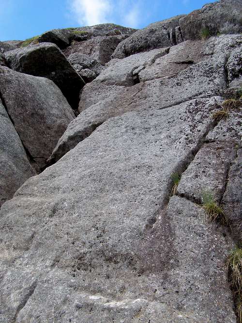
![Scramblin' on Iroquois]() Scramblin' on Iroquois
Scramblin' on Iroquois On the other side of Algonquin, once you reach tree line again, there is an obvious trail sign pointing left, down to Lake Colden. GO RIGHT at this sign to take the trail to Iroquois! I missed this turn last year and was too far down along the trail to feel like going all the way back up. The trail to Iroquois went through a lot of scrub and marsh, but there were a lot of bridges over the worst parts that helped a lot. This trail goes fairly quick, quicker than I thought it looked like at first. I went over Boundary Peak and over to some neat scrambles on Iroquois to the summit, arriving at 10:30 AM. I still had my coat on, which was a wise decision because the wind was blowing fiercely up here as well. I took a short break behind a large rock overlooking Indian Pass and Wallface, awesome views! I decided to take a little longer break back down in the trees, so left Iroquois and was back at the trail junction at 11:06.
Just inside tree-line on my start down the trail to Lake Colden, I took a good break to snack, get a drink and take my coat off. As I was there, a couple hiked past me and stopped just beyond. I asked them if they were going to Iroquois Peak, and when they said yes, I was able to point them in the right direction luckily. The next 1.7 miles was very steep but interesting and after an hour I stopped for a real lunch break at a section of the trail that is right in the stream bed, time 12:07. It was a very relaxing lunch and I took my time to rest with amazing views over to Mt Colden, knowing I'd need my energy for the trek up my next summit. I started on the trail again at 12:32 and reached the trail register at Lake Colden at 1:06.
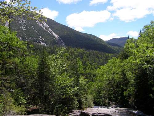
![Lunchtime!]() Lunchtime!
Lunchtime! There were no new sign-in pages at the trail register since last fall, so I didn't sign in here and continued to the Mt Colden trail. There were a couple small bridges along Lake Colden and I stopped at a bridge right by the Mt Colden trail junction to take a picture of Algonquin Peak. As far away as the summit of Algonquin Peak was from here, I could hear the wind howling loudly up there like a jumbo jet taking off. It was incredible! It's very scenic along the lake here. Time: 1:21.
I started up the trail to Mt Colden and the trail wasn't too bad. Not nearly as steep as I was expecting. The trail was moderately steep, not bad, dirt and roots, fairly easy terrain through the woods and easy to follow. The trail stayed that way for a while and I spotted some cliffs through the trees to the left of the trail. Right after this the trail climbs up over a small cliff and begins a steep, wet slab climb that goes on forever. Higher and higher I went, wondering if this part actually had an end! Finally, after a small, 4 foot ladder (which was amusing after the climb I'd just made) the trail comes to some cliffs and boulders and mellows out some. I wound my way up the trail and next thing I knew I was above tree-line. After a short stretch along the open rock, I reached the summit of Mt Colden at 3:10.
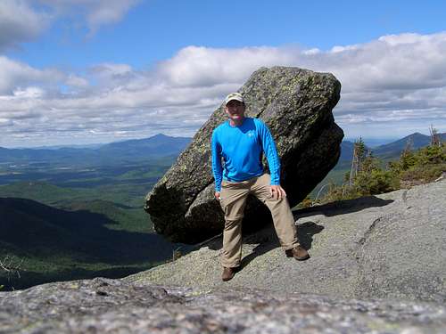
![Final summit of the day.]() Final summit of the day.
Final summit of the day. At the summit there was a short side trail up to a rock with a hole in it that I believe would've been used for surveying long ago. I believe this was the true summit, even though I didn't seen any sign, disk or other summit marking. After a rest and a few pictures on my final summit I headed down the trail towards the false summits (if ascending from Lake Arnold). After all of the day's hiking, I was glad to realize the false summits looked worse from Mt Colden than they actually were.
At 4:15, just past Lake Arnold, I was at the Lake Arnold Trail junction and headed left towards Marcy Dam. The next 1.5 miles were a total rock hop with no flat section of trail for relief. I couldn't wait for this part to end! An odd thing I spotted on a boulder in the middle of the trail was a USGS marker. Not sure why they put one in such a location that could easily shift with the seasons. At 5:00 I was at the Avalanche Pass trail and knew it was easy going from here on out. Taking a right, I headed out on a much more agreeable trail and was back at the parking lot at 6:08 PM.
One of the things I love about the Adirondacks is the great variety of trails that can be combined to make different hikes. This particular loop was challenging, yet still very doable in a day. I'm not a speed hiker and I like to take pictures, but I completed this loop in 11 hrs 18 min., a good hour or two faster than I estimated when I planned this out. By the map, I figured the mileage to be 16.2 miles with about 5200 ft elevation gain. This was also the longest hike I've done at this point and at least 1200 ft more elevation gain than anything I'd ever done before. An awesome day and I'm already looking at another challenging loop hike from Upper Works. I hope this trip report has been useful to anyone planning hikes in this area. Happy Trails!


Comments
Post a Comment