
-
 23804 Hits
-
 80.49% Score
-
 12 Votes
|
|
Canyon |
|---|---|
|
|
47.79793°N / 90.15704°W |
|
|
Hiking, Canyoneering |
|
|
Summer |
|
|
Canyoneering...In Minnesota
Minnesota’s ‘North Shore’ – that part of the state that stretches along Lake Superior toward Canada - contains a chain of natural wonders: The Sawtooth Mountains and northern forests that line the lake provide summits and long distance hiking, skiing, or snowshoeing trails. The hundreds of lakes in the backcountry provide innumerable canoe routes, and the area supports a brace of very large waterfalls that tumble down to the lake.
But one thing you may not expect are canyons, especially one as surprising as Kadunce Canyon. This mile-long canyon provides a banquet of waterfalls in a varied and challenging semi-canyoneering environment. It is delightful and memorable hike through the enclosed canyon's flowing stream, and presents challenging obstacles to go along with about a dozen beautiful falls. Its only a mile or less - but what a mile!
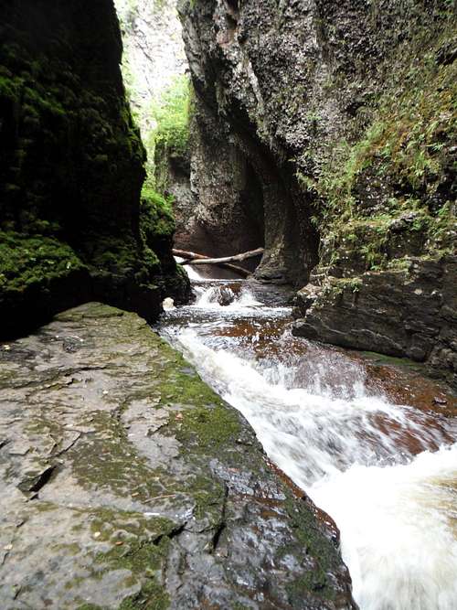
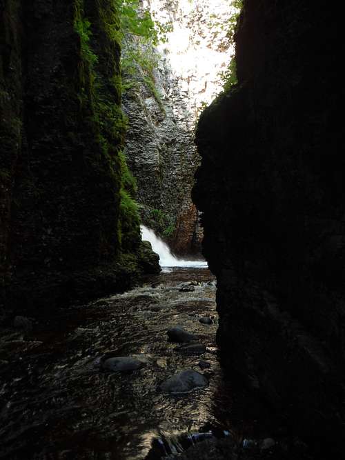 Entering the Grotto of the Second Fall
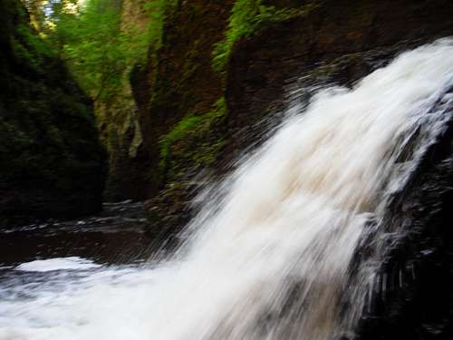 Kadunce Canyon - Water Powered
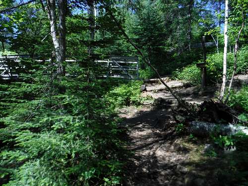
Getting There
The Kadunce River lies 9 miles northeast of Grand Marais, Minnesota, on the main highway that serves the North Shore, Route 61. It is about 30 miles south of the Canadian border. The bridge crossing of the Kadunce is well marked. Park east of the bridge in a nice lot that has about 6-8 spots. You are right on the fine lakeshore at the mouth of the creek.
Carefully cross the highway and walk west to the trailhead on the creek (The Kadunce feels much more like a creek than a river). A sign marks the spur of the Superior Hiking Trail that parallels the creek on the east side, but the views are limited on this trail until near the end. I recommend using the trail as your return route.
Go up the trail a bit until you can safely step into the creek, from this point forward, you will be wading upstream in ankle to knee deep water (amber colored due to the organics from decaying leaves). In one place, you may be swimming in it.
Some Cautions and Warnings
The Kadunce River’s flow rates are variable. I have only been to the creek in summer, when the flow is lower, but recent rains can increase the flow markedly. The canyon width can be as small as six feet or so - you should treat this canyon like any other slot canyon – do not attempt if there is a threat of rain that could cause flash flooding.
I am sure Spring snow melt would be a raging torrent.
In any weather, there is risk of fall, injury and even drowning. There are two areas of class 4 climbing on breakable rock in a wet environment, where a fall combined with deep water could severely injure you, or worse. You will be nearly always be walking, and sometimes climbing, in water – there are relatively few areas of dry ground.
The water temperature levels I experienced in mid-July and August were not frigid, they were pleasant even on a cloudy day. I imagine that at that point of the year the Kadunce is draining shallow sun warmed lakes.
Treat the combination of dangers with the respect they deserve.
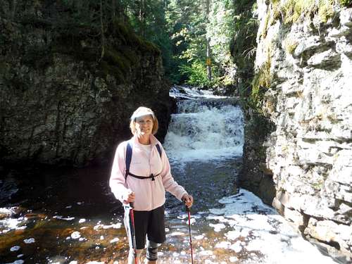
Going Upstream in Summer
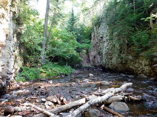
Travelling up the wooded creek, you step through the water mostly on rock with occasional sandy or pebble bottoms. You will negotiate your way up and around small falls caused by small boulders or deadfall.
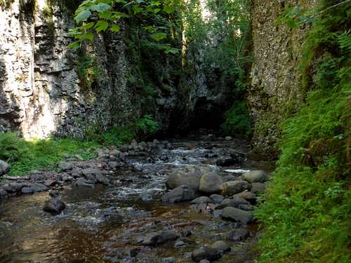
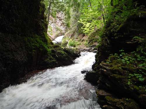
As you head up the creek, the canyon walls will soon creep slowly up and enclose you in a canyon that narrows as the walls rise up to 100 feet above you. The walls get higher and the creek starts to resemble more of the closed in canyon form it will assume for most of the trip.
 Early Kadunce River Scenery
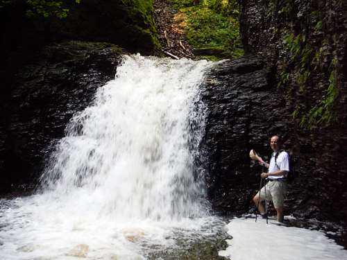
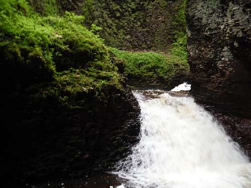
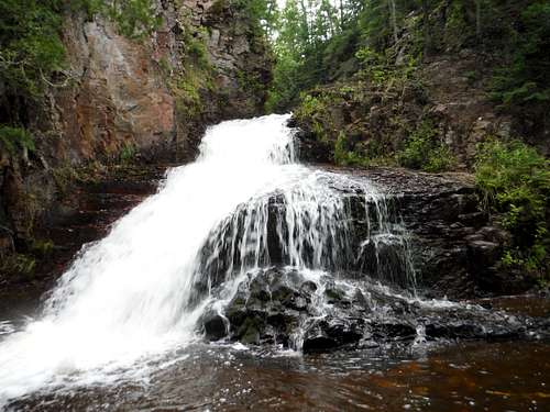
The creek will also make a sharp turn or two, one of which places a fast 6 foot fall directly in your path. A short path prior to the last turn on the left side brings one up and around it through a convenient notch in the canyon wall.
 First Fall - Kadunce Canyon
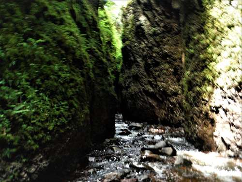
While you will see a few access points to reach the eastern rim from the creek, please do not use these to go up or down, as they cause erosion. Soon even these routes will vanish as the walls completely embrace you in a passage that never gets wider than 20-30 feet, and is often much less.
 The Canyon Closes
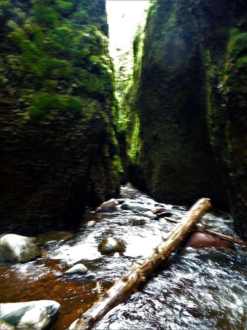
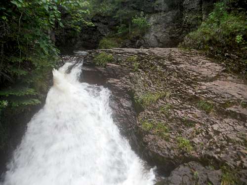
Entering the Grotto of the Second Fall
Soon a healthy roar will be heard as one approaches the first significant obstacle – a 12+ foot fall that drops into a grotto-like area. You can end the journey up river here if you wish, the fall is lovely, loud and beautiful in this rocky setting.
 The Second Fall - Kadunce CanyonKadunce Canyon - Second Fall, looking down canyon
However, more waterfalls await if you can surmount the wall to the right of the falls. The wall has many projections but many are too small to be classified as ‘good’ hand holds, and the rock is not strong (I saw several areas where rock had broken off in the year between my two summer visits). A slippery class 4, that is extra tough when you are alone, will get you past these falls.
Once you muscle your way up on top of the falls, the creek swings right into a long, dark and flowing passage that is breathtaking, but my waterproof camera (a must) was not up to capturing it well:
 Narrow Passage - Kadunce Canyon
Narrow Passage - Kadunce Canyon 2
 End of the Narrow Passage
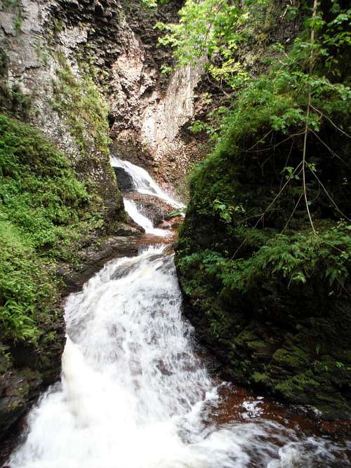
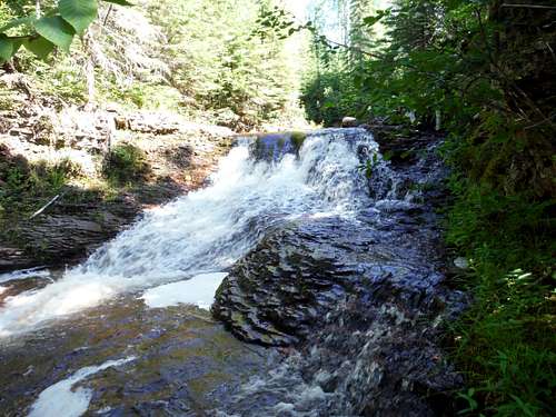
The next large fall (6-8 feet?) but can be bypassed on the left with a short section of class 3 climbing onto a fern covered rocky hump.
 3rd Fall - Kadunce Canyon
A section of narrow twisting falls…
 Your Twisting Route through Kadunce Canyon
…delivers one to the crux, a 20-25 foot high (my estimate, measuring from the surface of the water) obstacle I dubbed the ‘Tri-Fall’.
 Kadunce Canyon Crux - The 'Tri-Fall'
It stands in another grotto like area, there is no way around it. The picture does not do the falls justice, especially as the water here is the deepest I experienced in the canyon, and the speed and volume of the water was intimidating (I did this in July but there had been heavy rains in the weeks previous). I started going up on the left, but the force of the fall at the top was too great to even attempt to push over. I ended up returning to the bottom of the fall and swimming (I lost the bottom for a few feet) to the right and climbing that water sloshed projection between the second and third fall (class 3 on small holds plus flowing, roaring water equals solid class 4).
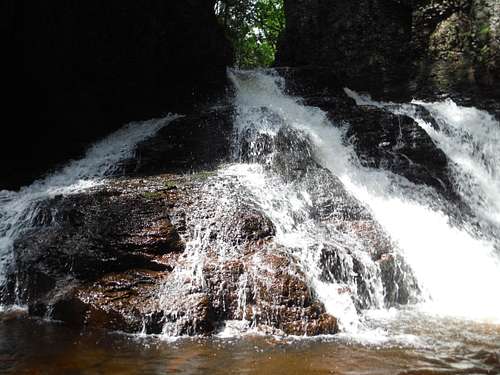
After overcoming this challenge, the canyon piles on one set of beautiful falls after another, which are all easier than what you have come through but still remarkable. A truly memorable experience, and a highlight of my trip.
 Kadunce River - Another Beautiful Fall
 Another Waterfall To Get Up - Kadunce Canyon
 Kadunce Waterfall
 Near End of Kadunce Canyon
The canyon walls will drop away, and Kadunce Canyon becomes Kadunce River again. A bridge over the creek for hikers on the Superior Hiking Trail is your ending point. Sign the register at the east end of the bridge. Return to your car on the mile long spur trail.
 End of Kadunce Canyon Hike
In Winter
I have hiked the frozen Kadunce in winter using micro-spikes up to the second fall, and it is also beautiful trip. At that time I had no idea there was something past that point! Perhaps some SPer with winter skills can add some information on what icy challenges await past this fall.
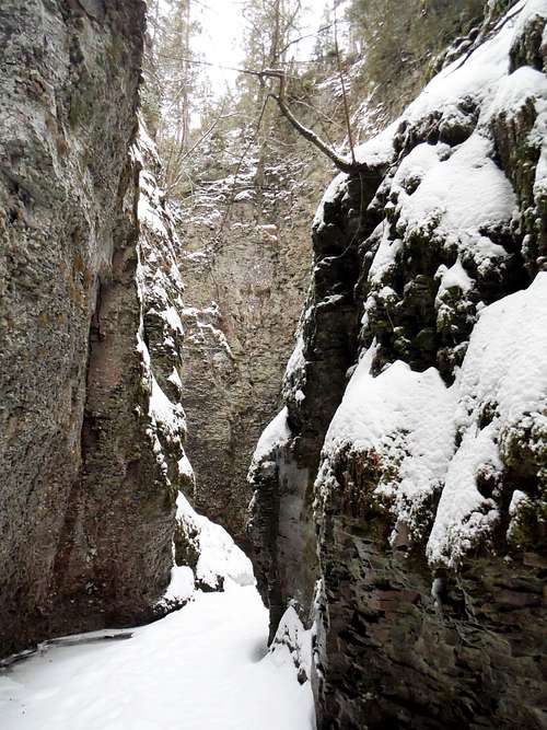 Kadunce Canyon - Winter
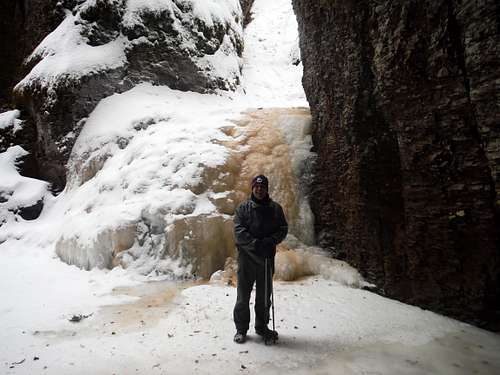 Second Falls in Winter - Kadunce Canyon
Other Stuff
Kadunce River is located near the abandoned Covill township. In the parking area make sure you read the historical marker about its namesake, Colonel William J. Colvill, and the part of the 1st Minnesota Regiment in the Civil War.