-
 2189 Hits
-
 80.49% Score
-
 12 Votes
|
|
Mountain/Rock |
|---|---|
|
|
46.28790°N / 14.57982°E |
|
|
Hiking, Scrambling, Canyoneering |
|
|
Spring, Summer, Fall, Winter |
|
|
4131 ft / 1259 m |
|
|
Overview
Kamniški vrh had already its SP page, but it was deleted and its author has not been active any more.
The summit is one of the lowest in Kamnik-Savinja Alps, however it still has some importance for hiking and other outdoor activities (for example paragliding). The nature is still quite unspoiled, a few areas are even protected as important natural objects. Due to the proximity to Kamnik town, the summit is very frequented.
Geography
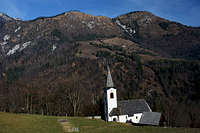
The ridge of Kamniški vrh is simply a low extention of the Krvavec massif. It runs in the W-E direction, attached to the higher summit of Kržišče, 1685 m. North of the ridge lies the valley of Korošica (side valley of Kamniška Bistrica), south of the ridge lies the valley of Bistričica. Lowering from Kržišče towards the east, the ridge descends to the altitude of 1181 m, then rises again to both summits of Kamniški vrh. The western summit is called Planjava (don't mix this Planjava with the high summit in the central part of Kamnik-Savinja Alps), the eastern summit is Kamniški vrh. On this one the ridge branches. The summits further towards the east are unimportant, the two in the northern branch still exceed 1000 meters, while the two in the southern branch are lower. Between both branches there's the valley of Potok (creek), which forms cascades, protected as a 'natural monument'. The southern slopes of Kamniški vrh are mostly grassy, intermitted with some rocky structures. The northern slopes are all covered with dense woods. On a flat part west of Planjava, some 100 meters below the main ridge, there's an ex alpine pasture, called Osredek, 1010 m. Three huts are still standing there.
In addition to Potok cascades, two other natural features are also protected. The first one is Slevška (or Kamniška) roža, a ravine, filled with gravel in a form of a rose. The second protected area is the gorge of Korošak creek, below the Osredki meadow. In that ravine in high waters (but only then) a few quite nice waterfalls can be visited.
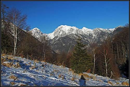
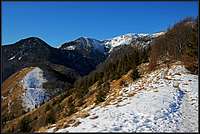
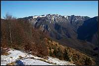
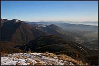
Summit views
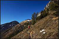
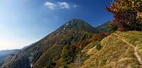
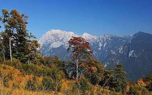 Planjava and Ojstrica |
 Brana, Planjava and Ojstrica |
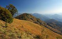
Nice and open are more or less only the views towards the south. In this sense, Kamniški vrh is a kind of balcony above the town of Kamnik. To have some views on the highest summits of Kamnik-Savinja Alps, you must go a bit along the main ridge, to find spots where these views open.
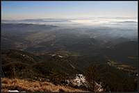 Southern views |
 Towards Krvavec |
 Towards Velika planina |
 Towards the SE |
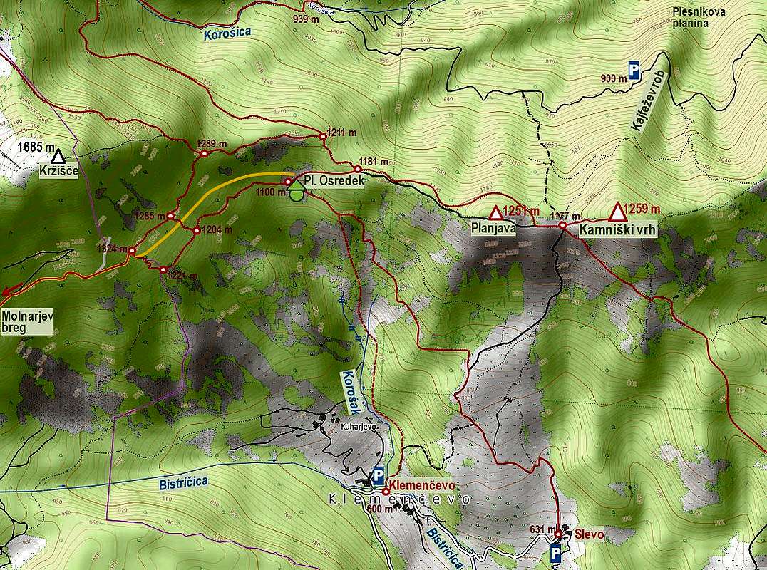
Getting there
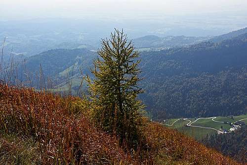
Young larch, rising promisely
As there are many ascent routes from all sides, there are also many trailheads. The majority of them are reached by driving from Kamnik town further towards the north and then in the two side valleys. The trailheads below the summit of Kržišče are however reached by the good, asphalt road on Krvavec.
- Klemenčevo, 600 m, in the valley of Bistričica.
- Slevo, 631 m. Above the valley of Bistričica.
- Okroglo, 650 m. Above the valley of Bistričica.
- Iverje, 458 m. On the banks of Kamniška Bistrica, at the mouth of Potok creek.
- Kajfežev rob, 900 m. Above the valley of Korošica.
- Korošica, 939 m. End of the valley road.
- Molnarjav breg. The turn 1200 m, on the road to Krvavec.
- Jezerca, 1400 m. Big parking place at the end of Krvavec road.
Routes overview
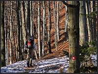
There are too many marked and unmarked trails to describe them all (and I've done only a few of them). You can follow the situation on the terrain, for more unusual approaches use a good map. But be also aware that some unmarked trails can get also quite steep and absolutely require safe step.
1. From Slevo, 631 m. One of the most used approaches. Park either in the hamlet or down by the Bistričica creek. Then continue northwards. The unmarked paths towards the right can become quite steep, so keep perhaps left. Still, on the altitude of some 850 m, you can deter right and take one of the unmarked paths, leading on the saddle between Planjava and Kamniški vrh. There turn right up, in 10 minutes you'll reach the summit. 1 h 30 min, T3.
2. From Okroglo, 650 m, or Županje Njive. You can start the tour even before reaching the crossroads to Slevo, in Županje Njive or in the hamlet of Okroglo, above the valley. This marked approach is a bit longer, leading you in northern direction through the woods. After gaining the suthern branch of the ridges above Potok, you go left, approaching the summit part. Reaching the steep grassy ridge below the summit (Bosova šija), you can either continue directly up (very steep), or, better, continue crossing the southern slopes to the saddle in the main ridge and then go right on top. 2 h, T3.
 Across the slopes |
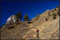 Straight up |
3. From Klemenčevo, 600 m. You start the tour in the valley of Bistričica, by an unmarked path you ascend towards the NE. After reaching the trail from Slevo (#1), continue on top as described. 1 h 30 min, T3.
4. By the valley of Potok. You start deep down in the valley of Kamniška Bistica, just after the big quarry. Then comfortably go up along the Potok creek. After reaching the valley end, continue by a pathless terrain some 100 m of altitude. When you reach the saddle above the valley, just continue by the tour #2 on top. 2 h 30 min, T3.
5. From the north. You enter the valley of Korošica, deterring by car from the main road just opposite of the lower cable-car station to Velika planina. On the first crossroads drive straight, but on the second one turn sharp left and continue by the mountain road some 3 km. Park on Kajfežev rob, 900 m. After it, it is likely that the road will be damaged. Continue walking by the road westwards, then catch a hunters path deterring sharp left. It will bring you up on the saddle between Planjava and Kamniški vrh. 1 h 15 min.
6. From the road on Krvavec. You best park above the Ambrož settlement - after the hamlet the road goes through the woods till the sharp left turn on 1200 m. Park there. Continue walking by a forrest road which ascends slightly over the southern slopes of Kržišče. Keep you eye on rare marks. At first keep left, after some 1250 m the new road ascends steeply left. Continue there straight (mark) by the old road, slightly descending. On the first right turn you continue straight by the marked path. It crosses horizontally the forrested slopes. On the crossing 1285 m, you have two options:
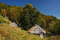
Osredek meadow
6a. Continue straight till the main ridge (1289 m), there turn right and descend by the ridge till its lowest point, 1181 m.
6b. Turn right down, cross the road (or simply follow it till the end) and descend to the lower crossroads, 1204 m. There turn left and continue on the Osredek meadow, 1100 m. From there ascend 80 m towards the main ridge.
When on the main ridge, you have again two options to continue. The right path is very nice, well beaten, panoramic, but not marked. It follows the ridge a bit up and down. Very recommendable! The left path is however faster, it crosses the slopes on the northern side, avoiding the ascent on Planjava summit. Both trails meet on the saddle below the main summit. Altogether 1 h 45 min, T2.
 On the ridge path |
 Crossing the summit of Planjava |
7. Along the waterfalls of Korošak. From Klemenčevo, 600 m, you continue to the hamlet of Kuharjevo and then by a steep, once marked path northwards, along the creek. From the path lower waterfalls can be visited, while the visit of the highest one is more demanding (steep scrambling)! Higher, the path crosses a ravine or two and finally follows a grassy rib towards the Osredki meadow. From there you can continue on Kamniški vrh (route #6), or descend by the marked path towards Slevo. make sure to deter right down in time - to reach Klemenčevo!
Mountain huts
All ascents are short and mountain huts are not needed. Just east of the main summit there is however a modest shelter, which can be used in emergency.
When on Kamniški vrh?
Kamniški vrh can be ascended any time of a year. But be careful on tours, if you have winter conditions. While it is likely that the most frequented approaches will be trodden, most of the ascent routes are very steep and can be dangerous if slippery. Consider taking appropriate winter equipment. In summer conditions good shoes and poles are sufficient.