Kings Peak Day Hike
I didn't think it would be much help writing a trip report about this hike until I finished it. My research for hiking Kings Peak (13,528 ft/ 4,123 m elevation) resulted in a lot of very worrisome information about the difficulty, route finding and temperamental weather. I came to discover that most of the info that I read was mostly written by hikers that had some kind of difficulty. I reckon that the folks that hiked Kings Peak without incident didn't really bother to document their hike.
I only had one wish: to hike car to car under 11 hours. I fulfilled my wish; I hiked car to car in 10 hours and 41 minutes. The total distance was exactly 25 miles. My initial target was to finish the hike under 12 hours. However, once I read a trip report on Summit Post of someone bragging about finishing the hike in 11 hours and 15 minutes, I really wanted to beat that guy's time. A little self-inflicted motivation is always good.
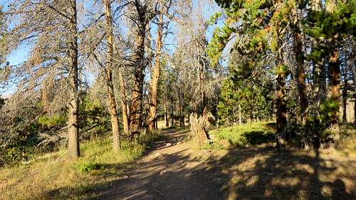
To me the hike did not seem difficult at all. I had more headaches trying get to the trailhead than to the summit. I left Evanston, WY at 3:30 AM with the hope that I will start my hike at 5:00 AM. On the way to the trailhead (thank Goodness for the phone's GPS), I made a few wrong turns, stop by the cops because, I am pretty sure, I looked suspicious driving 35 mph around farms at 4:30 AM in my struggle to find the right turns, I ran low on gas so I had to gas up, and such events. I finally made it to the trailhead and started my hike at 5:55 AM.
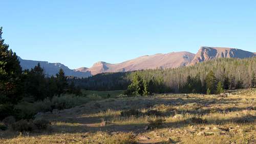
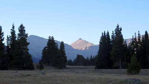
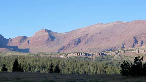
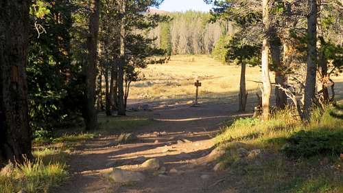
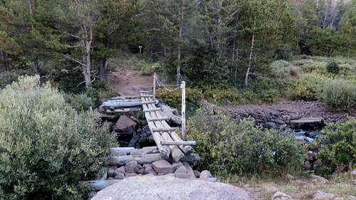
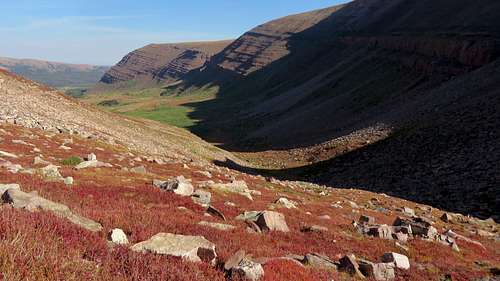
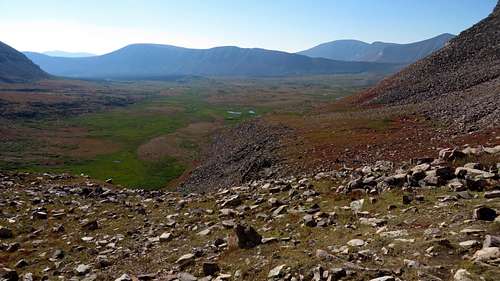
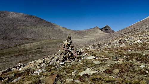
I hiked for an hour in the pitch dark forest. Once the light came up, I realized how beautiful the scenery was. The trail was very defined, impossible to miss. About an hour and 10 minutes into my hike I could see the summit. From there on it was only a matter of just going towards the summit in front of me. On my way to Gunsight Pass I saw two campers and then I passed a group of six guys huffing and puffing. I made it to the top of Gunsight Pass at 9:45 AM, 3 hours and 50 minutes from start time. Let me take a moment here to just say that the views from Gunsight Pass to the South are just magnificent.
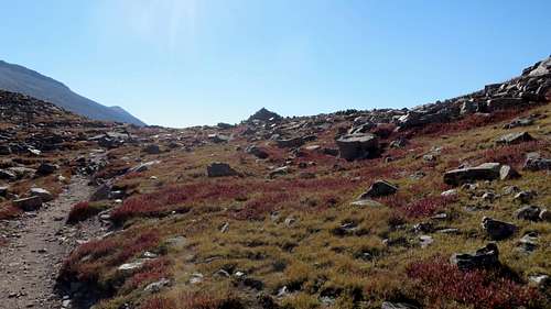
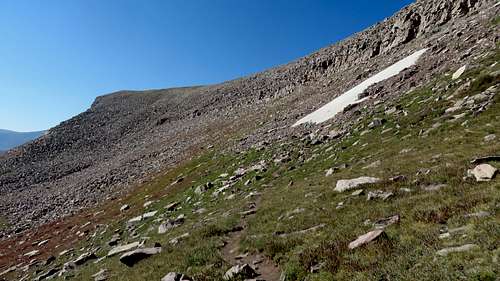
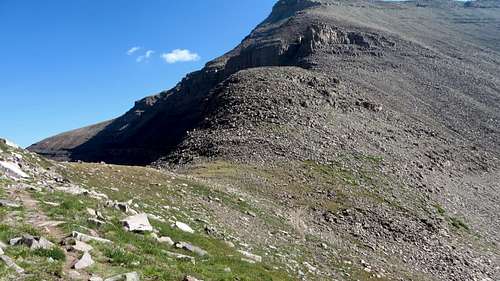
I was very worried, reading all of the reviews, that the shortcut from Gunsight Pass to the base of the mountain is nearly impossible to find and follow. I really wanted to take this shortcut and not to go down into the Painter's Basin just to go back up again. Well, that was not true. The split off is very visible and the trail is marked with serious cairns. At one point, for a very short distance, one has to do a little climbing to gain the plateau. But that is not a big deal. From the plateau the trail fades entirely and gives way to a great field of boulders. It's anyone's skill to find the way to the trail at the bottom of the mountain. Everything is in plain view, but finding the easiest way to hike is tricky.
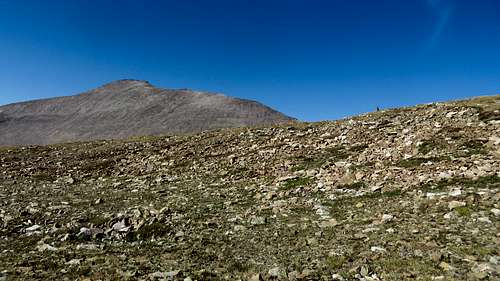
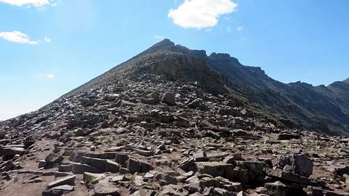
Once I got to the bottom of the mountain, a hiker came down from the summit. He camped somewhere the night before and summited early. He gave me the best advice: "hike up on the ridge or as close to the ridge as you can. The rocks are flat there. There is a little exposure, but don't worry." He was right: the rocks on the ridge were flat and for most of the hike up, or down, one doesn't have to leave the ridge. It is much easier to go up on the ridge than on the side of the mountain. It is tricky though because the natural tendency is to stay off the ridge. I gained the summit at 11:35 AM, almost 13 miles and 5 hours and 40 minutes from the start.
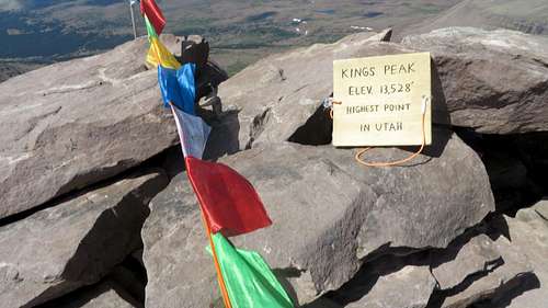
Even since I started the ascent at the bottom of the mountain, I could see clouds gathering above the peak. Everyone said that the weather in the afternoon can turn to ugly in a short time. The weather forecast was predicting thunder and rain after noon. I was determine to just get down from the summit as fast as I could. I took pictures on the summit, I signed the summit registry and I left. I don't think I spent more than 5 minutes on the summit.
![Kings Peak summit]() Kings Peak summit
Kings Peak summit | ![Toilet Bowl entrance]() Toilet Bowl entrance on the left from Anderson Pass
Toilet Bowl entrance on the left from Anderson Pass |
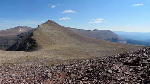
On my way down I came across two guys that were going up. I saw these guys as I was going up to the summit, while looking back down; they came up via the "toilet bowl" scree hill. They were in a group of four. One of them made it to the top of the hill much faster than his partners, but had to wait a long time for everyone to get up. I asked them how was it coming up that scree, and they said awful. I told them that I was planning to go down that way, and they advised not to. I smiled and wished them good luck. Obviously they had no idea who they were talking to. In the Eastern Sierra there are no trails going up and down mountains, especially mountains like Kings that are over 13,000 feet. There are lots of chimneys, drainages, shafts and couloirs that are nothing but scree. Truth be told, the "toilet bowl" scree hill was not the easiest, but also not the hardest I've experienced. It was actually a pleasure to come down on it, easy enough, and it cut a mile and a quarter from the distance. From the top of the couloir the entire valley is clearly visible, along with the main trail.
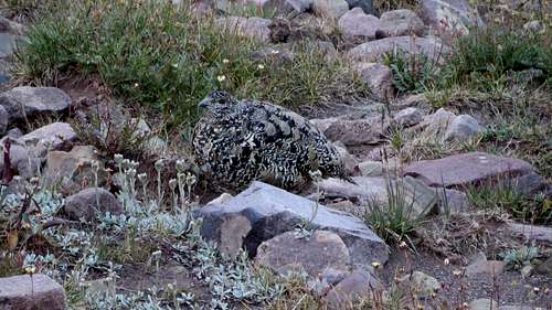
![Grouse]() Grouse
GrouseFrom the bottom of the bowl I used a bunch of use trails, some of them I suspect sheep trails, and kept right all the time until I merged into the main trail. Going on those use trails I heard a bear. It was probably eating berries in those bushes. I pulled out my whistle and blew until I cleared the bushes. I merged into the Henrys Fork Trail at about 8 1/2 miles from the trailhead. From there on it was really a very uninteresting hike, just moving down the trail, in the very hot sun. In about 10 minutes going down the Henrys Fork Trail I probably got bored because I got instantly sleepy. I could barely fight off my sleep. Looking back to the Peak I could see the clouds gathered seriously and something was brewing. Maybe not early afternoon, but later that day for sure.
The last six miles seemed long. And it was getting very hot. The last three miles seemed infinite. I finally made it to the very hot parking lot at 4:35 PM. That was 10 hours and 40 minutes from the start.
The only break I took intentionally was the 5 minutes or so on the summit. I also stopped for 5 minutes to talk to some older hikers that had questions about what I was doing and why I was hiking Kings Peak in a day. I also wasted some time to find one of the two bottles of water that I hid in order not to carry them with me to the summit and back. One bottle I found easily since I found a good, distinctive place to hide it, about 6 miles from the trailhead. The other one though, hidden about 3 miles from the trailhead, was not so easy. I was determined not to leave it behind as trash, so I looked for it until I found it.
![Car stuck on mountain]() Car stucked on mountain
Car stucked on mountainI got to the car and drove for an hour and a half to the hotel in Evanston, WY. After I ate dinner and took a shower, I laid in bed and a terrible headache hit me. Than serious shivering. I knew that was the altitude sickness and maybe some heat exposure. I had it before, when the altitude sickness hit me after I came down from the mountain (on Mt. Charleston, NV and White Mt. CA. On both of these mountains I failed/ didn’t have the means to acclimatize.) I had about 5-6 hours of a very horrible time. After that I was able to sleep, but having a lot of cold sweats. When I got up in the morning I was like new. The only one thing I underestimated was the altitude. I usually take some prescription altitude sickness pills, especially if I don't have the means to acclimatize. This time around I thought I did not need them. Only six weeks before, I did two weeks of high altitude hiking in Easter Sierra. I was stupid enough to believe that I was acclimatized, six weeks later.
And such is the story of the hike to this high point of Utah. I don't know what number this is, but I am still far away from bragging about how many high points I have under my belt. This hike was the furthest I had to hike to bag one peak. I have done others, longer hikes or trail runs, but to a summit and back this is at the top of my list so far.


Comments
Post a Comment